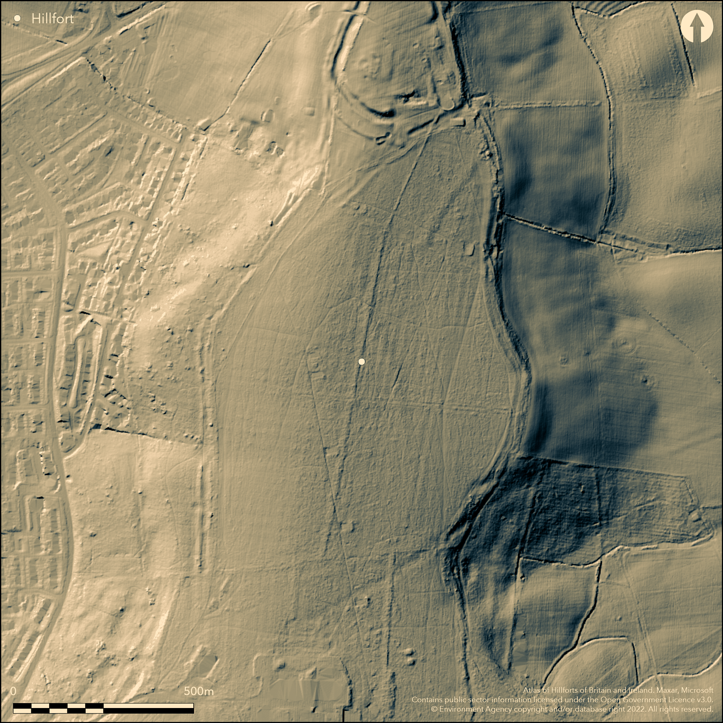
LiDAR 1m DTM Hillshade
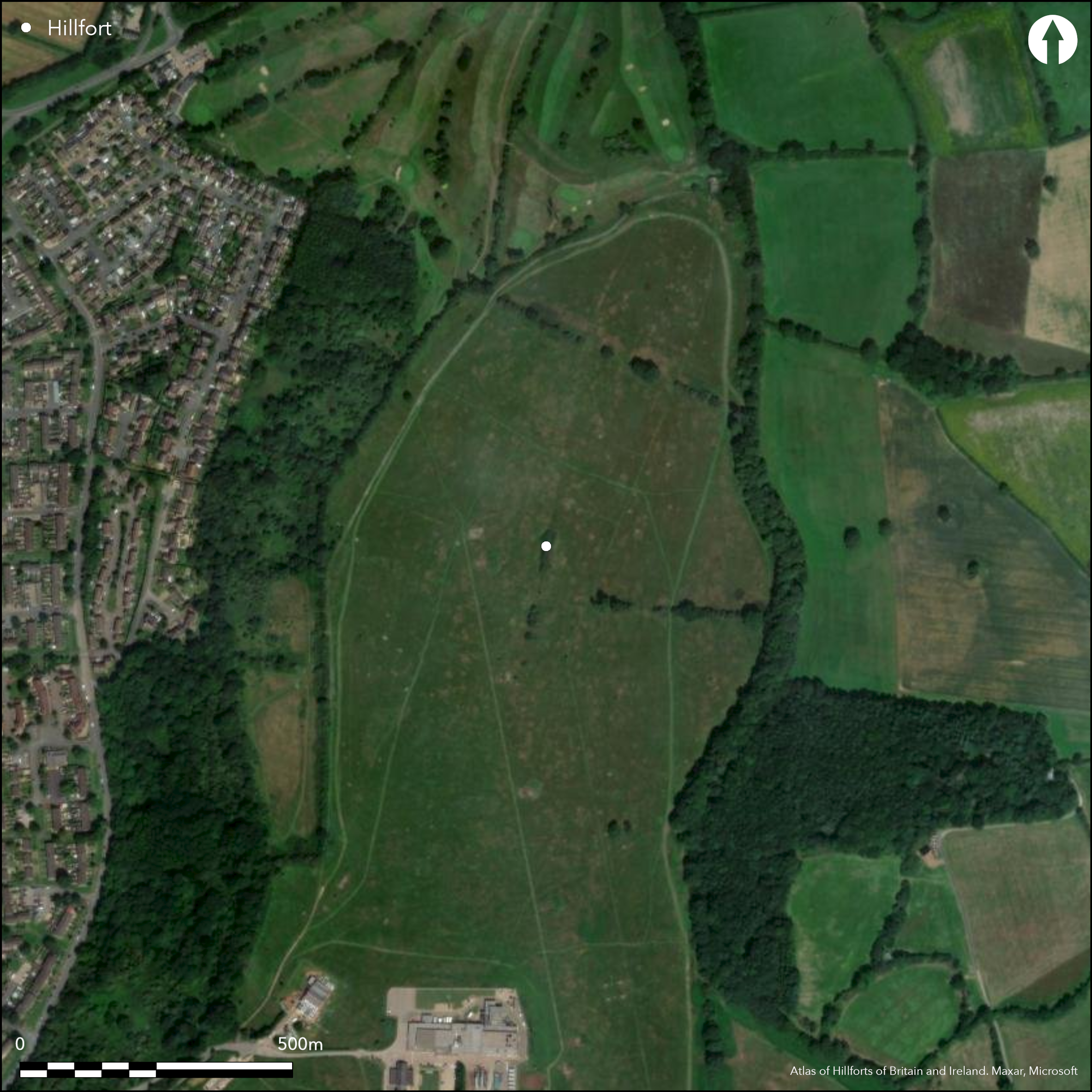
Satellite Imagery
LiDAR 1m DTM Hillshade
Satellite Imagery
Scroll left/right to view further images.
HER: Northamptonshire 631/4 (MNN11486)
NMR: SP 5 6 SE 6 (339880)
SM: 1010696
NGR: SP 588 626
X: 458877 Y: 262696 (OSGB36)
A large multi-vallate hilltop enclosure of 52ha on an isolated flat-topped hill to the E of Daventry. This site overlaps and partially incorporates Borough Hill 2 at it's N end. 18th century antiquarian records suggest that originally 3 ditches and 4 banks were continuous around the site, by the early 19th century most of these had been removed by agriculture. Now 2 banks and a ditch remain in the NW and E, 1 bank and ditch to the S, the line of the banks visible elsewhere to complete the circuit. Banks earthen, no further evidence of structure. No obvious original entrance but this may have been at the N where the enclosing works are badly disturbed by Borough Hill 2. On OS 1st Ed map (1884), limited excavation in the interior (Jackson 1993-4; 1996-7) produced LBA/EIA pottery and LBA metalwork suggesting an early date for this site which was then replaced by Borough Hill 2. A Romano-British barrow cemetary in the interior. Earthwork survey by RCHME (1981).
Citizen Science: ✓
Reliability of Data: Confirmed
Reliability of Interpretation: Confirmed
X: -126771 Y: 6847138 (EPSG: 3857)
Longitude: -1.1388069492288668 Latitude: 52.259253703014565 (EPSG:4326)
Country: England; None
Current County or Unitary Authority: Northamptonshire
Historic County: Northamptonshire
Current Parish/Community/Council/Townland: Daventry; Norton
Mainly extant, damage to banks in places, golf course in the N area, BBC transmission station in the S.
| Extant | ✓ |
| Cropmark | ✗ |
| Likely Destroyed | ✗ |
Mainly pasture, trees and scrub on banks and ditches.
| Woodland | ✓ |
| Commercial Forestry Plantation | ✗ |
| Parkland | ✗ |
| Pasture (Grazing) | ✓ |
| Arable | ✓ |
| Scrub/Bracken | ✗ |
| Bare Outcrop | ✗ |
| Heather/Moorland | ✗ |
| Heath | ✗ |
| Built-up | ✓ |
| Coastal Grassland | ✗ |
| Other | ✗ |
A contour fort on an isolated flat-topped hill
| Contour Fort | ✓ |
| Partial Contour Fort | ✗ |
| Promontory Fort | ✗ |
| Hillslope Fort | ✗ |
| Level Terrain Fort | ✗ |
| Marsh Fort | ✗ |
| Multiple Enclosure Fort | ✗ |
| Hilltop | ✓ |
| Coastal Promontory | ✗ |
| Inland Promontory | ✗ |
| Valley Bottom | ✗ |
| Knoll/Hillock/Outcrop | ✗ |
| Ridge | ✗ |
| Cliff/Plateau-edge/Scarp | ✗ |
| Hillslope | ✗ |
| Lowland | ✗ |
| Spur | ✗ |
Dominant Topographic Feature: Flat-topped isolated hill
| North | ✗ |
| Northeast | ✗ |
| East | ✗ |
| Southeast | ✗ |
| South | ✗ |
| Southwest | ✗ |
| West | ✗ |
| Northwest | ✗ |
| Level | ✓ |
Altitude: 195.0m
Boundary Type: Parish/Townland
Late Bronze/Early Iron Age ceramics and metalwork from excavation in the interior (Jackson 1993-4; 1996-7). Morphologically LBA large enclosure.
Reliability: C - Low
| Pre 1200BC | ✗ |
| 1200BC - 800BC | ✓ |
| 800BC - 400BC | ✓ |
| 400BC - AD50 | ✗ |
| AD50 - AD400 | ✗ |
| AD400 - AD 800 | ✗ |
| Post AD800 | ✗ |
| Unknown | ✗ |
| Pre Hillfort: | None |
| Post Hillfort: | None |
| Artefactual: | None |
| Morphology/Earthwork/Typology: | None |
In Aubrey's Monumenta Britannica (1665-1693). On OS 1st Ed map (1884). Small scale excavation (Jackson 1993-4; 1996-7. Earthwork survey (RCHME 1981). Mentioned by Morton in 1712, on map of Eayres in 1779.
| 1st Identified Map Depiction (1779): | None |
| Other (1884): | OS 1st Ed map |
| Earthwork Survey (1981): | RCHME |
| 1st Identified Written Reference (None): | None |
| Excavation (None): | Jackson |
Limited excavation in the interior produced LBA/EIA pottery and an Ewart Park bronze axehead
Streams 1km away
| None | ✓ |
| Spring | ✗ |
| Stream | ✗ |
| Pool | ✗ |
| Flush | ✗ |
| Well | ✗ |
| Other | ✗ |
None
| No Known Features | ✓ |
| Round Stone Structures | ✗ |
| Rectangular Stone Structures | ✗ |
| Curvilinear Platforms | ✗ |
| Other Roundhouse Evidence | ✗ |
| Pits | ✗ |
| Quarry Hollows | ✗ |
| Other | ✗ |
None
| No Known Excavation | ✗ |
| Pits | ✗ |
| Postholes | ✗ |
| Roundhouses | ✗ |
| Rectangular Structures | ✗ |
| Roads/Tracks | ✗ |
| Quarry Hollows | ✗ |
| Other | ✓ |
| Nothing Found | ✗ |
None
| No Known Geophysics | ✓ |
| Pits | ✗ |
| Roundhouses | ✗ |
| Rectangular Structures | ✗ |
| Roads/Tracks | ✗ |
| Quarry Hollows | ✗ |
| Other | ✗ |
| Nothing Found | ✗ |
LBA/EIA pottery, Ewart Park bronze axehead
| No Known Finds | ✗ |
| Pottery | ✓ |
| Metal | ✓ |
| Metalworking | ✗ |
| Human Bones | ✗ |
| Animal Bones | ✗ |
| Lithics | ✗ |
| Environmental | ✗ |
| Other | ✗ |
None
| APs Not Checked | ✓ |
| None | ✗ |
| Roundhouses | ✗ |
| Rectangular Structures | ✗ |
| Pits | ✗ |
| Postholes | ✗ |
| Roads/Tracks | ✗ |
| Other | ✗ |
Original entrance is probably at the N end where this site joins the later hillfort of Borough Hill 2. This area is badly disturbed and the entrance form is not discernible. At least 3 other breaks through the banks are post-IA
| 4: | None |
| 2: | None |
Guard Chambers: ✗
Chevaux de Frise: ✗
| 1. Other Forms (North): | None |
18th century antiquarian records suggest that originally 3 ditches and 4 banks were continuous around the site, by the early 19th century most of these had been removed by agriculture. Now 2 banks and a ditch remain in the NW and E, 1 bank and ditch to the S, the line of the banks visible elsewhere to complete the circuit. Banks earthen, no further evidence of structure.
| Area 1: | 52.0ha. |
| Total: | 52.0ha. |
Total Footprint Area: Noneha.
None
| ✗ | None |
| ✓ | None |
| NE Quadrant: | 2 |
| SE Quadrant: | 2 |
| SW Quadrant: | 2 |
| NW Quadrant: | 2 |
| Total: | 2 |
| Partial Univallate | ✗ |
| Univallate | ✗ |
| Partial Bivallate | ✗ |
| Bivallate | ✓ |
| Partial Multivallate | ✗ |
| Multivallate | ✗ |
| Unknown | ✗ |
| Partial Univallate | ✗ |
| Univallate | ✗ |
| Partial Bivallate | ✗ |
| Bivallate | ✗ |
| Partial Multivallate | ✗ |
| Multivallate | ✗ |
None
| None | ✗ |
| Earthen Bank | ✓ |
| Stone Wall | ✗ |
| Rubble | ✗ |
| Wall-walk | ✗ |
| Evidence of Timber | ✗ |
| Vitrification | ✗ |
| Other Burning | ✗ |
| Palisade | ✗ |
| Counter Scarp Bank | ✗ |
| Berm | ✗ |
| Unfinished | ✗ |
| Other | ✗ |
None
| None | ✗ |
| Earthen Bank | ✗ |
| Stone Wall | ✗ |
| Murus Duplex | ✗ |
| Timber-framed | ✗ |
| Timber-laced | ✗ |
| Vitrification | ✗ |
| Other Burning | ✗ |
| Palisade | ✗ |
| Counter Scarp Bank | ✗ |
| Berm | ✗ |
| Unfinished | ✗ |
| No Known Excavation | ✓ |
| Other | ✗ |
| ✗ | None |
| ✓ | None |
Number of Ditches: 2
| ✗ | None |
Jackson, D. A. 1993-4. The Iron Age hillfort at Borough Hill, Daventry, Northants. Northamptonshire Archaeol. 25, 5-20.
Jackson, D. A. 1996-7. Further evaluation at Borough Hill, Daventry, Northants. Northamptonshire Archaeol. 27, 143-64.
RCHME, 1981. An inventory of the Historical Monuments in the County of Northampton, Vol III, 63-6.
Atlas of Hillforts:
Wikidata:
This work is licensed under CC BY-SA 4.0

 and should be cited as:
Lock, Gary and Ralston, Ian. 2024. Atlas of Hillforts of Britain and Ireland. Available at: https://hillforts.arch.ox.ac.uk
Document Version 1.1