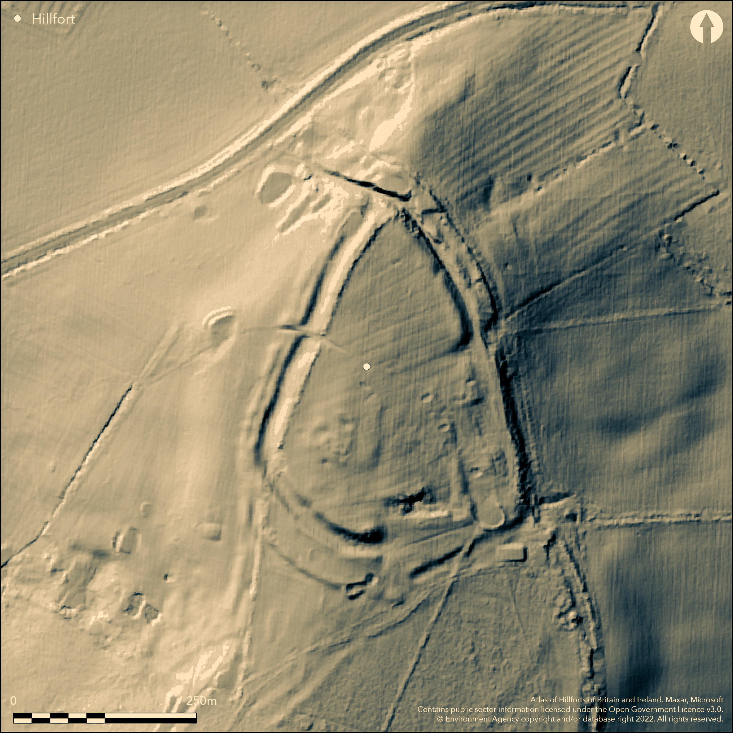
LiDAR 1m DTM Hillshade
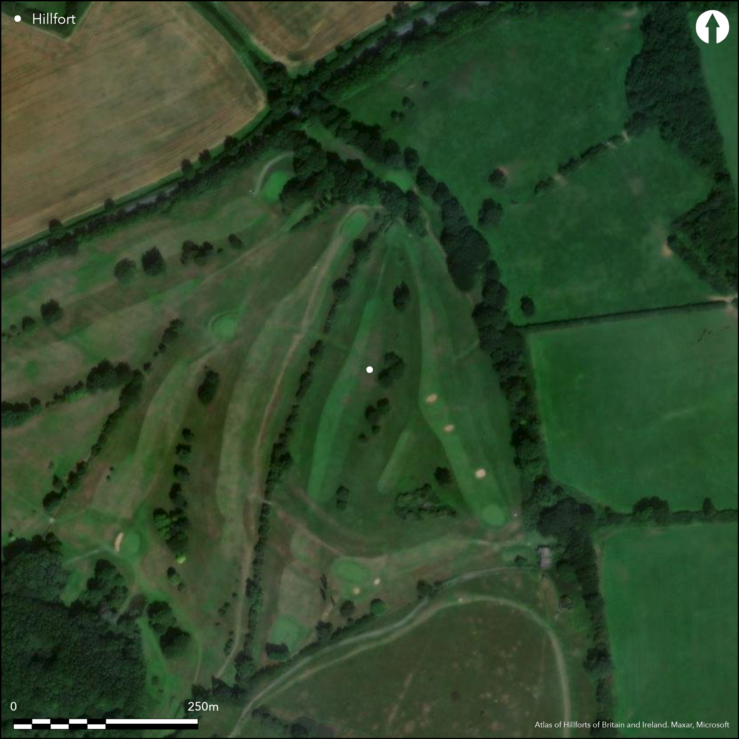
Satellite Imagery
LiDAR 1m DTM Hillshade
Satellite Imagery
Scroll left/right to view further images.
HER: Northamptonshire 631/4 (MNN11486)
NMR: SP 5 6 SE 6 (339880)
SM: 1010696
NGR: SP 589 632
X: 458912 Y: 263258 (OSGB36)
A triangular shaped multi-vallate partial contour hillfort at the N end of an isolated flat-topped hill E of Daventry. This site joins and is possibly partially incorporated into the N end of Borough Hill 1. Largely extant but damage to the SE. Surface evidence alone shows two earthen banks with ditch in between to NW and NE, extra bank and ditch where best preserved in the SW, mostly destroyed in the SE. A simple gap 35m wide within the S earthworks may be the original entrance although this is obscured by the relationship with Borough Hill 1 earthworks. Inturned entrance shown on Baker's 1822 map to E, perhaps leading to an external enclosure, post-IA gap to the W. Morphology of the earthworks and their relationship to the earlier Burough Hill 1 suggest this site is M/LIA. Borough Hill 1 may have continued as an annexe. An internal banked and ditched enclosure shown on Baker's map (1822), now ploughed out. On OS 1st Ed map (1884), earthwork survey by RCHME (1981), no other interventions.
Citizen Science: ✓
Reliability of Data: Confirmed
Reliability of Interpretation: Confirmed
X: -126703 Y: 6848056 (EPSG: 3857)
Longitude: -1.1381962771936762 Latitude: 52.26430203786191 (EPSG:4326)
Country: England; None
Current County or Unitary Authority: Northamptonshire
Historic County: Northamptonshire
Current Parish/Community/Council/Townland: Daventry; Norton
Largely extant but some damage
| Extant | ✓ |
| Cropmark | ✗ |
| Likely Destroyed | ✗ |
Trees on banks and ditches, golf course in the interior
| Woodland | ✓ |
| Commercial Forestry Plantation | ✗ |
| Parkland | ✗ |
| Pasture (Grazing) | ✓ |
| Arable | ✓ |
| Scrub/Bracken | ✗ |
| Bare Outcrop | ✗ |
| Heather/Moorland | ✗ |
| Heath | ✗ |
| Built-up | ✗ |
| Coastal Grassland | ✗ |
| Other | ✓ |
A partial contour fort that encloses the N end of an isolated flat-topped hill
| Contour Fort | ✗ |
| Partial Contour Fort | ✓ |
| Promontory Fort | ✗ |
| Hillslope Fort | ✗ |
| Level Terrain Fort | ✗ |
| Marsh Fort | ✗ |
| Multiple Enclosure Fort | ✗ |
| Hilltop | ✓ |
| Coastal Promontory | ✗ |
| Inland Promontory | ✗ |
| Valley Bottom | ✗ |
| Knoll/Hillock/Outcrop | ✗ |
| Ridge | ✗ |
| Cliff/Plateau-edge/Scarp | ✗ |
| Hillslope | ✗ |
| Lowland | ✗ |
| Spur | ✗ |
Dominant Topographic Feature: N end of isolated flat-topped hill
| North | ✗ |
| Northeast | ✗ |
| East | ✗ |
| Southeast | ✗ |
| South | ✗ |
| Southwest | ✗ |
| West | ✗ |
| Northwest | ✗ |
| Level | ✓ |
Altitude: 195.0m
Boundary Type: Parish/Townland
The morphology of the earthworks and it's relationship with Borough Hill 1 suggest M/LIA. No other dating evidence.
Reliability: C - Low
| Pre 1200BC | ✗ |
| 1200BC - 800BC | ✗ |
| 800BC - 400BC | ✗ |
| 400BC - AD50 | ✓ |
| AD50 - AD400 | ✗ |
| AD400 - AD 800 | ✗ |
| Post AD800 | ✗ |
| Unknown | ✗ |
| Pre Hillfort: | None |
| Post Hillfort: | None |
| Morphology/Earthwork/Typology: | None |
In Aubrey's Monumenta Britannica (1665-1693). On OS 1st Ed map (1884). Earthwork survey (RCHME 1981). Mentioned by Morton in 1712, on map of Eayres in 1779.
| 1st Identified Map Depiction (1779): | None |
| Other (1884): | OS 1st Ed |
| Earthwork Survey (1981): | RCHME |
| 1st Identified Written Reference (None): | None |
An internal banked and ditched enclosure shown on Baker's map (1822), now ploughed out.
Streams 1km away
| None | ✓ |
| Spring | ✗ |
| Stream | ✗ |
| Pool | ✗ |
| Flush | ✗ |
| Well | ✗ |
| Other | ✗ |
None
| No Known Features | ✗ |
| Round Stone Structures | ✗ |
| Rectangular Stone Structures | ✗ |
| Curvilinear Platforms | ✗ |
| Other Roundhouse Evidence | ✗ |
| Pits | ✗ |
| Quarry Hollows | ✗ |
| Other | ✓ |
None
| No Known Excavation | ✓ |
| Pits | ✗ |
| Postholes | ✗ |
| Roundhouses | ✗ |
| Rectangular Structures | ✗ |
| Roads/Tracks | ✗ |
| Quarry Hollows | ✗ |
| Other | ✗ |
| Nothing Found | ✗ |
None
| No Known Geophysics | ✓ |
| Pits | ✗ |
| Roundhouses | ✗ |
| Rectangular Structures | ✗ |
| Roads/Tracks | ✗ |
| Quarry Hollows | ✗ |
| Other | ✗ |
| Nothing Found | ✗ |
None
| No Known Finds | ✓ |
| Pottery | ✗ |
| Metal | ✗ |
| Metalworking | ✗ |
| Human Bones | ✗ |
| Animal Bones | ✗ |
| Lithics | ✗ |
| Environmental | ✗ |
| Other | ✗ |
NO APPARENT FEATURES
| APs Not Checked | ✓ |
| None | ✗ |
| Roundhouses | ✗ |
| Rectangular Structures | ✗ |
| Pits | ✗ |
| Postholes | ✗ |
| Roads/Tracks | ✗ |
| Other | ✗ |
A simple gap 35m wide within the S earthworks may be the original entrance although this is obscured by the relationship with Borough Hill 1 earthworks. Post-IA gap to the W. Inturned entrance shown on Baker's 1822 map to E, perhaps leading to an external enclosure..
| 3: | None |
| 2: | None |
Guard Chambers: ✗
Chevaux de Frise: ✗
| 1. Simple Gap (South): | None |
| 2. In-turned (East): | None |
Only surface evidence, earthen bank, 2 banks with ditch in between to NW and NE, extra bank and ditch where best preserved in the SW, mostly destroyed in the SE.
| Area 1: | 5.0ha. |
| Total: | 5.0ha. |
Total Footprint Area: Noneha.
None
| ✗ | None |
| ✓ | None |
| NE Quadrant: | 2 |
| SE Quadrant: | 1 |
| SW Quadrant: | 3 |
| NW Quadrant: | 2 |
| Total: | 3 |
| Partial Univallate | ✓ |
| Univallate | ✗ |
| Partial Bivallate | ✓ |
| Bivallate | ✗ |
| Partial Multivallate | ✓ |
| Multivallate | ✗ |
| Unknown | ✗ |
| Partial Univallate | ✗ |
| Univallate | ✗ |
| Partial Bivallate | ✗ |
| Bivallate | ✗ |
| Partial Multivallate | ✗ |
| Multivallate | ✗ |
None
| None | ✗ |
| Earthen Bank | ✓ |
| Stone Wall | ✗ |
| Rubble | ✗ |
| Wall-walk | ✗ |
| Evidence of Timber | ✗ |
| Vitrification | ✗ |
| Other Burning | ✗ |
| Palisade | ✗ |
| Counter Scarp Bank | ✗ |
| Berm | ✗ |
| Unfinished | ✗ |
| Other | ✗ |
None
| None | ✗ |
| Earthen Bank | ✗ |
| Stone Wall | ✗ |
| Murus Duplex | ✗ |
| Timber-framed | ✗ |
| Timber-laced | ✗ |
| Vitrification | ✗ |
| Other Burning | ✗ |
| Palisade | ✗ |
| Counter Scarp Bank | ✗ |
| Berm | ✗ |
| Unfinished | ✗ |
| No Known Excavation | ✓ |
| Other | ✗ |
| ✗ | None |
| ✓ | 2 ditches to SW where best preserved, 1 around the rest of the circuit |
Number of Ditches: 2
| ✗ | None |
Jackson, D. A. 1993-4. The Iron Age hillfort at Borough Hill, Daventry, Northants. Northamptonshire Archaeol. 25, 5-20.
Jackson, D. A. 1996-7. Further evaluation at Borough Hill, Daventry, Northants. Northamptonshire Archaeol. 27, 143-64.
RCHME, 1981. An inventory of the Historical Monuments in the County of Northampton, Vol III, 63-6.
Atlas of Hillforts:
Wikidata:
This work is licensed under CC BY-SA 4.0

 and should be cited as:
Lock, Gary and Ralston, Ian. 2024. Atlas of Hillforts of Britain and Ireland. Available at: https://hillforts.arch.ox.ac.uk
Document Version 1.1