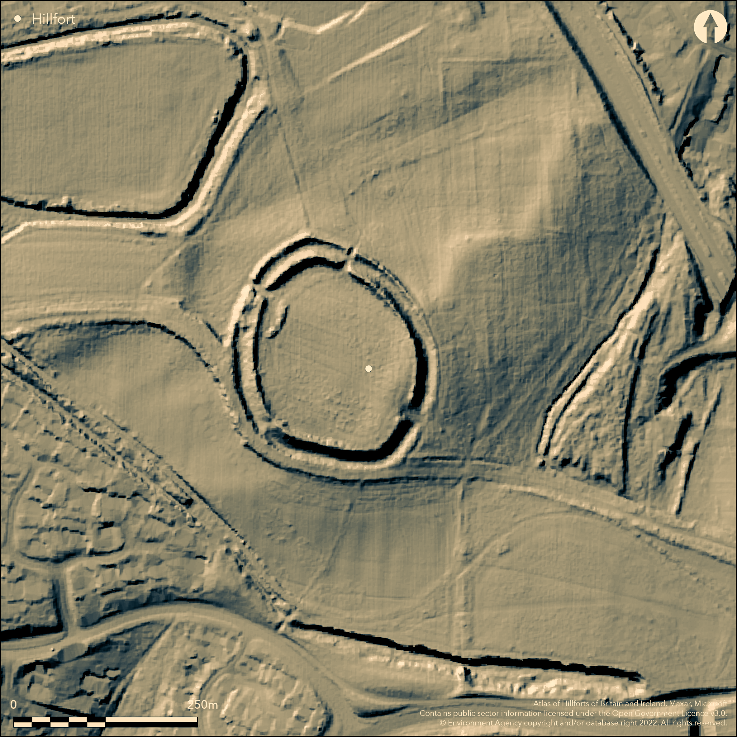
LiDAR 1m DTM Hillshade
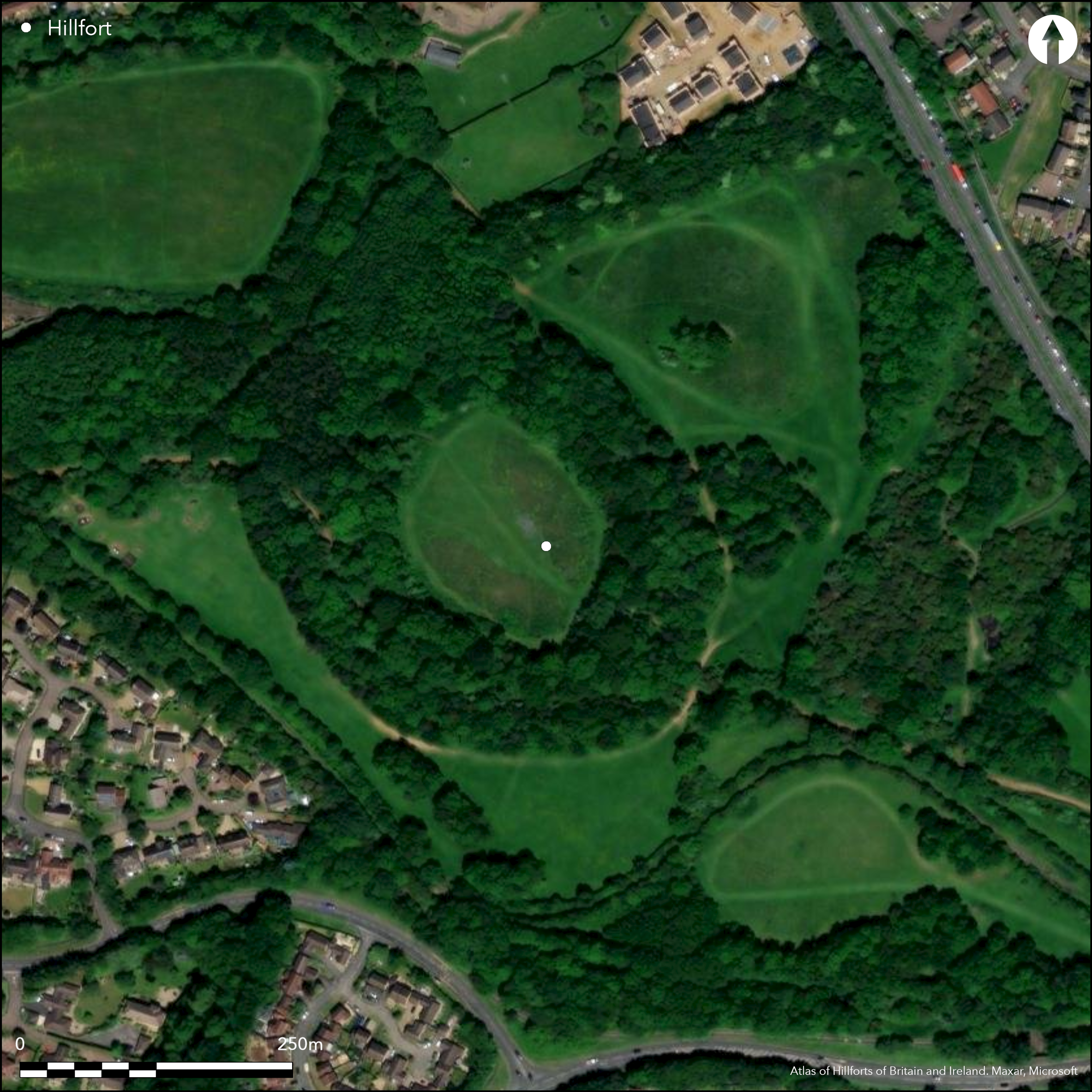
Satellite Imagery
LiDAR 1m DTM Hillshade
Satellite Imagery
Scroll left/right to view further images.
HER: Northamptonshire 1677 (MNN4248)
NMR: SP 7 5 NW 5 (None)
SM: 1012150
NGR: SP 7383 5835
X: 473830 Y: 258355 (OSGB36)
An elliptical enclosure of 1.6ha on a prominent hill overlooking the Nene Valley, SE of Northampton. The interior has been badly damaged by 19th century quarrying which revealed over 300 pits and resulted in an important collection of metalwork, pottery and over 100 quern stones (Fell 1936). The enclosing works comprise a rampart (3.7m high in places), ditch (2m deep in places) and counterscarp bank which survive for much of the circuit, some tree cover although the interior is clear. A possible outer ditch in the S and SE. Excavation (Jackson 1993-4) shows 7th/6th century box rampart with evidence of burning, replaced by a dump rampart in the 4th/3rd century BC, there are three C14 dates, the ditch was c.8m deep in places. Two possibly original entrances are now simple gaps at the N and SE. On the 1st Ed OS map (1885-1900), also described by antiquarians at the same time, earthwork survey (RCHME 1985).
Citizen Science: ✓
Reliability of Data: Confirmed
Reliability of Interpretation: Confirmed
X: -102493 Y: 6839717 (EPSG: 3857)
Longitude: -0.9207106659366209 Latitude: 52.218431816788666 (EPSG:4326)
Country: England
Current County or Unitary Authority: Northamptonshire
Historic County: Northamptonshire
Current Parish/Community/Council/Townland: Northampton
Ramparts largely extant, extensively quarried in the interior, some damage to ramparts. On Heritage at Risk Register (2015).
| Extant | ✓ |
| Cropmark | ✗ |
| Likely Destroyed | ✗ |
Interior is clear pasture, woodland over ramparts and beyond
| Woodland | ✓ |
| Commercial Forestry Plantation | ✗ |
| Parkland | ✗ |
| Pasture (Grazing) | ✓ |
| Arable | ✗ |
| Scrub/Bracken | ✗ |
| Bare Outcrop | ✗ |
| Heather/Moorland | ✗ |
| Heath | ✗ |
| Built-up | ✗ |
| Coastal Grassland | ✗ |
| Other | ✗ |
A partial contour fort on the N end of N-S narrow hill top
| Contour Fort | ✗ |
| Partial Contour Fort | ✓ |
| Promontory Fort | ✗ |
| Hillslope Fort | ✗ |
| Level Terrain Fort | ✗ |
| Marsh Fort | ✗ |
| Multiple Enclosure Fort | ✗ |
| Hilltop | ✓ |
| Coastal Promontory | ✗ |
| Inland Promontory | ✗ |
| Valley Bottom | ✗ |
| Knoll/Hillock/Outcrop | ✗ |
| Ridge | ✗ |
| Cliff/Plateau-edge/Scarp | ✗ |
| Hillslope | ✗ |
| Lowland | ✗ |
| Spur | ✗ |
Dominant Topographic Feature: Isolated hill top
| North | ✗ |
| Northeast | ✗ |
| East | ✗ |
| Southeast | ✗ |
| South | ✗ |
| Southwest | ✗ |
| West | ✗ |
| Northwest | ✗ |
| Level | ✓ |
Altitude: 109.0m
N/A
7th/6th century box rampart replace by dump rampart c. 4th/3rd century, 3 C14 dates (Jackson 1993-4).
Reliability: B - Medium
| Pre 1200BC | ✗ |
| 1200BC - 800BC | ✗ |
| 800BC - 400BC | ✓ |
| 400BC - AD50 | ✓ |
| AD50 - AD400 | ✗ |
| AD400 - AD 800 | ✗ |
| Post AD800 | ✗ |
| Unknown | ✗ |
| Pre Hillfort: | None |
| Post Hillfort: | None |
| Artefactual: | Jackson 1993-4 |
| C14: | Jackson 1993-4 |
Antiquarian reference (Dryden 1885), on 1st Ed OS map (1185-1900). Excavation in 1952 across the ramparts by Atkinson, then in 1988 by Jackson (Jackson 1993-4). Earthwork survey (RCHME 1985) and geophysical survey (Tingle and Jackson 2004).
| 1st Identified Written Reference (1885): | None |
| Earthwork Survey (1985): | None |
| Geophysical Survey (2004): | None |
| 1st Identified Map Depiction (None): | OS 1st ED |
| Excavation (None): | None |
Extensive quarrying in the 19th century in the interior revealed over 300 pits resulting in a large collection of metalwork, pottery and over 100 quern stones (many now in Northamptonshire Museum), some human skulls.
None
| None | ✓ |
| Spring | ✗ |
| Stream | ✗ |
| Pool | ✗ |
| Flush | ✗ |
| Well | ✗ |
| Other | ✗ |
None
| No Known Features | ✓ |
| Round Stone Structures | ✗ |
| Rectangular Stone Structures | ✗ |
| Curvilinear Platforms | ✗ |
| Other Roundhouse Evidence | ✗ |
| Pits | ✗ |
| Quarry Hollows | ✗ |
| Other | ✗ |
None
| No Known Excavation | ✗ |
| Pits | ✓ |
| Postholes | ✓ |
| Roundhouses | ✗ |
| Rectangular Structures | ✗ |
| Roads/Tracks | ✗ |
| Quarry Hollows | ✗ |
| Other | ✗ |
| Nothing Found | ✗ |
None
| No Known Geophysics | ✗ |
| Pits | ✓ |
| Roundhouses | ✗ |
| Rectangular Structures | ✗ |
| Roads/Tracks | ✗ |
| Quarry Hollows | ✗ |
| Other | ✗ |
| Nothing Found | ✗ |
A large collection of metal artefacts and over 100 quern stones from 19th century quarrying, plus human skulls.
| No Known Finds | ✗ |
| Pottery | ✓ |
| Metal | ✓ |
| Metalworking | ✓ |
| Human Bones | ✓ |
| Animal Bones | ✗ |
| Lithics | ✗ |
| Environmental | ✗ |
| Other | ✓ |
None
| APs Not Checked | ✓ |
| None | ✗ |
| Roundhouses | ✗ |
| Rectangular Structures | ✗ |
| Pits | ✗ |
| Postholes | ✗ |
| Roads/Tracks | ✗ |
| Other | ✗ |
two possible original entrances both now simple gaps, to N and SE, modern break in NW related to quarrying activity.
| 3: | None |
| 2: | None |
Guard Chambers: ✗
Chevaux de Frise: ✗
| 1. Simple Gap (North): | None |
| 2. Simple Gap (South east): | None |
Single bank with outer ditch (2m deep in places, originally c.8m shown by excavation) and counter scarp bank for the complete circuit, possibly an outer ditch in the S and SE areas. Excavation shows 7th/6th century box rampart replace by dump rampart, evidence of burning, c. 4th/3rd century, 3 C14 dates (Jackson 1993-4).
| Area 1: | 1.6ha. |
| Total: | 1.6ha. |
Total Footprint Area: Noneha.
None
| ✗ | None |
| ✓ | None |
| NE Quadrant: | 2 |
| SE Quadrant: | 2 |
| SW Quadrant: | 2 |
| NW Quadrant: | 2 |
| Total: | 2 |
| Partial Univallate | ✗ |
| Univallate | ✗ |
| Partial Bivallate | ✗ |
| Bivallate | ✓ |
| Partial Multivallate | ✗ |
| Multivallate | ✗ |
| Unknown | ✗ |
| Partial Univallate | ✗ |
| Univallate | ✗ |
| Partial Bivallate | ✗ |
| Bivallate | ✗ |
| Partial Multivallate | ✗ |
| Multivallate | ✗ |
None
| None | ✗ |
| Earthen Bank | ✓ |
| Stone Wall | ✗ |
| Rubble | ✗ |
| Wall-walk | ✗ |
| Evidence of Timber | ✗ |
| Vitrification | ✗ |
| Other Burning | ✗ |
| Palisade | ✗ |
| Counter Scarp Bank | ✓ |
| Berm | ✗ |
| Unfinished | ✗ |
| Other | ✗ |
None
| None | ✗ |
| Earthen Bank | ✓ |
| Stone Wall | ✗ |
| Murus Duplex | ✗ |
| Timber-framed | ✓ |
| Timber-laced | ✗ |
| Vitrification | ✗ |
| Other Burning | ✓ |
| Palisade | ✗ |
| Counter Scarp Bank | ✓ |
| Berm | ✗ |
| Unfinished | ✗ |
| No Known Excavation | ✗ |
| Other | ✗ |
| ✗ | None |
| ✓ | One ditch all around, possibly a second |
Number of Ditches: 1
| ✗ | None |
Fell, C. I. 1936. The Hunsbury hillfort, Northants: a new survey of the material. Archaeol J, 93, 57-100.
Jackson, D. A. 1993-4. Excavation of the hillfort defences at Hunsbury, Northampton, in 1952 and 1988. Northamptonshire Archaeol. 25, 5-20.
RCHME, 1985. An inventory of the Historical Monuments in the County of Northampton, Vol V, 277-83.
Tingle, M. and Jackson, D. 2004, Hunsbury Hillfort. Online at https://www.jwaller.co.uk/nas/Hunsbury-Hillfort.htm
Atlas of Hillforts:
Wikidata:
This work is licensed under CC BY-SA 4.0

 and should be cited as:
Lock, Gary and Ralston, Ian. 2024. Atlas of Hillforts of Britain and Ireland. Available at: https://hillforts.arch.ox.ac.uk
Document Version 1.1