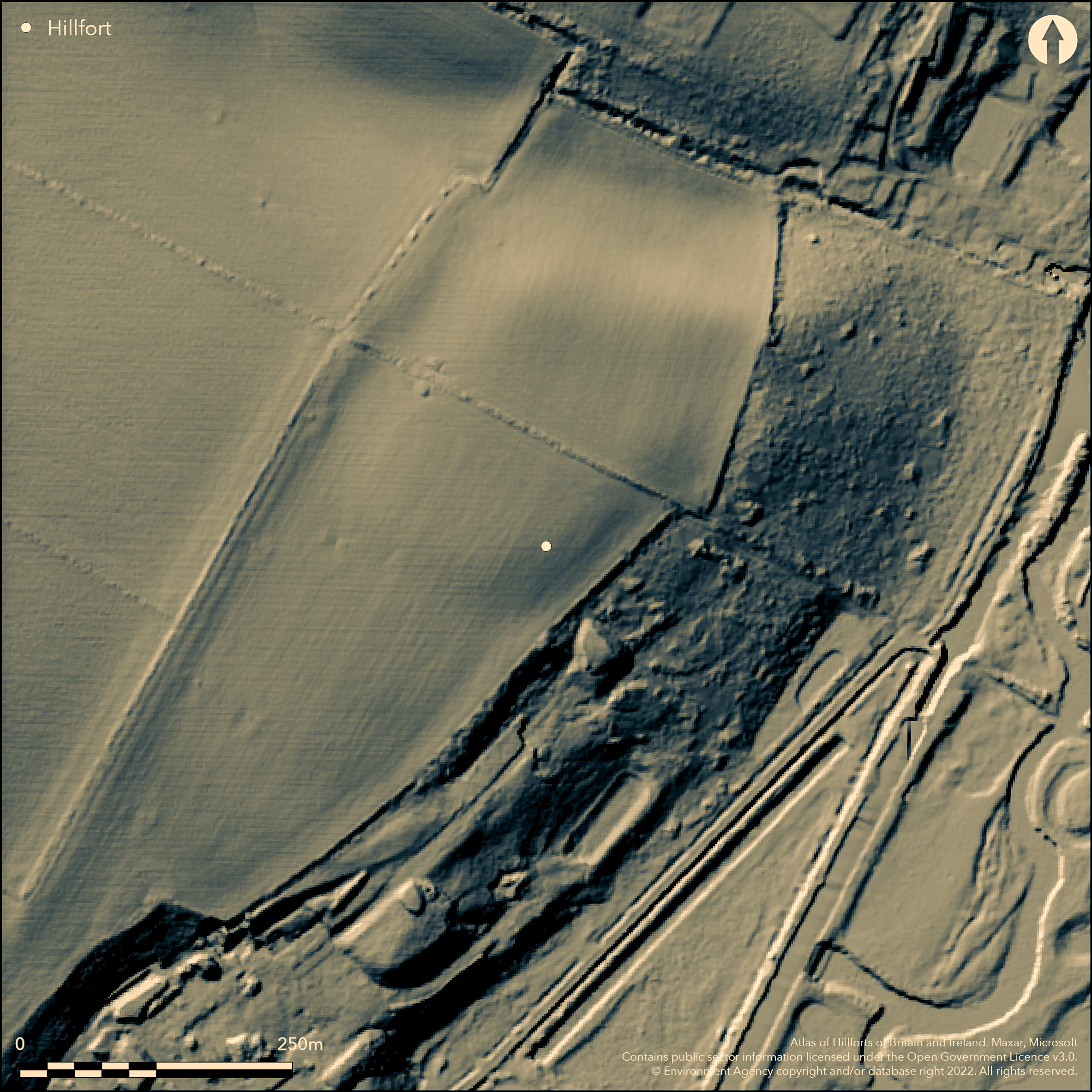
LiDAR 1m DTM Hillshade
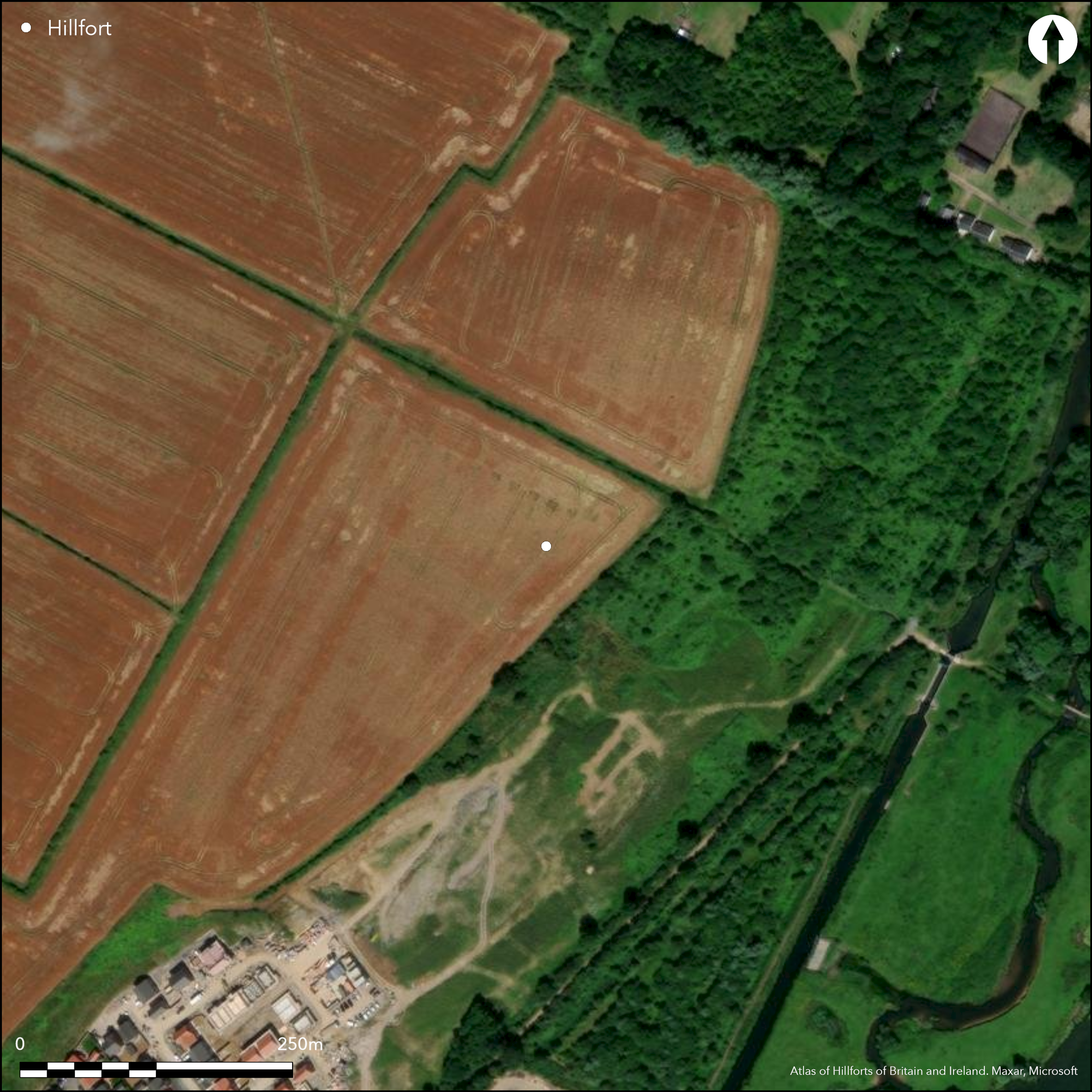
Satellite Imagery
LiDAR 1m DTM Hillshade
Satellite Imagery
Scroll left/right to view further images.
HER: Northamptonshire 1780/0/0 (MNN4311)
NMR: SP 9 7 SE 36 (347390)
SM: 1013267
NGR: SP 9550 7154
X: 495793 Y: 271506 (OSGB36)
A sub-rectangular enclosure of 3ha interior area, situated on a gentle slope overlooking the Nene Valley, E aspect, NE of Irthlingborough. First discovered by aerial photography in 1972, confirmed through fieldwalking, geophysical survey and limited excavation as part of the Raunds Area Survey (Parry and Blinkhorn 2006, 139-146). Univallate with ditch for entire circuit. Ditch shows on aerial photograph which excavation confirmed to be 17m wide but made up from shifting recuts, the original form was narrow and steep, 3m wide and 3.3m deep. Excavation also revealed a layer of rubble inside the ditch which may represent the rampart, 3-4m wide, contained E-MIA sherds, and 5 postholes suggesting timber-framed. A V-shaped palisade trench, along the inner edge of the main ditch, contained early RB pot. One entrance at SW, c4m wide with internal funnel-type form, with possible outworks. Probably E/MIA with Romano-British and early Saxon re-use.
Citizen Science: ✓
Reliability of Data: Confirmed
Reliability of Interpretation: Confirmed
X: -66299 Y: 6860608 (EPSG: 3857)
Longitude: -0.5955777395992808 Latitude: 52.33325274682102 (EPSG:4326)
Country: England
Current County or Unitary Authority: Northamptonshire
Historic County: Northamptonshire
Current Parish/Community/Council/Townland: Irthlingborough
On Heritage at Risk Register (2015).
| Extant | ✗ |
| Cropmark | ✓ |
| Likely Destroyed | ✗ |
None
| Woodland | ✗ |
| Commercial Forestry Plantation | ✗ |
| Parkland | ✗ |
| Pasture (Grazing) | ✗ |
| Arable | ✓ |
| Scrub/Bracken | ✗ |
| Bare Outcrop | ✗ |
| Heather/Moorland | ✗ |
| Heath | ✗ |
| Built-up | ✗ |
| Coastal Grassland | ✗ |
| Other | ✗ |
A hillslope fort on a gentle slope overlooking the Nene Valley, aspect E.
| Contour Fort | ✗ |
| Partial Contour Fort | ✗ |
| Promontory Fort | ✗ |
| Hillslope Fort | ✓ |
| Level Terrain Fort | ✗ |
| Marsh Fort | ✗ |
| Multiple Enclosure Fort | ✗ |
| Hilltop | ✗ |
| Coastal Promontory | ✗ |
| Inland Promontory | ✗ |
| Valley Bottom | ✗ |
| Knoll/Hillock/Outcrop | ✗ |
| Ridge | ✗ |
| Cliff/Plateau-edge/Scarp | ✗ |
| Hillslope | ✓ |
| Lowland | ✗ |
| Spur | ✗ |
Dominant Topographic Feature: Overlooks the Nene Valley
| North | ✗ |
| Northeast | ✗ |
| East | ✓ |
| Southeast | ✗ |
| South | ✗ |
| Southwest | ✗ |
| West | ✗ |
| Northwest | ✗ |
| Level | ✗ |
Altitude: 62.0m
N/A
Probably E/MIA based on limited pottery from excavation and field walking (Parry and Blinkhorn 2006, 139-146). Flints from fieldwalking suggest earlier occupation, Romano-British re-use (roundhouse), Early Saxon re-working of ditch and possible settlement.
Reliability: B - Medium
| Pre 1200BC | ✗ |
| 1200BC - 800BC | ✗ |
| 800BC - 400BC | ✓ |
| 400BC - AD50 | ✓ |
| AD50 - AD400 | ✗ |
| AD400 - AD 800 | ✗ |
| Post AD800 | ✗ |
| Unknown | ✗ |
| Pre Hillfort: | None |
| Post Hillfort: | None |
| Artefactual: | None |
Discovered on aerial photograph of 1972. Fieldwalking and geophysical survey together with small-scale excavation as part of the Raunds Area Survey (Parry and Blinkhorn 2006, 139-146).
| Other (1972): | Aerial photograph |
| Excavation (None): | None |
| Geophysical Survey (None): | None |
| Other (None): | Fieldwalking |
Aerial photographs and geophysics show 2 sub-rectangular and one D-shaped ditched enclosures, at least 7 roundhouses, 14-22m diameter with entrances to E and possibly many pits. Pottery from limited excavation.
R. Nene 300m to SE.
| None | ✓ |
| Spring | ✗ |
| Stream | ✗ |
| Pool | ✗ |
| Flush | ✗ |
| Well | ✗ |
| Other | ✗ |
None
| No Known Features | ✓ |
| Round Stone Structures | ✗ |
| Rectangular Stone Structures | ✗ |
| Curvilinear Platforms | ✗ |
| Other Roundhouse Evidence | ✗ |
| Pits | ✗ |
| Quarry Hollows | ✗ |
| Other | ✗ |
None
| No Known Excavation | ✗ |
| Pits | ✗ |
| Postholes | ✗ |
| Roundhouses | ✓ |
| Rectangular Structures | ✗ |
| Roads/Tracks | ✗ |
| Quarry Hollows | ✗ |
| Other | ✗ |
| Nothing Found | ✗ |
Pits, roundhouses and enclosures
| No Known Geophysics | ✗ |
| Pits | ✓ |
| Roundhouses | ✓ |
| Rectangular Structures | ✗ |
| Roads/Tracks | ✗ |
| Quarry Hollows | ✗ |
| Other | ✓ |
| Nothing Found | ✗ |
None
| No Known Finds | ✗ |
| Pottery | ✓ |
| Metal | ✗ |
| Metalworking | ✗ |
| Human Bones | ✗ |
| Animal Bones | ✗ |
| Lithics | ✗ |
| Environmental | ✗ |
| Other | ✗ |
Roundhouses, pits and enclosures
| APs Not Checked | ✗ |
| None | ✗ |
| Roundhouses | ✓ |
| Rectangular Structures | ✗ |
| Pits | ✓ |
| Postholes | ✗ |
| Roads/Tracks | ✗ |
| Other | ✓ |
One entrance at SW, c4m wide, ditch curves inwards to give off-set, two short lengths of ditch directly outside the entrance, 2 narrow ditches extend inwards to create funnel-type entrance.
| 1: | None |
| 2: | None |
Guard Chambers: ✗
Chevaux de Frise: ✗
| 1. Passage-way/Corridor (South west): | None |
| 1. Outworks (South west): | None |
Univallate with ditch for entire circuit. Ditch shows as 8m-14m wide on aerial photograph. Excavation showed it to be ditch 17m wide but made up from shifting recuts, original form was narrow and steep, 3m wide and 3.3m deep. Excavation revealed a layer of rubble 7m inside the ditch which may represent the rampart, 3-4m wide, contained E-MIA sherds, and 5 postholes suggesting timber-framed. V-shaped palisade trench, 1.6m deep along the inner edge of the main ditch, contained early RB pot.
| Area 1: | 3.0ha. |
| Total: | 3.0ha. |
Total Footprint Area: Noneha.
None
| ✗ | None |
| ✓ | None |
| NE Quadrant: | 1 |
| SE Quadrant: | 1 |
| SW Quadrant: | 1 |
| NW Quadrant: | 1 |
| Total: | 1 |
| Partial Univallate | ✗ |
| Univallate | ✓ |
| Partial Bivallate | ✗ |
| Bivallate | ✗ |
| Partial Multivallate | ✗ |
| Multivallate | ✗ |
| Unknown | ✗ |
| Partial Univallate | ✗ |
| Univallate | ✗ |
| Partial Bivallate | ✗ |
| Bivallate | ✗ |
| Partial Multivallate | ✗ |
| Multivallate | ✗ |
None
| None | ✗ |
| Earthen Bank | ✓ |
| Stone Wall | ✗ |
| Rubble | ✗ |
| Wall-walk | ✗ |
| Evidence of Timber | ✗ |
| Vitrification | ✗ |
| Other Burning | ✗ |
| Palisade | ✗ |
| Counter Scarp Bank | ✗ |
| Berm | ✗ |
| Unfinished | ✗ |
| Other | ✗ |
Excavation revealed a layer of rubble 7m inside the ditchwhich may represent the rampart, 3-4m wide, contained E-MIA sherds, and 5 postholes suggesting timber-framed. V-shaped palisade trench, 1.6m deep along the inner edge of the main ditch, contained early RB pot.
| None | ✗ |
| Earthen Bank | ✗ |
| Stone Wall | ✗ |
| Murus Duplex | ✗ |
| Timber-framed | ✓ |
| Timber-laced | ✗ |
| Vitrification | ✗ |
| Other Burning | ✗ |
| Palisade | ✗ |
| Counter Scarp Bank | ✗ |
| Berm | ✗ |
| Unfinished | ✗ |
| No Known Excavation | ✗ |
| Other | ✗ |
| ✗ | None |
| ✓ | Ditch shows as 8m-14m wide on aerial photograph. Excavation showed it to be ditch 17m wide but made up from shifting recuts, original form was narrow and steep, 3m wide and 3.3m deep. |
Number of Ditches: 1
| ✗ | None |
Foard, G. and Parry, S. 1986. Crow Hill, Irthlingborough. Northamptonshire Archaeol. 21, 12.
Parry, S. and Blinkhorn, P. 2006. Raunds Area Survey: an archaeological study of the landscape of Raunds, Northamptonshire, 1985-1994. Oxford: Oxbow Books, 61-65 and 139-51.
Atlas of Hillforts:
Wikidata:
This work is licensed under CC BY-SA 4.0

 and should be cited as:
Lock, Gary and Ralston, Ian. 2024. Atlas of Hillforts of Britain and Ireland. Available at: https://hillforts.arch.ox.ac.uk
Document Version 1.1