LiDAR 1m DTM Hillshade
Satellite Imagery
LiDAR 1m DTM Hillshade
Satellite Imagery
Scroll left/right to view further images.
HER: Northumberland 1292 (None)
NMR: NT 91 NE 39 (1033853)
SM: 1006540
NGR: NT 99216 16457
X: 399216 Y: 616457 (OSGB36)
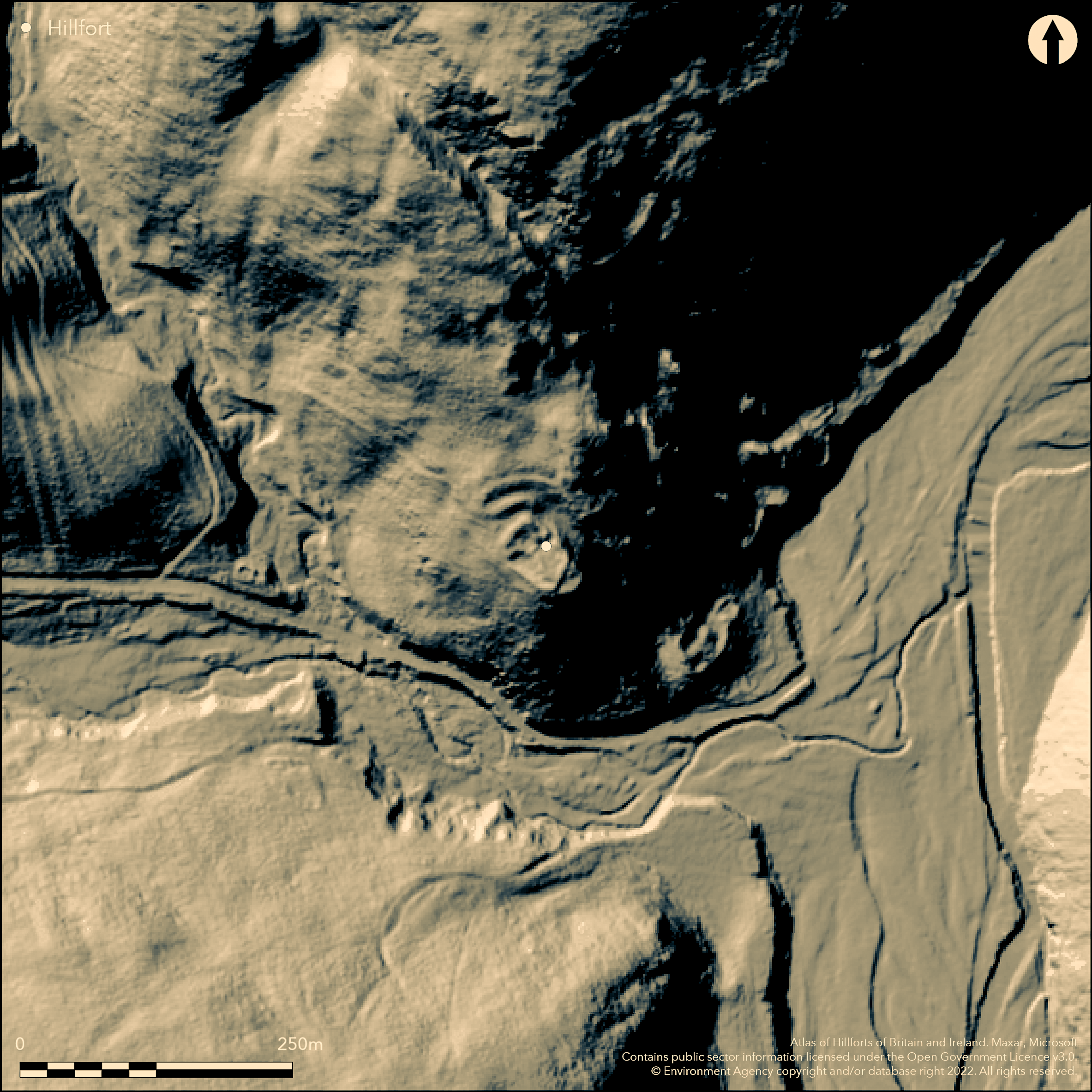
A small promontory fort lying at 195m OD on a SE projecting spur on Knock HIll. Although having a relatively small enclosed area of only 0.1ha and overlooked from the higher slopes of Knock Hill in the N, this site is heavily enclosed and holds a commanding position overlooking the Greensidehill Burn with clear views to the W and along the Breamish Valley. The enclosure is subrectangular in form, measuring 30m NW-SE by 20m transversely, contained within an inner earthen rampart measuring up to 0.7m high and 4.7m wide around the NW side. An extension to the main enclosure on its SE side follows the edge of the slopes and a slight outer scarp is visible. Two further outer banks and ditches protect the main enclosure in the NW. The banks measure approximately 1.2m high and up to 8m wide and the ditches 0.3m deep and 3-5m wide, terminating in the W at the top of the steep natural slopes. In the E the inner rampart ends abruptly at the head of a gully. At the northern crest of the outer rampart, the remains of a low turf-covered stone wall up to 0.5m high 2m wide, follows around to the E to merge with the natural slopes where it meets the remains of another similar wall which cuts down southwards into the gully to join with a man-made ramp outside the entrance. Slight traces of a ditch and outer scarp can be seen at its western end. Beyond the defences, a speculative outer palisade has been observed as a faint line in the turf and a slight bank 0.2m high and 1.5m wide running almost concentrically with the outer rampart from a rock outcrop in the W and terminating at the wall in the E. A centrally placed break is possibly an entrance. The entrance to the main enclosure lies in the NE, approached from the N up the SW side of a deep natural gully by a 2m wide man-made ramp. Internally the enclosure has been almost equally divided into three compartments, two lower compartments in the NE and SW were created by a low stone bank 0.4m high and 3m wide with a gap connecting the two in the NW. A lowering of the bank in the W of the SW compartment is modern damage. The single upper compartment is bordered by a scarp around its SE side. A circular flat area, probably a hut stance but now much mutilated, lies within the compartment. The SW side of the hut is cut by a line of stones 5.8m long. A small scooped area 3m in diameter, possibly the site of a further hut lies inside the main enclosure to the N of the entrance. The walls have been considerably damaged through stone robbing. The site is shown on 1885-1900 OS mapping and was included in the South-East Cheviots project. It is undated.
Citizen Science: ✗
Reliability of Data: Confirmed
Reliability of Interpretation: Confirmed
X: -224191 Y: 7448130 (EPSG: 3857)
Longitude: -2.013938524173954 Latitude: 55.442021100803274 (EPSG:4326)
Country: England
Current County or Unitary Authority: Northumberland
Historic County: Northumberland
Current Parish/Community/Council/Townland: Roddam
Damage has occurred through stone robbing
| Extant | ✓ |
| Cropmark | ✗ |
| Likely Destroyed | ✗ |
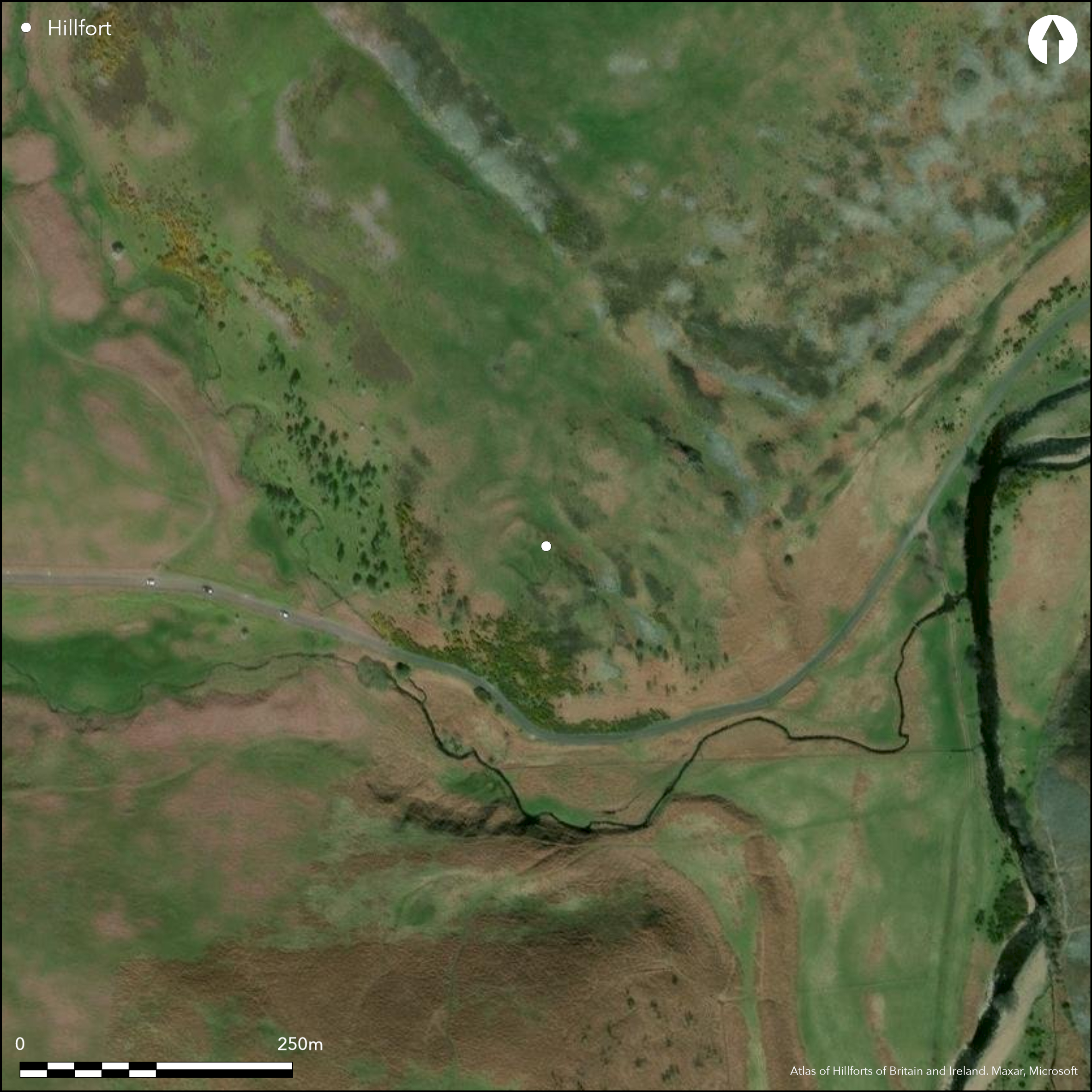
Satellite imagery shows heather or bracken
| Woodland | ✗ |
| Commercial Forestry Plantation | ✗ |
| Parkland | ✗ |
| Pasture (Grazing) | ✗ |
| Arable | ✗ |
| Scrub/Bracken | ✓ |
| Bare Outcrop | ✗ |
| Heather/Moorland | ✓ |
| Heath | ✗ |
| Built-up | ✗ |
| Coastal Grassland | ✗ |
| Other | ✗ |
A hillslope fort occupying a SE projecting spur on South Knock HIll at 195m OD. It holds a commanding position overlooking the Greensidehill Burn with clear views to the W and along the Breamish Valley.
| Contour Fort | ✗ |
| Partial Contour Fort | ✗ |
| Promontory Fort | ✗ |
| Hillslope Fort | ✓ |
| Level Terrain Fort | ✗ |
| Marsh Fort | ✗ |
| Multiple Enclosure Fort | ✗ |
| Hilltop | ✗ |
| Coastal Promontory | ✗ |
| Inland Promontory | ✗ |
| Valley Bottom | ✗ |
| Knoll/Hillock/Outcrop | ✗ |
| Ridge | ✗ |
| Cliff/Plateau-edge/Scarp | ✗ |
| Hillslope | ✓ |
| Lowland | ✗ |
| Spur | ✓ |
Dominant Topographic Feature: Spur overlooking the Breamish Valley
| North | ✗ |
| Northeast | ✗ |
| East | ✗ |
| Southeast | ✓ |
| South | ✗ |
| Southwest | ✗ |
| West | ✗ |
| Northwest | ✗ |
| Level | ✗ |
Altitude: 195.0m
N/A
Undated, presumed Iron Age
Reliability: D - None
| Pre 1200BC | ✗ |
| 1200BC - 800BC | ✗ |
| 800BC - 400BC | ✗ |
| 400BC - AD50 | ✗ |
| AD50 - AD400 | ✗ |
| AD400 - AD 800 | ✗ |
| Post AD800 | ✗ |
| Unknown | ✓ |
| Pre Hillfort: | None |
| Post Hillfort: | None |
| Morphology/Earthwork/Typology: | None |
Shown on 1885-1900 OS mapping. It was inspected by the OS Archaeology Division Field Investigation team in 1957,1969 and 1976 and was included within the RCHME South-East Cheviots Project in 2008 (earthwork plan p.48). Scheduled
| Other (1946): | Scheduled |
| Other (1957): | Field investigation |
| Other (1969): | Field investigation |
| Other (1976): | Field investigation |
| Earthwork Survey (2008): | SE Cheviots Project |
| 1st Identified Map Depiction (None): | OS mapping |
Enclosure almost equally divided into three compartments, two lower compartments in the NE and SW created by a low stone bank 0.4m high and 3m wide with a gap connecting the two in the NW. The single upper compartment is bordered by a scarp around its SE side. A circular flat area, probably a hut stance but now much mutilated, lies within the compartment. The SW side of the hut is cut by a line of stones 5.8m long. A small scooped area 3m in diameter, possibly the site of a further hut lies inside the main enclosure to the N of the entrance.
Situated above Greenside Burn
| None | ✓ |
| Spring | ✗ |
| Stream | ✗ |
| Pool | ✗ |
| Flush | ✗ |
| Well | ✗ |
| Other | ✗ |
None
| No Known Features | ✗ |
| Round Stone Structures | ✗ |
| Rectangular Stone Structures | ✗ |
| Curvilinear Platforms | ✓ |
| Other Roundhouse Evidence | ✓ |
| Pits | ✗ |
| Quarry Hollows | ✗ |
| Other | ✓ |
None
| No Known Excavation | ✓ |
| Pits | ✗ |
| Postholes | ✗ |
| Roundhouses | ✗ |
| Rectangular Structures | ✗ |
| Roads/Tracks | ✗ |
| Quarry Hollows | ✗ |
| Other | ✗ |
| Nothing Found | ✗ |
None
| No Known Geophysics | ✓ |
| Pits | ✗ |
| Roundhouses | ✗ |
| Rectangular Structures | ✗ |
| Roads/Tracks | ✗ |
| Quarry Hollows | ✗ |
| Other | ✗ |
| Nothing Found | ✗ |
None
| No Known Finds | ✓ |
| Pottery | ✗ |
| Metal | ✗ |
| Metalworking | ✗ |
| Human Bones | ✗ |
| Animal Bones | ✗ |
| Lithics | ✗ |
| Environmental | ✗ |
| Other | ✗ |
None
| APs Not Checked | ✓ |
| None | ✗ |
| Roundhouses | ✗ |
| Rectangular Structures | ✗ |
| Pits | ✗ |
| Postholes | ✗ |
| Roads/Tracks | ✗ |
| Other | ✗ |
A simple gap entrance lies in the NE of the main enclosure. A centrally placed break in the N of the palisade trench is possibly an entrance
| 4: | None |
| 2: | None |
Guard Chambers: ✗
Chevaux de Frise: ✗
| 1. Simple Gap (North east): | Inner rampart |
| 1. Simple Gap (North east): | Middle rampart |
| 1. Simple Gap (North east): | Outer rampart |
| 2. Simple Gap (North): | Palisade |
Subrectangular enclosure, measuring 30m NW-SE by 20m transversely, contained within an inner earthen rampart measuring up to 0.7m high and 4.7m wide around the vulnerable NW side. An extension to the main enclosure on its SE side follows the edge of the slopes and a slight outer scarp can be seen. Two further outer banks and ditches protect the main enclosure in the NW. The banks measure approximately 1.2m high and up to 8m wide and the ditches 0.3m deep and 3-5m wide, terminating in the W at the top of the steep natural slopes. In the E the inner rampart ends abruptly at the head of a gully. At the northern crest of the outer rampart, the remains of a low turf-covered stone wall up to 0.5m high 2m wide, follows around to the E to merge with the natural slopes where it meets the remains of another similar wall which cuts down southwards into the gully to join with a man-made ramp outside the entrance. Slight traces of a ditch and outer scarp can be seen at its western end. Beyond the defences, a speculative outer palisade has been observed as a faint line in the turf and a slight bank 0.2m high and 1.5m wide running almost concentrically with the outer rampart from a rock outcrop in the W and terminating at the wall in the E.
| Area 1: | 0.1ha. |
| Total: | 0.1ha. |
Total Footprint Area: Noneha.
None
| ✓ | Speculative. Possible palisade observed but temporal relationship to enclosure is uncertain |
| ✓ | Single rampart only for main enclosure. Two further defences in the NW |
| NE Quadrant: | 1 |
| SE Quadrant: | 1 |
| SW Quadrant: | 1 |
| NW Quadrant: | 3 |
| Total: | 3 |
| Partial Univallate | ✓ |
| Univallate | ✗ |
| Partial Bivallate | ✗ |
| Bivallate | ✗ |
| Partial Multivallate | ✓ |
| Multivallate | ✗ |
| Unknown | ✗ |
| Partial Univallate | ✗ |
| Univallate | ✗ |
| Partial Bivallate | ✗ |
| Bivallate | ✗ |
| Partial Multivallate | ✗ |
| Multivallate | ✗ |
None
| None | ✗ |
| Earthen Bank | ✓ |
| Stone Wall | ✓ |
| Rubble | ✗ |
| Wall-walk | ✗ |
| Evidence of Timber | ✗ |
| Vitrification | ✗ |
| Other Burning | ✗ |
| Palisade | ✓ |
| Counter Scarp Bank | ✗ |
| Berm | ✗ |
| Unfinished | ✗ |
| Other | ✗ |
None
| None | ✗ |
| Earthen Bank | ✗ |
| Stone Wall | ✗ |
| Murus Duplex | ✗ |
| Timber-framed | ✗ |
| Timber-laced | ✗ |
| Vitrification | ✗ |
| Other Burning | ✗ |
| Palisade | ✗ |
| Counter Scarp Bank | ✗ |
| Berm | ✗ |
| Unfinished | ✗ |
| No Known Excavation | ✓ |
| Other | ✗ |
| ✗ | None |
| ✓ | None |
Number of Ditches: 2
| ✗ | None |
Sainsbury I. in Topping P. Pearson, T. 2008. The South-East Cheviots Project. A descriptive account of the prehistoric landscape. English Heritage Report Series 83/2008 Published on-line https://services.english-heritage.org.uk/ResearchReportsPdfs/083-2008WEB1.pdf
Atlas of Hillforts:
Wikidata:
This work is licensed under CC BY-SA 4.0![]()
![]()
![]() and should be cited as:
and should be cited as:
Lock, Gary and Ralston, Ian. 2024. Atlas of Hillforts of Britain and Ireland. Available at: https://hillforts.arch.ox.ac.uk
Document Version 1.1