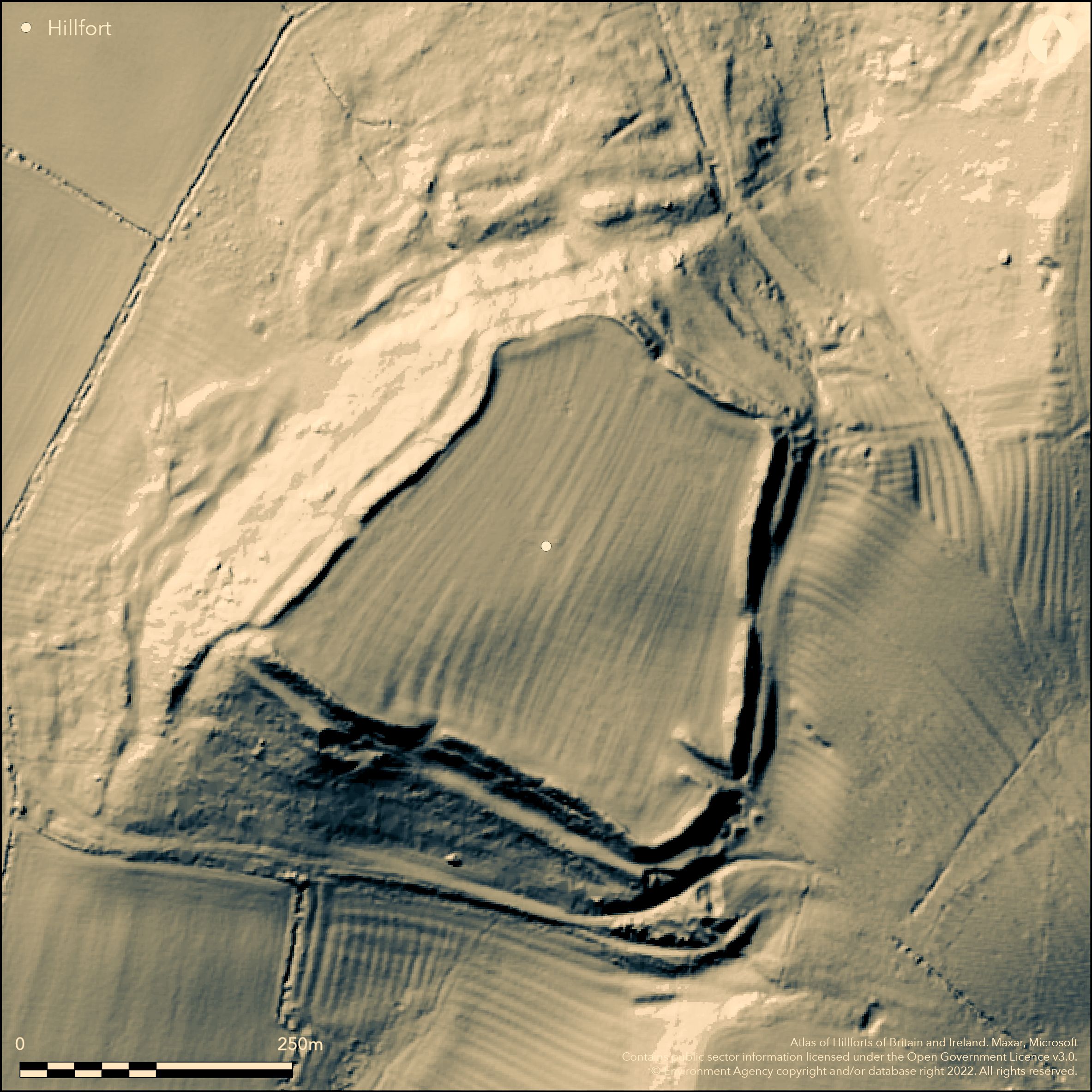
LiDAR 1m DTM Hillshade
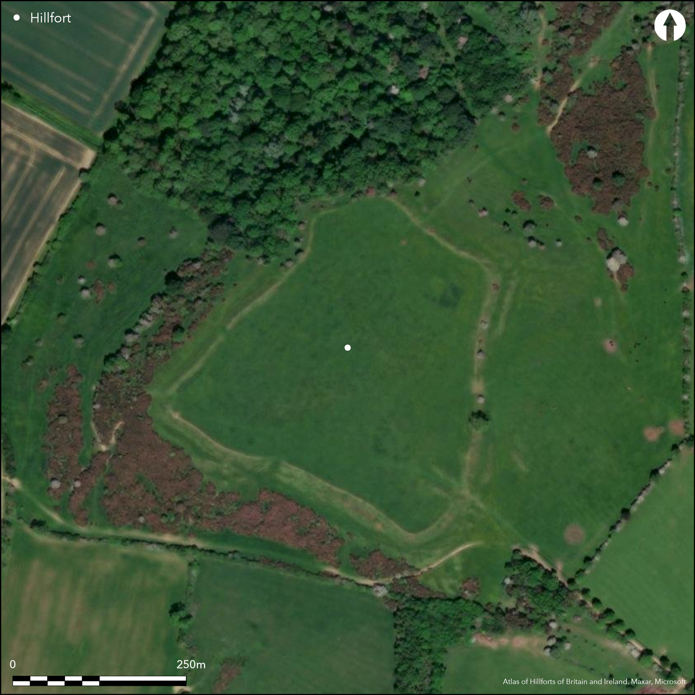
Satellite Imagery
LiDAR 1m DTM Hillshade
Satellite Imagery
Scroll left/right to view further images.
HER: Leicestershire and Rutland MLE4058 (None)
NMR: SK 7 1 SE 4 (321391)
SM: 1012441
NGR: SK 7608 1193
X: 476090 Y: 311980 (OSGB36)
Situated on an inland promontory, S of Melton Mowbray. Recorded by Leland (16th century), on 1st Ed OS map (1885-1900). Univallate with external ditch, roughly trapezoidal in shape enclosing 5ha, well preserved massive ramparts up to 3m high in places. A series of small-scale excavations (1935, 1960, 1967 and 1970-71 reported in Taylor et. al. 2012) have culminated in large-scale geophysics, excavations and re-evaluation by the University of Leicester (2010-2014). The single rampart has been shown to have a rubble/boulder core with layers of clay and capped by turf, dry-stone outer walling, leaning inwards in places. There are at least 6 breaks through the rampart, one definite original entrance is in-turned at the SE. Shown by excavation to have a cobbled road through the 40m long passage, dry-stone revetted inturn, gate-postholes, recess (guard chamber?) with hearths and floor levels. Probably developed from a simple gap when in-turn was added, then a later development saw the addition of the recess. C14 and artefactual dating dates the first in-turn to 370-220 cal BC and the ending of the recess occupation to 355-170 cal BC, overall the dating for the site is 450-150 cal BC. There is considerable renewed activity around the time of the Roman conquest and then possible occupation in the late Romano-British period. In the interior geophysics has shown over 400 pits, roundhouses of 6 to 15m diameter and enclosures all confirmed by excavation. Very rich assemblage of material culture, pottery, metalwork/ing, quern stones, worked bone, environmental, weaving. C14 and artefactual dating. There is a ditched (and banked?) annex to the SE containing roundhouses and pits which was discovered by geophysics in 2010, this also shows continuity of use into the Romano-British period. Evidence of Neolithic activity on the hill top.
Citizen Science: ✗
Reliability of Data: Confirmed
Reliability of Interpretation: Confirmed
X: -97451 Y: 6927722 (EPSG: 3857)
Longitude: -0.8754202234088015 Latitude: 52.70013095693034 (EPSG:4326)
Country: England
Current County or Unitary Authority: Leicestershire
Historic County: Leicestershire
Current Parish/Community/Council/Townland: Somerby
None
| Extant | ✓ |
| Cropmark | ✗ |
| Likely Destroyed | ✗ |
None
| Woodland | ✗ |
| Commercial Forestry Plantation | ✗ |
| Parkland | ✗ |
| Pasture (Grazing) | ✓ |
| Arable | ✗ |
| Scrub/Bracken | ✗ |
| Bare Outcrop | ✗ |
| Heather/Moorland | ✗ |
| Heath | ✗ |
| Built-up | ✗ |
| Coastal Grassland | ✗ |
| Other | ✗ |
On the top of an inland promontory
| Contour Fort | ✗ |
| Partial Contour Fort | ✗ |
| Promontory Fort | ✓ |
| Hillslope Fort | ✗ |
| Level Terrain Fort | ✗ |
| Marsh Fort | ✗ |
| Multiple Enclosure Fort | ✗ |
| Hilltop | ✗ |
| Coastal Promontory | ✗ |
| Inland Promontory | ✓ |
| Valley Bottom | ✗ |
| Knoll/Hillock/Outcrop | ✗ |
| Ridge | ✗ |
| Cliff/Plateau-edge/Scarp | ✗ |
| Hillslope | ✗ |
| Lowland | ✗ |
| Spur | ✗ |
Dominant Topographic Feature: Prominent position, good views
| North | ✗ |
| Northeast | ✗ |
| East | ✗ |
| Southeast | ✗ |
| South | ✗ |
| Southwest | ✗ |
| West | ✗ |
| Northwest | ✗ |
| Level | ✓ |
Altitude: 206.0m
N/A
From excavation - stratified artefacts, C14 dates. Neolithic activity, Romano-British occupation.
Reliability: A - High
| Pre 1200BC | ✗ |
| 1200BC - 800BC | ✗ |
| 800BC - 400BC | ✗ |
| 400BC - AD50 | ✓ |
| AD50 - AD400 | ✓ |
| AD400 - AD 800 | ✗ |
| Post AD800 | ✗ |
| Unknown | ✗ |
| Pre Hillfort: | None |
| Post Hillfort: | None |
| Artefactual: | None |
| C14: | None |
Recorded by Leland (16th century), on 1st Ed OS map (1885-1900). A series of small-scale excavations (1935, 1960, 1967 and 1970-71) have culminated in large-scale excavations and re-evaluation by the University of Leicester (2010-2014). Full geophysical survey (2010, University of Leicester).
| Geophysical Survey (2010): | None |
| 1st Identified Written Reference (None): | None |
| 1st Identified Map Depiction (None): | None |
| Excavation (None): | None |
| Excavation (None): | None |
Geophysics has shown over 400 pits, roundhouses (6-15m dia) and enclosures all confirmed by excavation. Very rich assemblage of material culture, pottery, metalwork/ing, quernstones, worked bone, environmental, weaving.
None
| None | ✓ |
| Spring | ✗ |
| Stream | ✗ |
| Pool | ✗ |
| Flush | ✗ |
| Well | ✗ |
| Other | ✗ |
None
| No Known Features | ✓ |
| Round Stone Structures | ✗ |
| Rectangular Stone Structures | ✗ |
| Curvilinear Platforms | ✗ |
| Other Roundhouse Evidence | ✗ |
| Pits | ✗ |
| Quarry Hollows | ✗ |
| Other | ✗ |
None
| No Known Excavation | ✗ |
| Pits | ✓ |
| Postholes | ✓ |
| Roundhouses | ✓ |
| Rectangular Structures | ✗ |
| Roads/Tracks | ✓ |
| Quarry Hollows | ✗ |
| Other | ✓ |
| Nothing Found | ✗ |
None
| No Known Geophysics | ✗ |
| Pits | ✓ |
| Roundhouses | ✓ |
| Rectangular Structures | ✗ |
| Roads/Tracks | ✗ |
| Quarry Hollows | ✗ |
| Other | ✓ |
| Nothing Found | ✗ |
None
| No Known Finds | ✗ |
| Pottery | ✓ |
| Metal | ✓ |
| Metalworking | ✓ |
| Human Bones | ✓ |
| Animal Bones | ✓ |
| Lithics | ✓ |
| Environmental | ✓ |
| Other | ✓ |
NO APPARENT FEATURES
| APs Not Checked | ✓ |
| None | ✗ |
| Roundhouses | ✗ |
| Rectangular Structures | ✗ |
| Pits | ✗ |
| Postholes | ✗ |
| Roads/Tracks | ✗ |
| Other | ✗ |
At least 6 breaks through the rampart, one definite original entrance is in-turned at the SE. Shown by excavation to have a cobbled road for the length of the 40 passage way, dry-stone revetted inturn, gate-postholes, recess (guard chamber?) with hearths and floor levels. Probably developed from a simple gap when in-turn was added, then a later development saw the addition of the recess..
| 6: | None |
| 2: | None |
Guard Chambers: ✓
Chevaux de Frise: ✗
| 1. In-turned (South east): | None |
Single rampart and ditch. Excavation has shown rampart to have a rubble/boulder core with layers of clay and capped by turf, dry-stone outer walling, leaning inwards in places.
| Area 1: | 5.0ha. |
| Total: | 5.0ha. |
Total Footprint Area: Noneha.
None
| ✗ | None |
| ✓ | None |
| NE Quadrant: | 1 |
| SE Quadrant: | 1 |
| SW Quadrant: | 1 |
| NW Quadrant: | 1 |
| Total: | 1 |
| Partial Univallate | ✗ |
| Univallate | ✓ |
| Partial Bivallate | ✗ |
| Bivallate | ✗ |
| Partial Multivallate | ✗ |
| Multivallate | ✗ |
| Unknown | ✗ |
| Partial Univallate | ✗ |
| Univallate | ✗ |
| Partial Bivallate | ✗ |
| Bivallate | ✗ |
| Partial Multivallate | ✗ |
| Multivallate | ✗ |
None
| None | ✗ |
| Earthen Bank | ✓ |
| Stone Wall | ✗ |
| Rubble | ✓ |
| Wall-walk | ✗ |
| Evidence of Timber | ✗ |
| Vitrification | ✗ |
| Other Burning | ✗ |
| Palisade | ✗ |
| Counter Scarp Bank | ✗ |
| Berm | ✗ |
| Unfinished | ✗ |
| Other | ✗ |
None
| None | ✗ |
| Earthen Bank | ✓ |
| Stone Wall | ✓ |
| Murus Duplex | ✗ |
| Timber-framed | ✗ |
| Timber-laced | ✗ |
| Vitrification | ✗ |
| Other Burning | ✗ |
| Palisade | ✗ |
| Counter Scarp Bank | ✗ |
| Berm | ✗ |
| Unfinished | ✗ |
| No Known Excavation | ✗ |
| Other | ✗ |
| ✗ | None |
| ✓ | None |
Number of Ditches: 1
| ✓ | Ditched (and banked?) annex to the SE containing roundhouses and pits. Discovered by geophysics in 2010, subsequently excavated by the University of Leicester. Same dates as the hillfort, middle Iron Age with continuity of use into the Romano-British period. |
Brown, A and Simpson, D. 1968. Burrough-on-the-Hill. Leicestershire Archaeol Hist Soc Trans, 43, 61.
Page, W. (ed) 1907. The Victoria history of the county of Leicester, Volume 1, 247-9.
Taylor, J., Thomas, J. and Hyam, A. 2011. Burrough Hill hillfort, Burrough on the Hill. Leicestershire Archaeol Hist Soc Trans, 85, 214-8.
Taylor, J., Thomas, J. and Haselgrove, C. 2012. Burrough Hill, Leicestershire: excavations at the hillfort in 1960, 1967 and 1970-71. Leicestershire Archaeol Hist Soc Trans, 86, 49-102.
Thawley, J. 1972. Burrough-on-the-Hill. Leicestershire Archaeol Hist Soc Trans, 47, 67.
Thomas, J., Taylor, J. and Hyam, A. 2012. Burrough Hill hillfort, Burrough on the Hill. Leicestershire Archaeol Hist Soc Trans, 86, 213-15.
Thomas, J., Taylor, J. and Hyam, A. 2013. Burrough Hill hillfort, Burrough on the Hill. Leicestershire Archaeol Hist Soc Trans, 87, 245-47.
Thomas, J. and Taylor, J. 2015. Burrough Hill. Signs of life in a Midlands hillfort. Current Archaeol, 301, 28-35.
Thomas, S. 1960. Burrough-on-the-Hill. Leicestershire Archaeol Hist Soc Trans, 35, 51-2.
University of Leicester, excavations 2010-2014: https://www2.le.ac.uk/departments/archaeology/research/projects/burrough-hill
Atlas of Hillforts:
Wikidata:
This work is licensed under CC BY-SA 4.0

 and should be cited as:
Lock, Gary and Ralston, Ian. 2024. Atlas of Hillforts of Britain and Ireland. Available at: https://hillforts.arch.ox.ac.uk
Document Version 1.1