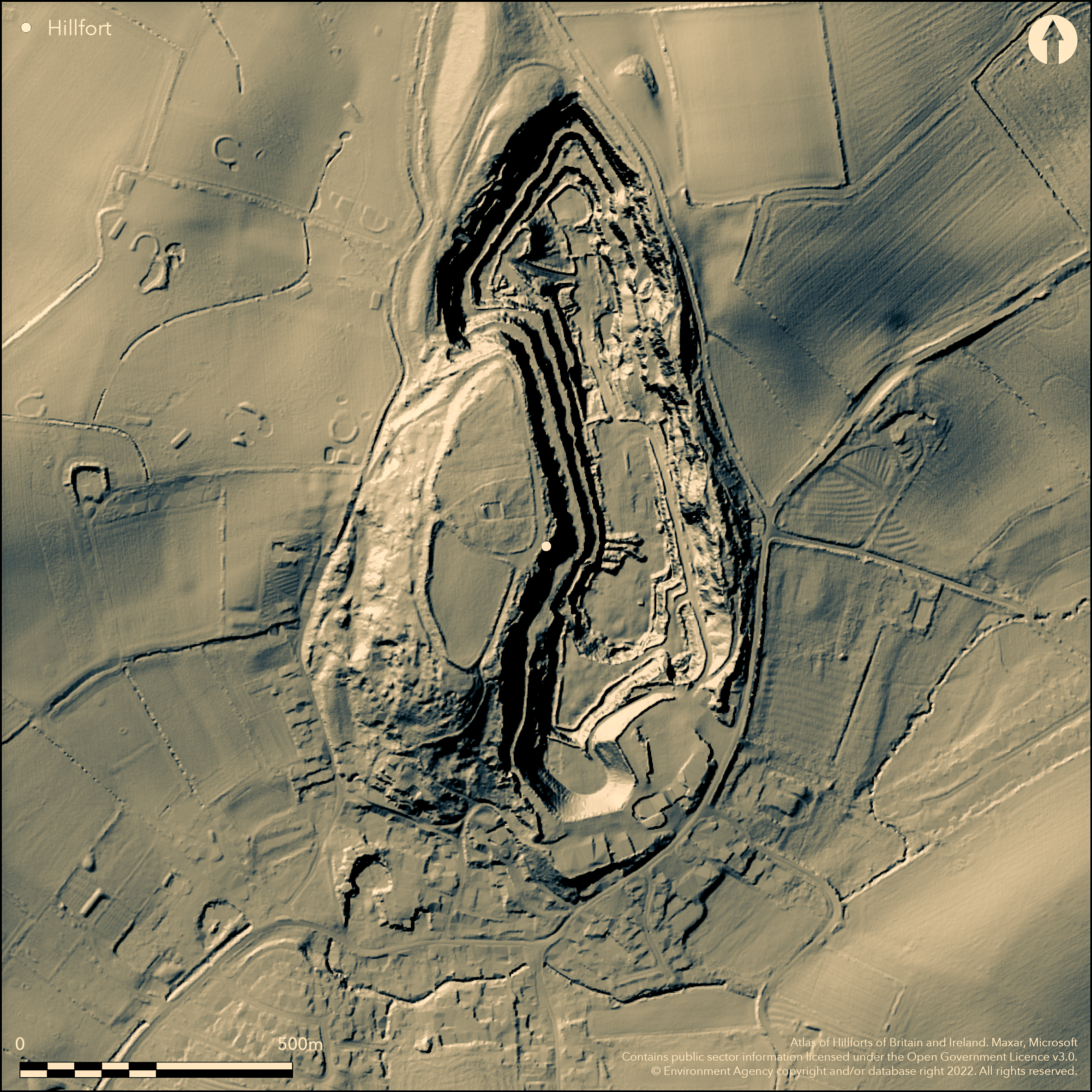
LiDAR 1m DTM Hillshade
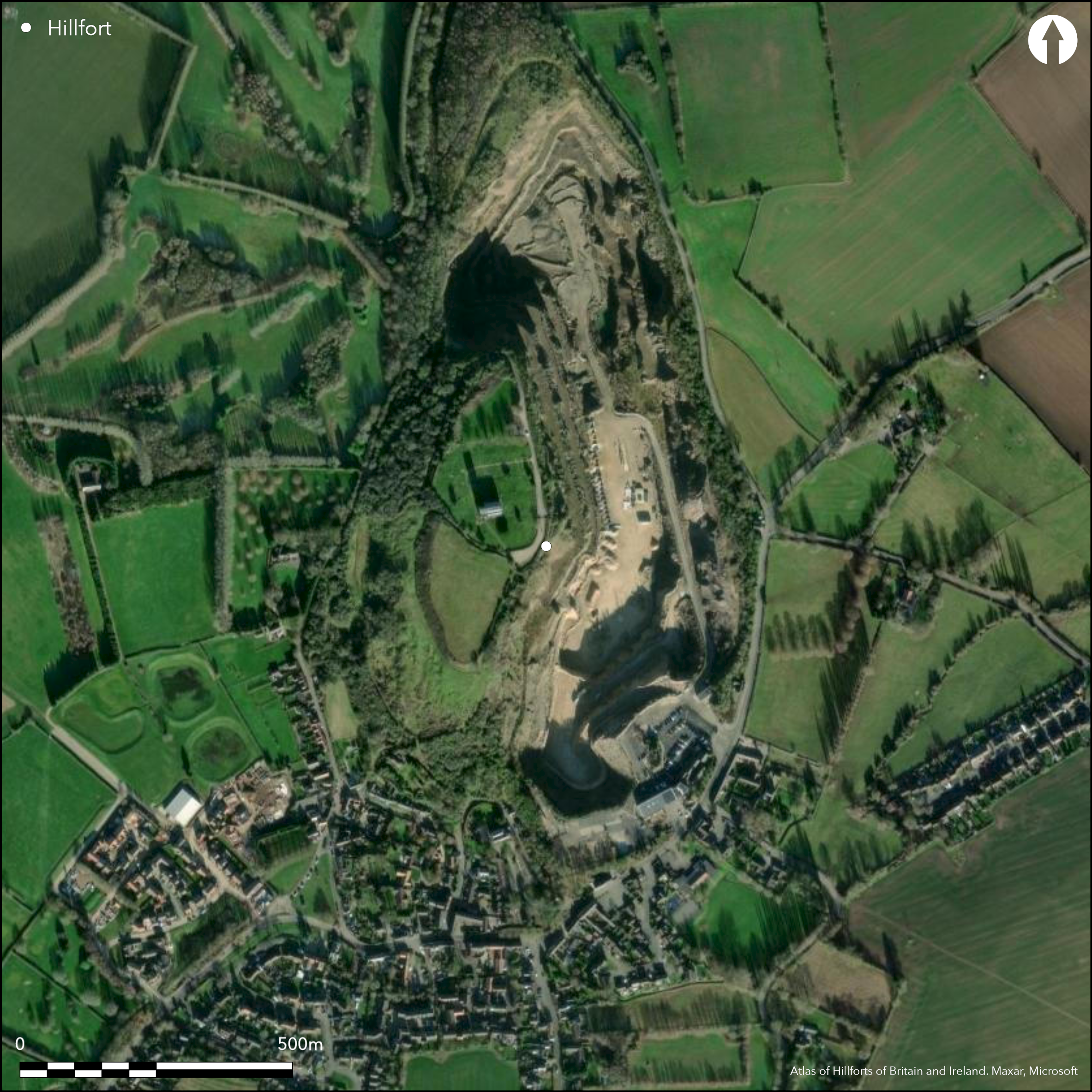
Satellite Imagery
LiDAR 1m DTM Hillshade
Satellite Imagery
Scroll left/right to view further images.
HER: Leicestershire and Rutland MLE4399 (None)
NMR: SK 4 2 SW 4 (315442)
SM: 1003606
NGR: SK 4062 2330
X: 440620 Y: 323300 (OSGB36)
On Breedon Hill, to the N of the village of Breedon-on-the-Hill, a prominent steep-sided hill with large-scale quarrying to the N and E which has removed some of the hillfort. On 1st Ed OS map (1885-1900). Enclosing approximately 9.3ha, sub-circular/oval in plan. Single rampart and ditch, in poor condition but 12m wide and 3m high in places, ditch in SW is 6m wide and 0.5m deep.. Excavation shows rampart to be of two phases, timber revettments front and rear in the first phase, second phase expansion by adding turf. An in-turned entrance on the W, passage at least 30m long. Excavations in the interior Kenyon (1950) showed 23 inhumations in rows, may be Iron Age based on pottery but may be Saxon, pits and postholes, good assemblage of pottery plus iron and bronze objects, worked bone, quern stones, weaving equipment, metal working. Roundhouses and pits on aerial photographs. Excavations in 1946 (Kenyon 1950), 1957 (Wacher 1964), 1966 (Wacher 1976-7), aerial photography (1961-3), other small-scale rescue excavations (no reports). Dated to the Iron Age by excavation, stratigraphy and artefacts. Pre-rampart Iron Age occupation. Medieval church in the interior.
Citizen Science: ✓
Reliability of Data: Confirmed
Reliability of Interpretation: Confirmed
X: -155723 Y: 6947139 (EPSG: 3857)
Longitude: -1.3988831766144858 Latitude: 52.80570579324281 (EPSG:4326)
Country: England
Current County or Unitary Authority: Leicestershire
Historic County: Derbyshire
Current Parish/Community/Council/Townland: Breedon on the Hill
Large area of quarrying to N and E
| Extant | ✓ |
| Cropmark | ✗ |
| Likely Destroyed | ✓ |
None
| Woodland | ✗ |
| Commercial Forestry Plantation | ✗ |
| Parkland | ✗ |
| Pasture (Grazing) | ✓ |
| Arable | ✗ |
| Scrub/Bracken | ✗ |
| Bare Outcrop | ✗ |
| Heather/Moorland | ✗ |
| Heath | ✗ |
| Built-up | ✓ |
| Coastal Grassland | ✗ |
| Other | ✗ |
Contour fort on the top of a steep-sided prominent hill
| Contour Fort | ✓ |
| Partial Contour Fort | ✗ |
| Promontory Fort | ✗ |
| Hillslope Fort | ✗ |
| Level Terrain Fort | ✗ |
| Marsh Fort | ✗ |
| Multiple Enclosure Fort | ✗ |
| Hilltop | ✓ |
| Coastal Promontory | ✗ |
| Inland Promontory | ✗ |
| Valley Bottom | ✗ |
| Knoll/Hillock/Outcrop | ✗ |
| Ridge | ✗ |
| Cliff/Plateau-edge/Scarp | ✗ |
| Hillslope | ✗ |
| Lowland | ✗ |
| Spur | ✗ |
Dominant Topographic Feature: Prominent hill
| North | ✗ |
| Northeast | ✗ |
| East | ✗ |
| Southeast | ✗ |
| South | ✗ |
| Southwest | ✗ |
| West | ✗ |
| Northwest | ✗ |
| Level | ✓ |
Altitude: 122.0m
N/A
Dated to the Iron Age by excavation, stratigraphy and artefacts. Pre-rampart Iron Age occupation. Medieval church in the interior.
Reliability: B - Medium
| Pre 1200BC | ✗ |
| 1200BC - 800BC | ✗ |
| 800BC - 400BC | ✓ |
| 400BC - AD50 | ✓ |
| AD50 - AD400 | ✗ |
| AD400 - AD 800 | ✗ |
| Post AD800 | ✗ |
| Unknown | ✗ |
| Pre Hillfort: | None |
| Post Hillfort: | None |
| Artefactual: | None |
On 1st Ed OS map (1885-1900). Excavations in 1946 (Kenyon 1950), 1957 (Wacher 1964), 1966 (Wacher 1976-7), aerial photography (1961-3), other small-scale rescue excavations (no reports).
| Excavation (1946): | None |
| Excavation (1957): | None |
| Excavation (1966): | None |
| 1st Identified Map Depiction (None): | None |
| Other (None): | None |
Excavations by Kenyon showed 23 inhumations in rows, may be IA based on pottery but may be Saxon, pits and postholes, good assemblage of pottery plus iron and bronze objects, worked bone, quern stones, weaving equipment, metal working. Roundhouses and pits on aerial photographs.
None
| None | ✓ |
| Spring | ✗ |
| Stream | ✗ |
| Pool | ✗ |
| Flush | ✗ |
| Well | ✗ |
| Other | ✗ |
None
| No Known Features | ✓ |
| Round Stone Structures | ✗ |
| Rectangular Stone Structures | ✗ |
| Curvilinear Platforms | ✗ |
| Other Roundhouse Evidence | ✗ |
| Pits | ✗ |
| Quarry Hollows | ✗ |
| Other | ✗ |
None
| No Known Excavation | ✗ |
| Pits | ✓ |
| Postholes | ✓ |
| Roundhouses | ✓ |
| Rectangular Structures | ✗ |
| Roads/Tracks | ✗ |
| Quarry Hollows | ✗ |
| Other | ✗ |
| Nothing Found | ✗ |
None
| No Known Geophysics | ✓ |
| Pits | ✗ |
| Roundhouses | ✗ |
| Rectangular Structures | ✗ |
| Roads/Tracks | ✗ |
| Quarry Hollows | ✗ |
| Other | ✗ |
| Nothing Found | ✗ |
None
| No Known Finds | ✗ |
| Pottery | ✓ |
| Metal | ✓ |
| Metalworking | ✓ |
| Human Bones | ✓ |
| Animal Bones | ✓ |
| Lithics | ✗ |
| Environmental | ✓ |
| Other | ✓ |
None
| APs Not Checked | ✗ |
| None | ✗ |
| Roundhouses | ✓ |
| Rectangular Structures | ✗ |
| Pits | ✓ |
| Postholes | ✗ |
| Roads/Tracks | ✗ |
| Other | ✗ |
An in-turned entrance on the W, passage at least 30m long
| None: | None |
| 2: | None |
Guard Chambers: ✗
Chevaux de Frise: ✗
| 1. In-turned (West): | None |
Single rampart and ditch, in poor condition but 12m wide and 3m high in places, ditch in SW is 6m wide and 0.5m deep. Excavation shows rampart to be of two phases, timber revettments front and rear in the first phase, second phase expansion by adding turf.
| Area 1: | 9.3ha. |
| Total: | 9.3ha. |
Total Footprint Area: Noneha.
None
| ✗ | None |
| ✗ | None |
| NE Quadrant: | 1 |
| SE Quadrant: | None |
| SW Quadrant: | None |
| NW Quadrant: | 1 |
| Total: | 1 |
| Partial Univallate | ✓ |
| Univallate | ✗ |
| Partial Bivallate | ✗ |
| Bivallate | ✗ |
| Partial Multivallate | ✗ |
| Multivallate | ✗ |
| Unknown | ✗ |
| Partial Univallate | ✗ |
| Univallate | ✗ |
| Partial Bivallate | ✗ |
| Bivallate | ✗ |
| Partial Multivallate | ✗ |
| Multivallate | ✗ |
None
| None | ✗ |
| Earthen Bank | ✓ |
| Stone Wall | ✗ |
| Rubble | ✗ |
| Wall-walk | ✗ |
| Evidence of Timber | ✗ |
| Vitrification | ✗ |
| Other Burning | ✗ |
| Palisade | ✗ |
| Counter Scarp Bank | ✗ |
| Berm | ✗ |
| Unfinished | ✗ |
| Other | ✗ |
None
| None | ✗ |
| Earthen Bank | ✓ |
| Stone Wall | ✗ |
| Murus Duplex | ✗ |
| Timber-framed | ✓ |
| Timber-laced | ✗ |
| Vitrification | ✗ |
| Other Burning | ✗ |
| Palisade | ✗ |
| Counter Scarp Bank | ✓ |
| Berm | ✗ |
| Unfinished | ✗ |
| No Known Excavation | ✗ |
| Other | ✓ |
| ✗ | None |
| ✓ | None |
Number of Ditches: 1
| ✗ | None |
Kenyon, K. 1950. Excavations at Breedon-on-the Hill, 1946. Leicestershire Archaeol Hist Soc Trans, 26, 17-82.
Wacher, J. 1964. Excavations at Breedon-on-the Hill, Leicestershire, 1957. Antiq J, 44, 122-42.
Wacher, J. 1976-7. Excavations at Breedon-on-the Hill. Leicestershire Archaeol Hist Soc Trans, 52, 1-35.
Atlas of Hillforts:
Wikidata:
This work is licensed under CC BY-SA 4.0

 and should be cited as:
Lock, Gary and Ralston, Ian. 2024. Atlas of Hillforts of Britain and Ireland. Available at: https://hillforts.arch.ox.ac.uk
Document Version 1.1