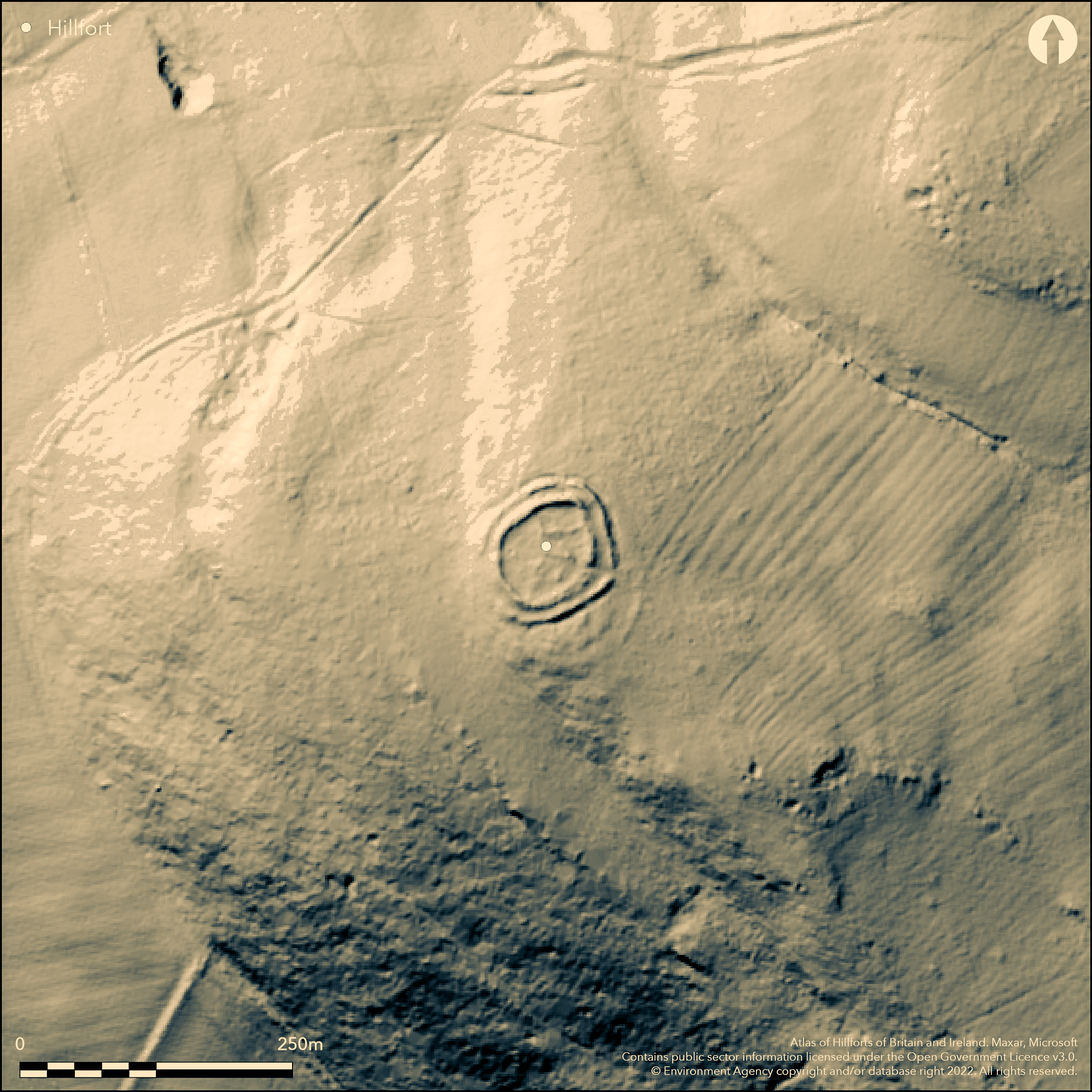
LiDAR 1m DTM Hillshade
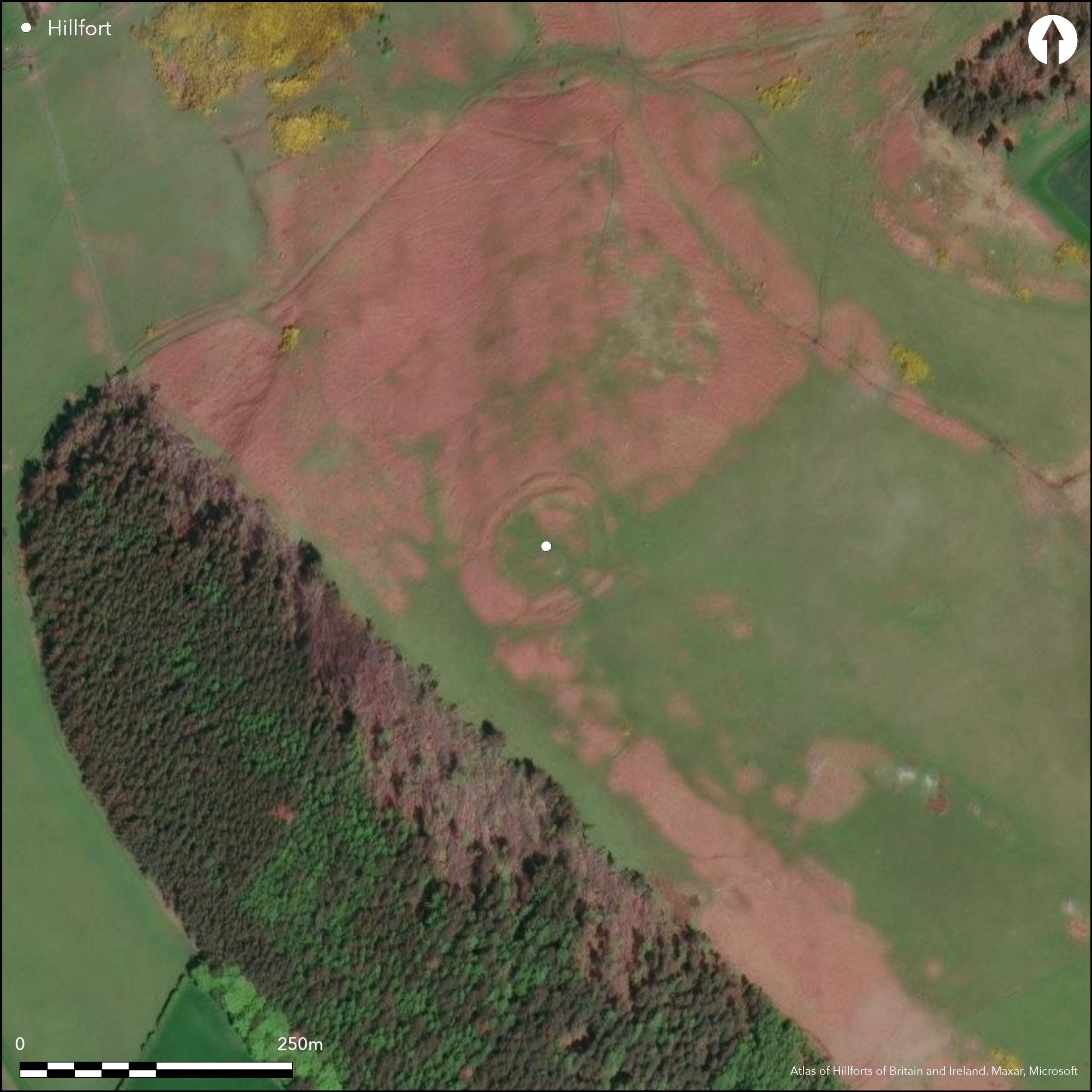
Satellite Imagery
LiDAR 1m DTM Hillshade
Satellite Imagery
Scroll left/right to view further images.
HER: Northumberland 3396 (None)
NMR: NU 02 NE 8 (5452)
SM: 1006552
NGR: NU 0721 2940
X: 407216 Y: 629401 (OSGB36)
A small bivallate or possibly former multivallate hillfort lying at 171m OD on a north-westerly facing spur below the crest of Chattonpark HIll. It lies on the NW extent of the spur beyond which the ground drops steeply around the N and W sides, the hillfort itself occupying land that slopes to the SE. It comprises two concentric earth and stone ramparts with an outer ditch. Faint traces of a a possible further rampart were observed near the entrance in the SE. The defences enclose an internal area of c. 0.17ha and give an overall site footprint of c. 0.5ha. The inner, and the strongest of the ramparts measures 6m wide and 0.5-1.5m high internally with a maximum height externally of 2.5m. The outer bank has a maximum width of 4m and a height of 1.3m internally and 2m externally. The outer ditch has a maximum depth of 0.7m. The outer bank and ditch merge into the natural slope in the SW. The third bank, described by MacLauchlan in 1864 was not recorded during later investigations. An entrance lies in the SE with an out-turned terminal in the N which extends across the end of the ditch. A sculptured rock with three cup and ring marks and a straight line of small slots cut into the rock lies to the W of this entrance with further cup and ring marked stones in the SE. In the N, a break with a causeway across the ditch suggests this is a further original entrance. Internally the enclosure has been divided by stone walls to form two compartments in the NE. Three hut circles were reported by MacLauchlan (1864) but only two can now be identified. They have a diameter of approximately 6m with the walls surviving approximately 0.4m high. One of the huts circles is joined to an enclosure by a wide curving bank, which was possibly used for livestock. The stone founded construction of the walls suggests this represents secondary use of the site. The banks are now heavily mutilated in places. The site is shown on 1856-65 mapping and reported by MacLauchlan (1864, 33) but it undated. Scheduled.
Citizen Science: ✗
Reliability of Data: Confirmed
Reliability of Interpretation: Confirmed
X: -210077 Y: 7470979 (EPSG: 3857)
Longitude: -1.8871522120966624 Latitude: 55.55827955111777 (EPSG:4326)
Country: England
Current County or Unitary Authority: Northumberland
Historic County: Northumberland
Current Parish/Community/Council/Townland: Chatton
Mutilation has occurred to the ramparts in places
| Extant | ✓ |
| Cropmark | ✗ |
| Likely Destroyed | ✗ |
Satellite imagery suggests rough grassland with some covering of heather or bracken
| Woodland | ✗ |
| Commercial Forestry Plantation | ✗ |
| Parkland | ✗ |
| Pasture (Grazing) | ✓ |
| Arable | ✗ |
| Scrub/Bracken | ✗ |
| Bare Outcrop | ✗ |
| Heather/Moorland | ✓ |
| Heath | ✗ |
| Built-up | ✗ |
| Coastal Grassland | ✗ |
| Other | ✗ |
A hillslope fort lying on a northwesterly-facing spur at 171m OD.
| Contour Fort | ✗ |
| Partial Contour Fort | ✗ |
| Promontory Fort | ✗ |
| Hillslope Fort | ✓ |
| Level Terrain Fort | ✗ |
| Marsh Fort | ✗ |
| Multiple Enclosure Fort | ✗ |
| Hilltop | ✗ |
| Coastal Promontory | ✗ |
| Inland Promontory | ✗ |
| Valley Bottom | ✗ |
| Knoll/Hillock/Outcrop | ✗ |
| Ridge | ✗ |
| Cliff/Plateau-edge/Scarp | ✗ |
| Hillslope | ✓ |
| Lowland | ✗ |
| Spur | ✓ |
Dominant Topographic Feature: Hillslope, spur
| North | ✗ |
| Northeast | ✗ |
| East | ✗ |
| Southeast | ✗ |
| South | ✗ |
| Southwest | ✗ |
| West | ✗ |
| Northwest | ✓ |
| Level | ✗ |
Altitude: 171.0m
N/A
Undated, presumed Iron Age. The proximity of the cup and ring marked stones might indicate an earlier use of this location. The stone construction of the internal walls and hut circles suggests later reuse.
Reliability: D - None
| Pre 1200BC | ✗ |
| 1200BC - 800BC | ✗ |
| 800BC - 400BC | ✗ |
| 400BC - AD50 | ✗ |
| AD50 - AD400 | ✗ |
| AD400 - AD 800 | ✗ |
| Post AD800 | ✗ |
| Unknown | ✓ |
| Pre Hillfort: | None |
| Post Hillfort: | None |
| Morphology/Earthwork/Typology: | None |
The site is shown on OS mapping for 1856-65. General reference in MacLauchlan in 1864. Field investigations in 1955 and 1969. Scheduled
| 1st Identified Written Reference (1864): | None |
| Other (1955): | Field investigation |
| Other (1969): | Field investigation |
| 1st Identified Map Depiction (None): | None |
| Other (None): | Scheduled |
Internally the enclosure has been divided by stone walls to form two compartments in the NE. Two hut circles with a diameter of c. 6m with the walls surviving c. 0.4m high. One of the huts circles is joined to an enclosure by a wide curving bank, which was possibly used for livestock. These are probably later than the original construction of the site.
None
| None | ✓ |
| Spring | ✗ |
| Stream | ✗ |
| Pool | ✗ |
| Flush | ✗ |
| Well | ✗ |
| Other | ✗ |
Walled compartments in the NE
| No Known Features | ✗ |
| Round Stone Structures | ✓ |
| Rectangular Stone Structures | ✗ |
| Curvilinear Platforms | ✗ |
| Other Roundhouse Evidence | ✗ |
| Pits | ✗ |
| Quarry Hollows | ✗ |
| Other | ✓ |
None
| No Known Excavation | ✓ |
| Pits | ✗ |
| Postholes | ✗ |
| Roundhouses | ✗ |
| Rectangular Structures | ✗ |
| Roads/Tracks | ✗ |
| Quarry Hollows | ✗ |
| Other | ✗ |
| Nothing Found | ✗ |
None
| No Known Geophysics | ✓ |
| Pits | ✗ |
| Roundhouses | ✗ |
| Rectangular Structures | ✗ |
| Roads/Tracks | ✗ |
| Quarry Hollows | ✗ |
| Other | ✗ |
| Nothing Found | ✗ |
None
| No Known Finds | ✓ |
| Pottery | ✗ |
| Metal | ✗ |
| Metalworking | ✗ |
| Human Bones | ✗ |
| Animal Bones | ✗ |
| Lithics | ✗ |
| Environmental | ✗ |
| Other | ✗ |
None
| APs Not Checked | ✓ |
| None | ✗ |
| Roundhouses | ✗ |
| Rectangular Structures | ✗ |
| Pits | ✗ |
| Postholes | ✗ |
| Roads/Tracks | ✗ |
| Other | ✗ |
Entrance in the SE with an out-turning terminal in the N which extends across the end of the ditch. In the N, a break with a causeway across the ditch suggests this is a further original entrance.
| 3: | None |
| 2: | None |
Guard Chambers: ✗
Chevaux de Frise: ✗
| 1. Out-turned (South east): | Inner rampart |
| 1. Simple Gap (South east): | Outer rampart. Out-turned terminal on the northern side |
| 2. Simple Gap (North): | None |
Two concentric earth and stone ramparts with an outer ditch. Faint traces of a possible further rampart were observed near the entrance in the SE. The defences enclose an internal area of c. 0.17ha and give an overall site footprint of c. 0.5ha. The inner, and the strongest of the ramparts measures 6m wide and 0.5-1.5m high internally with a maximum height externally of 2.5m. The outer bank has a maximum width of 4m and a height of 1.3m internally and 2m externally. The outer ditch has a maximum depth of 0.7m. The outer bank and ditch merge into the natural slope in the SW. The third bank was not recorded during later investigations.
| Area 1: | 0.17ha. |
| Total: | 0.17ha. |
Total Footprint Area: 0.5ha.
None
| ✗ | None |
| ✓ | Third rampart described by MacLauchlan not recorded during later investigations, although a possible bank was observed in the SE |
| NE Quadrant: | 2 |
| SE Quadrant: | 3 |
| SW Quadrant: | 2 |
| NW Quadrant: | 2 |
| Total: | 3 |
| Partial Univallate | ✗ |
| Univallate | ✗ |
| Partial Bivallate | ✓ |
| Bivallate | ✗ |
| Partial Multivallate | ✓ |
| Multivallate | ✗ |
| Unknown | ✗ |
| Partial Univallate | ✗ |
| Univallate | ✗ |
| Partial Bivallate | ✗ |
| Bivallate | ✗ |
| Partial Multivallate | ✗ |
| Multivallate | ✗ |
None
| None | ✗ |
| Earthen Bank | ✓ |
| Stone Wall | ✗ |
| Rubble | ✓ |
| Wall-walk | ✗ |
| Evidence of Timber | ✗ |
| Vitrification | ✗ |
| Other Burning | ✗ |
| Palisade | ✗ |
| Counter Scarp Bank | ✗ |
| Berm | ✗ |
| Unfinished | ✗ |
| Other | ✗ |
None
| None | ✗ |
| Earthen Bank | ✗ |
| Stone Wall | ✗ |
| Murus Duplex | ✗ |
| Timber-framed | ✗ |
| Timber-laced | ✗ |
| Vitrification | ✗ |
| Other Burning | ✗ |
| Palisade | ✗ |
| Counter Scarp Bank | ✗ |
| Berm | ✗ |
| Unfinished | ✗ |
| No Known Excavation | ✓ |
| Other | ✗ |
| ✗ | None |
| ✓ | None |
Number of Ditches: 1
| ✗ | None |
Gates, T. and Deegan, A. 2009. Monuments in the Landscape in Passmore, D.G. and Waddington, C. (eds). Managing Archaeological Landscapes in Northumberland. Till-Tweed Studies, Vol 1. Oxbow, 125-71.
MacLauchlan, H. 1864. Memoir written during a survey of the eastern branch of the Watling Street. 33 London.
Atlas of Hillforts:
Wikidata:
This work is licensed under CC BY-SA 4.0

 and should be cited as:
Lock, Gary and Ralston, Ian. 2024. Atlas of Hillforts of Britain and Ireland. Available at: https://hillforts.arch.ox.ac.uk
Document Version 1.1