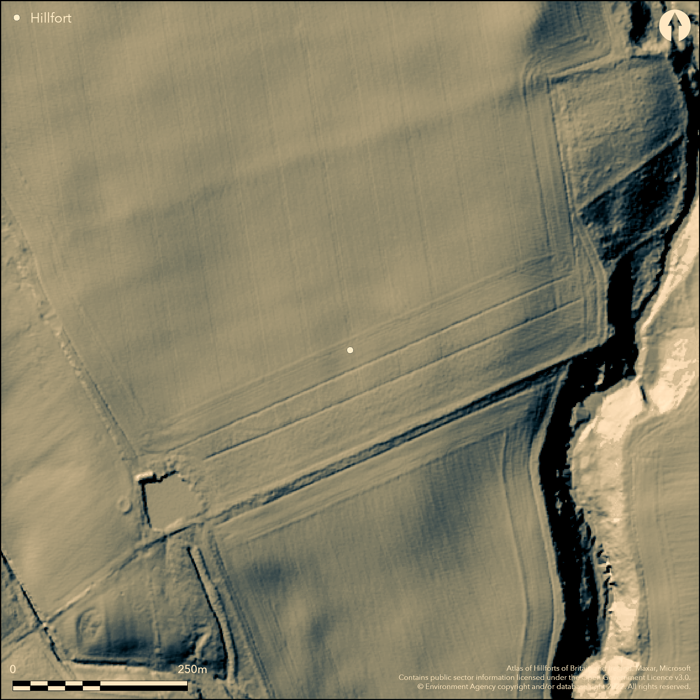
LiDAR 1m DTM Hillshade
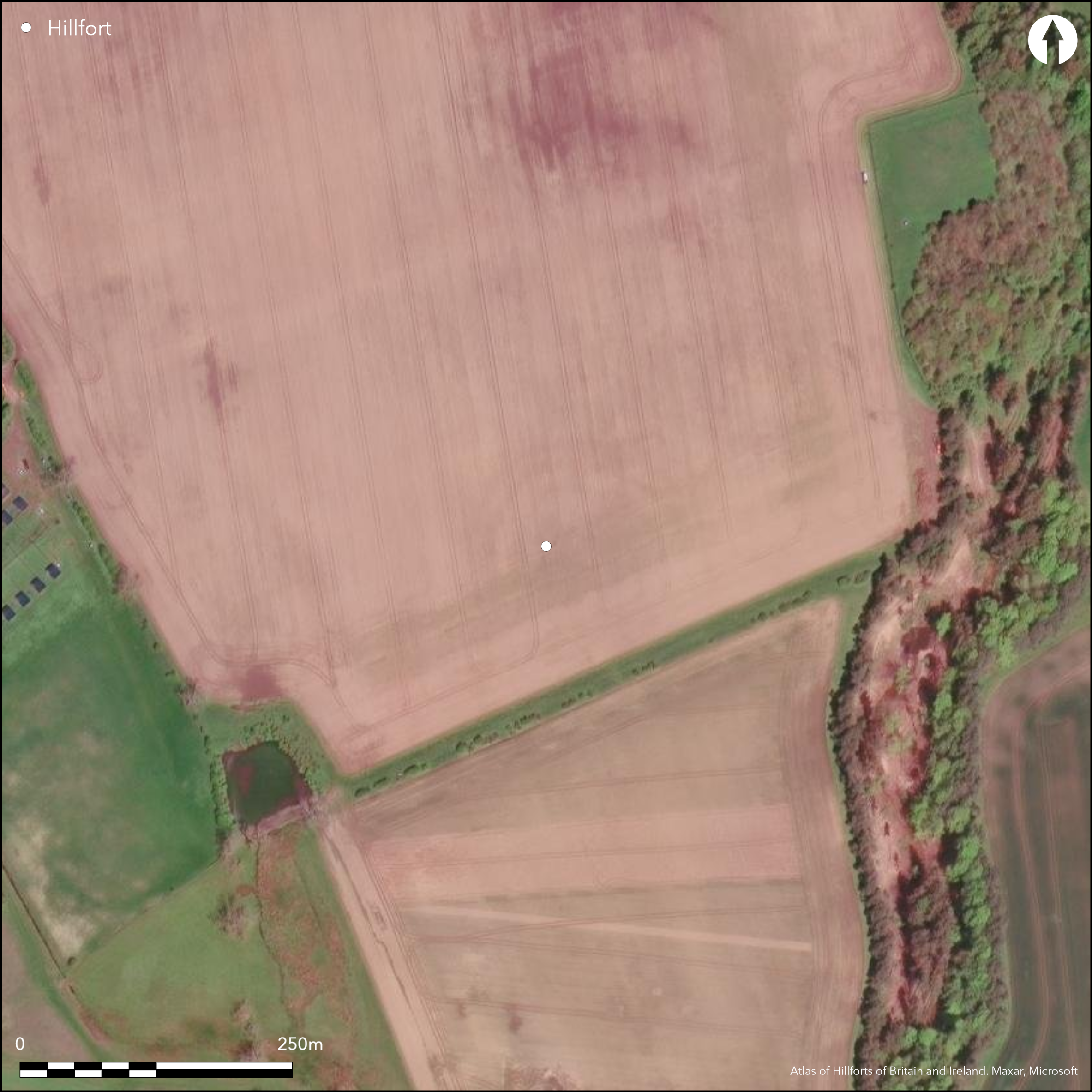
Satellite Imagery
LiDAR 1m DTM Hillshade
Satellite Imagery
Scroll left/right to view further images.
HER: Northumberland 3677 (None)
NMR: NU 03 NW 3 (6090)
SM: None
NGR: NU 0370 3508
X: 403700 Y: 635080 (OSGB36)
To the SE of Hetton Steads Farm, the cropmark of a multivallate hillfort. The fort it situated above a break in slope at approximately 90m OD on low lying ground that slopes gently to the S, SE and SW above the valley of the Hetton Burn. The cropmark shows three concentric ditches spaced less than 10m apart. The inner ditch measures 95m NW to SE by 80m NE-SW enclosing an inner area of 0.4ha, the outer ditch 135m E-W by an estimated 140m N-S. The course of the outer ditch in the S is cut by a modern field boundary and difficult to discern. An overall site footprint in the region of 1.3ha is estimated. Entrances lie in the SE and SW. In the SW two additional lengths of ditch give a staggered approach and the appearance of a system of hornworks. In the SE aerial transcription shows the outer ditches either side of the entrance curving towards the medial ditch (Passmore and Waddington 2012). A faint rise in the ground of a ploughed-out bank was observed during a RCHME field inspection in 1955. The site is recorded on 1856-65 OS mapping, and the cropmarked ditches show well on 2006 satellite imagery, but no earthworks now survive and it remains undated. It faces a further enclosure 200m to the SE across the Hetton Dean (Atlas No. 0581).
Citizen Science: ✗
Reliability of Data: Confirmed
Reliability of Interpretation: Confirmed
X: -216274 Y: 7481037 (EPSG: 3857)
Longitude: -1.9428187010092646 Latitude: 55.60934668820795 (EPSG:4326)
Country: England; None
Current County or Unitary Authority: Northumberland
Historic County: Northumberland
Current Parish/Community/Council/Townland: Chatton; Lowick
The ditches survive as cropmarks, the banks are destroyed
| Extant | ✗ |
| Cropmark | ✓ |
| Likely Destroyed | ✗ |
None
| Woodland | ✗ |
| Commercial Forestry Plantation | ✗ |
| Parkland | ✗ |
| Pasture (Grazing) | ✗ |
| Arable | ✓ |
| Scrub/Bracken | ✗ |
| Bare Outcrop | ✗ |
| Heather/Moorland | ✗ |
| Heath | ✗ |
| Built-up | ✗ |
| Coastal Grassland | ✗ |
| Other | ✗ |
A level terrain fort lying at 90m OD on a slight, south-easterly facing spur
| Contour Fort | ✗ |
| Partial Contour Fort | ✗ |
| Promontory Fort | ✗ |
| Hillslope Fort | ✗ |
| Level Terrain Fort | ✓ |
| Marsh Fort | ✗ |
| Multiple Enclosure Fort | ✗ |
| Hilltop | ✗ |
| Coastal Promontory | ✗ |
| Inland Promontory | ✗ |
| Valley Bottom | ✗ |
| Knoll/Hillock/Outcrop | ✗ |
| Ridge | ✗ |
| Cliff/Plateau-edge/Scarp | ✗ |
| Hillslope | ✗ |
| Lowland | ✓ |
| Spur | ✓ |
Dominant Topographic Feature: Slight spur
| North | ✗ |
| Northeast | ✗ |
| East | ✗ |
| Southeast | ✓ |
| South | ✗ |
| Southwest | ✗ |
| West | ✗ |
| Northwest | ✗ |
| Level | ✗ |
Altitude: 90.0m
Parish boundary between Chatton and Lowick runs through Hetton Dean to the E
Boundary Type: Parish/Townland
Undated
Reliability: D - None
| Pre 1200BC | ✗ |
| 1200BC - 800BC | ✗ |
| 800BC - 400BC | ✗ |
| 400BC - AD50 | ✗ |
| AD50 - AD400 | ✗ |
| AD400 - AD 800 | ✗ |
| Post AD800 | ✗ |
| Unknown | ✓ |
| Pre Hillfort: | None |
| Post Hillfort: | None |
The location is shown on 1856-65 OS mapping. Field investigations in 1955 and 1964. The site has been mapped from the air as part of the Milfield Geoarchaeology Project. (Archive object MD000298). Transcription by Rog Palmer in Passmore and Waddington (2012, 72)
| Other (1955): | Field investigation |
| Other (1964): | Field investigation |
| 1st Identified Map Depiction (None): | None |
| Other (None): | Millfield Geoarchaeology Project |
No features are recorded
Lies to the W of the Hetton Burn
| None | ✓ |
| Spring | ✗ |
| Stream | ✗ |
| Pool | ✗ |
| Flush | ✗ |
| Well | ✗ |
| Other | ✗ |
None
| No Known Features | ✓ |
| Round Stone Structures | ✗ |
| Rectangular Stone Structures | ✗ |
| Curvilinear Platforms | ✗ |
| Other Roundhouse Evidence | ✗ |
| Pits | ✗ |
| Quarry Hollows | ✗ |
| Other | ✗ |
None
| No Known Excavation | ✓ |
| Pits | ✗ |
| Postholes | ✗ |
| Roundhouses | ✗ |
| Rectangular Structures | ✗ |
| Roads/Tracks | ✗ |
| Quarry Hollows | ✗ |
| Other | ✗ |
| Nothing Found | ✗ |
None
| No Known Geophysics | ✓ |
| Pits | ✗ |
| Roundhouses | ✗ |
| Rectangular Structures | ✗ |
| Roads/Tracks | ✗ |
| Quarry Hollows | ✗ |
| Other | ✗ |
| Nothing Found | ✗ |
None
| No Known Finds | ✓ |
| Pottery | ✗ |
| Metal | ✗ |
| Metalworking | ✗ |
| Human Bones | ✗ |
| Animal Bones | ✗ |
| Lithics | ✗ |
| Environmental | ✗ |
| Other | ✗ |
None
| APs Not Checked | ✗ |
| None | ✓ |
| Roundhouses | ✗ |
| Rectangular Structures | ✗ |
| Pits | ✗ |
| Postholes | ✗ |
| Roads/Tracks | ✗ |
| Other | ✗ |
Entrances lie in the SE and SW. In the SW two additional lengths of ditch give a staggered approach and the appearance of a system of hornworks. In the SE aerial transcription shows the outer ditches either side of the entrance curving towards the medial ditch
| 6: | None |
| 2: | None |
Guard Chambers: ✗
Chevaux de Frise: ✗
| 1. Hornwork (South west): | Inner rampart |
| 1. Hornwork (South west): | Middle rampart |
| 1. Hornwork (South west): | Outer rampart |
| 2. Simple Gap (South east): | Inner rampart |
| 2. Simple Gap (South east): | Middle rampart |
| 2. In-turned (South east): | Outer rampart |
Cropmarks of three concentric ditches spaced less than 10m apart. The inner ditch measures 95m NW to SE by 80m NE-SW, the outer ditch 135m E-W by an estimated 140m N-S. The course of the outer ditch in the S is cut by a modern field boundary and difficult to discern. A faint rise in the ground of a ploughed-out bank was observed during a RCHME field investigators visit in 1955.
| Area 1: | 0.4ha. |
| Total: | 0.4ha. |
Total Footprint Area: 1.3ha.
None
| ✗ | None |
| ✓ | None |
| NE Quadrant: | 3 |
| SE Quadrant: | 3 |
| SW Quadrant: | 3 |
| NW Quadrant: | 3 |
| Total: | 3 |
| Partial Univallate | ✗ |
| Univallate | ✗ |
| Partial Bivallate | ✗ |
| Bivallate | ✗ |
| Partial Multivallate | ✗ |
| Multivallate | ✓ |
| Unknown | ✗ |
| Partial Univallate | ✗ |
| Univallate | ✗ |
| Partial Bivallate | ✗ |
| Bivallate | ✗ |
| Partial Multivallate | ✗ |
| Multivallate | ✗ |
A faint rise in the ground of a ploughed-out bank was observed during a RCHME field inspection in 1955.
| None | ✓ |
| Earthen Bank | ✗ |
| Stone Wall | ✗ |
| Rubble | ✗ |
| Wall-walk | ✗ |
| Evidence of Timber | ✗ |
| Vitrification | ✗ |
| Other Burning | ✗ |
| Palisade | ✗ |
| Counter Scarp Bank | ✗ |
| Berm | ✗ |
| Unfinished | ✗ |
| Other | ✗ |
None
| None | ✗ |
| Earthen Bank | ✗ |
| Stone Wall | ✗ |
| Murus Duplex | ✗ |
| Timber-framed | ✗ |
| Timber-laced | ✗ |
| Vitrification | ✗ |
| Other Burning | ✗ |
| Palisade | ✗ |
| Counter Scarp Bank | ✗ |
| Berm | ✗ |
| Unfinished | ✗ |
| No Known Excavation | ✓ |
| Other | ✗ |
| ✗ | None |
| ✓ | None |
Number of Ditches: 3
| ✗ | None |
Hope Dodds, M. (ed). 1935. Northumberland County History 14, 63.
Passmore, D.G. and Waddington, C. 2012. Archaeology and Environment in Northumberland. Till-Tweed studies, Vol 2. Oxbow
Atlas of Hillforts:
Wikidata:
This work is licensed under CC BY-SA 4.0

 and should be cited as:
Lock, Gary and Ralston, Ian. 2024. Atlas of Hillforts of Britain and Ireland. Available at: https://hillforts.arch.ox.ac.uk
Document Version 1.1