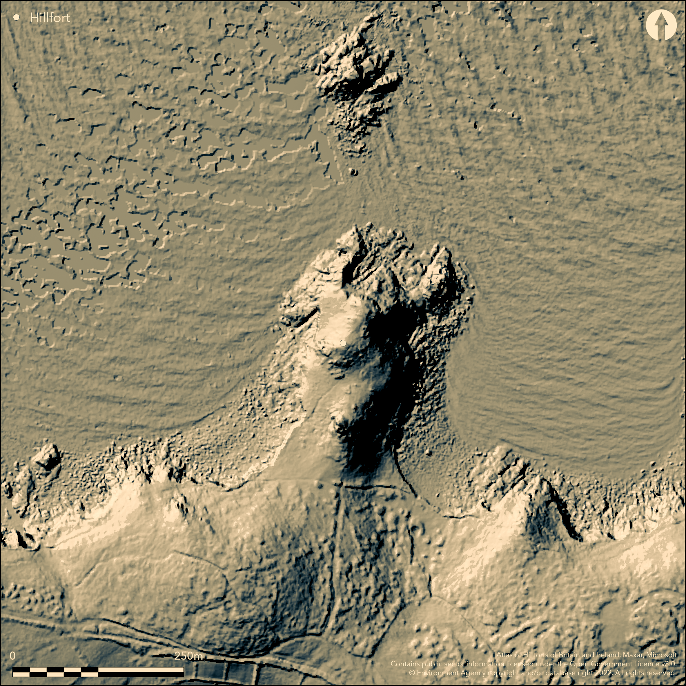
LiDAR 1m DTM Hillshade
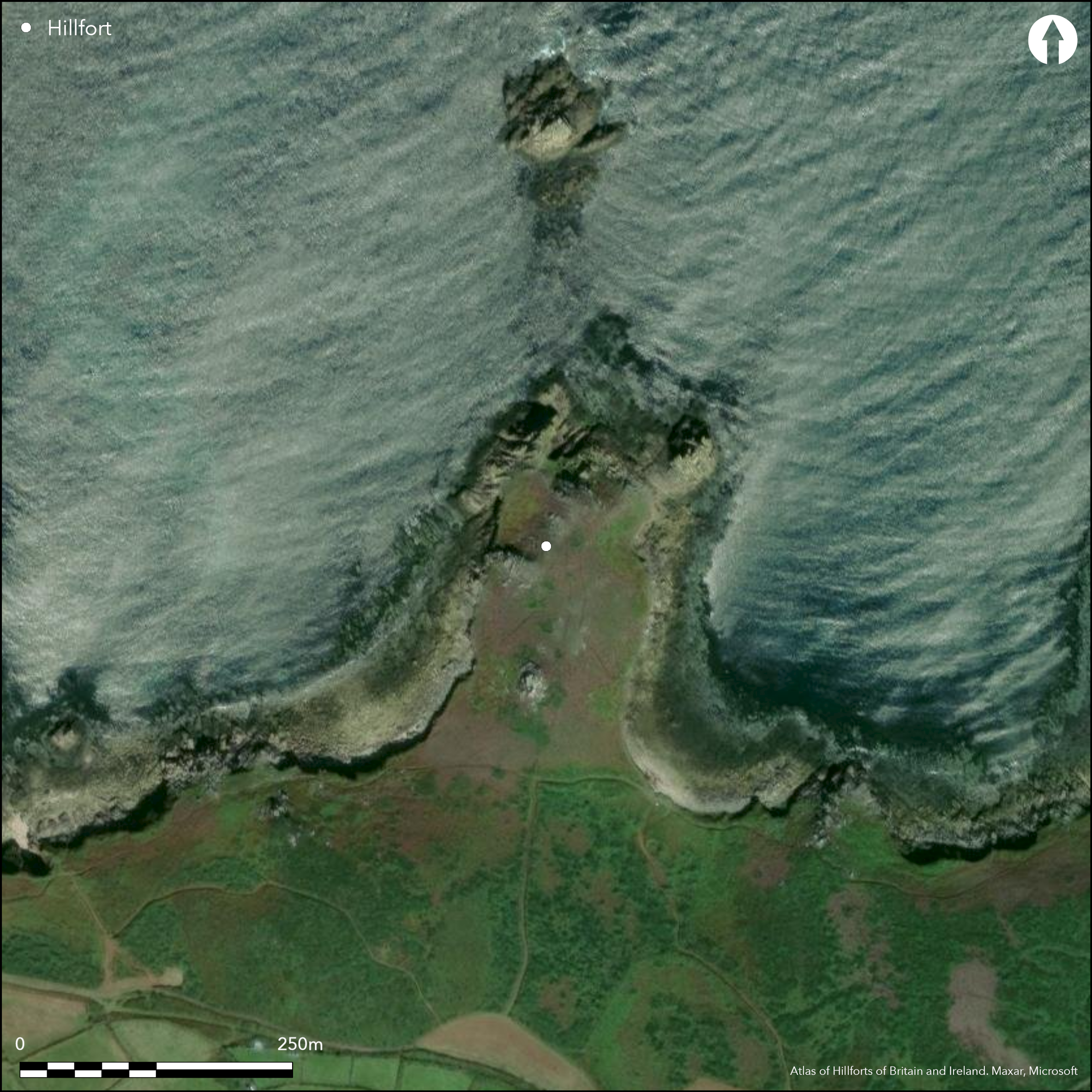
Satellite Imagery
LiDAR 1m DTM Hillshade
Satellite Imagery
Scroll left/right to view further images.
HER: Cornwall and Scilly MC030218 (7125)
NMR: SV 91 NW 7 (303719)
SM: None
NGR: SV936159
X: 93652 Y: 16031 (OSGB36)
Possible promontory fort located on prominent, rocky, NE-facing promontory of Burnt Hill, between St Martin's Bay to W and St Martin's Head to E, St Martin's, Isles of Scilly. Sea cliffs to N, landward to S. Site has been questioned as promontory fort. Under S slope of Burnt HIll possible boulder walls could cut off the promontory. Two hut circles and associated field walls, latter making interpretation difficult. The huts, c. 3.6m diameter and formed by walling of small stones 1m wide and 0.3m high. entrances not defined. From S hut wall enclosure, field wall runs to roof outcrop above, with small plot on W side. On neck promontory another wall runs almost across from cliff to cliff, forming irregular rectangle in centre, with another straight wall. Small excavation behind possible rampart, composed of mostly single, but also some multiple, stones to 0.8m high, near possible entrance by H.E. O'Neil, 1953 (no details). This is located on the SE slope of most N knoll of Burnt Hill. Suggested by O'Neil as rampart, this could possibly be just a field wall. Undated.
Citizen Science: ✗
Reliability of Data: Unconfirmed
Reliability of Interpretation: Unconfirmed
X: -698369 Y: 6440315 (EPSG: 3857)
Longitude: -6.273558954710923 Latitude: 49.96556963816535 (EPSG:4326)
Country: England
Current County or Unitary Authority: Isles of Scilly
Historic County: Cornwall
Current Parish/Community/Council/Townland: St Martin's
Banks spread but survives well otherwise.
| Extant | ✓ |
| Cropmark | ✗ |
| Likely Destroyed | ✗ |
Coastal grassland and bare rock.
| Woodland | ✗ |
| Commercial Forestry Plantation | ✗ |
| Parkland | ✗ |
| Pasture (Grazing) | ✗ |
| Arable | ✗ |
| Scrub/Bracken | ✗ |
| Bare Outcrop | ✗ |
| Heather/Moorland | ✗ |
| Heath | ✗ |
| Built-up | ✗ |
| Coastal Grassland | ✓ |
| Other | ✗ |
Possible promontory fort (aka cliff castle) located on prominent NE-facing promontory of Burnt Hill, between St Martin's Bay to W and St Martin's Head to E, St Martin's, Isles of Scilly.
| Contour Fort | ✗ |
| Partial Contour Fort | ✗ |
| Promontory Fort | ✓ |
| Hillslope Fort | ✗ |
| Level Terrain Fort | ✗ |
| Marsh Fort | ✗ |
| Multiple Enclosure Fort | ✗ |
| Hilltop | ✗ |
| Coastal Promontory | ✓ |
| Inland Promontory | ✗ |
| Valley Bottom | ✗ |
| Knoll/Hillock/Outcrop | ✗ |
| Ridge | ✗ |
| Cliff/Plateau-edge/Scarp | ✗ |
| Hillslope | ✗ |
| Lowland | ✗ |
| Spur | ✗ |
Dominant Topographic Feature: Coastal headland.
| North | ✗ |
| Northeast | ✗ |
| East | ✗ |
| Southeast | ✗ |
| South | ✗ |
| Southwest | ✗ |
| West | ✗ |
| Northwest | ✗ |
| Level | ✓ |
Altitude: 30.0m
N/A
The site has been questioned as a cliff castle, although definite 'settlement' dated to possibly late Bronze Age/Iron Age.
Reliability: C - Low
| Pre 1200BC | ✗ |
| 1200BC - 800BC | ✗ |
| 800BC - 400BC | ✓ |
| 400BC - AD50 | ✗ |
| AD50 - AD400 | ✗ |
| AD400 - AD 800 | ✗ |
| Post AD800 | ✗ |
| Unknown | ✗ |
| Pre Hillfort: | None |
| Post Hillfort: | None |
| Morphology/Earthwork/Typology: | Conjecture. |
Small excavation, H.E. O'Neil, 1953 (no details). Field investigation Ordnance Survey 1978. Measured survey English Heritage: Defending Scilly Project, 2008-2010. Plotted by NMP - no date.
| Excavation (1953): | H.E. O'Neil. |
| Other (1978): | Field investigation OS. |
| Earthwork Survey (None): | Measured survey English Heritage: Defending Scilly Project. |
| Other (None): | Plotted by NMP. |
Two hut circles confirmed.
None
| None | ✓ |
| Spring | ✗ |
| Stream | ✗ |
| Pool | ✗ |
| Flush | ✗ |
| Well | ✗ |
| Other | ✗ |
Two hut circles confirmed.
| No Known Features | ✗ |
| Round Stone Structures | ✓ |
| Rectangular Stone Structures | ✗ |
| Curvilinear Platforms | ✗ |
| Other Roundhouse Evidence | ✗ |
| Pits | ✗ |
| Quarry Hollows | ✗ |
| Other | ✗ |
None
| No Known Excavation | ✓ |
| Pits | ✗ |
| Postholes | ✗ |
| Roundhouses | ✗ |
| Rectangular Structures | ✗ |
| Roads/Tracks | ✗ |
| Quarry Hollows | ✗ |
| Other | ✗ |
| Nothing Found | ✗ |
None
| No Known Geophysics | ✓ |
| Pits | ✗ |
| Roundhouses | ✗ |
| Rectangular Structures | ✗ |
| Roads/Tracks | ✗ |
| Quarry Hollows | ✗ |
| Other | ✗ |
| Nothing Found | ✗ |
None
| No Known Finds | ✓ |
| Pottery | ✗ |
| Metal | ✗ |
| Metalworking | ✗ |
| Human Bones | ✗ |
| Animal Bones | ✗ |
| Lithics | ✗ |
| Environmental | ✗ |
| Other | ✗ |
None
| APs Not Checked | ✓ |
| None | ✗ |
| Roundhouses | ✗ |
| Rectangular Structures | ✗ |
| Pits | ✗ |
| Postholes | ✗ |
| Roads/Tracks | ✗ |
| Other | ✗ |
Possible SE entrance.
| 1: | None |
| 2: | Possible only. |
Guard Chambers: ✗
Chevaux de Frise: ✗
| 1. Simple Gap (South east): | Possible only. |
From S hut wall enclosure, field wall runs to roof outcrop above, with small plot on W side. On neck promontory another wall runs almost across from cliff to cliff, forming irregular rectangle in centre, with another straight wall. Small excavation behind possible rampart, composed of mostly single, but also some multiple, stones to 0.8m high, near possible entrance by H.E. O'Neil, 1953. This is located on the SE slope of most N knoll of Burnt Hill.
| Area 1: | Noneha. |
| Total: | Noneha. |
Total Footprint Area: Noneha.
None
| ✗ | Area not defined. |
| ✗ | Quadrants conjecture only. Possibly univallate? |
| NE Quadrant: | 0 |
| SE Quadrant: | 1 |
| SW Quadrant: | 0 |
| NW Quadrant: | 0 |
| Total: | 1 |
| Partial Univallate | ✓ |
| Univallate | ✗ |
| Partial Bivallate | ✗ |
| Bivallate | ✗ |
| Partial Multivallate | ✗ |
| Multivallate | ✗ |
| Unknown | ✗ |
| Partial Univallate | ✗ |
| Univallate | ✗ |
| Partial Bivallate | ✗ |
| Bivallate | ✗ |
| Partial Multivallate | ✗ |
| Multivallate | ✗ |
Stone and rubble walls.
| None | ✗ |
| Earthen Bank | ✗ |
| Stone Wall | ✓ |
| Rubble | ✓ |
| Wall-walk | ✗ |
| Evidence of Timber | ✗ |
| Vitrification | ✗ |
| Other Burning | ✗ |
| Palisade | ✗ |
| Counter Scarp Bank | ✗ |
| Berm | ✗ |
| Unfinished | ✗ |
| Other | ✗ |
Small excavation behind possible rampart, composed of mostly single, but also some multiple, stones to 0.8m high, near possible entrance by H.E. O'Neil, 1953 (no details).
| None | ✗ |
| Earthen Bank | ✓ |
| Stone Wall | ✓ |
| Murus Duplex | ✗ |
| Timber-framed | ✗ |
| Timber-laced | ✗ |
| Vitrification | ✗ |
| Other Burning | ✗ |
| Palisade | ✗ |
| Counter Scarp Bank | ✗ |
| Berm | ✗ |
| Unfinished | ✗ |
| No Known Excavation | ✗ |
| Other | ✗ |
| ✗ | None |
| ✗ | No details. |
Number of Ditches: 0
| ✗ | None |
Ashbee, P. 1974. Ancient Scilly: from the first farmers to the early Christians: an introduction and survey, Newton Abott, David and Charles, 321.
Lewis, H.A. 1948. St Martin's, St Helen's and Tean, 9.
O'Neil, B.H. St J. 1961. Isles of Scilly, MOW Guide. 16.
Russell, V. 1980. Isles of Scilly Survey, 47.
Atlas of Hillforts:
Wikidata:
This work is licensed under CC BY-SA 4.0

 and should be cited as:
Lock, Gary and Ralston, Ian. 2024. Atlas of Hillforts of Britain and Ireland. Available at: https://hillforts.arch.ox.ac.uk
Document Version 1.1