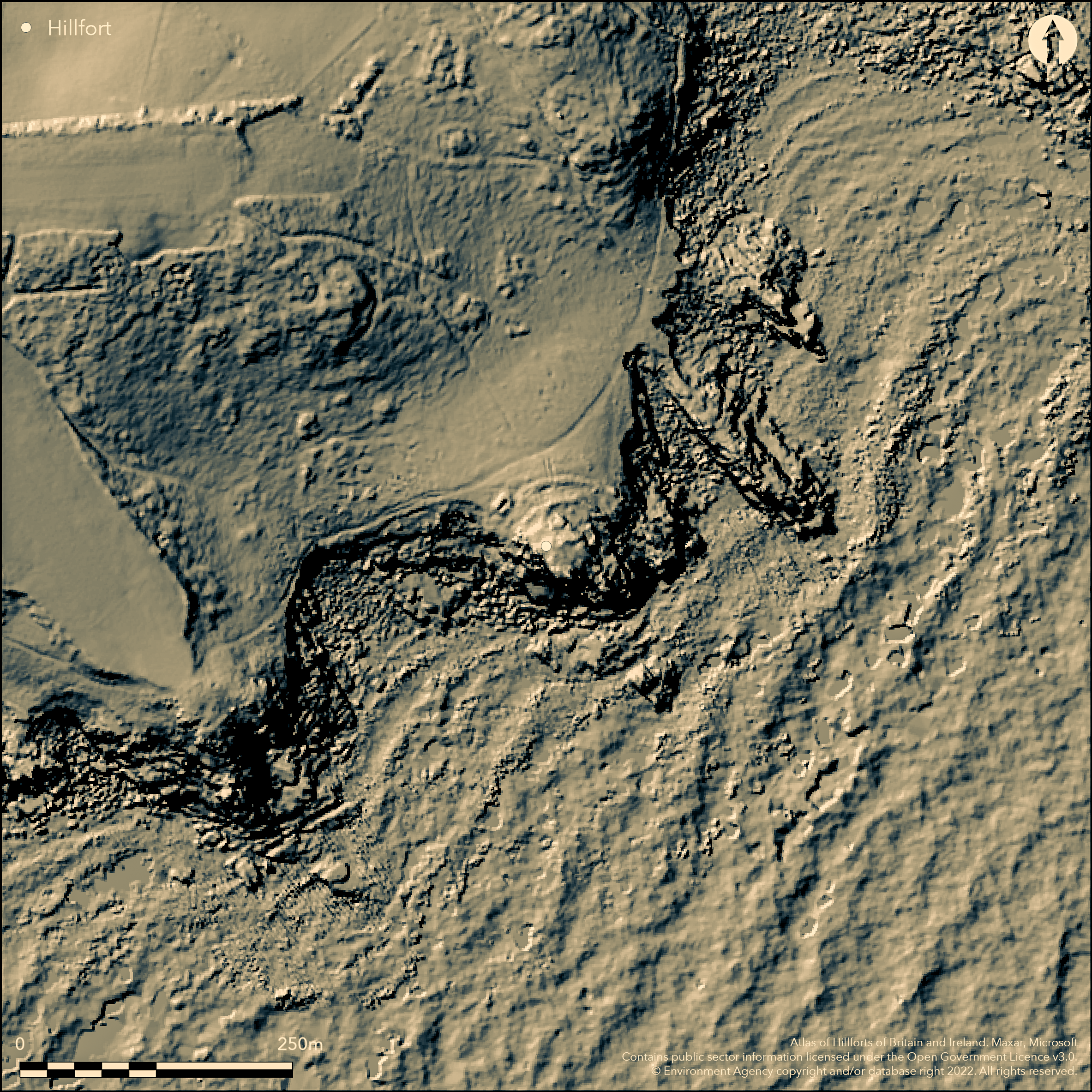
LiDAR 1m DTM Hillshade
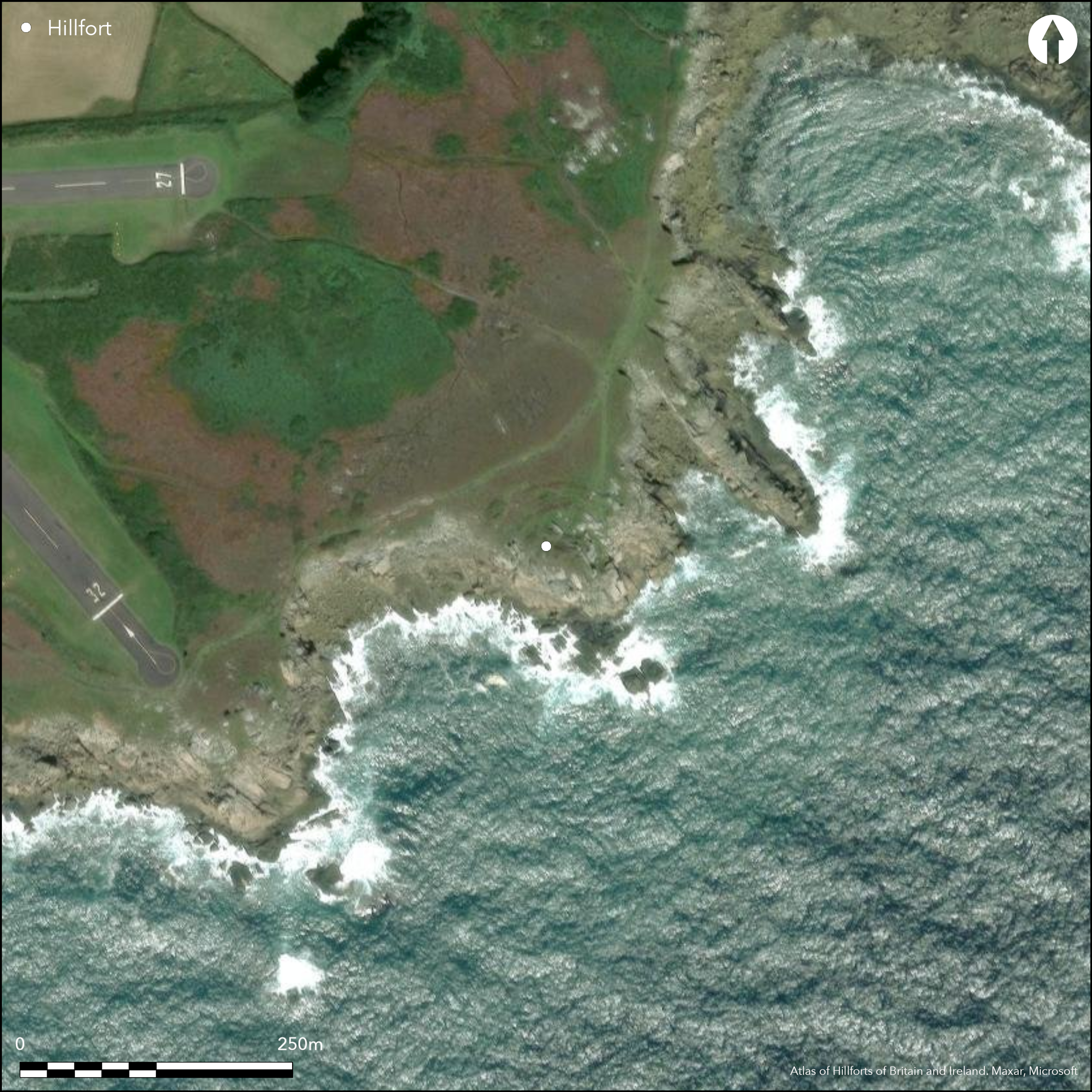
Satellite Imagery
LiDAR 1m DTM Hillshade
Satellite Imagery
Scroll left/right to view further images.
HER: Cornwall and Scilly MCO30538 (7536)
NMR: SV 91 SW 41 (304067)
SM: 1011935
NGR: SV92451006
X: 92457 Y: 10076 (OSGB36)
Multivallate promontory fort located on steep SE-facing coastal promontory, SE of Salakee Down, on St Mary's, Isles of Scilly. Steep sea cliffs to SE and SW, landward to N. Three semicircular banks and rock-cut ditches cut off neck of promontory, enclosing c. 0.3ha. The spread earth and stone banks nearly 4m wide and to c. 2m-2.5m high on downhill sides, with outer ditches, mostly filled in by slope downwash. Damaged on W side by, now deserted, coastguard's lookout. Site restricted for habitation and summit of headland encloses only small, flat, area c. 25m by 20m. Small excavation by B.H.St J. O'Neil 1939 and 1945 and investigation by P.W.M. Thriepland 1940. Summit very exposed and inhospitable and no obvious traces of habitation, though these could have been between ramparts and rocks. Two staggered original causeways between second, third and inner banks. Prominent rocks in interior result in suggestion as ritual site. Pottery fragments c. 300 BC from cutting in outer defences. On 1st Ed. OS map (1889-90).
Citizen Science: ✗
Reliability of Data: Confirmed
Reliability of Interpretation: Confirmed
X: -699690 Y: 6430971 (EPSG: 3857)
Longitude: -6.285425949345768 Latitude: 49.91154560508214 (EPSG:4326)
Country: England
Current County or Unitary Authority: Isles of Scilly
Historic County: Cornwall
Current Parish/Community/Council/Townland: St Mary's
Banks spread, otherwise coastal erosion appears much less than most cliff castles. Deserted coastguard's lookout and WWII firing range blockhouse on site. On Heritage at Risk Register (2015).
| Extant | ✓ |
| Cropmark | ✗ |
| Likely Destroyed | ✗ |
Coastal grassland and bare rock. Deserted coastguard's lookout and WWII firing range blockhouse on site.
| Woodland | ✗ |
| Commercial Forestry Plantation | ✗ |
| Parkland | ✗ |
| Pasture (Grazing) | ✗ |
| Arable | ✗ |
| Scrub/Bracken | ✗ |
| Bare Outcrop | ✗ |
| Heather/Moorland | ✗ |
| Heath | ✗ |
| Built-up | ✓ |
| Coastal Grassland | ✓ |
| Other | ✓ |
Multivallate promontory fort (aka cliff castle) located on steep SE-facing coastal promontory, SE of Sakalee Down, on St Mary's, Isles of Scilly.
| Contour Fort | ✗ |
| Partial Contour Fort | ✗ |
| Promontory Fort | ✓ |
| Hillslope Fort | ✗ |
| Level Terrain Fort | ✗ |
| Marsh Fort | ✗ |
| Multiple Enclosure Fort | ✗ |
| Hilltop | ✗ |
| Coastal Promontory | ✓ |
| Inland Promontory | ✗ |
| Valley Bottom | ✗ |
| Knoll/Hillock/Outcrop | ✗ |
| Ridge | ✗ |
| Cliff/Plateau-edge/Scarp | ✗ |
| Hillslope | ✗ |
| Lowland | ✗ |
| Spur | ✗ |
Dominant Topographic Feature: Coastal headland
| North | ✗ |
| Northeast | ✗ |
| East | ✗ |
| Southeast | ✓ |
| South | ✗ |
| Southwest | ✗ |
| West | ✗ |
| Northwest | ✗ |
| Level | ✗ |
Altitude: 40.0m
N/A
Pottery fragments c. 300 BC.
Reliability: C - Low
| Pre 1200BC | ✗ |
| 1200BC - 800BC | ✗ |
| 800BC - 400BC | ✗ |
| 400BC - AD50 | ✓ |
| AD50 - AD400 | ✗ |
| AD400 - AD 800 | ✗ |
| Post AD800 | ✗ |
| Unknown | ✗ |
| Pre Hillfort: | None |
| Post Hillfort: | None |
| Artefactual: | Pottery fragments. |
Mention by W. Borlase 1956. On 1st Ed. OS map (1889-90). Small excavation by B.H.St J. O'Neil 1939 and 1945 and investigation by P.W.M. Thriepland, 1940 - no details. Field investigation Ordnance Survey 1978. Desk assessment. Isles of Scilly Research Framework, Cornwall Archaeological Unit, 2010-12.
| 1st Identified Written Reference (1756): | W. Borlase. |
| Excavation (1940): | Engineer's pit investigation and possible cutting in outer edge of defences by P.W.M. Thriepland - no details. |
| Other (1978): | Field investigation OS. |
| 1st Identified Map Depiction (None): | OS map. |
| Excavation (None): | B.H.St J. O'Neil - no details. |
| Other (None): | Desk assessment. Isles of Scilly Research Framework, Cornwall Archaeological Unit. |
Pottery fragments c. 300 BC from a cutting made in the outer edge of the defences between 1939 and 1945.
None
| None | ✓ |
| Spring | ✗ |
| Stream | ✗ |
| Pool | ✗ |
| Flush | ✗ |
| Well | ✗ |
| Other | ✗ |
None
| No Known Features | ✓ |
| Round Stone Structures | ✗ |
| Rectangular Stone Structures | ✗ |
| Curvilinear Platforms | ✗ |
| Other Roundhouse Evidence | ✗ |
| Pits | ✗ |
| Quarry Hollows | ✗ |
| Other | ✗ |
None
| No Known Excavation | ✓ |
| Pits | ✗ |
| Postholes | ✗ |
| Roundhouses | ✗ |
| Rectangular Structures | ✗ |
| Roads/Tracks | ✗ |
| Quarry Hollows | ✗ |
| Other | ✗ |
| Nothing Found | ✗ |
None
| No Known Geophysics | ✓ |
| Pits | ✗ |
| Roundhouses | ✗ |
| Rectangular Structures | ✗ |
| Roads/Tracks | ✗ |
| Quarry Hollows | ✗ |
| Other | ✗ |
| Nothing Found | ✗ |
Pottery fragments c. 300 BC from a cutting made in the outer edge of the defences between 1939 and 1945.
| No Known Finds | ✗ |
| Pottery | ✓ |
| Metal | ✗ |
| Metalworking | ✗ |
| Human Bones | ✗ |
| Animal Bones | ✗ |
| Lithics | ✗ |
| Environmental | ✗ |
| Other | ✗ |
None
| APs Not Checked | ✓ |
| None | ✗ |
| Roundhouses | ✗ |
| Rectangular Structures | ✗ |
| Pits | ✗ |
| Postholes | ✗ |
| Roads/Tracks | ✗ |
| Other | ✗ |
None actually defined, but two staggered causeways between banks.
| 0: | None |
| 2: | None actually defined, but two staggered original causeways between banks. |
Guard Chambers: ✗
Chevaux de Frise: ✗
Three semicircular banks and rock-cut ditches cut off neck of promontory. The spread earth and stone banks nearly 4m wide and to c. 2m-2.5m high on downhill sides, with outer ditches, mostly filled in by slope downwash.
| Area 1: | 0.3ha. |
| Total: | 0.3ha. |
Total Footprint Area: Noneha.
None
| ✗ | None |
| ✗ | None |
| NE Quadrant: | 3 |
| SE Quadrant: | 0 |
| SW Quadrant: | 3 |
| NW Quadrant: | 3 |
| Total: | 3 |
| Partial Univallate | ✗ |
| Univallate | ✗ |
| Partial Bivallate | ✗ |
| Bivallate | ✗ |
| Partial Multivallate | ✓ |
| Multivallate | ✗ |
| Unknown | ✗ |
| Partial Univallate | ✗ |
| Univallate | ✗ |
| Partial Bivallate | ✗ |
| Bivallate | ✗ |
| Partial Multivallate | ✗ |
| Multivallate | ✗ |
Earth and stone banks. Inner bank incorporates natural terrain.
| None | ✗ |
| Earthen Bank | ✓ |
| Stone Wall | ✓ |
| Rubble | ✓ |
| Wall-walk | ✗ |
| Evidence of Timber | ✗ |
| Vitrification | ✗ |
| Other Burning | ✗ |
| Palisade | ✗ |
| Counter Scarp Bank | ✗ |
| Berm | ✗ |
| Unfinished | ✗ |
| Other | ✗ |
Cutting in the outer edge of defences. Earth and stone banks.
| None | ✗ |
| Earthen Bank | ✓ |
| Stone Wall | ✓ |
| Murus Duplex | ✗ |
| Timber-framed | ✗ |
| Timber-laced | ✗ |
| Vitrification | ✗ |
| Other Burning | ✗ |
| Palisade | ✗ |
| Counter Scarp Bank | ✗ |
| Berm | ✗ |
| Unfinished | ✗ |
| No Known Excavation | ✗ |
| Other | ✗ |
| ✗ | None |
| ✓ | Rock-cut ditches mostly filled in by downwash. |
Number of Ditches: 3
| ✗ | None |
Ashbee, P. 1974. Ancient Scilly: from the first farmers to the early Christians: an introduction and survey, Newton Abott, David and Charles, 211-12, 221, 218, 321.
Borlase, W. 1756. Observations on the Ancient and Present State of the Islands of Scilly, 17.
Cotton, M.A. 1958-9. Cornish Cliff Castles, Proc West Cornwall Fld Club, 2, 3, 119.
Gray, A. 1972. Prehistoric Habitation Sites on the Isles of Scilly, Cornish Archaeol, 11, 38.
Hencken, HO. 1932. The Archaeology of Cornwall and Scilly, 31, 308.
Johns C. 2012. Isles of Scilly Historic Environment Research Framework: resource assessment and research agenda, Report No 12R070, Cornwall Archaeological Unit, Cornwall County Council.
O'Neil, B.H. St J. 1961. Isles of Scilly, MOW Guide. 15.
Page, W. ed. 1906. The Victoria History of the County of Cornwall, 1, London: James Street, 459-60.
Atlas of Hillforts:
Wikidata:
This work is licensed under CC BY-SA 4.0

 and should be cited as:
Lock, Gary and Ralston, Ian. 2024. Atlas of Hillforts of Britain and Ireland. Available at: https://hillforts.arch.ox.ac.uk
Document Version 1.1