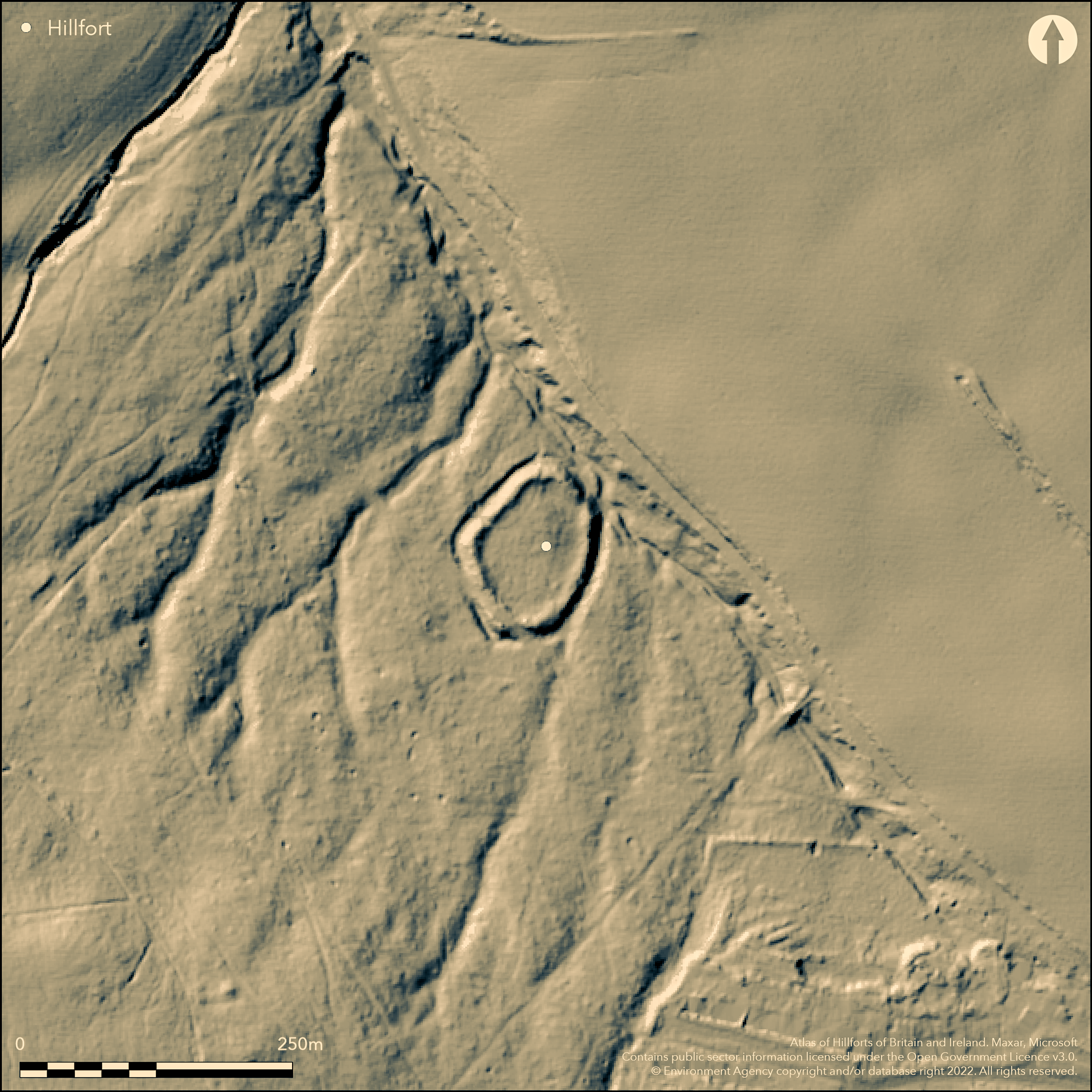
LiDAR 1m DTM Hillshade
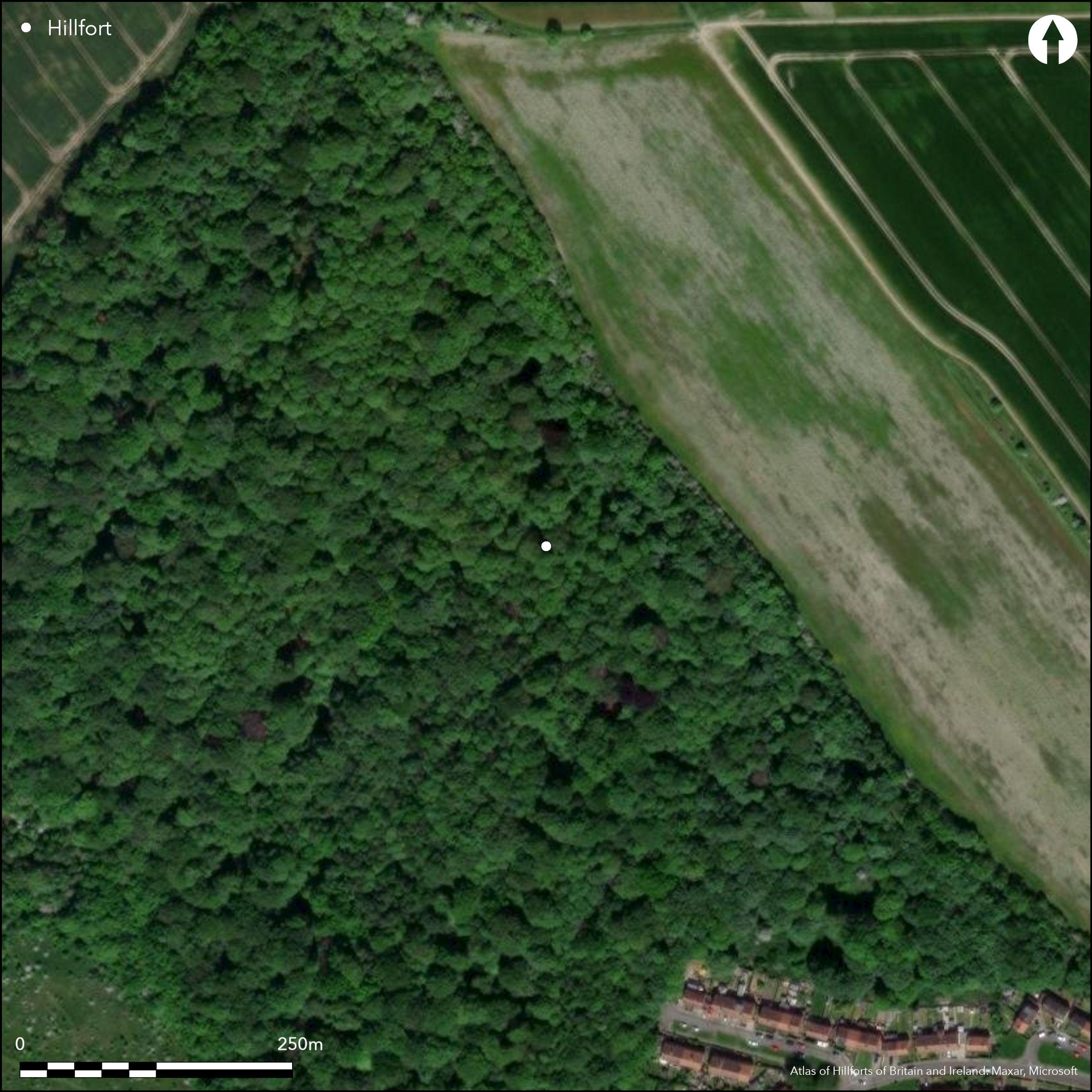
Satellite Imagery
LiDAR 1m DTM Hillshade
Satellite Imagery
Scroll left/right to view further images.
HER: South Yorkshire 00131/01 (None)
NMR: SK 39 NE 6 (314707)
SM: 1004829
NGR: SK 3955 9523
X: 439550 Y: 395230 (OSGB36)
Lying to the W of Greasborough, an oval enclosure of 0.4ha, now within Scholes Coppice. It lies at approximately 98m OD on sloping ground towards the bottom of a valley and is overlooked in the NE, W and S. A strong rampart stands 4.9m above the 15m wide outer ditch. A counterscarp standing 2.1m high has been recorded by some authorities. The bank and ditch follow the the natural contours of what is today a dry stream bed which was incorporated into the construction in the NE, said to take the place of the counterscarp in that part of the enclosure (Page 1974). An entrance lies in the NE. Small mounds and depressions were noted within the enclosure during a topographical survey (Latham, 1991). Their origin and function is unknown. An "outwork" was also noted to the W of the monument, although this has not been recorded on OS mapping. A number of abraded pottery sherds from three contexts were recovered during a small excavation in 1992 (Buckland and Cumberpatch 1992). Two rim sherds, possibly black burnished ware, provide a date of 3rd-4th century AD. A piece of Iron slag recovered from the site is thought to derive from medieval or post medieval metalworking. The site is scheduled, but no monument type has been assigned. Recorded on 1854-5 1:10,560 OS mapping, South Yorkshire HER reference a map of 1778 which is said to show the earthwork much as it survives today. Significant erosion is now occurring to the earthworks from the use of motorcycles and bicycles.
Citizen Science: ✗
Reliability of Data: Confirmed
Reliability of Interpretation: Confirmed
X: -156505 Y: 7067111 (EPSG: 3857)
Longitude: -1.4059041528553047 Latitude: 53.452340747989595 (EPSG:4326)
Country: England; None
Current County or Unitary Authority: South Yorkshire
Historic County: Yorkshire
Current Parish/Community/Council/Townland: Rotherham; Wentworth
Significant erosion is now occurring to the earthworks from the use of motorcycles and bicycles.
| Extant | ✓ |
| Cropmark | ✗ |
| Likely Destroyed | ✗ |
Ancient replanted woodland, once part of Kimberworth Deer Park. Designated nature reserve since 1996.
| Woodland | ✓ |
| Commercial Forestry Plantation | ✗ |
| Parkland | ✗ |
| Pasture (Grazing) | ✗ |
| Arable | ✗ |
| Scrub/Bracken | ✗ |
| Bare Outcrop | ✗ |
| Heather/Moorland | ✗ |
| Heath | ✗ |
| Built-up | ✗ |
| Coastal Grassland | ✗ |
| Other | ✗ |
A possible hillslope fort lying at approximately 98m OD on ground sloping towards the bottom of a valley. Overlooked in the NE, W and S
| Contour Fort | ✗ |
| Partial Contour Fort | ✗ |
| Promontory Fort | ✗ |
| Hillslope Fort | ✓ |
| Level Terrain Fort | ✗ |
| Marsh Fort | ✗ |
| Multiple Enclosure Fort | ✗ |
| Hilltop | ✗ |
| Coastal Promontory | ✗ |
| Inland Promontory | ✗ |
| Valley Bottom | ✗ |
| Knoll/Hillock/Outcrop | ✗ |
| Ridge | ✗ |
| Cliff/Plateau-edge/Scarp | ✗ |
| Hillslope | ✓ |
| Lowland | ✗ |
| Spur | ✗ |
Dominant Topographic Feature: Hillslope
| North | ✗ |
| Northeast | ✗ |
| East | ✗ |
| Southeast | ✗ |
| South | ✗ |
| Southwest | ✓ |
| West | ✗ |
| Northwest | ✗ |
| Level | ✗ |
Altitude: 98.0m
The parish boundary between Rotherham and Wentworth borders the rampart in the NE
Boundary Type: Parish/Townland
A small number of pottery sherds recovered during excavation show some activity in the Roman period.
Reliability: C - Low
| Pre 1200BC | ✗ |
| 1200BC - 800BC | ✗ |
| 800BC - 400BC | ✗ |
| 400BC - AD50 | ✗ |
| AD50 - AD400 | ✗ |
| AD400 - AD 800 | ✗ |
| Post AD800 | ✗ |
| Unknown | ✓ |
| Pre Hillfort: | None |
| Post Hillfort: | Possible 3rd-4th century AD activity, medieval-post medieval metalworking waste |
| Artefactual: | None |
The site is recorded on 1854-5 1:10,560 OS mapping. In 1992 it underwent a small-scale excavation, topographical survey and environmental analysis of samples taken from the site by University of Sheffield Archaeology Service. RCHME field investigation in 1965. Scheduled
| 1st Identified Map Depiction (1778): | South Yorkshire HER reference a map of 1778 which is said to show the earthwork much as it survives today |
| Other (1965): | Field investigation |
| Other (1979): | Visit by Hillfort Study Group |
| Excavation (1992): | None |
| Earthwork Survey (1992): | None |
| Other (1992): | Environmental sample analysis |
| 1st Identified Map Depiction (None): | OS mapping |
| Other (None): | Scheduled |
Small mounds and depressions were noted within the enclosure during a topographical survey (Latham, 1991)
A dry stream bed was incorporated into the construction in the NE, said by Page (1974) to take the place of the counterscarp in that part of the enclosure
| None | ✗ |
| Spring | ✗ |
| Stream | ✓ |
| Pool | ✗ |
| Flush | ✗ |
| Well | ✗ |
| Other | ✗ |
None
| No Known Features | ✓ |
| Round Stone Structures | ✗ |
| Rectangular Stone Structures | ✗ |
| Curvilinear Platforms | ✗ |
| Other Roundhouse Evidence | ✗ |
| Pits | ✗ |
| Quarry Hollows | ✗ |
| Other | ✗ |
No features were recorded
| No Known Excavation | ✗ |
| Pits | ✗ |
| Postholes | ✗ |
| Roundhouses | ✗ |
| Rectangular Structures | ✗ |
| Roads/Tracks | ✗ |
| Quarry Hollows | ✗ |
| Other | ✗ |
| Nothing Found | ✓ |
None
| No Known Geophysics | ✓ |
| Pits | ✗ |
| Roundhouses | ✗ |
| Rectangular Structures | ✗ |
| Roads/Tracks | ✗ |
| Quarry Hollows | ✗ |
| Other | ✗ |
| Nothing Found | ✗ |
Roman pottery; metal slag, possibly representing medieval or post medieval metalworking
| No Known Finds | ✗ |
| Pottery | ✓ |
| Metal | ✗ |
| Metalworking | ✓ |
| Human Bones | ✗ |
| Animal Bones | ✗ |
| Lithics | ✗ |
| Environmental | ✗ |
| Other | ✗ |
In Woodland
| APs Not Checked | ✓ |
| None | ✗ |
| Roundhouses | ✗ |
| Rectangular Structures | ✗ |
| Pits | ✗ |
| Postholes | ✗ |
| Roads/Tracks | ✗ |
| Other | ✗ |
A simple gap entrance lies in the NE.
| 1: | None |
| 2: | None |
Guard Chambers: ✗
Chevaux de Frise: ✗
| 1. Simple Gap (North east): | None |
Strong rampart which stands 4.9m above the wide outer ditch. A 2.1m high counterscarp has been recorded by some authorities. The bank and ditch follow the the natural contours of what is today a dry stream bed, this was incorporated into the construction in the NE and is said to take the place of the counterscarp in that part of the enclosure (Page 1974).
| Area 1: | 0.4ha. |
| Total: | 0.4ha. |
Total Footprint Area: Noneha.
None
| ✗ | None |
| ✓ | None |
| NE Quadrant: | 1 |
| SE Quadrant: | 1 |
| SW Quadrant: | 1 |
| NW Quadrant: | 1 |
| Total: | 1 |
| Partial Univallate | ✗ |
| Univallate | ✓ |
| Partial Bivallate | ✗ |
| Bivallate | ✗ |
| Partial Multivallate | ✗ |
| Multivallate | ✗ |
| Unknown | ✗ |
| Partial Univallate | ✗ |
| Univallate | ✗ |
| Partial Bivallate | ✗ |
| Bivallate | ✗ |
| Partial Multivallate | ✗ |
| Multivallate | ✗ |
None
| None | ✗ |
| Earthen Bank | ✓ |
| Stone Wall | ✗ |
| Rubble | ✗ |
| Wall-walk | ✗ |
| Evidence of Timber | ✗ |
| Vitrification | ✗ |
| Other Burning | ✗ |
| Palisade | ✗ |
| Counter Scarp Bank | ✓ |
| Berm | ✗ |
| Unfinished | ✗ |
| Other | ✗ |
No excavation of the ramparts
| None | ✓ |
| Earthen Bank | ✗ |
| Stone Wall | ✗ |
| Murus Duplex | ✗ |
| Timber-framed | ✗ |
| Timber-laced | ✗ |
| Vitrification | ✗ |
| Other Burning | ✗ |
| Palisade | ✗ |
| Counter Scarp Bank | ✗ |
| Berm | ✗ |
| Unfinished | ✗ |
| No Known Excavation | ✗ |
| Other | ✗ |
| ✗ | None |
| ✓ | None |
Number of Ditches: 1
| ✗ | None |
Atkinson, S. and Sydes, R.E. 1992. Report on the Archaeological Investigation of Caesers Camp Scheduled Ancient Monument, Kimberworth, Rotherham, South Yorkshire. South Yorkshire Archaeology Unit. Unpublished
Buckland, P.C. and Cumberpatch., C.G. 1992. The Pottery From the Excavations at Scholes Coppice 1992. Unpublished
Latham, I.D. 1991. Results of a Topographical Survey of Caesar's Camp, Scholes Coppice, Rotherham. South Yorkshire Archaeology Unit. Unpublished
Page, W. 1974. The Victoria History of the Counties of England: A History of Yorkshire. Volume II. 8-10
Wagner, P, 1992. Environmental Analysis of Samples from Scholes Coppice, Kimberworth, South Yorkshire. University of Sheffield Archaeology Service. Unpublished
Atlas of Hillforts:
Wikidata:
This work is licensed under CC BY-SA 4.0

 and should be cited as:
Lock, Gary and Ralston, Ian. 2024. Atlas of Hillforts of Britain and Ireland. Available at: https://hillforts.arch.ox.ac.uk
Document Version 1.1