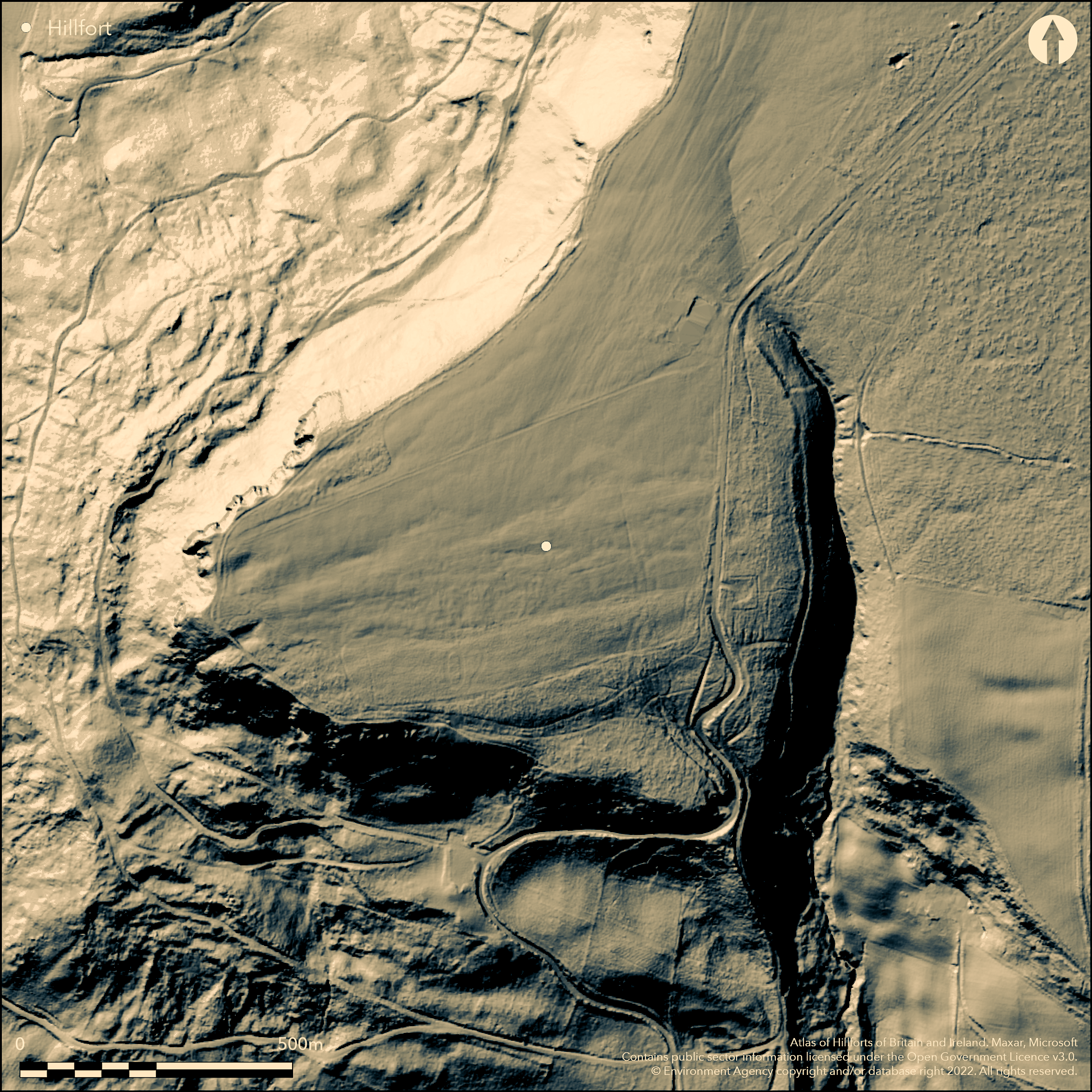
LiDAR 1m DTM Hillshade
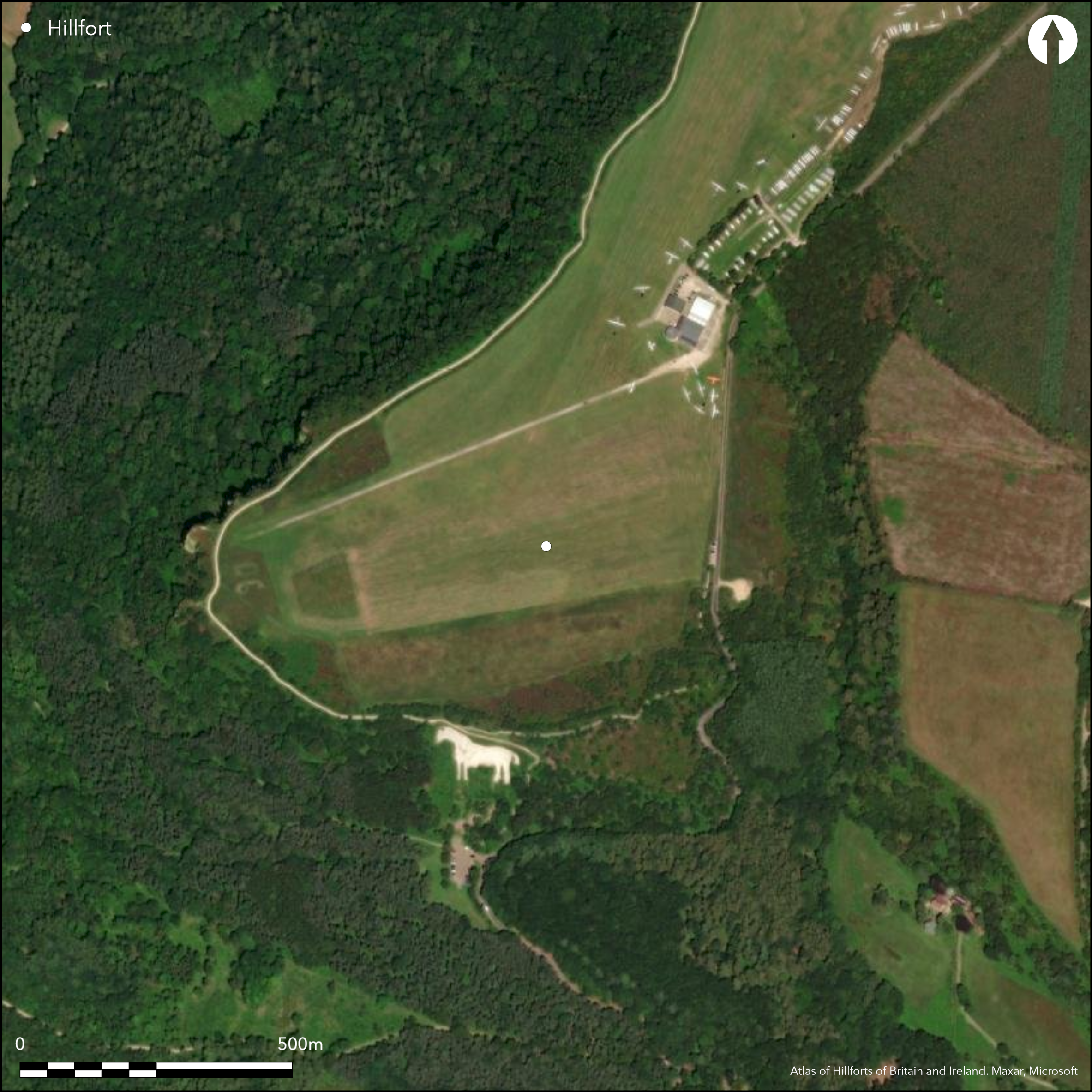
Satellite Imagery
LiDAR 1m DTM Hillshade
Satellite Imagery
Scroll left/right to view further images.
HER: North York Moors National Park 1135 (None)
NMR: SE 58 SW 12 (57324)
SM: 1015502
NGR: SE 5149 8152
X: 451490 Y: 481520 (OSGB36)
Occupying a spur of land on Roulston Scar and High Town Brow at 282m OD, in the SW of the Hambleton Hills. A bank and ditch lie in the N across the neck of land. Aerial photographs show that the earthwork continues around the spur and is further enhanced by naturally sheer cliffs in the W, a steep slope in the S and by a steep-sided valley above Boars Gill in the E, giving an internal area of 24.5ha. The location commands extensive views including across the Vale of York in the S. In c.1970, 190m of the 300m rampart across the neck of the promontory was levelled for an extension of a runway for a local gliding club. Rescue excavations in 1969-70 showed it was originally constructed as a timber-laced box rampart built into the bank to the S with a flat-bottomed ditch between 6-7m wide. It was later rebuilt as a dump rampart up to 2.5m high, possibly fronted with a drystone wall, and a low counterscarp. Historic OS map shows a possible entrance lay in this area. The line of the flattened bank and ditch can still be made out on aerial photographs. Elsewhere it continued around the promontory as a dump rampart up to 2.5m high with a ditch and counterscarp. Small excavations carried out in 2013 and 2015 primarily to gather environmental and dating evidence from deposits within the ditch and beneath the ramparts (Powlesland & Signorelli 2015) enhanced the information from earlier excavations. They showed the ditch to be rock-cut and 3m deep. The rampart was composed of redeposited turf with the outer timber framework comprising major posts with hurdles between. The large amount of stonework on the site is considered to have derived from a wall on top of the earthen rampart rather than fronting it. Radiocarbon dates from charred cereal grain gave a construction date at the Bronze Age/Iron Age transition at 900-800 calBC. A hearth behind the ramparts was dated 1027-898 cal BC. Hearth deposits within the ditch dated 350 cal BC are considered to represent possible reuse of the enclosure. Dating of a palisade within the enclosed area is problematic. Stratigraphically it appears to be later and a date of 1322 AD has been proposed, linking it to the Battle of Byland but radiocarbon dates from wood within a posthole gave dates of 1123-937 cal BC. It is uncertain if this material was redeposited during construction and further dating is proposed (Powlesland and Signorelli 2015). Internally no settlement evidence has been recorded. A description of a round barrow (SE58SW 11) is given in Grainge (1859) which was flattened as part of the airfield works but the southern half survives as a low semi-circular mound. Further damage to the site has been caused by post medieval limestone quarrying and afforestation in the S. The earthworks across the neck of the promontory were recorded by the OS in 1853 as Casten Dike and it was not identified as a possible promontory fort until the late 1960's.
Citizen Science: ✗
Reliability of Data: Confirmed
Reliability of Interpretation: Confirmed
X: -134884 Y: 7213231 (EPSG: 3857)
Longitude: -1.2116869556157601 Latitude: 54.226820794056955 (EPSG:4326)
Country: England
Current County or Unitary Authority: North Yorkshire
Historic County: Yorkshire
Current Parish/Community/Council/Townland: Kilburn High and Low
Well preserved where surviving, but ramparts levelled in 1960's
| Extant | ✓ |
| Cropmark | ✗ |
| Likely Destroyed | ✓ |
Grassland; used as a runway by a local gliding club
| Woodland | ✗ |
| Commercial Forestry Plantation | ✗ |
| Parkland | ✗ |
| Pasture (Grazing) | ✗ |
| Arable | ✗ |
| Scrub/Bracken | ✗ |
| Bare Outcrop | ✗ |
| Heather/Moorland | ✗ |
| Heath | ✗ |
| Built-up | ✗ |
| Coastal Grassland | ✗ |
| Other | ✓ |
Occupying a level promontory/spur of land at 282m OD
| Contour Fort | ✗ |
| Partial Contour Fort | ✗ |
| Promontory Fort | ✓ |
| Hillslope Fort | ✗ |
| Level Terrain Fort | ✗ |
| Marsh Fort | ✗ |
| Multiple Enclosure Fort | ✗ |
| Hilltop | ✗ |
| Coastal Promontory | ✗ |
| Inland Promontory | ✓ |
| Valley Bottom | ✗ |
| Knoll/Hillock/Outcrop | ✗ |
| Ridge | ✗ |
| Cliff/Plateau-edge/Scarp | ✗ |
| Hillslope | ✗ |
| Lowland | ✗ |
| Spur | ✓ |
Dominant Topographic Feature: Spur
| North | ✗ |
| Northeast | ✗ |
| East | ✗ |
| Southeast | ✗ |
| South | ✗ |
| Southwest | ✗ |
| West | ✗ |
| Northwest | ✗ |
| Level | ✓ |
Altitude: 282.0m
N/A
Radiocarbon dates from charred cereal grain gave a construction date of 900-800 cal BC; hearth behind the ramparts 1027-898 cal BC; hearth deposits within the ditch dated 350 cal BC considered to represent possible reuse of the enclosure. A date of 1123-937 cal BC for the palisade is considered problematic and further dating is proposed (Powlesland and Signorelli 2015)
Reliability: A - High
| Pre 1200BC | ✗ |
| 1200BC - 800BC | ✓ |
| 800BC - 400BC | ✓ |
| 400BC - AD50 | ✓ |
| AD50 - AD400 | ✗ |
| AD400 - AD 800 | ✗ |
| Post AD800 | ✗ |
| Unknown | ✗ |
| Pre Hillfort: | None |
| Post Hillfort: | None |
| C14: | None |
Recorded on 1853 OS mapping, included in the 'Gazeteer of Prehistoric England' Thomas (1960). Rescue excavation in 1969-70. OS Field investigation in 1977 and English Heritage Survey in 2001 on behalf of the Yorkshire Dales National Park. Investigations on behalf of the NYMNP in 2013 and 2015 (Powlesland and Signorelli 2015)
| 1st Identified Map Depiction (1853): | None |
| 1st Identified Written Reference (1960): | None |
| Other (1977): | Field investigation |
| Earthwork Survey (2001): | None |
| Excavation (2013): | None |
| Other (2013): | 3D Photogrammetery |
| Excavation (2015): | None |
| Excavation (None): | Rescue excavation |
No internal features are known other than surviving mound of a round barrow
Spring to the S
| None | ✓ |
| Spring | ✗ |
| Stream | ✗ |
| Pool | ✗ |
| Flush | ✗ |
| Well | ✗ |
| Other | ✗ |
None
| No Known Features | ✓ |
| Round Stone Structures | ✗ |
| Rectangular Stone Structures | ✗ |
| Curvilinear Platforms | ✗ |
| Other Roundhouse Evidence | ✗ |
| Pits | ✗ |
| Quarry Hollows | ✗ |
| Other | ✗ |
Excavation of ramparts only
| No Known Excavation | ✓ |
| Pits | ✗ |
| Postholes | ✗ |
| Roundhouses | ✗ |
| Rectangular Structures | ✗ |
| Roads/Tracks | ✗ |
| Quarry Hollows | ✗ |
| Other | ✗ |
| Nothing Found | ✗ |
None
| No Known Geophysics | ✓ |
| Pits | ✗ |
| Roundhouses | ✗ |
| Rectangular Structures | ✗ |
| Roads/Tracks | ✗ |
| Quarry Hollows | ✗ |
| Other | ✗ |
| Nothing Found | ✗ |
None
| No Known Finds | ✓ |
| Pottery | ✗ |
| Metal | ✗ |
| Metalworking | ✗ |
| Human Bones | ✗ |
| Animal Bones | ✗ |
| Lithics | ✗ |
| Environmental | ✗ |
| Other | ✗ |
None
| APs Not Checked | ✓ |
| None | ✗ |
| Roundhouses | ✗ |
| Rectangular Structures | ✗ |
| Pits | ✗ |
| Postholes | ✗ |
| Roads/Tracks | ✗ |
| Other | ✗ |
Historic OS shows a possible simple gap entrance lay within the box ramparts in the N
| None: | Numerous breaks caused by quarrying and afforestation |
| 2: | None |
Guard Chambers: ✗
Chevaux de Frise: ✗
| 1. Simple Gap (North): | None |
A bank and ditch lie across the neck of land in the N. 190m of the 300m rampart is now destroyed but shown to have been constructed as a timber-laced box rampart built into the bank to the S with a flat-bottomed ditch between 6-7m wide and 3m deep. It was later rebuilt as a dump rampart up to 2.5m high, possibly fronted or topped with a drystone wall, and a low counterscarp. A dump rampart continues around the promontory with an outer ditch and counterscarp. An internal palisade is considered to be a later feature.
| Area 1: | 24.5ha. |
| Total: | 24.5ha. |
Total Footprint Area: Noneha.
None
| ✓ | Palisade |
| ✓ | Aerial photographs show that the earthwork continues around the promontory |
| NE Quadrant: | 1 |
| SE Quadrant: | 1 |
| SW Quadrant: | 1 |
| NW Quadrant: | 1 |
| Total: | 1 |
| Partial Univallate | ✗ |
| Univallate | ✓ |
| Partial Bivallate | ✗ |
| Bivallate | ✗ |
| Partial Multivallate | ✗ |
| Multivallate | ✗ |
| Unknown | ✗ |
| Partial Univallate | ✗ |
| Univallate | ✗ |
| Partial Bivallate | ✗ |
| Bivallate | ✗ |
| Partial Multivallate | ✗ |
| Multivallate | ✗ |
None
| None | ✗ |
| Earthen Bank | ✓ |
| Stone Wall | ✗ |
| Rubble | ✗ |
| Wall-walk | ✗ |
| Evidence of Timber | ✗ |
| Vitrification | ✗ |
| Other Burning | ✗ |
| Palisade | ✗ |
| Counter Scarp Bank | ✓ |
| Berm | ✗ |
| Unfinished | ✗ |
| Other | ✗ |
None
| None | ✗ |
| Earthen Bank | ✓ |
| Stone Wall | ✓ |
| Murus Duplex | ✗ |
| Timber-framed | ✗ |
| Timber-laced | ✗ |
| Vitrification | ✓ |
| Other Burning | ✗ |
| Palisade | ✓ |
| Counter Scarp Bank | ✓ |
| Berm | ✗ |
| Unfinished | ✗ |
| No Known Excavation | ✗ |
| Other | ✗ |
| ✗ | None |
| ✓ | None |
Number of Ditches: 1
| ✗ | None |
Grainge, E.W. 1859 The Vale of Mowbray: a historical and topographical account of Thirsk and its neighbourhood
Oswald, A. and Pearson, T. 2001. Report AI/11/2001 Roulston Scar Survey. Unpublished
Powlesland, D. and Signorelli G. 2015. Excavations at Roulston Scar (in prep.). Privately circulated
Thomas N. 1960. Gazeteer of Prehistoric England, Batsford, 252
Atlas of Hillforts:
Wikidata:
This work is licensed under CC BY-SA 4.0

 and should be cited as:
Lock, Gary and Ralston, Ian. 2024. Atlas of Hillforts of Britain and Ireland. Available at: https://hillforts.arch.ox.ac.uk
Document Version 1.1