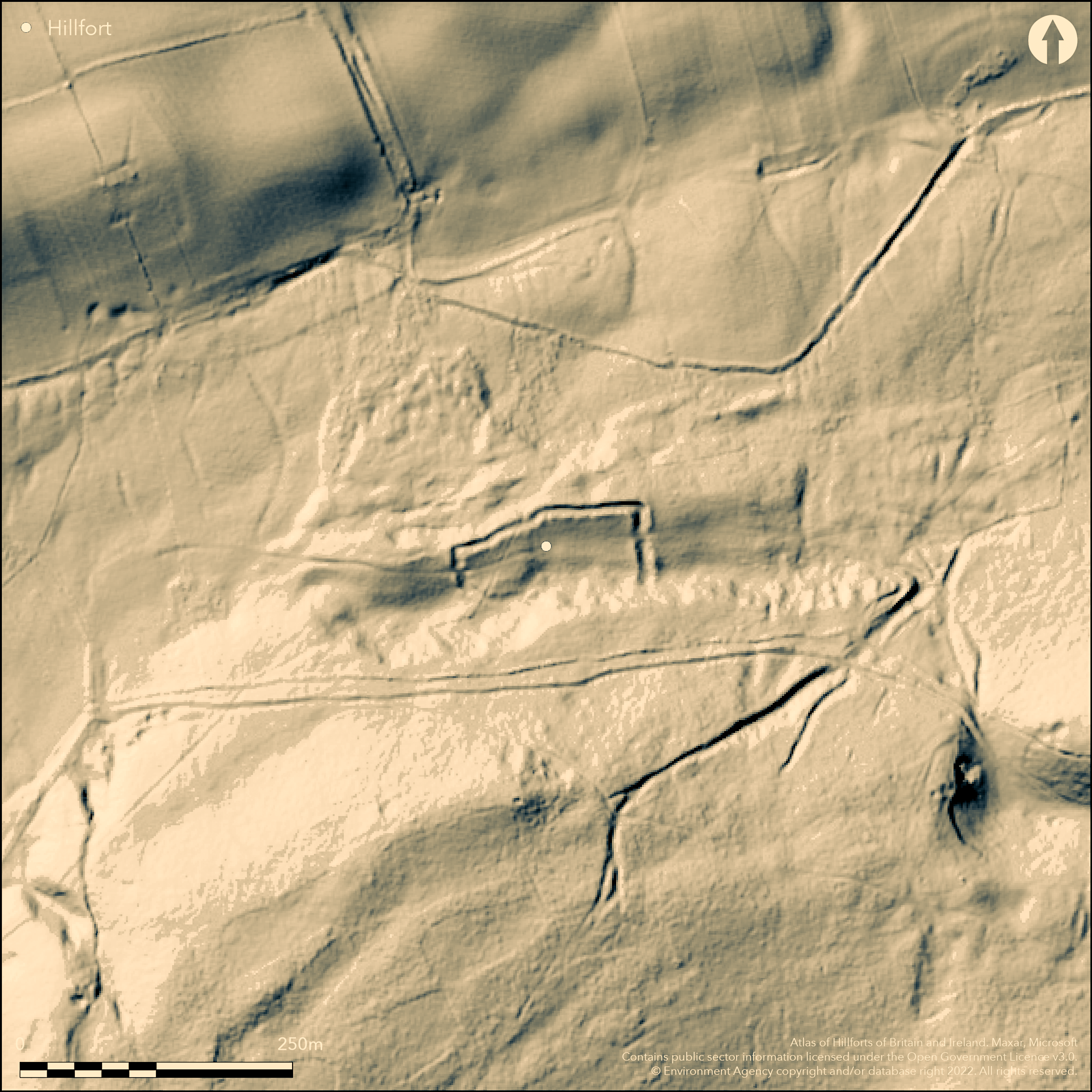
LiDAR 1m DTM Hillshade
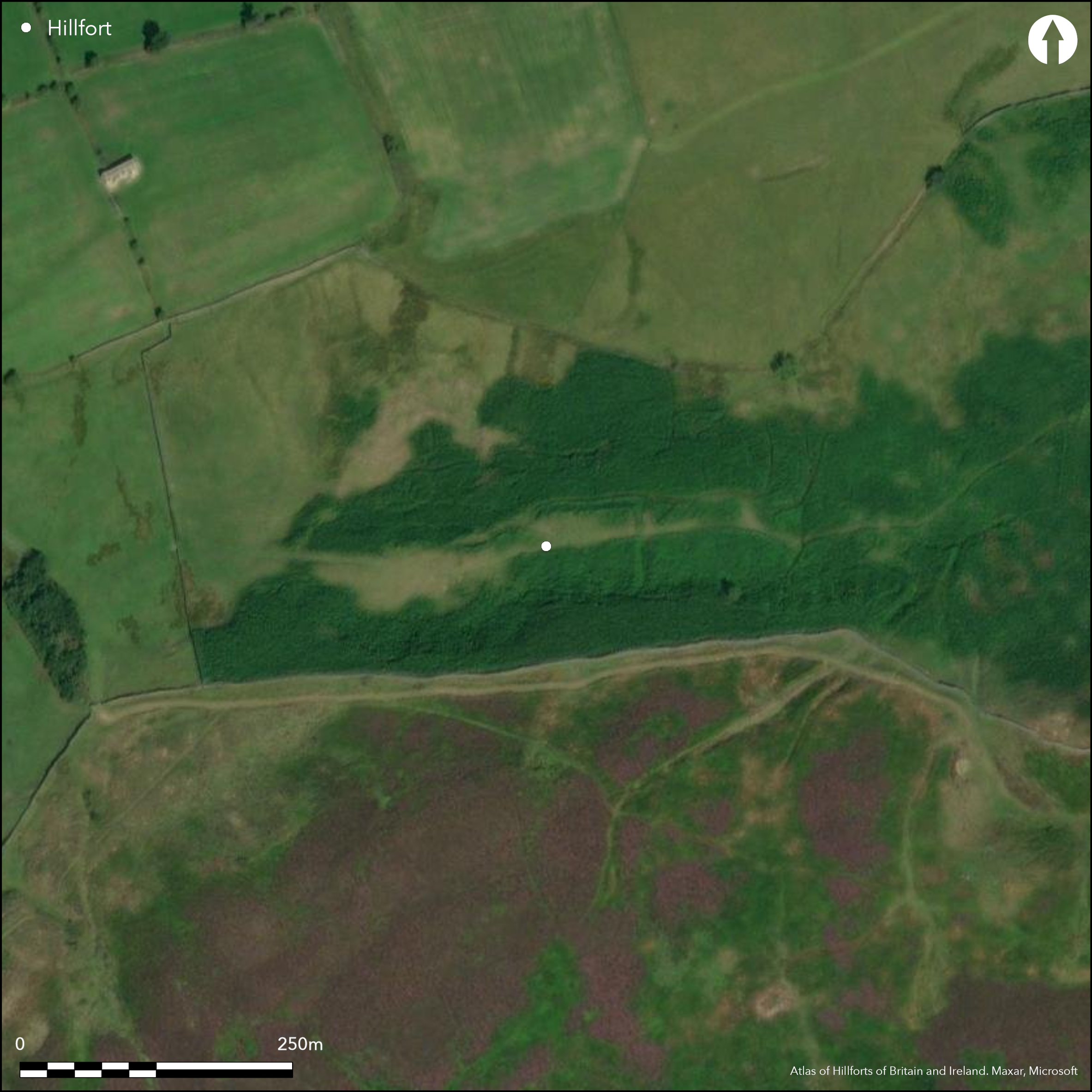
Satellite Imagery
LiDAR 1m DTM Hillshade
Satellite Imagery
Scroll left/right to view further images.
HER: Yorkshire Dales National Park MYD5147 (None)
NMR: SE 18 NW 19 (50922)
SM: 1009322
NGR: SE 1050 8533
X: 410505 Y: 485335 (OSGB36)
Lying to the NE of Caldbergh, a possible hillfort located at 293m OD on a terrace on a steep, N-facing hillside. It comprises a 3-sided enclosure measuring 125m E-W by 60m transversely with two stone ramparts standing 1.3m high and a medial ditch and steep slopes to the S. This location allows it to be extremely well concealed from below while commanding extensive views from the E through N to W. A 3m gap lies centrally in the E and W ends which carry a modern track. A further 2m break lies in the N. The ditch is best preserved in the NE measuring 9m wide and 2.2m deep. Overlying rig and furrow possibly masks evidence for internal features contemporary with the hillfort. It was scheduled in 1970 as a slight 'univallate' hillfort. It interpretation as a hillfort is disputed by Bowden (1996) who considers its location and slight earthworks to be indefensible. A resistance and magnetometry survey was carried out in 2004. Nothing recorded. The site is recorded on 1888-1913 OS mapping. Scheduled.
Citizen Science: ✗
Reliability of Data: Confirmed
Reliability of Interpretation: Confirmed
X: -204853 Y: 7220234 (EPSG: 3857)
Longitude: -1.8402219408317615 Latitude: 54.26358018494695 (EPSG:4326)
Country: England
Current County or Unitary Authority: North Yorkshire
Historic County: Yorkshire
Current Parish/Community/Council/Townland: Caldbergh with East Scrafton
None
| Extant | ✓ |
| Cropmark | ✗ |
| Likely Destroyed | ✗ |
Upland calcareous grassland
| Woodland | ✗ |
| Commercial Forestry Plantation | ✗ |
| Parkland | ✗ |
| Pasture (Grazing) | ✗ |
| Arable | ✗ |
| Scrub/Bracken | ✗ |
| Bare Outcrop | ✗ |
| Heather/Moorland | ✗ |
| Heath | ✗ |
| Built-up | ✗ |
| Coastal Grassland | ✗ |
| Other | ✓ |
A possible hillslope fort lying at 293m OD on a level terrace on a N-facing hillside
| Contour Fort | ✗ |
| Partial Contour Fort | ✗ |
| Promontory Fort | ✗ |
| Hillslope Fort | ✓ |
| Level Terrain Fort | ✗ |
| Marsh Fort | ✗ |
| Multiple Enclosure Fort | ✗ |
| Hilltop | ✗ |
| Coastal Promontory | ✗ |
| Inland Promontory | ✗ |
| Valley Bottom | ✗ |
| Knoll/Hillock/Outcrop | ✗ |
| Ridge | ✗ |
| Cliff/Plateau-edge/Scarp | ✗ |
| Hillslope | ✓ |
| Lowland | ✗ |
| Spur | ✗ |
Dominant Topographic Feature: Level terrace on a steep, N-facing hillside
| North | ✓ |
| Northeast | ✗ |
| East | ✗ |
| Southeast | ✗ |
| South | ✗ |
| Southwest | ✗ |
| West | ✗ |
| Northwest | ✗ |
| Level | ✗ |
Altitude: 293.0m
N/A
The site is undated
Reliability: D - None
| Pre 1200BC | ✗ |
| 1200BC - 800BC | ✗ |
| 800BC - 400BC | ✗ |
| 400BC - AD50 | ✗ |
| AD50 - AD400 | ✗ |
| AD400 - AD 800 | ✗ |
| Post AD800 | ✗ |
| Unknown | ✓ |
| Pre Hillfort: | None |
| Post Hillfort: | None |
Recorded on 1883-1900 OS mapping. Listed by Challis and Harding as a curvilinear enclosure. Field investigation 1977. Resistance and magnetometry survey in 2004 to locate subsurface remains in the interior of the fort to help understand the nature of Iron age activity and the impact of current MoD ownership. Scheduled
| Other (1970): | Scheduled |
| 1st Identified Written Reference (1975): | None |
| Other (1977): | Field investigation |
| Geophysical Survey (2004): | Magnetometry and resistance |
| 1st Identified Map Depiction (None): | None |
Overlying rig and furrow possibly masks internal features
None
| None | ✓ |
| Spring | ✗ |
| Stream | ✗ |
| Pool | ✗ |
| Flush | ✗ |
| Well | ✗ |
| Other | ✗ |
None
| No Known Features | ✓ |
| Round Stone Structures | ✗ |
| Rectangular Stone Structures | ✗ |
| Curvilinear Platforms | ✗ |
| Other Roundhouse Evidence | ✗ |
| Pits | ✗ |
| Quarry Hollows | ✗ |
| Other | ✗ |
None
| No Known Excavation | ✓ |
| Pits | ✗ |
| Postholes | ✗ |
| Roundhouses | ✗ |
| Rectangular Structures | ✗ |
| Roads/Tracks | ✗ |
| Quarry Hollows | ✗ |
| Other | ✗ |
| Nothing Found | ✗ |
None
| No Known Geophysics | ✓ |
| Pits | ✗ |
| Roundhouses | ✗ |
| Rectangular Structures | ✗ |
| Roads/Tracks | ✗ |
| Quarry Hollows | ✗ |
| Other | ✗ |
| Nothing Found | ✗ |
None
| No Known Finds | ✓ |
| Pottery | ✗ |
| Metal | ✗ |
| Metalworking | ✗ |
| Human Bones | ✗ |
| Animal Bones | ✗ |
| Lithics | ✗ |
| Environmental | ✗ |
| Other | ✗ |
None
| APs Not Checked | ✓ |
| None | ✗ |
| Roundhouses | ✗ |
| Rectangular Structures | ✗ |
| Pits | ✗ |
| Postholes | ✗ |
| Roads/Tracks | ✗ |
| Other | ✗ |
A 3m gap lies centrally in the E and W ends which carries a modern track. A further 2m break lies in the N.
| 3: | None |
| 2: | None |
Guard Chambers: ✗
Chevaux de Frise: ✗
| 1. Simple Gap (East): | None |
| 2. Simple Gap (West): | None |
Three-sided enclosure measuring 125m E-W by 60m transversely with two turf-covered stone ramparts standing 1.3m high and a medial ditch, steep slopes in the S. The ditch is best preserved in the NE measuring 9m wide and 2.2m deep. Not strictly possible to calculate enclosed area as not closed form
| Area 1: | 0.27ha. |
| Total: | 0.27ha. |
Total Footprint Area: Noneha.
None
| ✗ | Calculated from satellite imagery |
| ✗ | Scheduled as univallate, although described as having two stone walls neither of which is described as a counterscarp |
| NE Quadrant: | 2 |
| SE Quadrant: | None |
| SW Quadrant: | None |
| NW Quadrant: | 2 |
| Total: | 2 |
| Partial Univallate | ✗ |
| Univallate | ✗ |
| Partial Bivallate | ✓ |
| Bivallate | ✗ |
| Partial Multivallate | ✗ |
| Multivallate | ✗ |
| Unknown | ✗ |
| Partial Univallate | ✗ |
| Univallate | ✗ |
| Partial Bivallate | ✗ |
| Bivallate | ✗ |
| Partial Multivallate | ✗ |
| Multivallate | ✗ |
None
| None | ✗ |
| Earthen Bank | ✗ |
| Stone Wall | ✓ |
| Rubble | ✗ |
| Wall-walk | ✗ |
| Evidence of Timber | ✗ |
| Vitrification | ✗ |
| Other Burning | ✗ |
| Palisade | ✗ |
| Counter Scarp Bank | ✗ |
| Berm | ✗ |
| Unfinished | ✗ |
| Other | ✗ |
None
| None | ✗ |
| Earthen Bank | ✗ |
| Stone Wall | ✗ |
| Murus Duplex | ✗ |
| Timber-framed | ✗ |
| Timber-laced | ✗ |
| Vitrification | ✗ |
| Other Burning | ✗ |
| Palisade | ✗ |
| Counter Scarp Bank | ✗ |
| Berm | ✗ |
| Unfinished | ✗ |
| No Known Excavation | ✓ |
| Other | ✗ |
| ✗ | None |
| ✓ | None |
Number of Ditches: 1
| ✗ | None |
Challis, A.J. and Harding, D.W. 1975 Later Prehistory from Trent to the Tyne. BAR 20 pt 2, 52
Bowden, M. 1996 Maiden Castle Swaledale Survey, 16-JUL-1996. RCHME. Unpublished
Harrison, T.S . 2005. Ephemeral Features Inside Iron Age Hillforts; The Impact of MOD Use at Castle Steads HIllfort, 01/01/2005
Atlas of Hillforts:
Wikidata:
This work is licensed under CC BY-SA 4.0

 and should be cited as:
Lock, Gary and Ralston, Ian. 2024. Atlas of Hillforts of Britain and Ireland. Available at: https://hillforts.arch.ox.ac.uk
Document Version 1.1