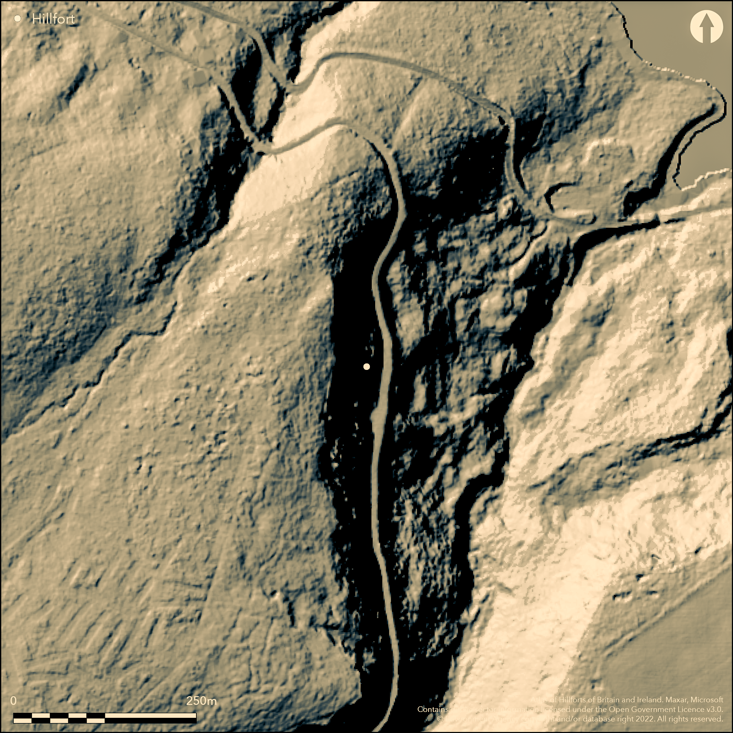
LiDAR 1m DTM Hillshade
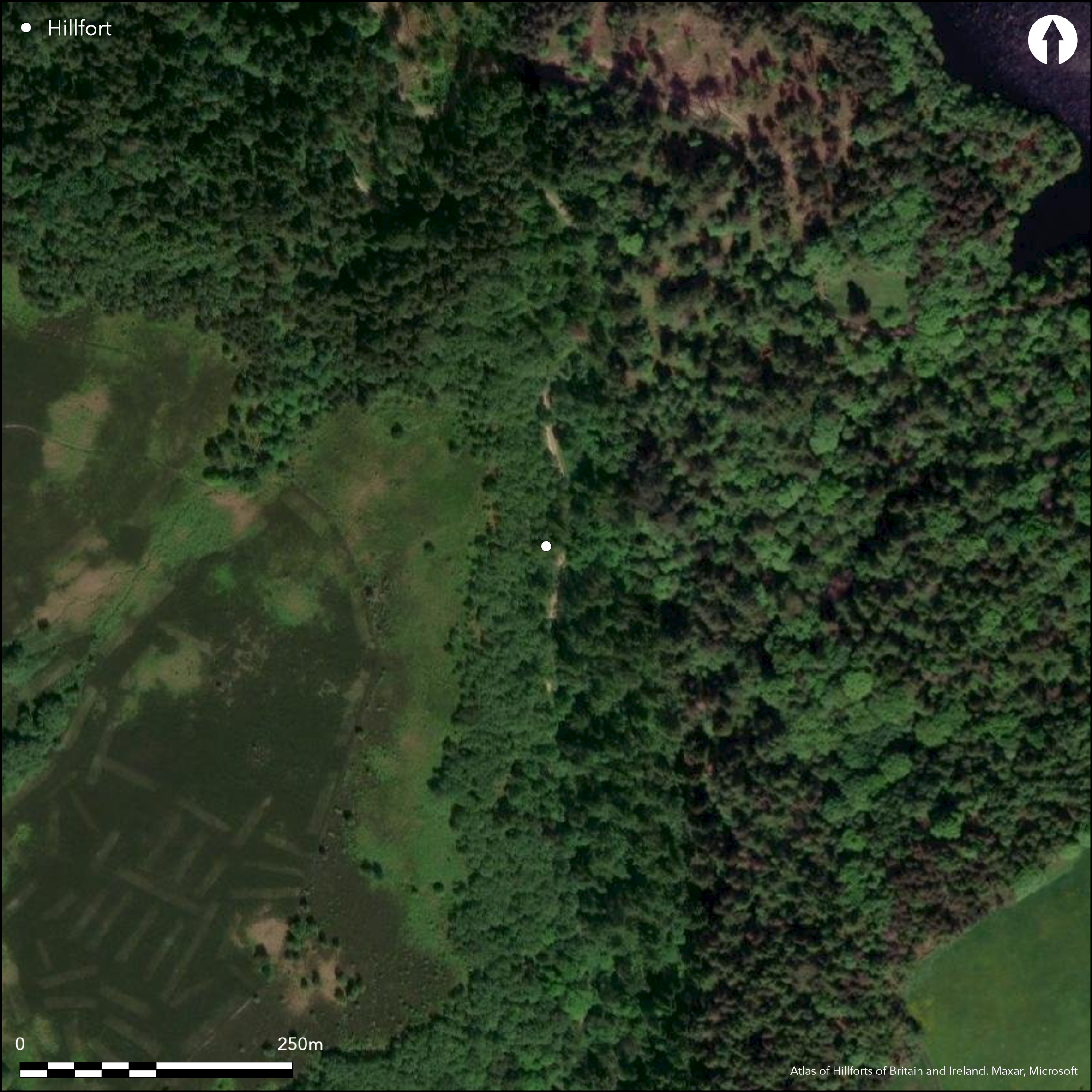
Satellite Imagery
LiDAR 1m DTM Hillshade
Satellite Imagery
Scroll left/right to view further images.
HER: South Yorkshire 02857/01 (None)
NMR: SK 28 NE 20 (312206)
SM: None
NGR: SK 2716 8644
X: 427162 Y: 386449 (OSGB36)
On a steep rocky sided spur overlooking the Rivelin Dams on Ash Cabin Flat, a possible promontory fort discovered by T.C. Welsh during fieldwalking in 1975 (Moorhouse 1977). Now in woodland it lies between the sides of Wyming Brook and a stream issuing between Rivelin Dams and Wyming Brook corner. The enclosed area Is formed by a stoney bank and shallow ditch. Rough walls of large stones backed by rubble and boulders 2-3m thick and incorporating in-situ rocks, lie around the other approaches. The outermost wall is discontinuous. Incorporated into the inner wall is a long stone in which a pair of opposing slots have been cut in adjacent sides. A survey in 2013 found the remains to comprise a very spread bank approximately 20m long aligned E-W and a further bank in the S on a SW-NE alignment, the two banks meeting at the NE point of the promontory (Dennison 2013). The report noted that these earthworks did not closely resemble the original description. The location of entrances is unknown but a narrow pass approaches from Wyming Brook on the NE side. A D-shaped enclosure measuring 15m by 16m internally abuts the wall of the inner rampart and possible circular and rectangular huts have also been identified. The site is not recorded on OS mapping. Minimal investigations, undated.
Citizen Science: ✗
Reliability of Data: Unconfirmed
Reliability of Interpretation: Unconfirmed
X: -177354 Y: 7052516 (EPSG: 3857)
Longitude: -1.5931979003511123 Latitude: 53.374194697924665 (EPSG:4326)
Country: England
Current County or Unitary Authority: South Yorkshire
Historic County: Yorkshire
Current Parish/Community/Council/Townland: Sheffield
Within the Wyming Brook Nature Reserve. All features are now denuded.
| Extant | ✓ |
| Cropmark | ✗ |
| Likely Destroyed | ✗ |
None
| Woodland | ✓ |
| Commercial Forestry Plantation | ✗ |
| Parkland | ✗ |
| Pasture (Grazing) | ✗ |
| Arable | ✗ |
| Scrub/Bracken | ✗ |
| Bare Outcrop | ✗ |
| Heather/Moorland | ✗ |
| Heath | ✗ |
| Built-up | ✗ |
| Coastal Grassland | ✗ |
| Other | ✗ |
On a steep rocky sided spur at 274m OD,overlooking the Rivelin Dams on Ash Cabin Flat
| Contour Fort | ✗ |
| Partial Contour Fort | ✗ |
| Promontory Fort | ✓ |
| Hillslope Fort | ✓ |
| Level Terrain Fort | ✗ |
| Marsh Fort | ✗ |
| Multiple Enclosure Fort | ✗ |
| Hilltop | ✗ |
| Coastal Promontory | ✗ |
| Inland Promontory | ✓ |
| Valley Bottom | ✗ |
| Knoll/Hillock/Outcrop | ✗ |
| Ridge | ✗ |
| Cliff/Plateau-edge/Scarp | ✗ |
| Hillslope | ✗ |
| Lowland | ✗ |
| Spur | ✓ |
Dominant Topographic Feature: Steep rocky sided spur
| North | ✗ |
| Northeast | ✓ |
| East | ✗ |
| Southeast | ✗ |
| South | ✗ |
| Southwest | ✗ |
| West | ✗ |
| Northwest | ✗ |
| Level | ✗ |
Altitude: 274.0m
N/A
The site is undated
Reliability: D - None
| Pre 1200BC | ✗ |
| 1200BC - 800BC | ✗ |
| 800BC - 400BC | ✗ |
| 400BC - AD50 | ✗ |
| AD50 - AD400 | ✗ |
| AD400 - AD 800 | ✗ |
| Post AD800 | ✗ |
| Unknown | ✓ |
| Pre Hillfort: | None |
| Post Hillfort: | None |
Discovered in 1977 (Moorhouse 1977) and the location confirmed in 2013
| 1st Identified Written Reference (1977): | None |
D-shaped enclosure measuring 15m by 16m which abuts the wall of the inner rampart. Possible circular and rectangular huts have also been identified
Lies between the sides of Wyming Brook and a stream issuing between Rivelin Dams and Wyming Brook corner
| None | ✓ |
| Spring | ✗ |
| Stream | ✗ |
| Pool | ✗ |
| Flush | ✗ |
| Well | ✗ |
| Other | ✗ |
None
| No Known Features | ✗ |
| Round Stone Structures | ✓ |
| Rectangular Stone Structures | ✓ |
| Curvilinear Platforms | ✗ |
| Other Roundhouse Evidence | ✗ |
| Pits | ✗ |
| Quarry Hollows | ✗ |
| Other | ✗ |
None
| No Known Excavation | ✓ |
| Pits | ✗ |
| Postholes | ✗ |
| Roundhouses | ✗ |
| Rectangular Structures | ✗ |
| Roads/Tracks | ✗ |
| Quarry Hollows | ✗ |
| Other | ✗ |
| Nothing Found | ✗ |
None
| No Known Geophysics | ✓ |
| Pits | ✗ |
| Roundhouses | ✗ |
| Rectangular Structures | ✗ |
| Roads/Tracks | ✗ |
| Quarry Hollows | ✗ |
| Other | ✗ |
| Nothing Found | ✗ |
None
| No Known Finds | ✓ |
| Pottery | ✗ |
| Metal | ✗ |
| Metalworking | ✗ |
| Human Bones | ✗ |
| Animal Bones | ✗ |
| Lithics | ✗ |
| Environmental | ✗ |
| Other | ✗ |
Obscured by woodland
| APs Not Checked | ✓ |
| None | ✗ |
| Roundhouses | ✗ |
| Rectangular Structures | ✗ |
| Pits | ✗ |
| Postholes | ✗ |
| Roads/Tracks | ✗ |
| Other | ✗ |
No evidence for entrances. A possible pass approaches from Wyming Brook to the NE of the enclosure
| None: | None |
| 2: | None |
Guard Chambers: ✗
Chevaux de Frise: ✗
Enclosed area Is formed by a stoney bank and shallow ditch. Walls of large stones backed by rubble and boulders 2-3m thick, incorporating in-situ rocks, lie around the other approaches. The outermost wall is discontinuous. A further survey in 2013 found the remains to comprise a very spread bank approximately 20m long aligned E-W and a further bank in the S on a SW-NE alignment, the two banks meeting at the NE point of the promontory (Dennison 2013)
| Area 1: | Noneha. |
| Total: | Noneha. |
Total Footprint Area: Noneha.
None
| ✗ | None |
| ✗ | None |
| NE Quadrant: | 1 |
| SE Quadrant: | None |
| SW Quadrant: | 1 |
| NW Quadrant: | None |
| Total: | 1 |
| Partial Univallate | ✓ |
| Univallate | ✗ |
| Partial Bivallate | ✗ |
| Bivallate | ✗ |
| Partial Multivallate | ✗ |
| Multivallate | ✗ |
| Unknown | ✗ |
| Partial Univallate | ✗ |
| Univallate | ✗ |
| Partial Bivallate | ✗ |
| Bivallate | ✗ |
| Partial Multivallate | ✗ |
| Multivallate | ✗ |
Natural, in-situ stones incorporated into the ramparts
| None | ✗ |
| Earthen Bank | ✗ |
| Stone Wall | ✗ |
| Rubble | ✓ |
| Wall-walk | ✗ |
| Evidence of Timber | ✗ |
| Vitrification | ✗ |
| Other Burning | ✗ |
| Palisade | ✗ |
| Counter Scarp Bank | ✗ |
| Berm | ✗ |
| Unfinished | ✗ |
| Other | ✓ |
None
| None | ✗ |
| Earthen Bank | ✗ |
| Stone Wall | ✗ |
| Murus Duplex | ✗ |
| Timber-framed | ✗ |
| Timber-laced | ✗ |
| Vitrification | ✗ |
| Other Burning | ✗ |
| Palisade | ✗ |
| Counter Scarp Bank | ✗ |
| Berm | ✗ |
| Unfinished | ✗ |
| No Known Excavation | ✓ |
| Other | ✗ |
| ✗ | None |
| ✓ | None |
Number of Ditches: 1
| ✗ | None |
Dennison, E. 2013. Wyming Brook Nature Reserve, Sheffield, South Yorkshire. Updated Archaeological Desk-Top Survey. Grey Literature Report: EDAS, 9. https://archaeologydataservice.ac.uk/archiveDS/archiveDownload?t=arch-888-1/dissemination/pdf/eddennis1-171738-1.pdf. Accessed Mar 2016
Dennison, E 2001 Wyming Brook Nature Reserve, Sheffield, South Yorkshire: Archaeological Desk-Top Survey unpublished EDAS archive report 2001/131.R01 for the Sheffield Wildlife Trust
Gowans, E & Pouncett, J. 2007. Redmires Camp Plantation, Sheffield: Desk-Based Assessment and Level 2 Archaeological Survey. Unpublished Archaeological Survey and Evaluation Ltd report held by SYSMR)
Moorhouse, S (ed) 1977. The Yorkshire Archaeological Register: 1976. Yorkshire
Atlas of Hillforts:
Wikidata:
This work is licensed under CC BY-SA 4.0

 and should be cited as:
Lock, Gary and Ralston, Ian. 2024. Atlas of Hillforts of Britain and Ireland. Available at: https://hillforts.arch.ox.ac.uk
Document Version 1.1