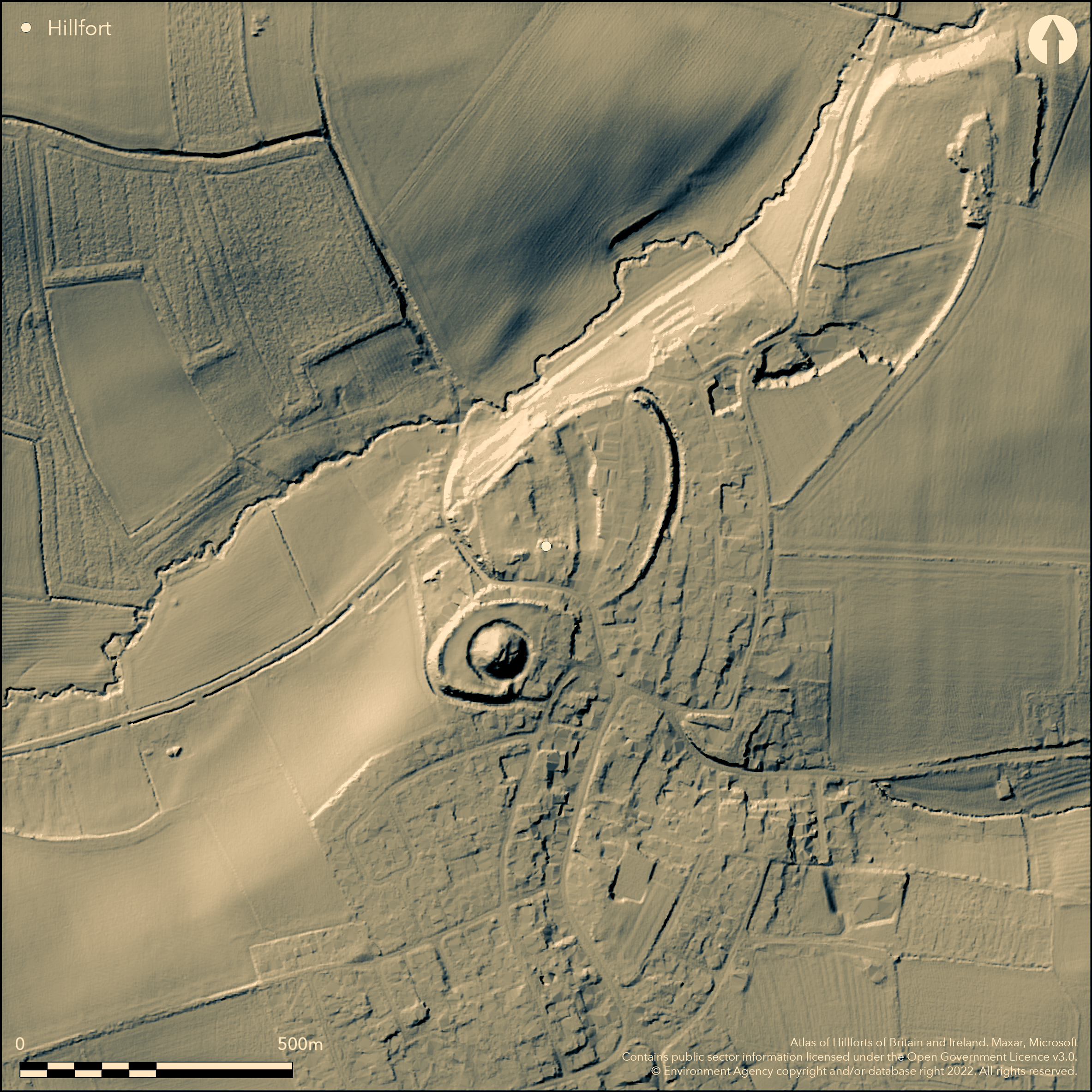
LiDAR 1m DTM Hillshade
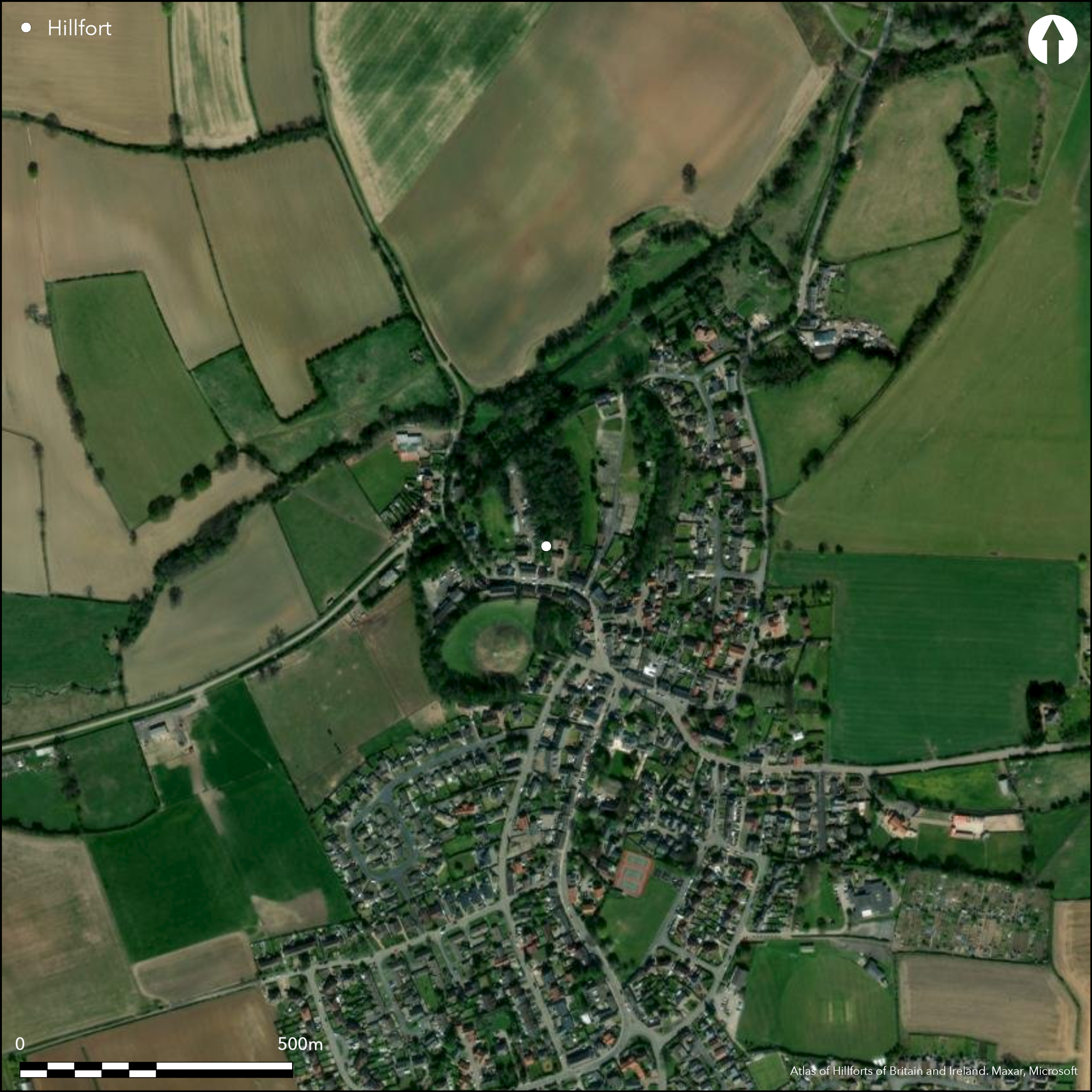
Satellite Imagery
LiDAR 1m DTM Hillshade
Satellite Imagery
Scroll left/right to view further images.
HER: West Yorkshire Archaeology Advisory Service 4 (None)
NMR: SE 33 NE 7 (52862)
SM: 1010924
NGR: SE 39899 37615
X: 439899 Y: 437615 (OSGB36)
Lying on the S bank of Rake Beck, a large univallate hillfort, which encloses the summit of Wendel Hill in the N and Hall Tower HIll in the S, occupying an overall area of 6.1ha. It is strategically located between the rivers Wharfe and Aire, N of the Aire's confluence with the River Calder. It holds a commanding position on an E-W route across the Pennines and is well situated for N-S communications on the W side of the Ouse-Trent basin. It lies 4km from the later line of the Roman road from Lincoln to Aldborough and is argued to be the capital of Cartimandua (Hanson and Campbell 1986). The hillfort later became the location of a Motte and Bailey Castle which occupied 1.8ha of the hillfort on Hall Tower HIll. The Iron Age defences best survive on Wendel Hill where they stand up to 4.5m high and on the SW side of Hall Tower HIll, although these were considerably altered and refortified in the 12th century. A further circuit was identified on the S side of Hall Tower Hill during the construction of houses in the 1960's. A massive in-turned entrance lies in the N on the NW side of Wendel HIll. Internal features contemporary with the hillfort are expected to be preserved in the open areas within the interior. Small scale excavations prior to 1834 found human bone which is undated, and a Republican and Claudian coin, although their find spots were not recorded. A trial excavation in 1991 ahead of development confirmed the presence of the Iron Age ditch on the SE side of Wendel Hill which can no longer be seen as an earthwork. A small number of medieval pottery fragments were recovered at that time. Housing, roads and trees now encroach into the hillfort with open spaces between. Resistance and magnetometer surveys were carried out as part of a local heritage initiative (Harrison and Webb 2006). Discrete magnetic anomalies were recorded which could be the remains of pits but more likely result from modern activity. A medieval or post medieval lime kiln was discovered during works in 1967. The site is recorded on 1885-1900 OS mapping. Scheduled.
Citizen Science: ✗
Reliability of Data: Confirmed
Reliability of Interpretation: Confirmed
X: -155316 Y: 7138642 (EPSG: 3857)
Longitude: -1.3952235704026754 Latitude: 53.83326576685428 (EPSG:4326)
Country: England
Current County or Unitary Authority: West Yorkshire
Historic County: Yorkshire
Current Parish/Community/Council/Townland: Barwick in Elmet and Scholes
Sheep have been brought in to graze on the monument in order to keep the vegetation under control
| Extant | ✓ |
| Cropmark | ✗ |
| Likely Destroyed | ✗ |
Grassland - undifferentiated
| Woodland | ✗ |
| Commercial Forestry Plantation | ✗ |
| Parkland | ✗ |
| Pasture (Grazing) | ✓ |
| Arable | ✗ |
| Scrub/Bracken | ✗ |
| Bare Outcrop | ✗ |
| Heather/Moorland | ✗ |
| Heath | ✗ |
| Built-up | ✗ |
| Coastal Grassland | ✗ |
| Other | ✗ |
A contour fort surrounding the summits of Wendel Hill and Hall Tower Hill at approximately 83m OD trending northwards from 86m OD in the S to 72m OD in the N
| Contour Fort | ✓ |
| Partial Contour Fort | ✗ |
| Promontory Fort | ✗ |
| Hillslope Fort | ✗ |
| Level Terrain Fort | ✗ |
| Marsh Fort | ✗ |
| Multiple Enclosure Fort | ✗ |
| Hilltop | ✓ |
| Coastal Promontory | ✗ |
| Inland Promontory | ✗ |
| Valley Bottom | ✗ |
| Knoll/Hillock/Outcrop | ✗ |
| Ridge | ✗ |
| Cliff/Plateau-edge/Scarp | ✗ |
| Hillslope | ✗ |
| Lowland | ✗ |
| Spur | ✗ |
Dominant Topographic Feature: Summits of Wendel Hill and Hall Tower Hill
| North | ✓ |
| Northeast | ✗ |
| East | ✗ |
| Southeast | ✗ |
| South | ✗ |
| Southwest | ✗ |
| West | ✗ |
| Northwest | ✗ |
| Level | ✗ |
Altitude: 83.0m
N/A
Undated
Reliability: D - None
| Pre 1200BC | ✗ |
| 1200BC - 800BC | ✗ |
| 800BC - 400BC | ✗ |
| 400BC - AD50 | ✗ |
| AD50 - AD400 | ✗ |
| AD400 - AD 800 | ✗ |
| Post AD800 | ✗ |
| Unknown | ✓ |
| Pre Hillfort: | None |
| Post Hillfort: | Motte and Bailey Castle, lime kiln |
Recorded on 1885-1900 OS Mapping. General reference in Coleman (1908). Field investigations in 1961 and 1964. Small scale unpublished excavations prior to 1834 . Trial excavation in 1991 ahead of development. Resistance and magnetometer surveys were carried out in 2005 and 2006 (Harrison & Webb 2006). Scheduled
| 1st Identified Written Reference (1908): | General reference |
| Other (1949): | Scheduled |
| Other (1961): | Field investigation |
| Other (1964): | Field investigation |
| Excavation (1991): | None |
| 1st Identified Map Depiction (None): | None |
| Geophysical Survey (None): | None |
| Excavation (None): | None |
No internal features are known but they are expected to survive
Rake Beck to the W
| None | ✓ |
| Spring | ✗ |
| Stream | ✗ |
| Pool | ✗ |
| Flush | ✗ |
| Well | ✗ |
| Other | ✗ |
None
| No Known Features | ✓ |
| Round Stone Structures | ✗ |
| Rectangular Stone Structures | ✗ |
| Curvilinear Platforms | ✗ |
| Other Roundhouse Evidence | ✗ |
| Pits | ✗ |
| Quarry Hollows | ✗ |
| Other | ✗ |
None
| No Known Excavation | ✗ |
| Pits | ✗ |
| Postholes | ✗ |
| Roundhouses | ✗ |
| Rectangular Structures | ✗ |
| Roads/Tracks | ✗ |
| Quarry Hollows | ✗ |
| Other | ✗ |
| Nothing Found | ✓ |
Magentic anomalies, possibly modern
| No Known Geophysics | ✗ |
| Pits | ✗ |
| Roundhouses | ✗ |
| Rectangular Structures | ✗ |
| Roads/Tracks | ✗ |
| Quarry Hollows | ✗ |
| Other | ✓ |
| Nothing Found | ✗ |
Republican and Claudian coin. Undated human bone
| No Known Finds | ✗ |
| Pottery | ✗ |
| Metal | ✗ |
| Metalworking | ✗ |
| Human Bones | ✓ |
| Animal Bones | ✗ |
| Lithics | ✗ |
| Environmental | ✗ |
| Other | ✓ |
None
| APs Not Checked | ✓ |
| None | ✗ |
| Roundhouses | ✗ |
| Rectangular Structures | ✗ |
| Pits | ✗ |
| Postholes | ✗ |
| Roads/Tracks | ✗ |
| Other | ✗ |
Massive in-turned entrance in the N on the NW side of Wendel HIll.
| 1: | None |
| 2: | None |
Guard Chambers: ✗
Chevaux de Frise: ✗
| 1. In-turned (North): | None |
Large univallate hillfort which encloses the summit of Wendel Hill in the N and Hall Tower HIll in the S, occupying an overall area of 6.1ha. The defences survive best on Wendel Hill where they stand up to 4.5m high and on the SW side of Hall Tower HIll, although these were considerably altered and refortified in the 12th century. A further circuit was identified on the S side of Hall Tower Hill during the construction of houses in the 1960's.
| Area 1: | 6.1ha. |
| Total: | 6.1ha. |
Total Footprint Area: Noneha.
None
| ✗ | None |
| ✓ | None |
| NE Quadrant: | 1 |
| SE Quadrant: | 1 |
| SW Quadrant: | 1 |
| NW Quadrant: | 1 |
| Total: | 1 |
| Partial Univallate | ✗ |
| Univallate | ✓ |
| Partial Bivallate | ✗ |
| Bivallate | ✗ |
| Partial Multivallate | ✗ |
| Multivallate | ✗ |
| Unknown | ✗ |
| Partial Univallate | ✗ |
| Univallate | ✗ |
| Partial Bivallate | ✗ |
| Bivallate | ✗ |
| Partial Multivallate | ✗ |
| Multivallate | ✗ |
None
| None | ✗ |
| Earthen Bank | ✓ |
| Stone Wall | ✗ |
| Rubble | ✗ |
| Wall-walk | ✗ |
| Evidence of Timber | ✗ |
| Vitrification | ✗ |
| Other Burning | ✗ |
| Palisade | ✗ |
| Counter Scarp Bank | ✗ |
| Berm | ✗ |
| Unfinished | ✗ |
| Other | ✗ |
Ditch investigated
| None | ✗ |
| Earthen Bank | ✗ |
| Stone Wall | ✗ |
| Murus Duplex | ✗ |
| Timber-framed | ✗ |
| Timber-laced | ✗ |
| Vitrification | ✗ |
| Other Burning | ✗ |
| Palisade | ✗ |
| Counter Scarp Bank | ✗ |
| Berm | ✗ |
| Unfinished | ✗ |
| No Known Excavation | ✗ |
| Other | ✓ |
| ✗ | None |
| ✓ | None |
Number of Ditches: 1
| ✗ | None |
Colman, F.S., 1908, A History of the Parish of Barwick-in-Elmet, in the county of York (Thoresby Society 17) p. 19-24
Hanson, W.S. and Campbell, D.B. 1986. The Brigantes: From Clientage to Conquest. Britannia 17, 1986 Page(s)73-89
Harrison, T. S. and Webb, A. 2006. Barwick Earthwork Project, Barwick In Elmet, West Yorkshire Archaeological Services WYAS 1518
Atlas of Hillforts:
Wikidata:
This work is licensed under CC BY-SA 4.0

 and should be cited as:
Lock, Gary and Ralston, Ian. 2024. Atlas of Hillforts of Britain and Ireland. Available at: https://hillforts.arch.ox.ac.uk
Document Version 1.1