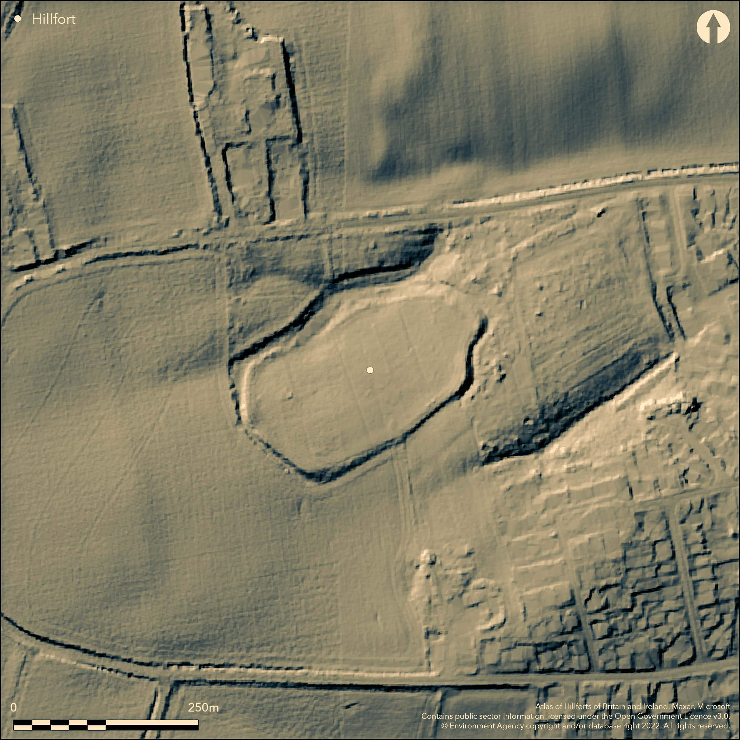
LiDAR 1m DTM Hillshade
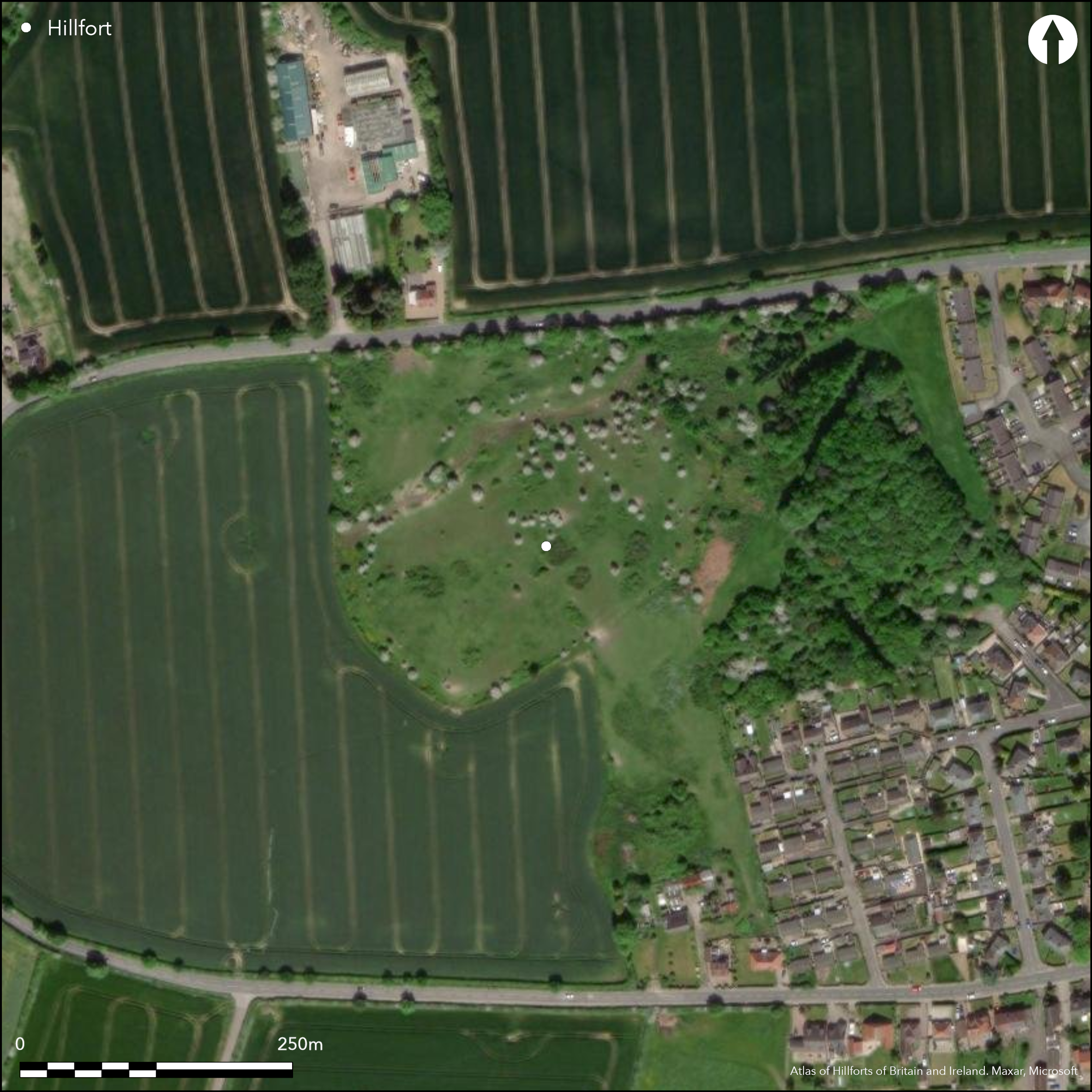
Satellite Imagery
LiDAR 1m DTM Hillshade
Satellite Imagery
Scroll left/right to view further images.
HER: West Yorkshire Archaeology Advisory Service 83 (None)
NMR: SE 41 SW 6 (54286)
SM: 1018818
NGR: SE 4351 1047
X: 443517 Y: 410472 (OSGB36)
A possible univallate hillfort 200m NNW of Kirkby Common Farm on Brierley Common. It lies on sloping ground at the E end of a low ridge with good visibility to the N and W. Oval in form with a single bank and ditch measuring 222m SW-NE by 133m transversely enclosing 1.8ha. It survives best in the SW and E with the bank up to 10m wide and standing up to 1m high and the external ditch between 7-10m wide and 1.5m deep. Slight ravines in the N and S. Today there is no discernible entrance. In the SE the line of the defences is marked by a slight lynchet and some plough damage has occurred to the ditch in the SW. No internal features are known and the interior falls into a slight gully in the W. An unpublished excavation by F. Atkinson of Wakefield Museum in 1949 recovered only burnt sandstone and pottery said to be Iron Age. A Southern annex reported by Atkinson measuring approximately 150m by 40m comprising a bank and possibly a ditch was investigated through geophysics however no geophysical evidence was found to support this. Anomalies of a possible archaeological origin that might indicate the presence of a second inner ditch and an internal enclosure were recorded within the interior (Whittingham 1997). Damage has occurred to the site through modern fences in the S and W and the removal of a hedge which has mutilated the bank. Ridge and furrow ploughing has been identified within the interior. The site is recorded on 1885-1900 OS mapping. It is scheduled as a prehistoric enclosed settlement.
Citizen Science: ✗
Reliability of Data: Confirmed
Reliability of Interpretation: Confirmed
X: -149620 Y: 7092703 (EPSG: 3857)
Longitude: -1.3440579078631503 Latitude: 53.58902347813117 (EPSG:4326)
Country: England
Current County or Unitary Authority: West Yorkshire
Historic County: Yorkshire
Current Parish/Community/Council/Townland: South Kirkby and Moorthorpe
Recorded on the Monuments at Risk register as generally unsatisfactory with major localised problems with the principal vulnerability being plant growth
| Extant | ✓ |
| Cropmark | ✗ |
| Likely Destroyed | ✗ |
None
| Woodland | ✗ |
| Commercial Forestry Plantation | ✗ |
| Parkland | ✓ |
| Pasture (Grazing) | ✗ |
| Arable | ✗ |
| Scrub/Bracken | ✗ |
| Bare Outcrop | ✗ |
| Heather/Moorland | ✗ |
| Heath | ✗ |
| Built-up | ✗ |
| Coastal Grassland | ✗ |
| Other | ✗ |
An enclosure lying at approximately 88m OD on ground that falls away to the NE and defined by a spring in the N
| Contour Fort | ✗ |
| Partial Contour Fort | ✗ |
| Promontory Fort | ✗ |
| Hillslope Fort | ✓ |
| Level Terrain Fort | ✗ |
| Marsh Fort | ✗ |
| Multiple Enclosure Fort | ✗ |
| Hilltop | ✗ |
| Coastal Promontory | ✗ |
| Inland Promontory | ✗ |
| Valley Bottom | ✗ |
| Knoll/Hillock/Outcrop | ✗ |
| Ridge | ✗ |
| Cliff/Plateau-edge/Scarp | ✗ |
| Hillslope | ✓ |
| Lowland | ✗ |
| Spur | ✗ |
Dominant Topographic Feature: Hillslope
| North | ✗ |
| Northeast | ✓ |
| East | ✗ |
| Southeast | ✗ |
| South | ✗ |
| Southwest | ✗ |
| West | ✗ |
| Northwest | ✗ |
| Level | ✗ |
Altitude: 88.0m
N/A
Few fragments of what was said to be Iron Age pottery, but this is unverified.
Reliability: D - None
| Pre 1200BC | ✗ |
| 1200BC - 800BC | ✗ |
| 800BC - 400BC | ✗ |
| 400BC - AD50 | ✗ |
| AD50 - AD400 | ✗ |
| AD400 - AD 800 | ✗ |
| Post AD800 | ✗ |
| Unknown | ✓ |
| Pre Hillfort: | None |
| Post Hillfort: | Rig and furrow ploughing |
| Artefactual: | None |
Recorded on 1885-1900 OS mapping and included in VCH Yorks (1912). An excavation was carried out in 1949, but the results were unpublished. A geophysical survey carried out to look for the presence of an annex reported in 1949 found no evidence but possible features within the enclosure were recorded. RCHME field investigations 1960, 1964 and 1987. Scheduled
| 1st Identified Written Reference (1912): | None |
| Other (1951): | Scheduled |
| Other (1960): | Field investigation |
| Other (1964): | Field investigation |
| Other (1987): | Field investigation |
| Geophysical Survey (1997): | None |
| 1st Identified Map Depiction (None): | None |
| Excavation (1949): | None |
Geophysical anomalies of a possible archaeological origin which might indicate the presence of a second inner ditch and an internal enclosure were recorded within the interior (Whittingham 1997). Burnt standstone and pottery fragments (IA?) from excavation
A spring lies to the NW
| None | ✓ |
| Spring | ✗ |
| Stream | ✗ |
| Pool | ✗ |
| Flush | ✗ |
| Well | ✗ |
| Other | ✗ |
None
| No Known Features | ✓ |
| Round Stone Structures | ✗ |
| Rectangular Stone Structures | ✗ |
| Curvilinear Platforms | ✗ |
| Other Roundhouse Evidence | ✗ |
| Pits | ✗ |
| Quarry Hollows | ✗ |
| Other | ✗ |
Excavation report has not been published
| No Known Excavation | ✗ |
| Pits | ✗ |
| Postholes | ✗ |
| Roundhouses | ✗ |
| Rectangular Structures | ✗ |
| Roads/Tracks | ✗ |
| Quarry Hollows | ✗ |
| Other | ✓ |
| Nothing Found | ✗ |
None
| No Known Geophysics | ✗ |
| Pits | ✗ |
| Roundhouses | ✗ |
| Rectangular Structures | ✗ |
| Roads/Tracks | ✗ |
| Quarry Hollows | ✗ |
| Other | ✗ |
| Nothing Found | ✓ |
Burnt standstone and pottery fragments
| No Known Finds | ✗ |
| Pottery | ✓ |
| Metal | ✗ |
| Metalworking | ✗ |
| Human Bones | ✗ |
| Animal Bones | ✗ |
| Lithics | ✗ |
| Environmental | ✗ |
| Other | ✓ |
None
| APs Not Checked | ✓ |
| None | ✗ |
| Roundhouses | ✗ |
| Rectangular Structures | ✗ |
| Pits | ✗ |
| Postholes | ✗ |
| Roads/Tracks | ✗ |
| Other | ✗ |
The location of any entrance is unrecorded
| None: | None |
| 2: | None |
Guard Chambers: ✗
Chevaux de Frise: ✗
Oval in form, it comprises a single bank and ditch measuring 222m SW-NE by 133m transversely enclosing 1.8ha. It survives best in the SW and E with the bank up to 10m wide and standing up to 1m high and the external ditch between 7-10m wide and 1.5m deep. In the N and S slight ravines provide some natural defence. Anomalies of a possible archaeological origin that might indicate the presence of a second inner ditch and an internal enclosure were recorded within the interior (Whittingham 1997)
| Area 1: | 1.8ha. |
| Total: | 1.8ha. |
Total Footprint Area: Noneha.
None
| ✗ | None |
| ✗ | None |
| NE Quadrant: | 1 |
| SE Quadrant: | 1 |
| SW Quadrant: | 1 |
| NW Quadrant: | None |
| Total: | 1 |
| Partial Univallate | ✓ |
| Univallate | ✗ |
| Partial Bivallate | ✗ |
| Bivallate | ✗ |
| Partial Multivallate | ✗ |
| Multivallate | ✗ |
| Unknown | ✗ |
| Partial Univallate | ✗ |
| Univallate | ✗ |
| Partial Bivallate | ✗ |
| Bivallate | ✗ |
| Partial Multivallate | ✗ |
| Multivallate | ✗ |
Anomalies of a possible archaeological origin which might indicate the presence of a second inner ditch and an internal enclosure were recorded within the interior (Whittingham 1997)
| None | ✗ |
| Earthen Bank | ✓ |
| Stone Wall | ✗ |
| Rubble | ✗ |
| Wall-walk | ✗ |
| Evidence of Timber | ✗ |
| Vitrification | ✗ |
| Other Burning | ✗ |
| Palisade | ✗ |
| Counter Scarp Bank | ✗ |
| Berm | ✗ |
| Unfinished | ✗ |
| Other | ✗ |
None
| None | ✓ |
| Earthen Bank | ✗ |
| Stone Wall | ✗ |
| Murus Duplex | ✗ |
| Timber-framed | ✗ |
| Timber-laced | ✗ |
| Vitrification | ✗ |
| Other Burning | ✗ |
| Palisade | ✗ |
| Counter Scarp Bank | ✗ |
| Berm | ✗ |
| Unfinished | ✗ |
| No Known Excavation | ✗ |
| Other | ✗ |
| ✗ | None |
| ✓ | None |
Number of Ditches: 1
| ✗ | None |
Page, W. 1912 The Victoria History of the County of York, Volume Two.
Whittingham M. 1997. South Kirkby Camp, South Kirkby, West Yorkshire, Gradiometer Survey. West Yorkshire Archaeology Service.
Atlas of Hillforts:
Wikidata:
This work is licensed under CC BY-SA 4.0

 and should be cited as:
Lock, Gary and Ralston, Ian. 2024. Atlas of Hillforts of Britain and Ireland. Available at: https://hillforts.arch.ox.ac.uk
Document Version 1.1