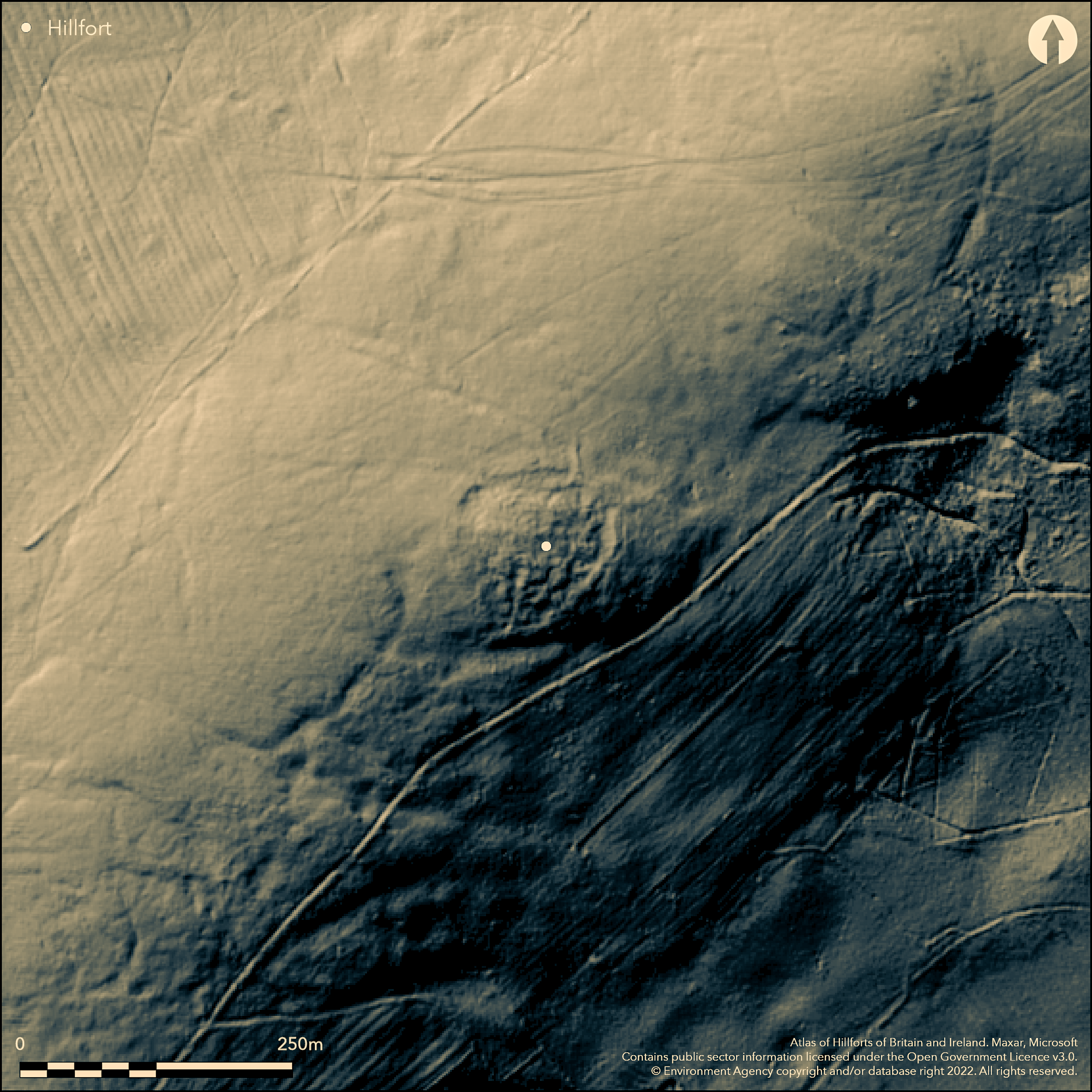
LiDAR 1m DTM Hillshade
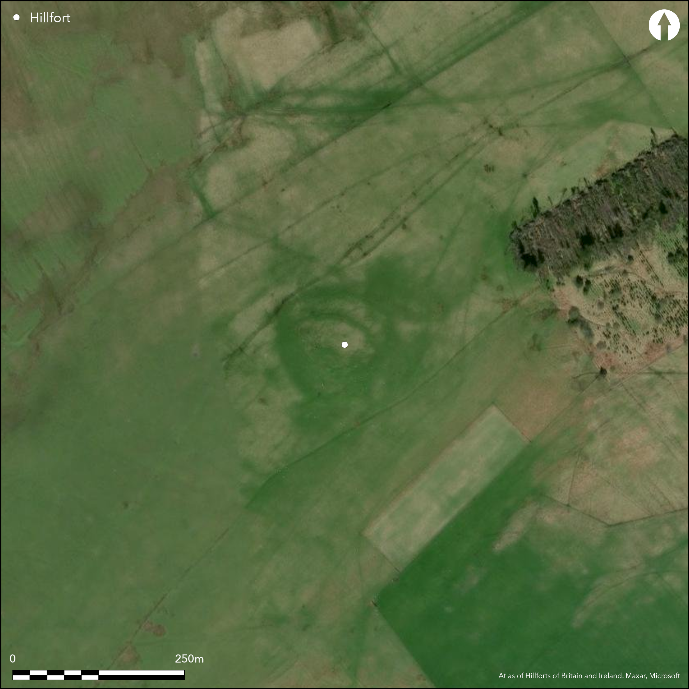
Satellite Imagery
LiDAR 1m DTM Hillshade
Satellite Imagery
Scroll left/right to view further images.
HER: Northumberland 1358 (None)
NMR: NT 91 SE 29 (1033824)
SM: 1006417
NGR: NT 98855 12818
X: 398855 Y: 612818 (OSGB36)
Lying at 335m OD on the SE slopes of Hart Law, 1.25km to the SW of Prendwick, the earthwork and cropmarked remains of a palisaded enclosure of approximately 0.75ha. The site has the steep slopes of Hart Law to the S. Circular in plan, approximately 97m in diameter, it comprises a low, flattened bank in the N, E and W 0.1-0.2m high and intermittent traces of a double palisade trench around the perimeter, the ditches spaced approximately 2.4-2.7m apart. In the S the surrounding bank is visible as an outward facing scarp 1.3m high, formed from scarping the natural hillslope. In the SW it is made visible as a vegetational change. Breaks are visible in the NE, N and NW but the location of the original entrance is uncertain. Within the interior a bank 0.8m high follows the N and NE arc of enclosure which separates the summit from the lower scarp and divides the area into upper and lower sections. The relationship of this bank to the palisade is unclear. Twenty or more platform or ring groove houses have been recorded 5.2-10m in diameter many of which are contiguous and a large house can be seen to have replaced a smaller one. In some, entrances and a slight outer bank can be identified. Three houses lie within the lower section, one of which cuts into the inner bank. If scooped houses are present they are now masked by later quarrying. A break in the NE of the internal bank corresponds with that seen in the outer enclosure. Some quarrying has occurred and the site is now eroding. It is not recorded on OS mapping, Minimal investigations and undated. Scheduled as a palisaded settlement.
Citizen Science: ✗
Reliability of Data: Confirmed
Reliability of Interpretation: Confirmed
X: -224824 Y: 7441716 (EPSG: 3857)
Longitude: -2.019628550201607 Latitude: 55.409321322086576 (EPSG:4326)
Country: England
Current County or Unitary Authority: Northumberland
Historic County: Northumberland
Current Parish/Community/Council/Townland: Alnham
Eroding
| Extant | ✓ |
| Cropmark | ✗ |
| Likely Destroyed | ✗ |
None
| Woodland | ✗ |
| Commercial Forestry Plantation | ✗ |
| Parkland | ✗ |
| Pasture (Grazing) | ✓ |
| Arable | ✗ |
| Scrub/Bracken | ✗ |
| Bare Outcrop | ✗ |
| Heather/Moorland | ✗ |
| Heath | ✗ |
| Built-up | ✗ |
| Coastal Grassland | ✗ |
| Other | ✗ |
A palisaded enclosure lying at 335m OD on the SE slopes of Hart Law
| Contour Fort | ✗ |
| Partial Contour Fort | ✗ |
| Promontory Fort | ✗ |
| Hillslope Fort | ✓ |
| Level Terrain Fort | ✗ |
| Marsh Fort | ✗ |
| Multiple Enclosure Fort | ✗ |
| Hilltop | ✗ |
| Coastal Promontory | ✗ |
| Inland Promontory | ✗ |
| Valley Bottom | ✗ |
| Knoll/Hillock/Outcrop | ✗ |
| Ridge | ✗ |
| Cliff/Plateau-edge/Scarp | ✗ |
| Hillslope | ✓ |
| Lowland | ✗ |
| Spur | ✗ |
Dominant Topographic Feature: SE slopes of Hart Law
| North | ✗ |
| Northeast | ✗ |
| East | ✗ |
| Southeast | ✓ |
| South | ✗ |
| Southwest | ✗ |
| West | ✗ |
| Northwest | ✗ |
| Level | ✗ |
Altitude: 335.0m
N/A
Undated, probably late Bronze Age-early Iron Age
Reliability: D - None
| Pre 1200BC | ✗ |
| 1200BC - 800BC | ✗ |
| 800BC - 400BC | ✗ |
| 400BC - AD50 | ✗ |
| AD50 - AD400 | ✗ |
| AD400 - AD 800 | ✗ |
| Post AD800 | ✗ |
| Unknown | ✓ |
| Pre Hillfort: | None |
| Post Hillfort: | Trig point |
| Morphology/Earthwork/Typology: | None |
Included in the SE Cheviots project. Scheduled
| Other (1985): | Scheduled |
| Earthwork Survey (1989): | None |
Twenty or more platform or ring groove houses 5.2-10m in diameter many of which are contiguous. In some entrances and a slight outer bank can be identified. Scooped houses might be present but difficult to discern from quarrying activities
Prendwick burn to the S and W
| None | ✓ |
| Spring | ✗ |
| Stream | ✗ |
| Pool | ✗ |
| Flush | ✗ |
| Well | ✗ |
| Other | ✗ |
Ring-groove and ring-ditch houses
| No Known Features | ✗ |
| Round Stone Structures | ✗ |
| Rectangular Stone Structures | ✗ |
| Curvilinear Platforms | ✓ |
| Other Roundhouse Evidence | ✓ |
| Pits | ✗ |
| Quarry Hollows | ✗ |
| Other | ✓ |
None
| No Known Excavation | ✓ |
| Pits | ✗ |
| Postholes | ✗ |
| Roundhouses | ✗ |
| Rectangular Structures | ✗ |
| Roads/Tracks | ✗ |
| Quarry Hollows | ✗ |
| Other | ✗ |
| Nothing Found | ✗ |
None
| No Known Geophysics | ✓ |
| Pits | ✗ |
| Roundhouses | ✗ |
| Rectangular Structures | ✗ |
| Roads/Tracks | ✗ |
| Quarry Hollows | ✗ |
| Other | ✗ |
| Nothing Found | ✗ |
None
| No Known Finds | ✓ |
| Pottery | ✗ |
| Metal | ✗ |
| Metalworking | ✗ |
| Human Bones | ✗ |
| Animal Bones | ✗ |
| Lithics | ✗ |
| Environmental | ✗ |
| Other | ✗ |
Platform or ring groove houses
| APs Not Checked | ✗ |
| None | ✗ |
| Roundhouses | ✗ |
| Rectangular Structures | ✗ |
| Pits | ✗ |
| Postholes | ✗ |
| Roads/Tracks | ✗ |
| Other | ✓ |
The location of entrances is unverified
| 6: | None |
| 2: | Unknown |
Guard Chambers: ✗
Chevaux de Frise: ✗
Earthwork and cropmarked remains of a palisaded enclosure of approximately 0.75ha. Circular in plan, approximately 97m in diameter, low, flattened bank in the N, E and W 0.1-0.2m high and intermittent traces of a double palisade trench around the perimeter, the ditches spaced approximately 2.4-2.7m apart. In the S the surrounding bank is visible as an outward facing scarp 1.3m high, formed from scarping the natural hillslope. In the SW it is made visible as a vegetational change
| Area 1: | 0.75ha. |
| Total: | 0.75ha. |
Total Footprint Area: Noneha.
None
| ✗ | None |
| ✓ | Probably, low bank in the N, E and W, outward-facing scarp in W |
| NE Quadrant: | 2 |
| SE Quadrant: | 2 |
| SW Quadrant: | 2 |
| NW Quadrant: | 2 |
| Total: | 2 |
| Partial Univallate | ✗ |
| Univallate | ✗ |
| Partial Bivallate | ✗ |
| Bivallate | ✓ |
| Partial Multivallate | ✗ |
| Multivallate | ✗ |
| Unknown | ✗ |
| Partial Univallate | ✗ |
| Univallate | ✗ |
| Partial Bivallate | ✗ |
| Bivallate | ✗ |
| Partial Multivallate | ✗ |
| Multivallate | ✗ |
Double palisade
| None | ✗ |
| Earthen Bank | ✓ |
| Stone Wall | ✗ |
| Rubble | ✗ |
| Wall-walk | ✗ |
| Evidence of Timber | ✗ |
| Vitrification | ✗ |
| Other Burning | ✗ |
| Palisade | ✓ |
| Counter Scarp Bank | ✗ |
| Berm | ✗ |
| Unfinished | ✗ |
| Other | ✗ |
None
| None | ✗ |
| Earthen Bank | ✗ |
| Stone Wall | ✗ |
| Murus Duplex | ✗ |
| Timber-framed | ✗ |
| Timber-laced | ✗ |
| Vitrification | ✗ |
| Other Burning | ✗ |
| Palisade | ✗ |
| Counter Scarp Bank | ✗ |
| Berm | ✗ |
| Unfinished | ✗ |
| No Known Excavation | ✓ |
| Other | ✗ |
| ✗ | None |
| ✗ | Palisade trenches |
Number of Ditches: 0
| ✗ | None |
Field, D. 1988. SE Cheviots Project. RCHME: 26-May-1988
Topping, P. and Pearson, T. 1988. The South-East Cheviots Project: A Descriptive Account of the Prehistoric Landscape. Research Department Report Series no. 83-2003
Atlas of Hillforts:
Wikidata:
This work is licensed under CC BY-SA 4.0

 and should be cited as:
Lock, Gary and Ralston, Ian. 2024. Atlas of Hillforts of Britain and Ireland. Available at: https://hillforts.arch.ox.ac.uk
Document Version 1.1