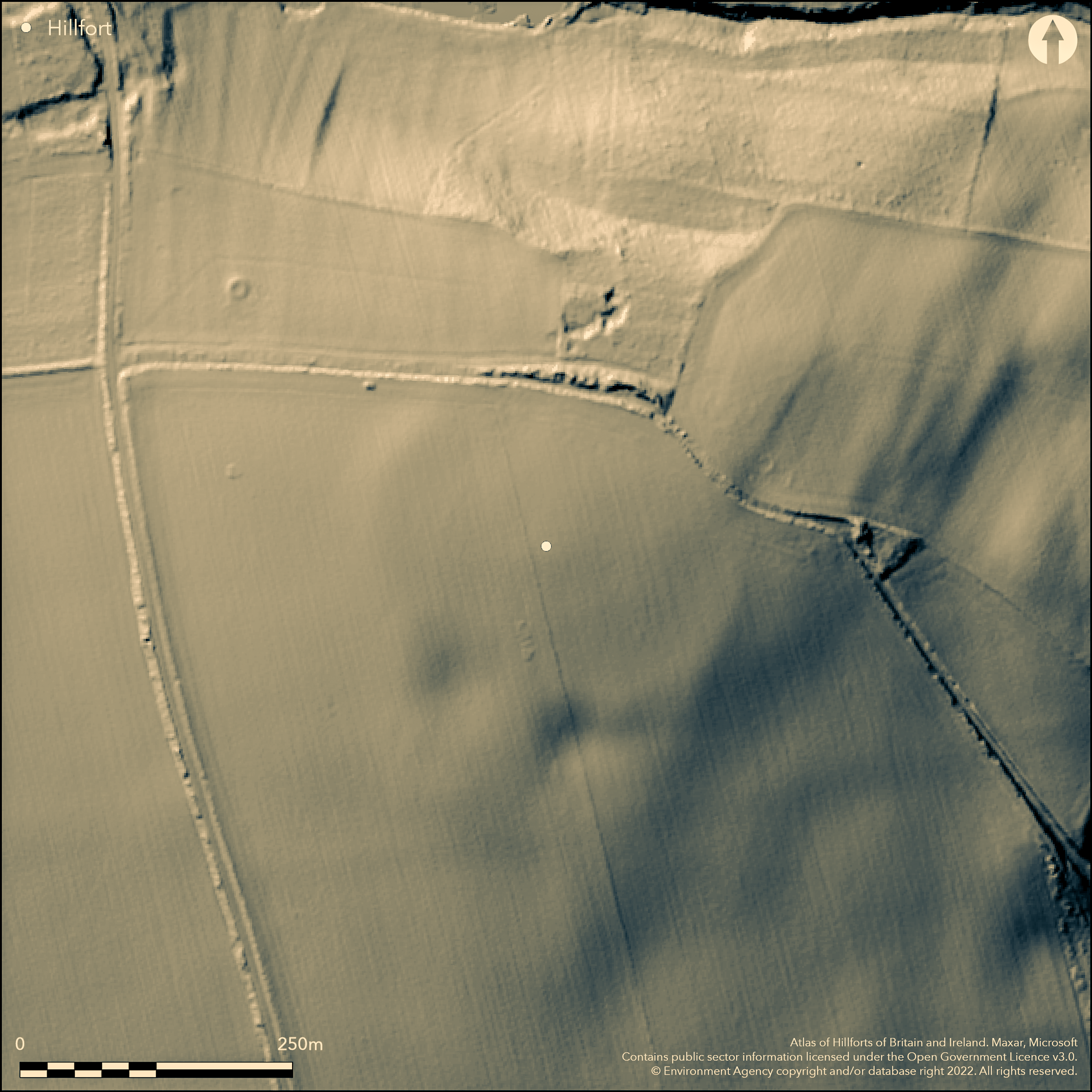
LiDAR 1m DTM Hillshade
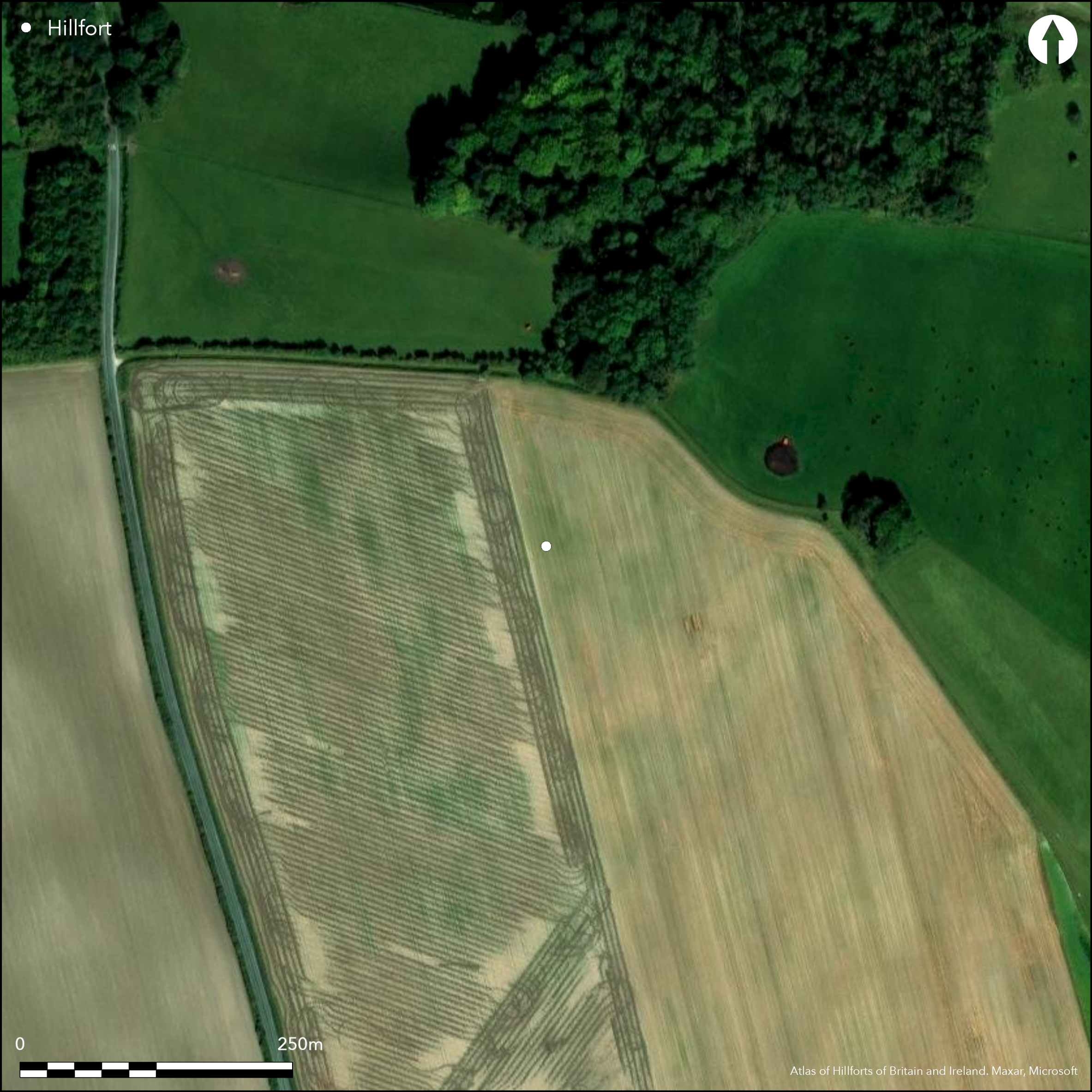
Satellite Imagery
LiDAR 1m DTM Hillshade
Satellite Imagery
Scroll left/right to view further images.
HER: Humber Archaeology Partnership 4183 (None)
NMR: SE 85 SW 1 (61810)
SM: None
NGR: SE 81580 53433
X: 481580 Y: 453433 (OSGB36)
Lying on a field known as 'Bruffs', approximately 450m to the SE of Great Givendale on the western edge of the Yorkshire Wolds, a univallate contour fort of 3.1ha. It was recorded as a shadow site and cropmarks on an aerial photograph taken in 1958. Its location at 158m OD on the summit of a hill would have offered a commanding position over a wide expanse of the Vale of York to the W and S. The site was circular in plan and a survey in 1959 showed the rampart survived between 1.2-1.5m high in woodland to the N, but was plough levelled elsewhere (Dymond 1959). Quarrying had destroyed all traces of the ramparts in the S. The site was first noted by Phillips (1855) and then through the discovery of a La Tne period inhumation complete with Iron sword, shield and spearhead in a chalk pit in 1868 (Mortimer 1869) now known to have been part of the hillfort. Three further unaccompanied burials were discovered. Further excavations in 1961-2 (Stead et al. 1968) sectioned the ditch along nine points showing it to be rounded in profile, 1.8-2.1m deep and 3-4.5m wide. A berm 3.7-4.6m wide lay on the inside of the ditch beyond which was a levelled rampart marked out by two rows of postholes spaced at intervals of between 1.8-3m, for a timber frame, which would have contained chalk blocks. Blocks from the ramparts found within the ditch fill were interpreted as an act of deliberate slighting, with the wall pushed into the ditch. A causeway 3.7m wide lay in the SE giving access to a stream and springs. On either side of this the ditch was found to be wider and more flat-bottomed than elsewhere. However postholes in this region continued without a break. A crouched burial and a large quantity of Iron Age pottery and animal bone was recovered, mainly from the ditch. Medieval and Romano-British pottery and a sherd of a Bronze Age collared urn came from the surface of the interior. The excavations also showed that the plough had obliterated any features within the enclosure, with only those around the margins of the rampart surviving. Amongst these are four eight four-post structures interpreted as granaries, although no evidence for storage pits was found. The site is not recorded on OS mapping.
Citizen Science: ✗
Reliability of Data: Confirmed
Reliability of Interpretation: Confirmed
X: -84357 Y: 7164579 (EPSG: 3857)
Longitude: -0.7577952836368603 Latitude: 53.97054112108712 (EPSG:4326)
Country: England
Current County or Unitary Authority: East Riding of Yorkshire
Historic County: Yorkshire
Current Parish/Community/Council/Townland: Millington
Ramparts destroyed by quarrying in the S.
| Extant | ✗ |
| Cropmark | ✓ |
| Likely Destroyed | ✓ |
None
| Woodland | ✓ |
| Commercial Forestry Plantation | ✗ |
| Parkland | ✗ |
| Pasture (Grazing) | ✗ |
| Arable | ✓ |
| Scrub/Bracken | ✗ |
| Bare Outcrop | ✗ |
| Heather/Moorland | ✗ |
| Heath | ✗ |
| Built-up | ✗ |
| Coastal Grassland | ✗ |
| Other | ✗ |
A univallate contour fort lying at 158m OD on summit of a small hill
| Contour Fort | ✓ |
| Partial Contour Fort | ✗ |
| Promontory Fort | ✗ |
| Hillslope Fort | ✗ |
| Level Terrain Fort | ✗ |
| Marsh Fort | ✗ |
| Multiple Enclosure Fort | ✗ |
| Hilltop | ✓ |
| Coastal Promontory | ✗ |
| Inland Promontory | ✗ |
| Valley Bottom | ✗ |
| Knoll/Hillock/Outcrop | ✗ |
| Ridge | ✗ |
| Cliff/Plateau-edge/Scarp | ✗ |
| Hillslope | ✗ |
| Lowland | ✗ |
| Spur | ✗ |
Dominant Topographic Feature: Hilltop
| North | ✓ |
| Northeast | ✗ |
| East | ✗ |
| Southeast | ✗ |
| South | ✗ |
| Southwest | ✗ |
| West | ✗ |
| Northwest | ✗ |
| Level | ✗ |
Altitude: 158.0m
N/A
A La Tne period inhumation with iron sword, shield, spearhead discovered in a chalkpit. Iron age pottery from approximately 70 different vessels was recovered
Reliability: B - Medium
| Pre 1200BC | ✗ |
| 1200BC - 800BC | ✗ |
| 800BC - 400BC | ✓ |
| 400BC - AD50 | ✓ |
| AD50 - AD400 | ✗ |
| AD400 - AD 800 | ✗ |
| Post AD800 | ✗ |
| Unknown | ✗ |
| Pre Hillfort: | None |
| Post Hillfort: | None |
| Artefactual: | None |
| Morphology/Earthwork/Typology: | None |
The site was first noted by Phillips (1959). Discovery of human remains in 1868 and subsequent excavations (Mortimer 1869). Excavation of the ditches and interior 1958 and 1961-2. Field investigation in 1973.
| 1st Identified Written Reference (1853): | None |
| Excavation (1868): | Excavation of burials |
| Other (1958): | Rediscovered through aerial photographs |
| Other (1973): | Field investigation |
| Excavation (None): | None |
The plough has obliterated any features within the enclosure, with only those around the margins of the rampart surviving. Amongst these are four eight four-post structures interpreted as granaries, although no evidence for storage pits was found. Large quantities of pottery and animal bone from the ditch fill. Medieval and Romano-British pottery and a single sherd from a Bronze Age collared urn from the surface of the interior. Inhumations
Becks lie to the S andE
| None | ✓ |
| Spring | ✗ |
| Stream | ✗ |
| Pool | ✗ |
| Flush | ✗ |
| Well | ✗ |
| Other | ✗ |
None
| No Known Features | ✓ |
| Round Stone Structures | ✗ |
| Rectangular Stone Structures | ✗ |
| Curvilinear Platforms | ✗ |
| Other Roundhouse Evidence | ✗ |
| Pits | ✗ |
| Quarry Hollows | ✗ |
| Other | ✗ |
Possible four post granaries
| No Known Excavation | ✗ |
| Pits | ✗ |
| Postholes | ✓ |
| Roundhouses | ✗ |
| Rectangular Structures | ✓ |
| Roads/Tracks | ✗ |
| Quarry Hollows | ✗ |
| Other | ✗ |
| Nothing Found | ✗ |
None
| No Known Geophysics | ✓ |
| Pits | ✗ |
| Roundhouses | ✗ |
| Rectangular Structures | ✗ |
| Roads/Tracks | ✗ |
| Quarry Hollows | ✗ |
| Other | ✗ |
| Nothing Found | ✗ |
None
| No Known Finds | ✗ |
| Pottery | ✓ |
| Metal | ✗ |
| Metalworking | ✗ |
| Human Bones | ✓ |
| Animal Bones | ✓ |
| Lithics | ✓ |
| Environmental | ✗ |
| Other | ✗ |
None
| APs Not Checked | ✗ |
| None | ✓ |
| Roundhouses | ✗ |
| Rectangular Structures | ✗ |
| Pits | ✗ |
| Postholes | ✗ |
| Roads/Tracks | ✗ |
| Other | ✗ |
Causeway 3.7m wide in the SE
| 1: | None |
| 2: | None |
Guard Chambers: ✗
Chevaux de Frise: ✗
| 1. Other Forms (South east): | None |
Recorded as a shadow site and cropmarks on an aerial photograph. Circular in plan, a survey in 1959 showed the rampart survived between 1.2-1.5m high in woodland to the N, but was plough levelled elsewhere (Dymond 1959). Quarrying had destroyed all traces of the defences in the S. Excavations in 1961-2 showed the ditch had a rounded profile, 1.8-2.1m deep and 3-4.5m wide. A berm 3.7-4.6m wide lay on the inside of the ditch beyond which was a levelled rampart marked out by two rows of postholes spaced at intervals of between 1.8-3m, for a timber frame, which would have contained chalk blocks.
| Area 1: | 3.1ha. |
| Total: | 3.1ha. |
Total Footprint Area: Noneha.
None
| ✗ | None |
| ✓ | Now destroyed in the S |
| NE Quadrant: | 1 |
| SE Quadrant: | 1 |
| SW Quadrant: | 1 |
| NW Quadrant: | 1 |
| Total: | 1 |
| Partial Univallate | ✗ |
| Univallate | ✓ |
| Partial Bivallate | ✗ |
| Bivallate | ✗ |
| Partial Multivallate | ✗ |
| Multivallate | ✗ |
| Unknown | ✗ |
| Partial Univallate | ✗ |
| Univallate | ✗ |
| Partial Bivallate | ✗ |
| Bivallate | ✗ |
| Partial Multivallate | ✗ |
| Multivallate | ✗ |
None
| None | ✗ |
| Earthen Bank | ✓ |
| Stone Wall | ✗ |
| Rubble | ✗ |
| Wall-walk | ✗ |
| Evidence of Timber | ✗ |
| Vitrification | ✗ |
| Other Burning | ✗ |
| Palisade | ✗ |
| Counter Scarp Bank | ✗ |
| Berm | ✓ |
| Unfinished | ✗ |
| Other | ✗ |
None
| None | ✗ |
| Earthen Bank | ✗ |
| Stone Wall | ✓ |
| Murus Duplex | ✗ |
| Timber-framed | ✓ |
| Timber-laced | ✗ |
| Vitrification | ✗ |
| Other Burning | ✗ |
| Palisade | ✗ |
| Counter Scarp Bank | ✗ |
| Berm | ✓ |
| Unfinished | ✗ |
| No Known Excavation | ✗ |
| Other | ✗ |
| ✗ | None |
| ✓ | None |
Number of Ditches: 1
| ✗ | None |
Dymond, D.P. 1959. Grimthorpe: A Hillfort on the Yorkshire Wolds. Antiquity, 33, 131. 208-213
Mortimer, J.R. 1869. Notice of the opening of an Anglo-Saxon grave, at Grimthorpe, Yorkshire. Reliquary, ix. 180-2
Phillips J. 1855. The Rivers, Mountains and Sea-Coast of Yorkshire
Stead, I.M., Jarman, M., Fagg, A., Higgs E.S. and Denston C. B. 1968. An Iron Age Hill-Fort at Grimthorpe, Yorkshire, England. Proc Prehist Soc (New Series), 34, pp 148-190.
Atlas of Hillforts:
Wikidata:
This work is licensed under CC BY-SA 4.0

 and should be cited as:
Lock, Gary and Ralston, Ian. 2024. Atlas of Hillforts of Britain and Ireland. Available at: https://hillforts.arch.ox.ac.uk
Document Version 1.1