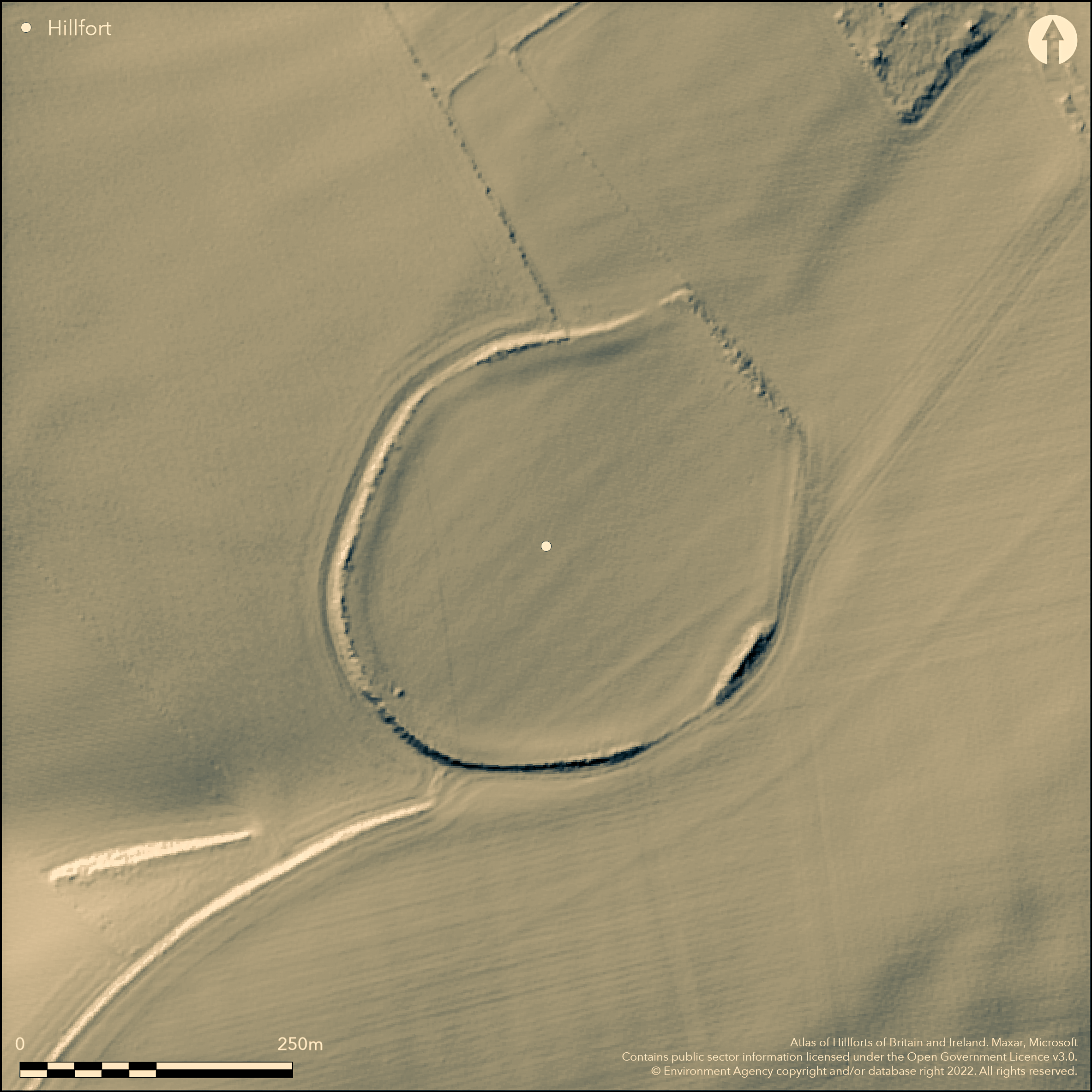
LiDAR 1m DTM Hillshade
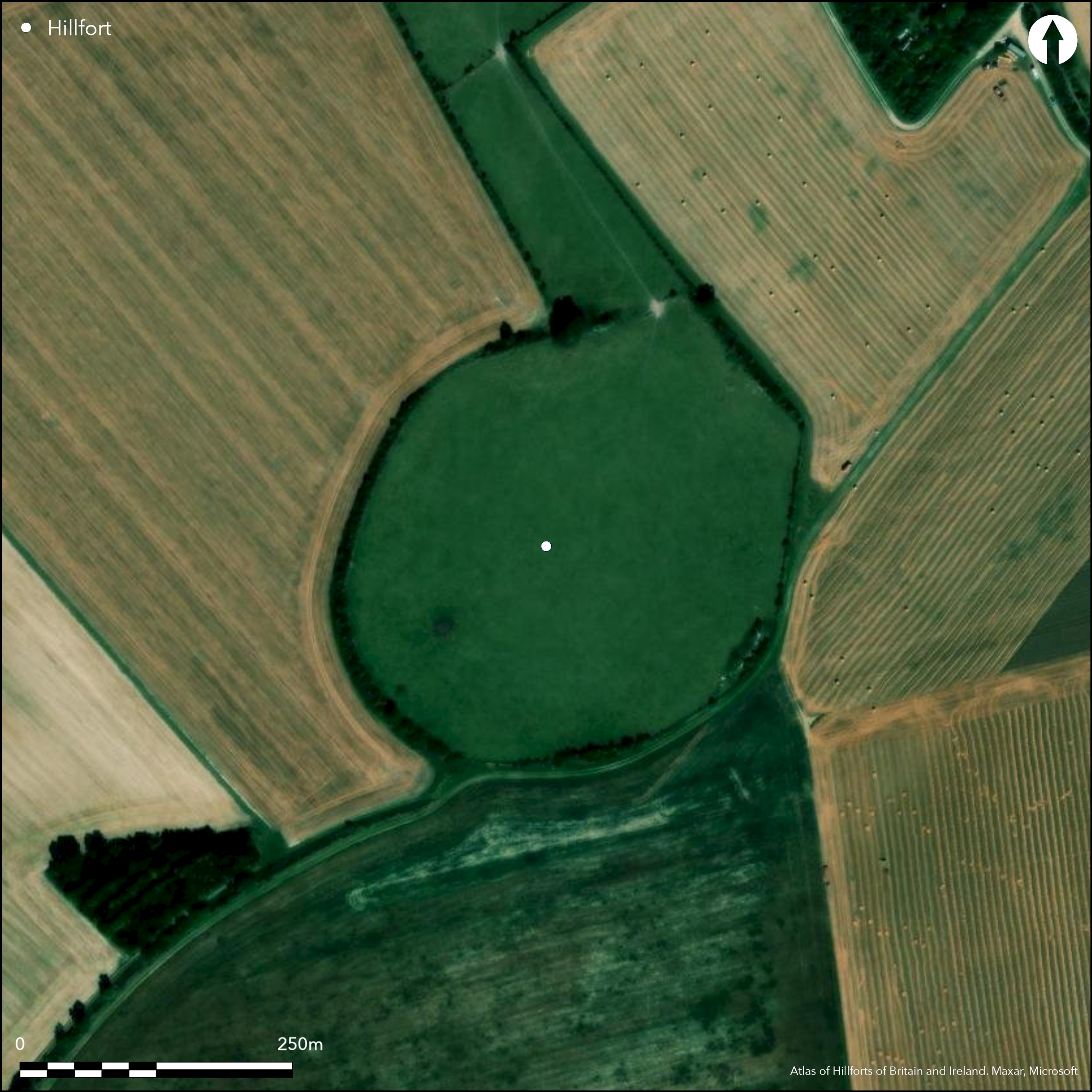
Satellite Imagery
LiDAR 1m DTM Hillshade
Satellite Imagery
Scroll left/right to view further images.
HER: Hertfordshire MHT26 (None)
NMR: TL 2 3 NE 9 (365512)
SM: 1008981
NGR: TL 2612 3870
X: 526120 Y: 238710 (OSGB36)
Located SE of Ashwell on the W slopes of Claybush Hill with commanding views. An oval enclosure measuring 290m x 245m of c5.0ha enclosed area, ploughed in the interior, trees and scrub on the rampart. On 1st Ed OS map (1885-1900). A single ditch shows on aerial photographs and was confirmed by excavation in the 19th century (Bedlam 1856-9) to be V-shaped, 4.5m deep, 6m wide at the top and 1m at the bottom. Internal earthen bank is badly damaged by ploughing but survives best at SE as a chalk bank, 1.7m high and 10.0m wide, for a distance of 60.0m, elsewhere ploughing has destroyed all evidence of the rampart, or has reduced it to an outward-facing scarp, 2.5m in maximum height, largely overgrown with scrub, and occupied by a later field bank which accentuates its height. Bedlam (ibid) suggests a possible second bank on the E and W sides although nothing shows now. Two simple gaps may be original entrances, at the NW 20m wide and at the SE 40m wide. In the interior pits were shown by excavation, two sub-rectangular enclosures, possible roundhouses and pits by aerial photography. A range of material known through the excavation and ploughing the interior including human and animal bones, Iron Age, Romano-British and Saxon pottery, an enamelled fibula and worked bone. Appleby (2009) suggests the hillfort was involved in the Boudican revolt.
Citizen Science: ✗
Reliability of Data: Confirmed
Reliability of Interpretation: Confirmed
X: -18135 Y: 6805990 (EPSG: 3857)
Longitude: -0.1629066893027485 Latitude: 52.03242256790602 (EPSG:4326)
Country: England
Current County or Unitary Authority: Hertfordshire
Historic County: Bedfordshire
Current Parish/Community/Council/Townland: Ashwell
None
| Extant | ✓ |
| Cropmark | ✗ |
| Likely Destroyed | ✓ |
None
| Woodland | ✗ |
| Commercial Forestry Plantation | ✗ |
| Parkland | ✗ |
| Pasture (Grazing) | ✗ |
| Arable | ✓ |
| Scrub/Bracken | ✓ |
| Bare Outcrop | ✗ |
| Heather/Moorland | ✗ |
| Heath | ✗ |
| Built-up | ✗ |
| Coastal Grassland | ✗ |
| Other | ✗ |
On a gradual hillslope looking W with commanding views.
| Contour Fort | ✗ |
| Partial Contour Fort | ✗ |
| Promontory Fort | ✗ |
| Hillslope Fort | ✓ |
| Level Terrain Fort | ✗ |
| Marsh Fort | ✗ |
| Multiple Enclosure Fort | ✗ |
| Hilltop | ✗ |
| Coastal Promontory | ✗ |
| Inland Promontory | ✗ |
| Valley Bottom | ✗ |
| Knoll/Hillock/Outcrop | ✗ |
| Ridge | ✗ |
| Cliff/Plateau-edge/Scarp | ✗ |
| Hillslope | ✓ |
| Lowland | ✗ |
| Spur | ✗ |
Dominant Topographic Feature: None
| North | ✗ |
| Northeast | ✗ |
| East | ✗ |
| Southeast | ✗ |
| South | ✗ |
| Southwest | ✗ |
| West | ✓ |
| Northwest | ✗ |
| Level | ✗ |
Altitude: 84.0m
N/A
Limited 19th century excavations (Beldam 1856-9) suggest Iron Age pottery plus bank and ditch characteristics and pits inside. Bronze Age ring ditch from aerial photographs. Finds of Roman and Saxon pottery.
Reliability: C - Low
| Pre 1200BC | ✗ |
| 1200BC - 800BC | ✗ |
| 800BC - 400BC | ✓ |
| 400BC - AD50 | ✓ |
| AD50 - AD400 | ✗ |
| AD400 - AD 800 | ✗ |
| Post AD800 | ✗ |
| Unknown | ✗ |
| Pre Hillfort: | None |
| Post Hillfort: | None |
| Artefactual: | None |
| Morphology/Earthwork/Typology: | None |
On 1st Ed OS map (1885-1900). Limited 19th century excavations (Beldam 1856-9).
| Excavation (1856): | None |
| 1st Identified Map Depiction (None): | None |
Pits shown by excavation (1.5m deep and diameter), two sub-rectangular enclosures, possible roundhouses and pits by aerial photography. A range of material known through excavation and ploughing the interior including human and animal bones, pottery, an enamelled fibula and worked bone.
None
| None | ✓ |
| Spring | ✗ |
| Stream | ✗ |
| Pool | ✗ |
| Flush | ✗ |
| Well | ✗ |
| Other | ✗ |
None
| No Known Features | ✓ |
| Round Stone Structures | ✗ |
| Rectangular Stone Structures | ✗ |
| Curvilinear Platforms | ✗ |
| Other Roundhouse Evidence | ✗ |
| Pits | ✗ |
| Quarry Hollows | ✗ |
| Other | ✗ |
None
| No Known Excavation | ✗ |
| Pits | ✓ |
| Postholes | ✗ |
| Roundhouses | ✗ |
| Rectangular Structures | ✗ |
| Roads/Tracks | ✗ |
| Quarry Hollows | ✗ |
| Other | ✗ |
| Nothing Found | ✗ |
None
| No Known Geophysics | ✓ |
| Pits | ✗ |
| Roundhouses | ✗ |
| Rectangular Structures | ✗ |
| Roads/Tracks | ✗ |
| Quarry Hollows | ✗ |
| Other | ✗ |
| Nothing Found | ✗ |
None
| No Known Finds | ✗ |
| Pottery | ✓ |
| Metal | ✓ |
| Metalworking | ✗ |
| Human Bones | ✓ |
| Animal Bones | ✓ |
| Lithics | ✗ |
| Environmental | ✗ |
| Other | ✗ |
APs show two sub-rectangular enclosures, possible roundhouses and pits within the interior.
| APs Not Checked | ✗ |
| None | ✗ |
| Roundhouses | ✓ |
| Rectangular Structures | ✗ |
| Pits | ✓ |
| Postholes | ✗ |
| Roads/Tracks | ✗ |
| Other | ✓ |
Two simple gaps may be original entrances, at the NW 20m wide and at the SE 40m wide.
| None: | None |
| 2: | None |
Guard Chambers: ✗
Chevaux de Frise: ✗
| 1. Simple Gap (North west): | None |
| 2. Simple Gap (South east): | None |
A single ditch shows on aerial photographs and was confirmed by excavation (Bedlam 1856-9) to be V-shaped, 4.5m deep, 6m wide at the top and 1m at the bottom. Internal earthen bank is badly damaged by ploughing but survives best at SE as a chalk bank, 1.7m high and 10.0m wide, for a distance of 60.0m.. A possible second bank on the E and W sides.
| Area 1: | 5.0ha. |
| Total: | 5.0ha. |
Total Footprint Area: Noneha.
None
| ✗ | None |
| ✓ | None |
| NE Quadrant: | 1 |
| SE Quadrant: | 1 |
| SW Quadrant: | 1 |
| NW Quadrant: | 1 |
| Total: | 1 |
| Partial Univallate | ✗ |
| Univallate | ✓ |
| Partial Bivallate | ✗ |
| Bivallate | ✗ |
| Partial Multivallate | ✗ |
| Multivallate | ✗ |
| Unknown | ✗ |
| Partial Univallate | ✗ |
| Univallate | ✗ |
| Partial Bivallate | ✗ |
| Bivallate | ✗ |
| Partial Multivallate | ✗ |
| Multivallate | ✗ |
None
| None | ✗ |
| Earthen Bank | ✓ |
| Stone Wall | ✗ |
| Rubble | ✗ |
| Wall-walk | ✗ |
| Evidence of Timber | ✗ |
| Vitrification | ✗ |
| Other Burning | ✗ |
| Palisade | ✗ |
| Counter Scarp Bank | ✗ |
| Berm | ✗ |
| Unfinished | ✗ |
| Other | ✗ |
None
| None | ✗ |
| Earthen Bank | ✓ |
| Stone Wall | ✗ |
| Murus Duplex | ✗ |
| Timber-framed | ✗ |
| Timber-laced | ✗ |
| Vitrification | ✗ |
| Other Burning | ✗ |
| Palisade | ✗ |
| Counter Scarp Bank | ✗ |
| Berm | ✗ |
| Unfinished | ✗ |
| No Known Excavation | ✗ |
| Other | ✗ |
| ✗ | None |
| ✓ | None |
Number of Ditches: 1
| ✗ | None |
Appleby, G. 2009. The Boudican revolt: countdown to defeat. Hertfordshire Archaeol Hist, 16, 57-65.
Beldam, J. 1856-9. Memoir on some excavations... recently made at the Arbury Banks, near Ashwell, Hertfordshire. Proc Soc Antiq. 1st series, vol.4, 285-91.
Page, W. (ed). 1908. The Victoria County History of Hertfordshire. Volume II, 105
Atlas of Hillforts:
Wikidata:
This work is licensed under CC BY-SA 4.0

 and should be cited as:
Lock, Gary and Ralston, Ian. 2024. Atlas of Hillforts of Britain and Ireland. Available at: https://hillforts.arch.ox.ac.uk
Document Version 1.1