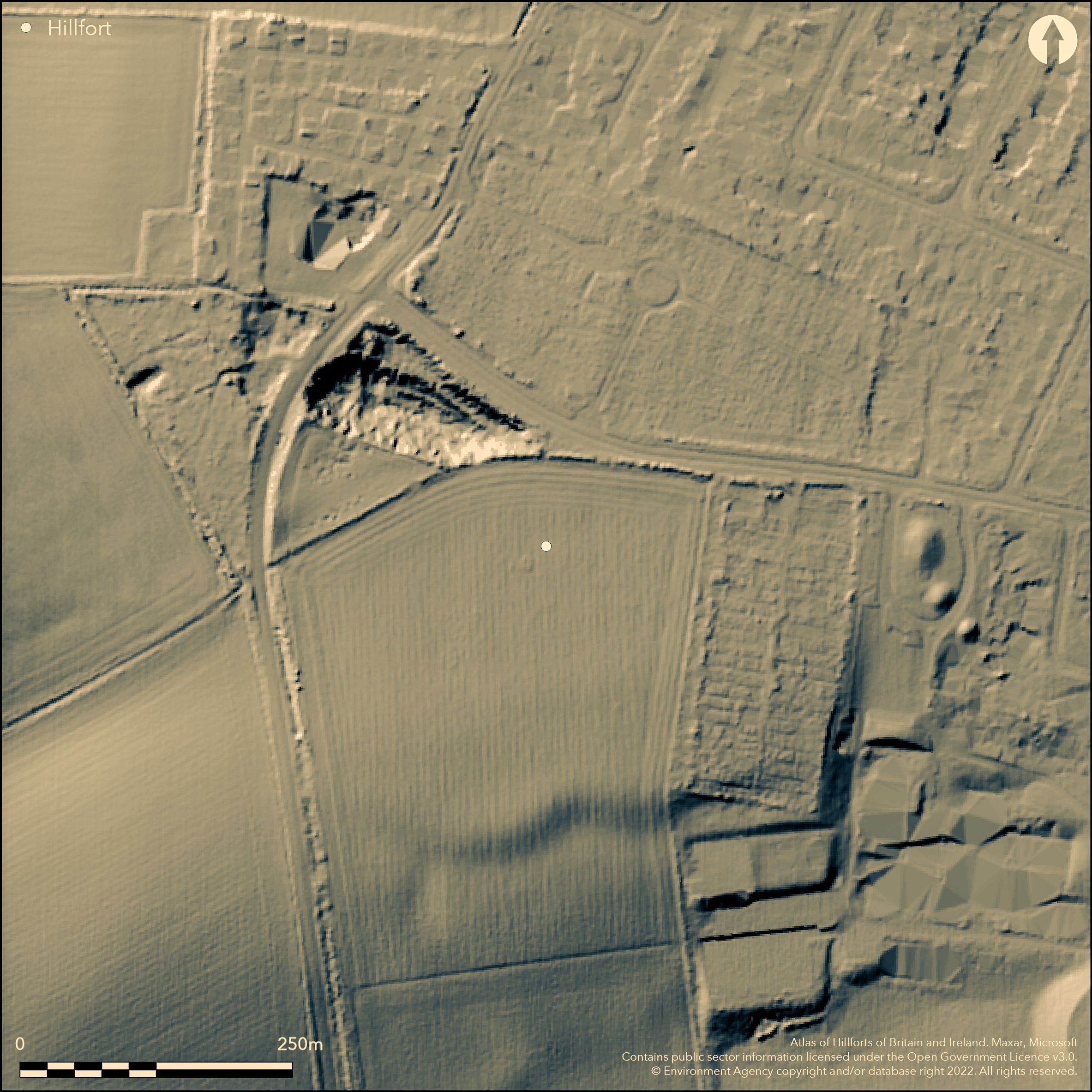
LiDAR 1m DTM Hillshade
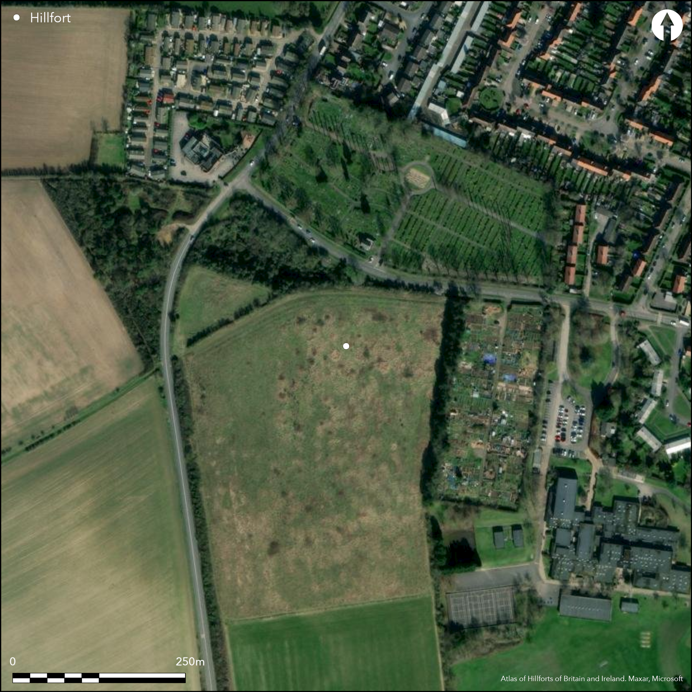
Satellite Imagery
LiDAR 1m DTM Hillshade
Satellite Imagery
Scroll left/right to view further images.
HER: Hertfordshire MHT63 (None)
NMR: TL 2 3 SW 18 (365779)
SM: 1016410
NGR: TL 202 325
X: 520220 Y: 232510 (OSGB36)
On the W outskirts of Letchworth garden City, occupying the crest and part of the S facing slope of Willbury Hill, a broad promontory with extensive views over to the S and SW. Largely destroyed by agriculture and building although ramparts and internal features have been recorded through aerial photography since the 1950s. On Walker's map of Hertfordshire (1835) and the 1st Ed OS map (1885-1900), in Camden's Britannia (17th century). Various early work summarised in Applebaum (1951) together with his excavations of 1933, further excavations in 1959 (Moss-Eccaardt 1968). Univallate with a ditch comprising of two conjoining enclosures W and E probably converging to the N but now destroyed, one may be an 'annex'. Part of W rampart still surviving to 1,5m high but elsewhere identified as crop mark. E enclosure is smaller at c200m diameter. In 1933 limited excavations across the S ramparts uncovered the bases of the bank which measured up to 8m in width and contained evidence of timber frameworks and revetment, probably two phases. The first, a narrow palisade with traces of an incomplete bank, is now thought to date from the Late Bronze Age (c.1,000 to 700 BC), in the Middle Iron Age (c.400 BC), more substantial banks were constructed on the earlier alignments and accompanied by large external ditches some 8m across and 2.7m in depth. Evidence of burning and collapse suggests that the later banks were relatively short lived, although occupation is thought to have continued on a limited scale within the denuded ramparts. It is impossible to establish the original number of entrances, the W enclosure has an in-turned entrance on its S side which excavation shows a a series of timber gateways, and crop marks suggest a simple gap entrance joining the two enclosures. Aerial photography and excavation shows the E enclosure to be densely packed with pits and roundhouses, limited excavation in the W enclosure shows Iron Age occupation. Roman material suggests occupation continued into the Romano-British period.
Citizen Science: ✗
Reliability of Data: Confirmed
Reliability of Interpretation: Confirmed
X: -27946 Y: 6796151 (EPSG: 3857)
Longitude: -0.25104347226936047 Latitude: 51.978014477807335 (EPSG:4326)
Country: England
Current County or Unitary Authority: Hertfordshire
Historic County: Bedfordshire
Current Parish/Community/Council/Townland: Letchworth Garden City
On Heritage at Risk Register (2015).
| Extant | ✓ |
| Cropmark | ✓ |
| Likely Destroyed | ✗ |
None
| Woodland | ✗ |
| Commercial Forestry Plantation | ✗ |
| Parkland | ✗ |
| Pasture (Grazing) | ✗ |
| Arable | ✓ |
| Scrub/Bracken | ✗ |
| Bare Outcrop | ✗ |
| Heather/Moorland | ✗ |
| Heath | ✗ |
| Built-up | ✓ |
| Coastal Grassland | ✗ |
| Other | ✗ |
A partial contour/promontory fort occupying the crest and part of the S facing slope of a broad promontory with extensive views over to the S and SW.
| Contour Fort | ✗ |
| Partial Contour Fort | ✓ |
| Promontory Fort | ✓ |
| Hillslope Fort | ✗ |
| Level Terrain Fort | ✗ |
| Marsh Fort | ✗ |
| Multiple Enclosure Fort | ✗ |
| Hilltop | ✗ |
| Coastal Promontory | ✗ |
| Inland Promontory | ✓ |
| Valley Bottom | ✗ |
| Knoll/Hillock/Outcrop | ✗ |
| Ridge | ✗ |
| Cliff/Plateau-edge/Scarp | ✗ |
| Hillslope | ✓ |
| Lowland | ✗ |
| Spur | ✗ |
Dominant Topographic Feature: Extensive views to the W and SW
| North | ✗ |
| Northeast | ✗ |
| East | ✗ |
| Southeast | ✗ |
| South | ✓ |
| Southwest | ✓ |
| West | ✗ |
| Northwest | ✗ |
| Level | ✗ |
Altitude: 84.0m
N/A
Late Bronze Age to late Iron Age phases identified by excavation and artefacts including diagnostic pottery. Roman occupation represented by a burial, coins and other artefacts.
Reliability: B - Medium
| Pre 1200BC | ✗ |
| 1200BC - 800BC | ✓ |
| 800BC - 400BC | ✓ |
| 400BC - AD50 | ✓ |
| AD50 - AD400 | ✗ |
| AD400 - AD 800 | ✗ |
| Post AD800 | ✗ |
| Unknown | ✗ |
| Pre Hillfort: | None |
| Post Hillfort: | None |
| Artefactual: | None |
On Walker's map of Hertfordshire (1835) and the 1st Ed OS map (1885-1900). In Camden's Britannia (17th century). Various early work summarised in Applebaum (1951) together with his excavations of 1933. Further excavations in 1959 (Moss-Eccaardt 1968). Many aerial photographs from the 1950s onwards.
| 1st Identified Map Depiction (1835): | None |
| Excavation (1933): | None |
| Excavation (1959): | None |
| 1st Identified Written Reference (None): | None |
| Other (None): | APs |
Excavation has shown pits, postholes and roundhouses and produced pottery, metal objects, human burials and animal bones. Aerial photography has shown many pits and roundhouses in the E enclosure.
None
| None | ✓ |
| Spring | ✗ |
| Stream | ✗ |
| Pool | ✗ |
| Flush | ✗ |
| Well | ✗ |
| Other | ✗ |
None
| No Known Features | ✓ |
| Round Stone Structures | ✗ |
| Rectangular Stone Structures | ✗ |
| Curvilinear Platforms | ✗ |
| Other Roundhouse Evidence | ✗ |
| Pits | ✗ |
| Quarry Hollows | ✗ |
| Other | ✗ |
None
| No Known Excavation | ✗ |
| Pits | ✓ |
| Postholes | ✓ |
| Roundhouses | ✓ |
| Rectangular Structures | ✗ |
| Roads/Tracks | ✓ |
| Quarry Hollows | ✗ |
| Other | ✗ |
| Nothing Found | ✗ |
None
| No Known Geophysics | ✓ |
| Pits | ✗ |
| Roundhouses | ✗ |
| Rectangular Structures | ✗ |
| Roads/Tracks | ✗ |
| Quarry Hollows | ✗ |
| Other | ✗ |
| Nothing Found | ✗ |
None
| No Known Finds | ✗ |
| Pottery | ✓ |
| Metal | ✓ |
| Metalworking | ✗ |
| Human Bones | ✓ |
| Animal Bones | ✓ |
| Lithics | ✗ |
| Environmental | ✗ |
| Other | ✗ |
Gullies
| APs Not Checked | ✗ |
| None | ✗ |
| Roundhouses | ✓ |
| Rectangular Structures | ✗ |
| Pits | ✓ |
| Postholes | ✗ |
| Roads/Tracks | ✗ |
| Other | ✓ |
Impossible to establish the original number of entrances. The W enclosure has an in-turned entrance on its S side which was excavated in 1933 showing phases of timber gateways. Crop marks suggest a simple gap entrance joining the two enclosures.
| None: | None |
| 2: | None |
Guard Chambers: ✗
Chevaux de Frise: ✗
| 1. In-turned (South): | None |
| 2. Simple Gap (East): | None |
Univallate with a ditch comprising of two conjoining enclosures W and E. Part of W rampart still surviving to 1,5m high but elsewhere identified as crop mark. In 1933 limited excavations across the S ramparts uncovered the bases of the bank which measured up to 8m in width and contained evidence of timber frameworks and revetment, probably two phases. The first, a narrow palisade with traces of an incomplete bank, is now thought to date from the Late Bronze Age (c.1,000 to 700 BC), in the Middle Iron Age (c.400 BC), more substantial banks were constructed on the earlier alignments and accompanied by large external ditches some 8m across and 2.7m in depth. Evidence of burning and collapse suggests that the later banks were relatively short lived,
| Area 1: | Noneha. |
| Total: | Noneha. |
Total Footprint Area: Noneha.
None
| ✗ | None |
| ✗ | None |
| NE Quadrant: | 1 |
| SE Quadrant: | 1 |
| SW Quadrant: | 1 |
| NW Quadrant: | 1 |
| Total: | 1 |
| Partial Univallate | ✗ |
| Univallate | ✓ |
| Partial Bivallate | ✗ |
| Bivallate | ✗ |
| Partial Multivallate | ✗ |
| Multivallate | ✗ |
| Unknown | ✗ |
| Partial Univallate | ✗ |
| Univallate | ✗ |
| Partial Bivallate | ✗ |
| Bivallate | ✗ |
| Partial Multivallate | ✗ |
| Multivallate | ✗ |
None
| None | ✗ |
| Earthen Bank | ✓ |
| Stone Wall | ✗ |
| Rubble | ✗ |
| Wall-walk | ✗ |
| Evidence of Timber | ✗ |
| Vitrification | ✗ |
| Other Burning | ✗ |
| Palisade | ✗ |
| Counter Scarp Bank | ✗ |
| Berm | ✗ |
| Unfinished | ✗ |
| Other | ✗ |
None
| None | ✗ |
| Earthen Bank | ✓ |
| Stone Wall | ✗ |
| Murus Duplex | ✗ |
| Timber-framed | ✓ |
| Timber-laced | ✗ |
| Vitrification | ✗ |
| Other Burning | ✓ |
| Palisade | ✓ |
| Counter Scarp Bank | ✗ |
| Berm | ✗ |
| Unfinished | ✗ |
| No Known Excavation | ✗ |
| Other | ✗ |
| ✗ | None |
| ✓ | None |
Number of Ditches: 1
| ✓ | The two conjoining enclosures suggest that one may be an annex |
Applebaum, E. S. 1951. Excavations at Wilbury Hill, an Iron Age Hillfort near Letchworth, Hertfordshire, 1933. Arch J, 106, 12-37
Moss-Eccaardt, J. 1964. Excavations at Wilbury Hill an Iron Age Hill fort near Letchworth, Herts, 1959. Bedfordshire Archaeol J, 2, 34-46,
Atlas of Hillforts:
Wikidata:
This work is licensed under CC BY-SA 4.0

 and should be cited as:
Lock, Gary and Ralston, Ian. 2024. Atlas of Hillforts of Britain and Ireland. Available at: https://hillforts.arch.ox.ac.uk
Document Version 1.1