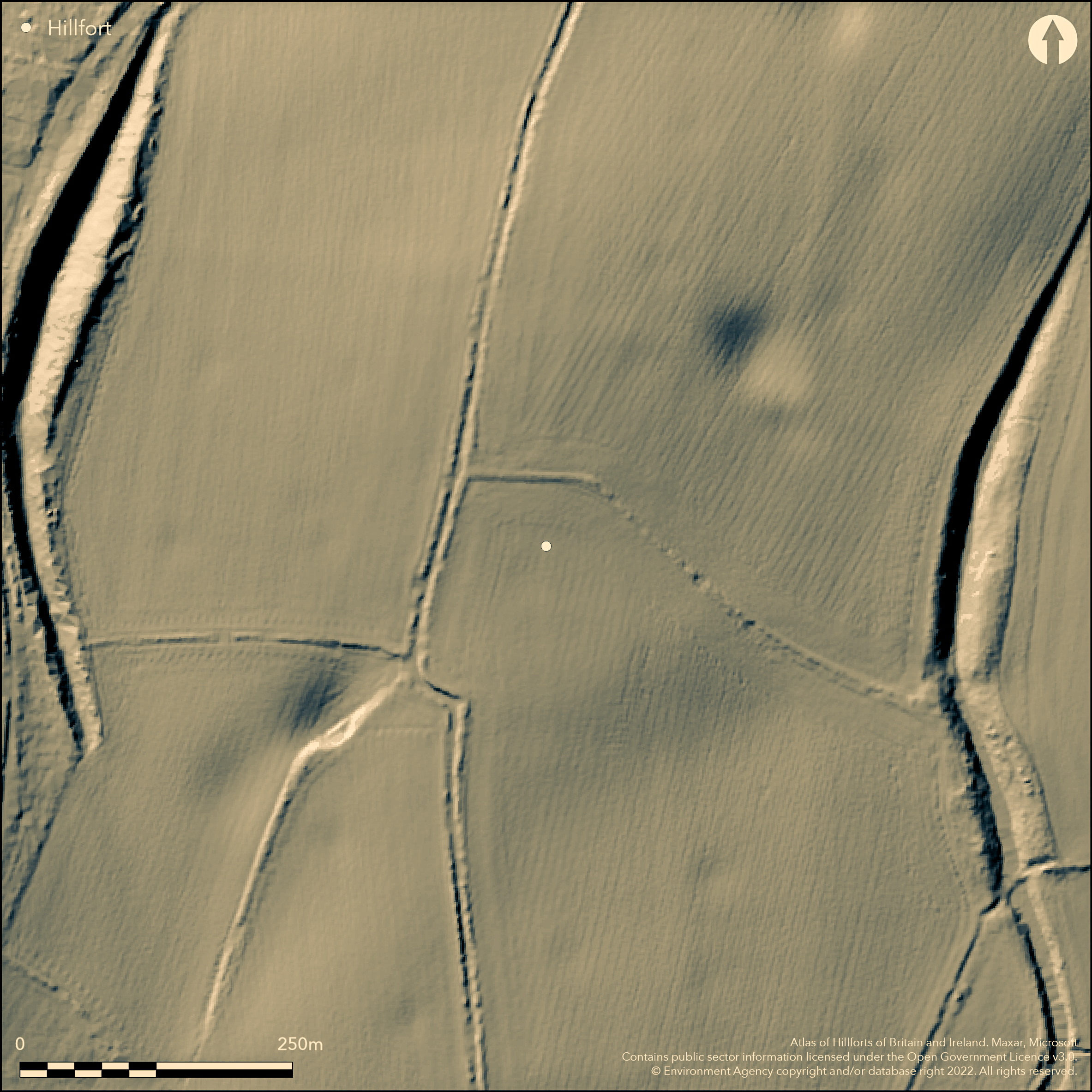
LiDAR 1m DTM Hillshade
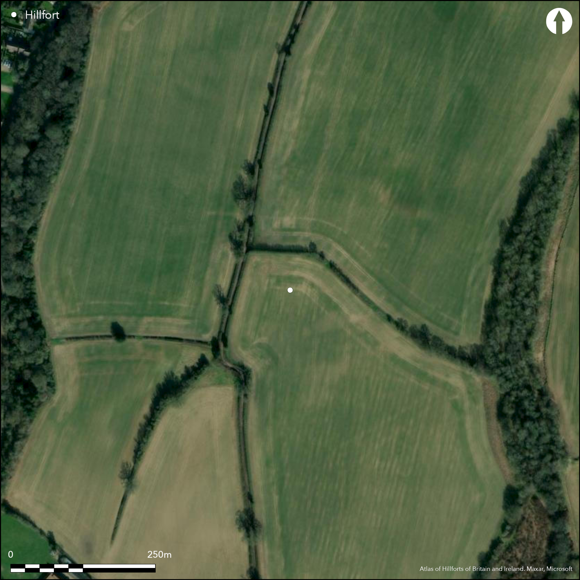
Satellite Imagery
LiDAR 1m DTM Hillshade
Satellite Imagery
Scroll left/right to view further images.
HER: Hertfordshire MHT48 (MHT9913?)
NMR: TL 1 1 SE 6 (362165)
SM: 1003521
NGR: TL 185133
X: 518580 Y: 213310 (OSGB36)
Situated SE of Wheathampstead on a hilltop overlooking the River Lea, ploughed in the interior, trees/shrubs on banks. An irregular area of c.40ha is defined by two massive ditches, the Devil's Dyke (40m wide and 12m deep in places) to the W and The Slad to the E, probably originally continued around the S but uncertain to the N. On 1st Edition OS map (1885-1900). Suggested as an oppidum by Wheeler and Wheeler (1936) and the centre for the Catuvellauni who were defeated by Caesar here in 54BC. The Wheelers dug a trench through the Devil's Dyke and established a late Iron Age date, 1st century BC, with possible contemporary occupation, a hearth with Belgic pottery, limited excavation within the interior supported this dating. There is a suggestion that this site might be related to the late Iron Age site (another oppidum?) at Prae Wood (Atlas number 1830), about 10k to the SE and possible joined by Beech Bottom Dyke, another earthwork which runs partially between them. There are also nearby sites of late Iron Age date (Bryant 2007), undated enclosures in the interior identified by aerial photography (Hertfordshire HER). Included here as a possible enclosed oppidum (Cunliffe and Rowley 1976) although questioned by Bryant (2007).
Citizen Science: ✓
Reliability of Data: Confirmed
Reliability of Interpretation: Unconfirmed
X: -31337 Y: 6765090 (EPSG: 3857)
Longitude: -0.28150598495094764 Latitude: 51.80581651703439 (EPSG:4326)
Country: England
Current County or Unitary Authority: Hertfordshire
Historic County: Hertfordshire
Current Parish/Community/Council/Townland: Wheathampstead
N/A as not a hillfort
| Extant | ✗ |
| Cropmark | ✗ |
| Likely Destroyed | ✗ |
None
| Woodland | ✗ |
| Commercial Forestry Plantation | ✗ |
| Parkland | ✗ |
| Pasture (Grazing) | ✗ |
| Arable | ✗ |
| Scrub/Bracken | ✗ |
| Bare Outcrop | ✗ |
| Heather/Moorland | ✗ |
| Heath | ✗ |
| Built-up | ✗ |
| Coastal Grassland | ✗ |
| Other | ✗ |
N/A as not a hillfort
| Contour Fort | ✗ |
| Partial Contour Fort | ✗ |
| Promontory Fort | ✗ |
| Hillslope Fort | ✗ |
| Level Terrain Fort | ✗ |
| Marsh Fort | ✗ |
| Multiple Enclosure Fort | ✗ |
| Hilltop | ✗ |
| Coastal Promontory | ✗ |
| Inland Promontory | ✗ |
| Valley Bottom | ✗ |
| Knoll/Hillock/Outcrop | ✗ |
| Ridge | ✗ |
| Cliff/Plateau-edge/Scarp | ✗ |
| Hillslope | ✗ |
| Lowland | ✗ |
| Spur | ✗ |
Dominant Topographic Feature: None
| North | ✗ |
| Northeast | ✗ |
| East | ✗ |
| Southeast | ✗ |
| South | ✗ |
| Southwest | ✗ |
| West | ✗ |
| Northwest | ✗ |
| Level | ✗ |
Altitude: Nonem
N/A
N/A as not a hillfort
Reliability: D - None
| Pre 1200BC | ✗ |
| 1200BC - 800BC | ✗ |
| 800BC - 400BC | ✗ |
| 400BC - AD50 | ✗ |
| AD50 - AD400 | ✗ |
| AD400 - AD 800 | ✗ |
| Post AD800 | ✗ |
| Unknown | ✓ |
| Pre Hillfort: | None |
| Post Hillfort: | None |
N/A as not a hillfort
N/A as not a hillfort
None
| None | ✗ |
| Spring | ✗ |
| Stream | ✗ |
| Pool | ✗ |
| Flush | ✗ |
| Well | ✗ |
| Other | ✗ |
None
| No Known Features | ✗ |
| Round Stone Structures | ✗ |
| Rectangular Stone Structures | ✗ |
| Curvilinear Platforms | ✗ |
| Other Roundhouse Evidence | ✗ |
| Pits | ✗ |
| Quarry Hollows | ✗ |
| Other | ✗ |
None
| No Known Excavation | ✗ |
| Pits | ✗ |
| Postholes | ✗ |
| Roundhouses | ✗ |
| Rectangular Structures | ✗ |
| Roads/Tracks | ✗ |
| Quarry Hollows | ✗ |
| Other | ✗ |
| Nothing Found | ✗ |
None
| No Known Geophysics | ✗ |
| Pits | ✗ |
| Roundhouses | ✗ |
| Rectangular Structures | ✗ |
| Roads/Tracks | ✗ |
| Quarry Hollows | ✗ |
| Other | ✗ |
| Nothing Found | ✗ |
None
| No Known Finds | ✗ |
| Pottery | ✗ |
| Metal | ✗ |
| Metalworking | ✗ |
| Human Bones | ✗ |
| Animal Bones | ✗ |
| Lithics | ✗ |
| Environmental | ✗ |
| Other | ✗ |
None
| APs Not Checked | ✓ |
| None | ✗ |
| Roundhouses | ✗ |
| Rectangular Structures | ✗ |
| Pits | ✗ |
| Postholes | ✗ |
| Roads/Tracks | ✗ |
| Other | ✗ |
N/A as not a hillfort
| None: | None |
| 2: | None |
Guard Chambers: ✗
Chevaux de Frise: ✗
N/A as not a hillfort
| Area 1: | Noneha. |
| Total: | Noneha. |
Total Footprint Area: Noneha.
None
| ✗ | None |
| ✗ | None |
| NE Quadrant: | None |
| SE Quadrant: | None |
| SW Quadrant: | None |
| NW Quadrant: | None |
| Total: | None |
| Partial Univallate | ✗ |
| Univallate | ✗ |
| Partial Bivallate | ✗ |
| Bivallate | ✗ |
| Partial Multivallate | ✗ |
| Multivallate | ✗ |
| Unknown | ✓ |
| Partial Univallate | ✗ |
| Univallate | ✗ |
| Partial Bivallate | ✗ |
| Bivallate | ✗ |
| Partial Multivallate | ✗ |
| Multivallate | ✗ |
None
| None | ✗ |
| Earthen Bank | ✗ |
| Stone Wall | ✗ |
| Rubble | ✗ |
| Wall-walk | ✗ |
| Evidence of Timber | ✗ |
| Vitrification | ✗ |
| Other Burning | ✗ |
| Palisade | ✗ |
| Counter Scarp Bank | ✗ |
| Berm | ✗ |
| Unfinished | ✗ |
| Other | ✗ |
None
| None | ✗ |
| Earthen Bank | ✗ |
| Stone Wall | ✗ |
| Murus Duplex | ✗ |
| Timber-framed | ✗ |
| Timber-laced | ✗ |
| Vitrification | ✗ |
| Other Burning | ✗ |
| Palisade | ✗ |
| Counter Scarp Bank | ✗ |
| Berm | ✗ |
| Unfinished | ✗ |
| No Known Excavation | ✗ |
| Other | ✗ |
| ✗ | None |
| ✗ | None |
Number of Ditches: None
| ✗ | None |
Bryant, S. 2007. Central places or special places? The origins and development of 'oppida' in Hertfordshire, in Haselgrove, C. and Moore, T. (eds) The Later Iron Age in Britain and Beyond. Oxford: Oxbow Books, 62-80.
Cunliffe, B. and Rowley, T. (eds) 1976. Oppida: the beginnings of urbanisation in Barbarian Europe, BAR Int Ser 11.
Saunders, C. and Havercroft, A.B. 1982. Excavations on the line of the Wheathampstead by-pass 1974 and 1977. With some thoughts on the oppida at Wheathampstead and Verulamium by C. Saunders. Hertfordshire Archaeol, 8, 11-39.
Wheeler, R.E.M. and Wheeler, T.V. 1936. Verulamium. A Belgic and two Roman cities. Reports of the Research Committee of the Society of Antiquaries of London, No. XI. Oxford: Oxford University Press.
Atlas of Hillforts:
Wikidata:
This work is licensed under CC BY-SA 4.0

 and should be cited as:
Lock, Gary and Ralston, Ian. 2024. Atlas of Hillforts of Britain and Ireland. Available at: https://hillforts.arch.ox.ac.uk
Document Version 1.1