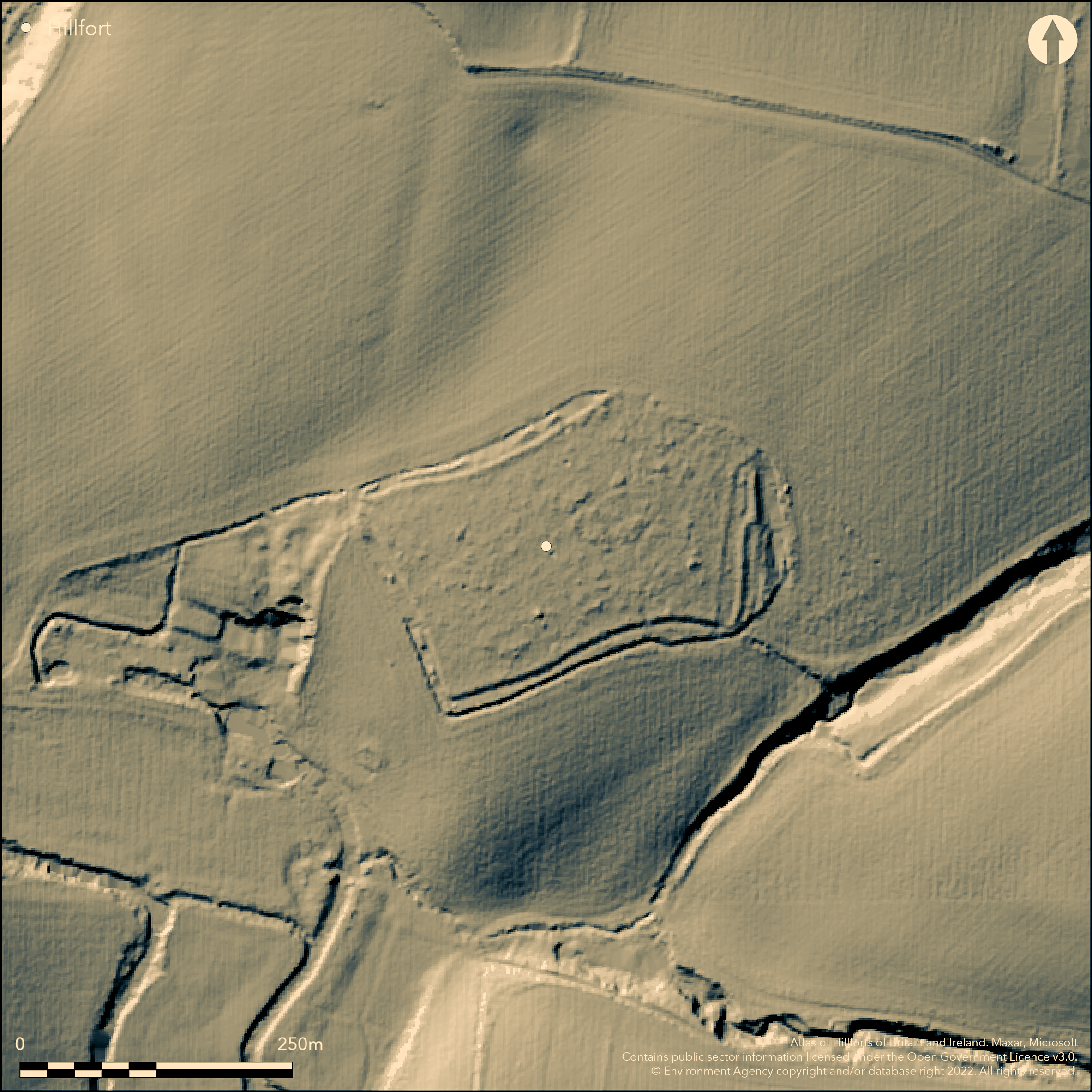
LiDAR 1m DTM Hillshade
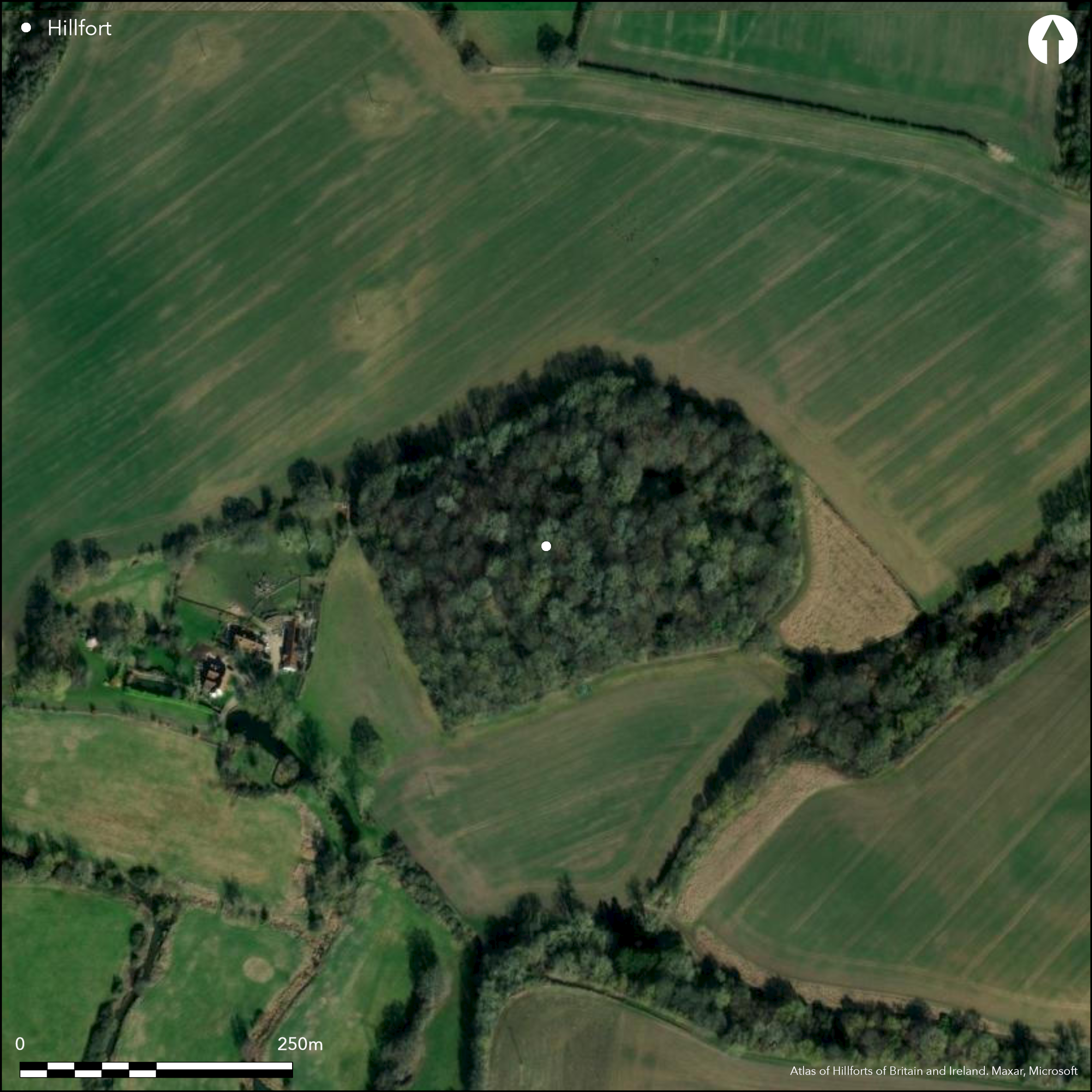
Satellite Imagery
LiDAR 1m DTM Hillshade
Satellite Imagery
Scroll left/right to view further images.
HER: Hertfordshire MHT110 (None)
NMR: TL 3 2 SE 22 (368019)
SM: None
NGR: TL 394239
X: 539490 Y: 223960 (OSGB36)
Situated between Puckeridge and Braughing, on hillside overlooking the River Rib, within woodland. First recognised in 1938 (Crawford), a univallate sub-rectangular enclosure of c.2ha, measures overall 220.0m NE-SW by 130.0m transversely and comprises a weak ditch averaging 4.0m wide and 0.5m deep, with traces of an inner bank, 4.0m wide and less than 0.2m high. Destruction of the bank at the NE revealed some Iron Age pottery, three Iron Age coins were found in Gatesbury Wood in 1936. Minimal investigations, no evidence for an entrance or internal features. The importance of this site may be its proximity to the extensive late Iron Age/Belgic and Roman site at Braughing (Potter and Trow 1998), generally thought to be an oppidum (Atlas number 1832). It has also been suggested that this may be a medieval earthwork associated with woodland management, or Iron Age in origin and modified in the medieval period.
Citizen Science: ✗
Reliability of Data: Confirmed
Reliability of Interpretation: Unconfirmed
X: 2881 Y: 6781467 (EPSG: 3857)
Longitude: 0.02588276481924711 Latitude: 51.8966905460962 (EPSG:4326)
Country: England
Current County or Unitary Authority: Hertfordshire
Historic County: Hertfordshire
Current Parish/Community/Council/Townland: Braughing
None
| Extant | ✓ |
| Cropmark | ✗ |
| Likely Destroyed | ✗ |
None
| Woodland | ✓ |
| Commercial Forestry Plantation | ✗ |
| Parkland | ✗ |
| Pasture (Grazing) | ✗ |
| Arable | ✗ |
| Scrub/Bracken | ✗ |
| Bare Outcrop | ✗ |
| Heather/Moorland | ✗ |
| Heath | ✗ |
| Built-up | ✗ |
| Coastal Grassland | ✗ |
| Other | ✗ |
Univallate on hillslope overlooking River Rib
| Contour Fort | ✗ |
| Partial Contour Fort | ✗ |
| Promontory Fort | ✗ |
| Hillslope Fort | ✓ |
| Level Terrain Fort | ✗ |
| Marsh Fort | ✗ |
| Multiple Enclosure Fort | ✗ |
| Hilltop | ✗ |
| Coastal Promontory | ✗ |
| Inland Promontory | ✗ |
| Valley Bottom | ✗ |
| Knoll/Hillock/Outcrop | ✗ |
| Ridge | ✗ |
| Cliff/Plateau-edge/Scarp | ✗ |
| Hillslope | ✓ |
| Lowland | ✗ |
| Spur | ✗ |
Dominant Topographic Feature: Overlooks River Rib
| North | ✗ |
| Northeast | ✗ |
| East | ✗ |
| Southeast | ✗ |
| South | ✗ |
| Southwest | ✓ |
| West | ✗ |
| Northwest | ✗ |
| Level | ✗ |
Altitude: 84.0m
N/A
Iron Age pottery from destroyed bank and coins as surface finds suggest late Iron Age
Reliability: C - Low
| Pre 1200BC | ✗ |
| 1200BC - 800BC | ✗ |
| 800BC - 400BC | ✗ |
| 400BC - AD50 | ✓ |
| AD50 - AD400 | ✓ |
| AD400 - AD 800 | ✗ |
| Post AD800 | ✗ |
| Unknown | ✗ |
| Pre Hillfort: | None |
| Post Hillfort: | None |
| Artefactual: | None |
| Morphology/Earthwork/Typology: | None |
First recognised in 1938 (Crawford), on OS 1:25,000 map (1937-1961)
| 1st Identified Written Reference (1938): | None |
| 1st Identified Map Depiction (None): | None |
No evidence for interior other than finds - destruction of the bank at the NE revealed some Iron Age pottery, three Iron Age coins were found in Gatesbury Wood in 1936
None
| None | ✓ |
| Spring | ✗ |
| Stream | ✗ |
| Pool | ✗ |
| Flush | ✗ |
| Well | ✗ |
| Other | ✗ |
None
| No Known Features | ✓ |
| Round Stone Structures | ✗ |
| Rectangular Stone Structures | ✗ |
| Curvilinear Platforms | ✗ |
| Other Roundhouse Evidence | ✗ |
| Pits | ✗ |
| Quarry Hollows | ✗ |
| Other | ✗ |
None
| No Known Excavation | ✓ |
| Pits | ✗ |
| Postholes | ✗ |
| Roundhouses | ✗ |
| Rectangular Structures | ✗ |
| Roads/Tracks | ✗ |
| Quarry Hollows | ✗ |
| Other | ✗ |
| Nothing Found | ✗ |
None
| No Known Geophysics | ✓ |
| Pits | ✗ |
| Roundhouses | ✗ |
| Rectangular Structures | ✗ |
| Roads/Tracks | ✗ |
| Quarry Hollows | ✗ |
| Other | ✗ |
| Nothing Found | ✗ |
None
| No Known Finds | ✗ |
| Pottery | ✓ |
| Metal | ✗ |
| Metalworking | ✗ |
| Human Bones | ✗ |
| Animal Bones | ✗ |
| Lithics | ✗ |
| Environmental | ✗ |
| Other | ✓ |
NO APPARENT FEATURES
| APs Not Checked | ✗ |
| None | ✓ |
| Roundhouses | ✗ |
| Rectangular Structures | ✗ |
| Pits | ✗ |
| Postholes | ✗ |
| Roads/Tracks | ✗ |
| Other | ✗ |
No evidence of original entrance, NE area of ramparts are destroyed
| 1: | None |
| 2: | None |
Guard Chambers: ✗
Chevaux de Frise: ✗
A univallate sub-rectangular enclosure of c.2ha, measures overall 220.0m NE-SW by 130.0m transversely and comprises a weak ditch averaging 4.0m wide and 0.5m deep, with traces of an inner bank, 4.0m wide and less than 0.2m high, destroyed at the NE
| Area 1: | 2.0ha. |
| Total: | 2.0ha. |
Total Footprint Area: Noneha.
None
| ✗ | None |
| ✓ | None |
| NE Quadrant: | 1 |
| SE Quadrant: | 1 |
| SW Quadrant: | 1 |
| NW Quadrant: | 1 |
| Total: | 1 |
| Partial Univallate | ✗ |
| Univallate | ✓ |
| Partial Bivallate | ✗ |
| Bivallate | ✗ |
| Partial Multivallate | ✗ |
| Multivallate | ✗ |
| Unknown | ✗ |
| Partial Univallate | ✗ |
| Univallate | ✗ |
| Partial Bivallate | ✗ |
| Bivallate | ✗ |
| Partial Multivallate | ✗ |
| Multivallate | ✗ |
None
| None | ✗ |
| Earthen Bank | ✓ |
| Stone Wall | ✗ |
| Rubble | ✗ |
| Wall-walk | ✗ |
| Evidence of Timber | ✗ |
| Vitrification | ✗ |
| Other Burning | ✗ |
| Palisade | ✗ |
| Counter Scarp Bank | ✗ |
| Berm | ✗ |
| Unfinished | ✗ |
| Other | ✗ |
None
| None | ✗ |
| Earthen Bank | ✗ |
| Stone Wall | ✗ |
| Murus Duplex | ✗ |
| Timber-framed | ✗ |
| Timber-laced | ✗ |
| Vitrification | ✗ |
| Other Burning | ✗ |
| Palisade | ✗ |
| Counter Scarp Bank | ✗ |
| Berm | ✗ |
| Unfinished | ✗ |
| No Known Excavation | ✓ |
| Other | ✗ |
| ✗ | None |
| ✓ | None |
Number of Ditches: 1
| ✗ | None |
Crawford, O.G.S. 1938. Hertfordshire place-names. Antiquity xii (December 1938), 432-6.
Potter, T.W. and Trow, S.D. 1988. Puckeridge-Braughing, Herts: the Ermine Street excavations, 1971-1972. The late Iron Age and Roman settlement. Hertfordshire Archaeol, 10.
Atlas of Hillforts:
Wikidata:
This work is licensed under CC BY-SA 4.0

 and should be cited as:
Lock, Gary and Ralston, Ian. 2024. Atlas of Hillforts of Britain and Ireland. Available at: https://hillforts.arch.ox.ac.uk
Document Version 1.1