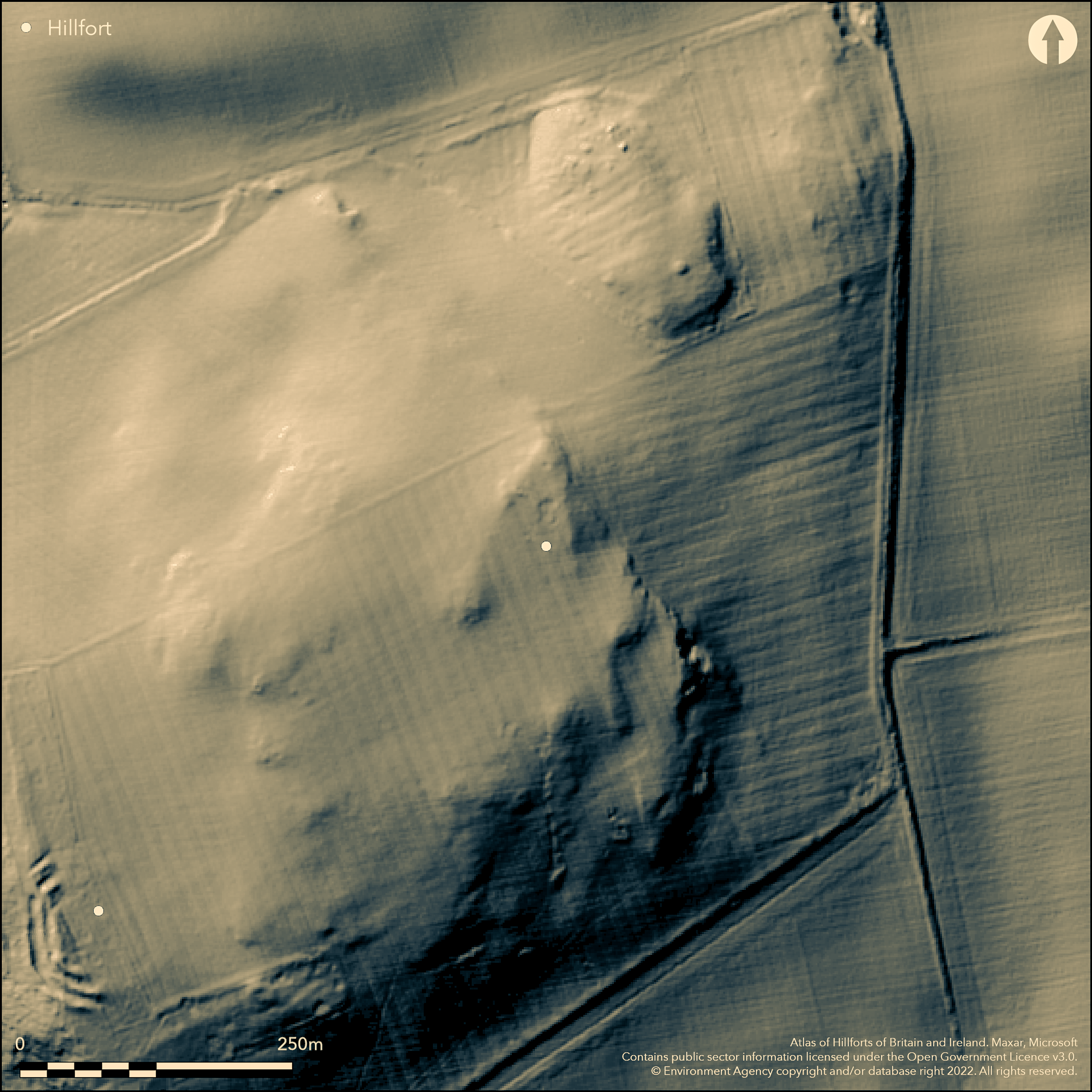
LiDAR 1m DTM Hillshade
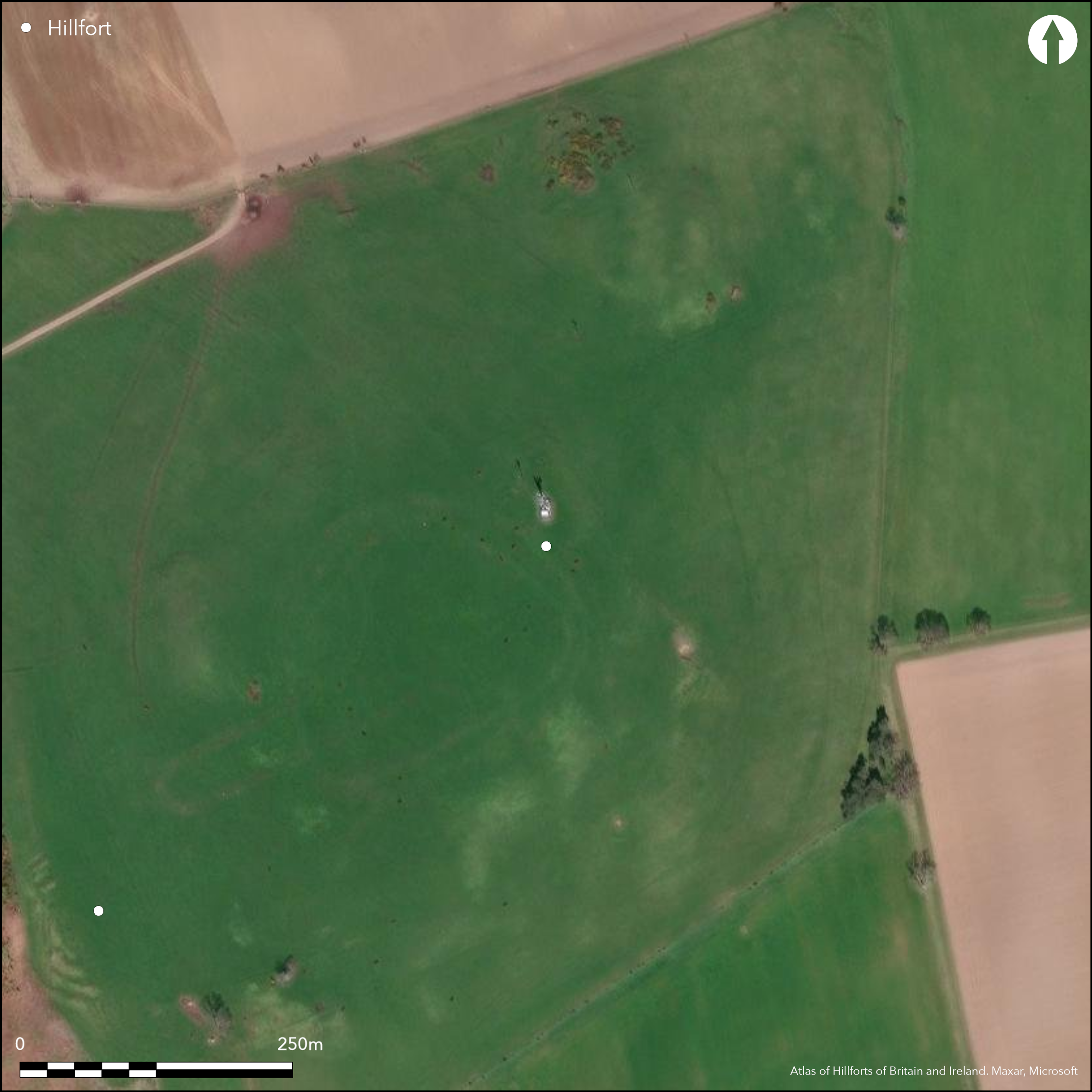
Satellite Imagery
LiDAR 1m DTM Hillshade
Satellite Imagery
Scroll left/right to view further images.
HER: Northumberland No record found (None)
NMR: NU 01 NW 162 (1381885)
SM: None
NGR: NU 0463 1804
X: 404630 Y: 618048 (OSGB36)
Lying at 181m OD on the summit of East Brandon Hill approximately 1km to the NE of Brandon, possibly cropmarked remains of a large palisaded enclosure. The egg-shaped enclosure measures 112m E-W by 18m N-S enclosing 0.62ha. It comprises at least three, possibly four narrow concentric palisade trenches approximately 5m and 2m apart from inner to outer rampart. It is unlikely that all were contemporary. In the N, a 2m wide ditch leaves the main path of the palisade trench and follows the palisade, terminating at the entrance. An out-turned entrance lies on the E side which is off-set through each palisade ditch impeding direct access into the enclosure. No internal features are recorded. Three Bronze Age Ewart Park type swords were discovered close to the southern perimeter of the enclosure in 1857 (MacLauchlan 1857). An excavation ahead of the installation of a telecommunications mast on Brandon Hill found no features of certain archaeological significance. The site is undated but presumed to be late Bronze Age or early Iron Age.
Citizen Science: ✗
Reliability of Data: Confirmed
Reliability of Interpretation: Confirmed
X: -214661 Y: 7450932 (EPSG: 3857)
Longitude: -1.9283346812880908 Latitude: 55.45629712480304 (EPSG:4326)
Country: England
Current County or Unitary Authority: Northumberland
Historic County: Northumberland
Current Parish/Community/Council/Townland: Ingram
None
| Extant | ✗ |
| Cropmark | ✓ |
| Likely Destroyed | ✗ |
None
| Woodland | ✗ |
| Commercial Forestry Plantation | ✗ |
| Parkland | ✗ |
| Pasture (Grazing) | ✓ |
| Arable | ✗ |
| Scrub/Bracken | ✗ |
| Bare Outcrop | ✗ |
| Heather/Moorland | ✗ |
| Heath | ✗ |
| Built-up | ✗ |
| Coastal Grassland | ✗ |
| Other | ✗ |
A possible palisaded enclosure lying on the summit of a hill at 181m OD
| Contour Fort | ✓ |
| Partial Contour Fort | ✗ |
| Promontory Fort | ✗ |
| Hillslope Fort | ✗ |
| Level Terrain Fort | ✗ |
| Marsh Fort | ✗ |
| Multiple Enclosure Fort | ✗ |
| Hilltop | ✓ |
| Coastal Promontory | ✗ |
| Inland Promontory | ✗ |
| Valley Bottom | ✗ |
| Knoll/Hillock/Outcrop | ✗ |
| Ridge | ✗ |
| Cliff/Plateau-edge/Scarp | ✗ |
| Hillslope | ✗ |
| Lowland | ✗ |
| Spur | ✗ |
Dominant Topographic Feature: Hilltop
| North | ✗ |
| Northeast | ✗ |
| East | ✗ |
| Southeast | ✓ |
| South | ✗ |
| Southwest | ✗ |
| West | ✗ |
| Northwest | ✗ |
| Level | ✗ |
Altitude: 181.0m
N/A
Undated, probably late Bronze Age/early Iron Age
Reliability: D - None
| Pre 1200BC | ✗ |
| 1200BC - 800BC | ✗ |
| 800BC - 400BC | ✗ |
| 400BC - AD50 | ✗ |
| AD50 - AD400 | ✗ |
| AD400 - AD 800 | ✗ |
| Post AD800 | ✗ |
| Unknown | ✓ |
| Pre Hillfort: | None |
| Post Hillfort: | Trig point |
| Morphology/Earthwork/Typology: | None |
Referenced in MacLauchlan 1857 with regards to the swords. These are recorded under a separate record (NMR Mapsheet NU01NW 13). An excavation in 1997 recorded no certain archaeological features
| 1st Identified Written Reference (1857): | None |
| Excavation (1997): | None |
No features recorded
None
| None | ✓ |
| Spring | ✗ |
| Stream | ✗ |
| Pool | ✗ |
| Flush | ✗ |
| Well | ✗ |
| Other | ✗ |
None
| No Known Features | ✓ |
| Round Stone Structures | ✗ |
| Rectangular Stone Structures | ✗ |
| Curvilinear Platforms | ✗ |
| Other Roundhouse Evidence | ✗ |
| Pits | ✗ |
| Quarry Hollows | ✗ |
| Other | ✗ |
None
| No Known Excavation | ✓ |
| Pits | ✗ |
| Postholes | ✗ |
| Roundhouses | ✗ |
| Rectangular Structures | ✗ |
| Roads/Tracks | ✗ |
| Quarry Hollows | ✗ |
| Other | ✗ |
| Nothing Found | ✗ |
None
| No Known Geophysics | ✓ |
| Pits | ✗ |
| Roundhouses | ✗ |
| Rectangular Structures | ✗ |
| Roads/Tracks | ✗ |
| Quarry Hollows | ✗ |
| Other | ✗ |
| Nothing Found | ✗ |
Three Bronze Age Ewart Park type swords
| No Known Finds | ✗ |
| Pottery | ✗ |
| Metal | ✓ |
| Metalworking | ✗ |
| Human Bones | ✗ |
| Animal Bones | ✗ |
| Lithics | ✗ |
| Environmental | ✗ |
| Other | ✗ |
None
| APs Not Checked | ✗ |
| None | ✓ |
| Roundhouses | ✗ |
| Rectangular Structures | ✗ |
| Pits | ✗ |
| Postholes | ✗ |
| Roads/Tracks | ✗ |
| Other | ✗ |
An out-turned entrance lies on the E side which is off-set through each palisade ditch impeding direct access into the enclosure.
| 3: | None |
| 2: | None |
Guard Chambers: ✗
Chevaux de Frise: ✗
| 1. Out-turned (East): | None |
| 1. Oblique (East): | Through all palisade trenches |
Egg-shaped enclosure measuring 112m W-E by 18m N-S enclosing 0.62ha. It comprises at least three, possibly four narrow concentric palisade trenches approximately 5m and 2m apart from inner to outer rampart. In the N, a 2m wide ditch leaves the main path of the palisade trench and follows the palisade, terminating at the entrance.
| Area 1: | 0.62ha. |
| Total: | 0.62ha. |
Total Footprint Area: Noneha.
None
| ✓ | None |
| ✓ | Possibly a fourth palisade trench, but unconfirmed. The palisades were probably not all contemporary |
| NE Quadrant: | 3 |
| SE Quadrant: | 3 |
| SW Quadrant: | 3 |
| NW Quadrant: | 3 |
| Total: | 3 |
| Partial Univallate | ✗ |
| Univallate | ✗ |
| Partial Bivallate | ✗ |
| Bivallate | ✗ |
| Partial Multivallate | ✗ |
| Multivallate | ✓ |
| Unknown | ✗ |
| Partial Univallate | ✗ |
| Univallate | ✗ |
| Partial Bivallate | ✗ |
| Bivallate | ✗ |
| Partial Multivallate | ✗ |
| Multivallate | ✗ |
At least three narrow concentric palisade trenches
| None | ✗ |
| Earthen Bank | ✗ |
| Stone Wall | ✗ |
| Rubble | ✗ |
| Wall-walk | ✗ |
| Evidence of Timber | ✗ |
| Vitrification | ✗ |
| Other Burning | ✗ |
| Palisade | ✓ |
| Counter Scarp Bank | ✗ |
| Berm | ✗ |
| Unfinished | ✗ |
| Other | ✗ |
No excavation of the ramparts
| None | ✗ |
| Earthen Bank | ✗ |
| Stone Wall | ✗ |
| Murus Duplex | ✗ |
| Timber-framed | ✗ |
| Timber-laced | ✗ |
| Vitrification | ✗ |
| Other Burning | ✗ |
| Palisade | ✗ |
| Counter Scarp Bank | ✗ |
| Berm | ✗ |
| Unfinished | ✗ |
| No Known Excavation | ✓ |
| Other | ✗ |
| ✗ | None |
| ✓ | Palisade trenches and a broader ditch |
Number of Ditches: 1
| ✗ | None |
Gates, T and Deegan, A. 2009. Monuments in the Landscape in Passmore, D.G. and Waddington, C. (eds). Managing Archaeological Landscapes in Northumberland. Till-Tweed Studies, Vol 1. Oxbow, 125-71.
MacLauchlan H. 1857. Roman Roads in Northumberland, 56
The Archaeological Practice, 1997. Brandon Hill, Telecommunications Mast: archaeological excavation 1997. Unpublished
Atlas of Hillforts:
Wikidata:
This work is licensed under CC BY-SA 4.0

 and should be cited as:
Lock, Gary and Ralston, Ian. 2024. Atlas of Hillforts of Britain and Ireland. Available at: https://hillforts.arch.ox.ac.uk
Document Version 1.1