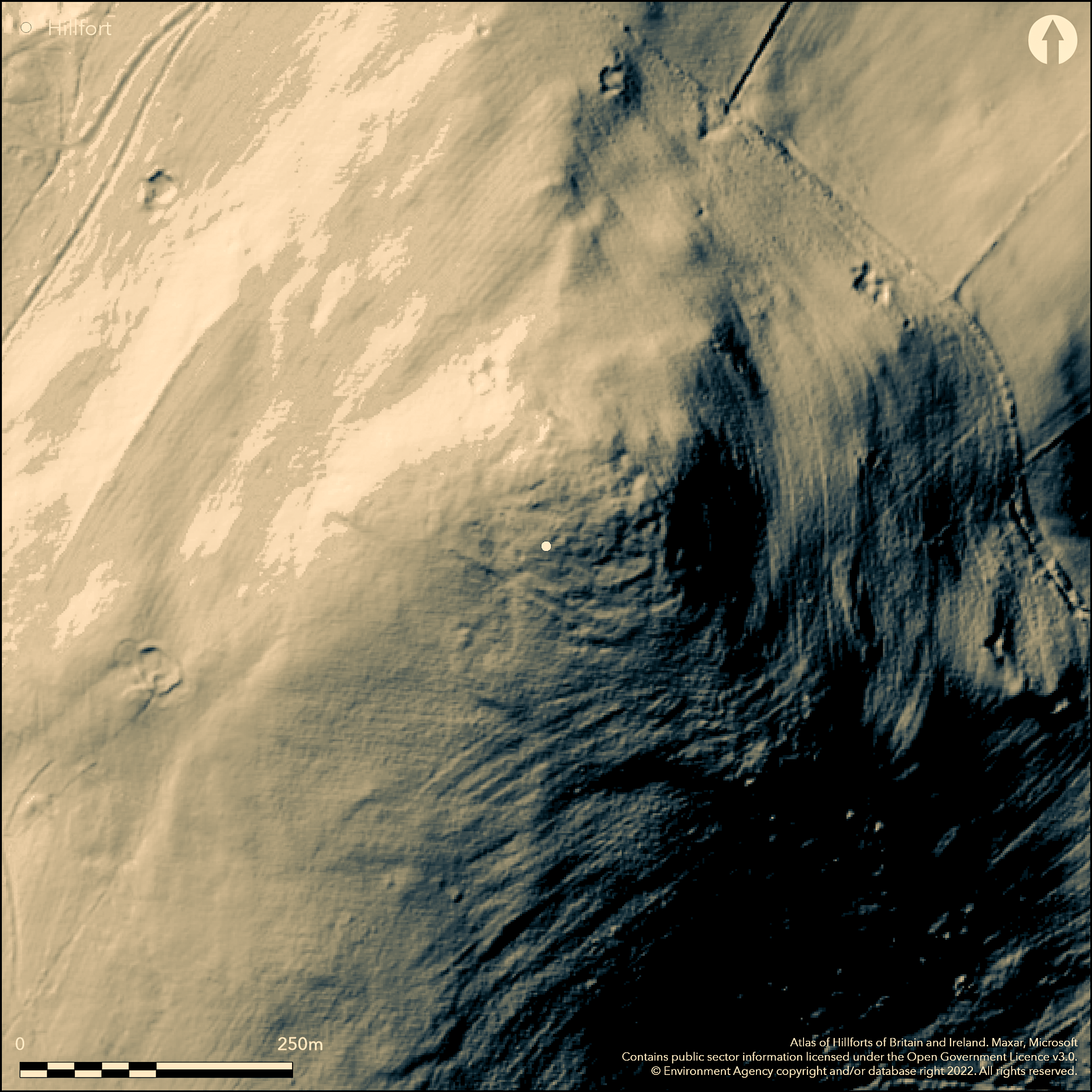
LiDAR 1m DTM Hillshade
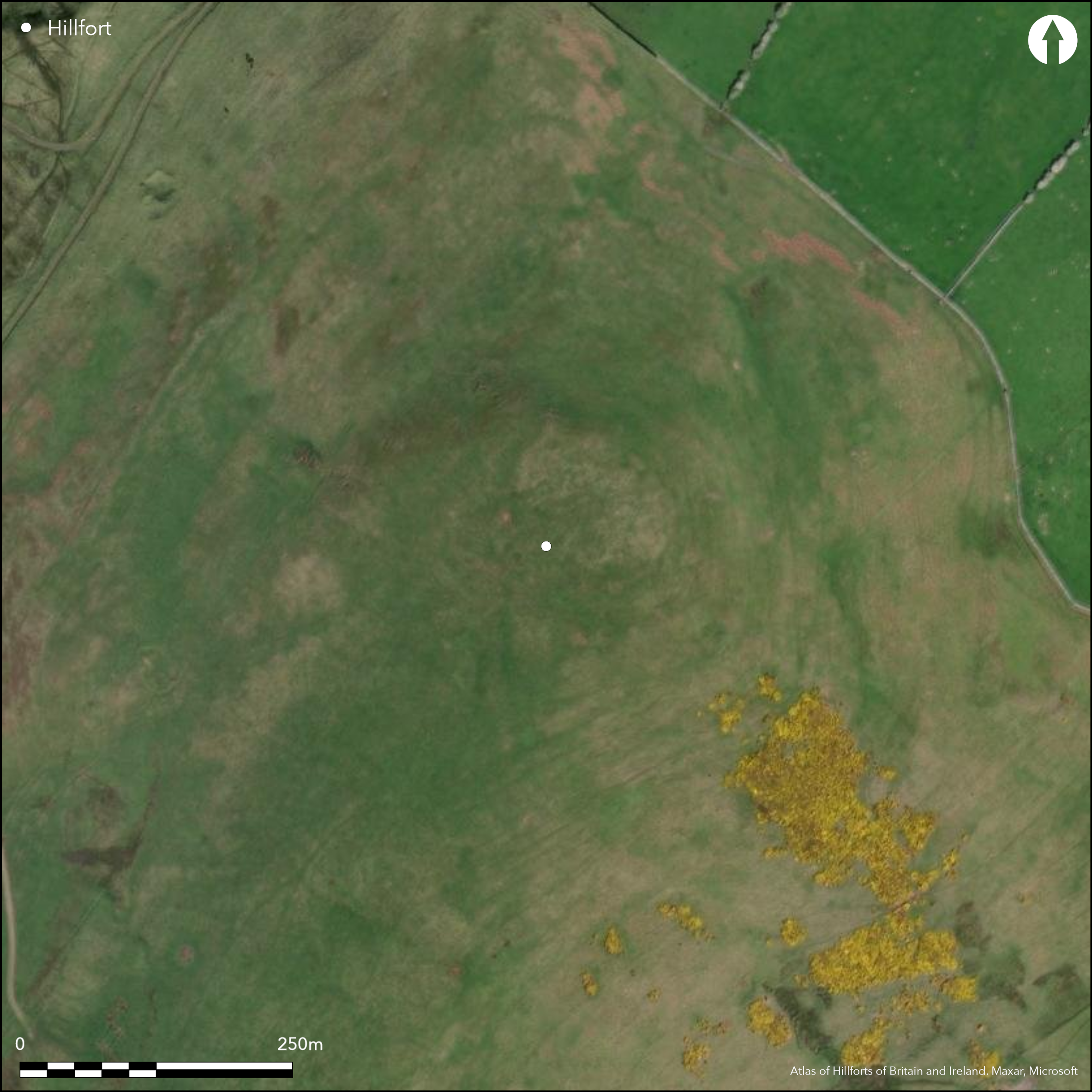
Satellite Imagery
LiDAR 1m DTM Hillshade
Satellite Imagery
Scroll left/right to view further images.
HER: Northumberland 639 (None)
NMR: NT 82 NE 75 (918)
SM: 1009040
NGR: NT 87232 27796
X: 387232 Y: 627796 (OSGB36)
At the northern extent of an inland promontory approximately 550m to the S of Elsdonburn, a palisaded enclosure and a later hillfort. It lies at 319m OD on ground that slopes away steeply in all but the S and SW. Slight traces of ramparts can be seen on aerial photographs and on the ground in the N and it is estimated to measure 60m N-S by 70m E-W, enclosing 0.42ha. Excavation (Burgess 1971) showed the settlement was originally enclosed by a double palisade which was incomplete in its first phase then replaced and completed with stone ramparts. The palisade trenches were filled with stones and varied in depth from a few centimetres to 0.5m and was 0.5m wide. No evidence for the use of timber was recovered and the trench does not appear to continue in the E so may not have been complete. It was later replaced by three stone ramparts except in the E where there is only a single rampart. Burgess (1971) identified house scoops and several hut circles on the S side of the interior measuring between 6.1-7.7m in diameter during scheduling. An entrance lies on the western side. Pottery, flint tools, stone pounders, iron working remains, a spindle whorl and an iron sword were also recovered during the excavations which showed that the site was mainly used during the seventh and sixth centuries BC. Limited excavations were carried out in 1970 and 1978 which dated to the site to the 7th-6th centuries BC (Burgess, 1971 and 1979). The site is not recorded on OS mapping. Scheduled as a defended settlement. Romano-British homesteads lie nearby
Citizen Science: ✗
Reliability of Data: Confirmed
Reliability of Interpretation: Confirmed
X: -245336 Y: 7468118 (EPSG: 3857)
Longitude: -2.203891983800064 Latitude: 55.54374012123755 (EPSG:4326)
Country: England
Current County or Unitary Authority: Northumberland
Historic County: Northumberland
Current Parish/Community/Council/Townland: Kirknewton
Mainly survives as a cropmark
| Extant | ✓ |
| Cropmark | ✗ |
| Likely Destroyed | ✗ |
None
| Woodland | ✗ |
| Commercial Forestry Plantation | ✗ |
| Parkland | ✗ |
| Pasture (Grazing) | ✓ |
| Arable | ✗ |
| Scrub/Bracken | ✗ |
| Bare Outcrop | ✗ |
| Heather/Moorland | ✓ |
| Heath | ✗ |
| Built-up | ✗ |
| Coastal Grassland | ✗ |
| Other | ✗ |
A contour fort lying at 319m OD on the summit of Ell's Knowe
| Contour Fort | ✓ |
| Partial Contour Fort | ✗ |
| Promontory Fort | ✗ |
| Hillslope Fort | ✗ |
| Level Terrain Fort | ✗ |
| Marsh Fort | ✗ |
| Multiple Enclosure Fort | ✗ |
| Hilltop | ✓ |
| Coastal Promontory | ✗ |
| Inland Promontory | ✓ |
| Valley Bottom | ✗ |
| Knoll/Hillock/Outcrop | ✗ |
| Ridge | ✗ |
| Cliff/Plateau-edge/Scarp | ✗ |
| Hillslope | ✗ |
| Lowland | ✗ |
| Spur | ✗ |
Dominant Topographic Feature: Summit of Ell's Knowe
| North | ✗ |
| Northeast | ✗ |
| East | ✗ |
| Southeast | ✗ |
| South | ✗ |
| Southwest | ✗ |
| West | ✗ |
| Northwest | ✗ |
| Level | ✓ |
Altitude: 319.0m
N/A
Pottery, flint tools, stone pounders, iron working remains, a spindle whorl and an iron sword were recovered during the excavations. Pottery is comparable to 7th-6th century B.C. pottery from other similar sites in the region. Palisaded enclosure pre-dates hillfort.
Reliability: B - Medium
| Pre 1200BC | ✗ |
| 1200BC - 800BC | ✗ |
| 800BC - 400BC | ✓ |
| 400BC - AD50 | ✗ |
| AD50 - AD400 | ✗ |
| AD400 - AD 800 | ✗ |
| Post AD800 | ✗ |
| Unknown | ✗ |
| Pre Hillfort: | None |
| Post Hillfort: | None |
| Artefactual: | None |
Limited excavations were carried out in 1970 and 1978 across the ramparts and house platforms. Field investigation in 1969. Scheduled as a defended settlement
| Other (1969): | Field investigation |
| Excavation (1978): | Burgess, 1979 |
| Other (1994): | Scheduled |
| Excavation (1970): | Burgess, 1971 |
Several hut circles have been identified on the S side of the interior measuring between 6.1-7.7m in diameter. House scoops were identified by Burgess (1971). Pottery, flint tools, stone pounders, iron working remains, spindle whorl, iron sword
Elsdon Burn approximately 610m to the N
| None | ✓ |
| Spring | ✗ |
| Stream | ✗ |
| Pool | ✗ |
| Flush | ✗ |
| Well | ✗ |
| Other | ✗ |
Ring-grooves around platforms and ring-ditch houses
| No Known Features | ✗ |
| Round Stone Structures | ✗ |
| Rectangular Stone Structures | ✗ |
| Curvilinear Platforms | ✗ |
| Other Roundhouse Evidence | ✓ |
| Pits | ✗ |
| Quarry Hollows | ✗ |
| Other | ✗ |
None
| No Known Excavation | ✗ |
| Pits | ✗ |
| Postholes | ✗ |
| Roundhouses | ✓ |
| Rectangular Structures | ✗ |
| Roads/Tracks | ✗ |
| Quarry Hollows | ✗ |
| Other | ✗ |
| Nothing Found | ✗ |
None
| No Known Geophysics | ✓ |
| Pits | ✗ |
| Roundhouses | ✗ |
| Rectangular Structures | ✗ |
| Roads/Tracks | ✗ |
| Quarry Hollows | ✗ |
| Other | ✗ |
| Nothing Found | ✗ |
Pottery, flint tools, stone pounders, iron working remains, spindle whorl, iron sword
| No Known Finds | ✗ |
| Pottery | ✓ |
| Metal | ✗ |
| Metalworking | ✓ |
| Human Bones | ✗ |
| Animal Bones | ✗ |
| Lithics | ✓ |
| Environmental | ✗ |
| Other | ✓ |
None
| APs Not Checked | ✓ |
| None | ✗ |
| Roundhouses | ✗ |
| Rectangular Structures | ✗ |
| Pits | ✗ |
| Postholes | ✗ |
| Roads/Tracks | ✗ |
| Other | ✗ |
An entrance lies on the western side
| 3: | Limited information on entrances, assumed it comprises a single break through each rampart |
| 2: | None |
Guard Chambers: ✗
Chevaux de Frise: ✗
| 1. Simple Gap (West): | Inner rampart |
| 1. Simple Gap (West): | Middle rampart |
| 1. Simple Gap (West): | Outer rampart |
Double palisade trench filled with stones and varying in depth from a few centimetres to 0.5m and 0.5m wide. No evidence for the use of timber was recovered and the trench does not appear to continue in the E so may not have been complete. It was later replaced by three stone ramparts except in the E where there is only a single rampart. The remains today are most visible in the N
| Area 1: | 0.42ha. |
| Total: | 0.42ha. |
Total Footprint Area: Noneha.
None
| ✓ | Excavation (Burgess 1971) showed the settlement was originally enclosed by a double palisade which was incomplete in its first phase then replaced and completed with stone ramparts |
| ✓ | Three stone ramparts except in the E where there is only a single rampart. |
| NE Quadrant: | 1 |
| SE Quadrant: | 1 |
| SW Quadrant: | 3 |
| NW Quadrant: | 3 |
| Total: | 3 |
| Partial Univallate | ✓ |
| Univallate | ✗ |
| Partial Bivallate | ✗ |
| Bivallate | ✗ |
| Partial Multivallate | ✓ |
| Multivallate | ✗ |
| Unknown | ✗ |
| Partial Univallate | ✗ |
| Univallate | ✗ |
| Partial Bivallate | ✗ |
| Bivallate | ✗ |
| Partial Multivallate | ✗ |
| Multivallate | ✗ |
None
| None | ✗ |
| Earthen Bank | ✗ |
| Stone Wall | ✓ |
| Rubble | ✗ |
| Wall-walk | ✗ |
| Evidence of Timber | ✗ |
| Vitrification | ✗ |
| Other Burning | ✗ |
| Palisade | ✗ |
| Counter Scarp Bank | ✗ |
| Berm | ✗ |
| Unfinished | ✗ |
| Other | ✗ |
None
| None | ✗ |
| Earthen Bank | ✗ |
| Stone Wall | ✓ |
| Murus Duplex | ✗ |
| Timber-framed | ✗ |
| Timber-laced | ✗ |
| Vitrification | ✗ |
| Other Burning | ✗ |
| Palisade | ✓ |
| Counter Scarp Bank | ✗ |
| Berm | ✗ |
| Unfinished | ✓ |
| No Known Excavation | ✗ |
| Other | ✗ |
| ✗ | None |
| ✗ | Palisade trenches only |
Number of Ditches: None
| ✗ | None |
Burgess, C. 1979. Excavations at Ell's Knowe, Northumberland. Univ Durham Univ Newcastle upon Tyne Archaeol Rep, vol. 8.
Burgess, C. 1971. Reports on Excavations in 1970 Arch Newsbulletin for Northumberland, Cumberland & Westmoreland - Volume: 10, 1971, 2-3
Jobey, G.1965. Hillforts and Settlements in Northumberland. Archaeol Aeliana (4th Series) 43
Atlas of Hillforts:
Wikidata:
This work is licensed under CC BY-SA 4.0

 and should be cited as:
Lock, Gary and Ralston, Ian. 2024. Atlas of Hillforts of Britain and Ireland. Available at: https://hillforts.arch.ox.ac.uk
Document Version 1.1