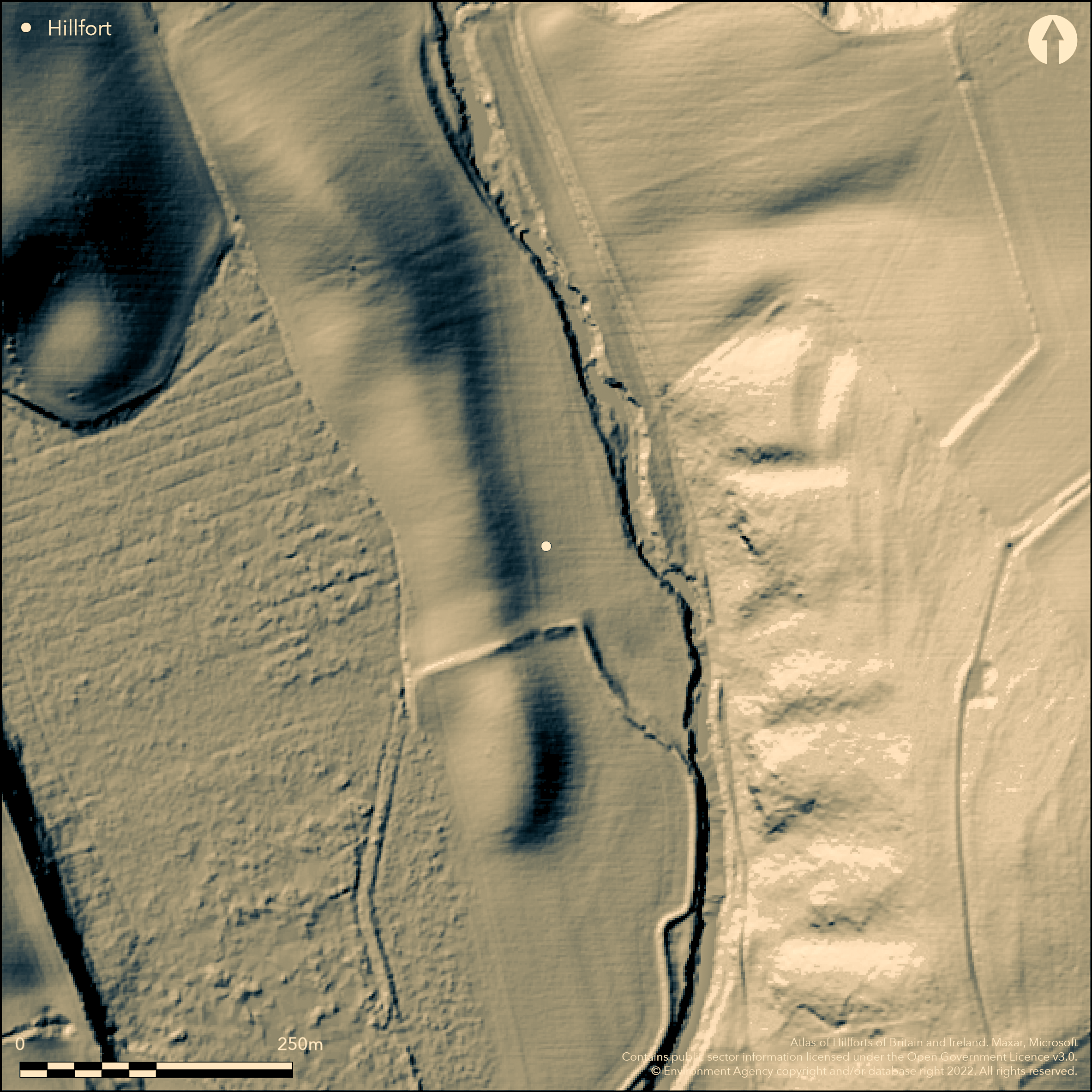
LiDAR 1m DTM Hillshade
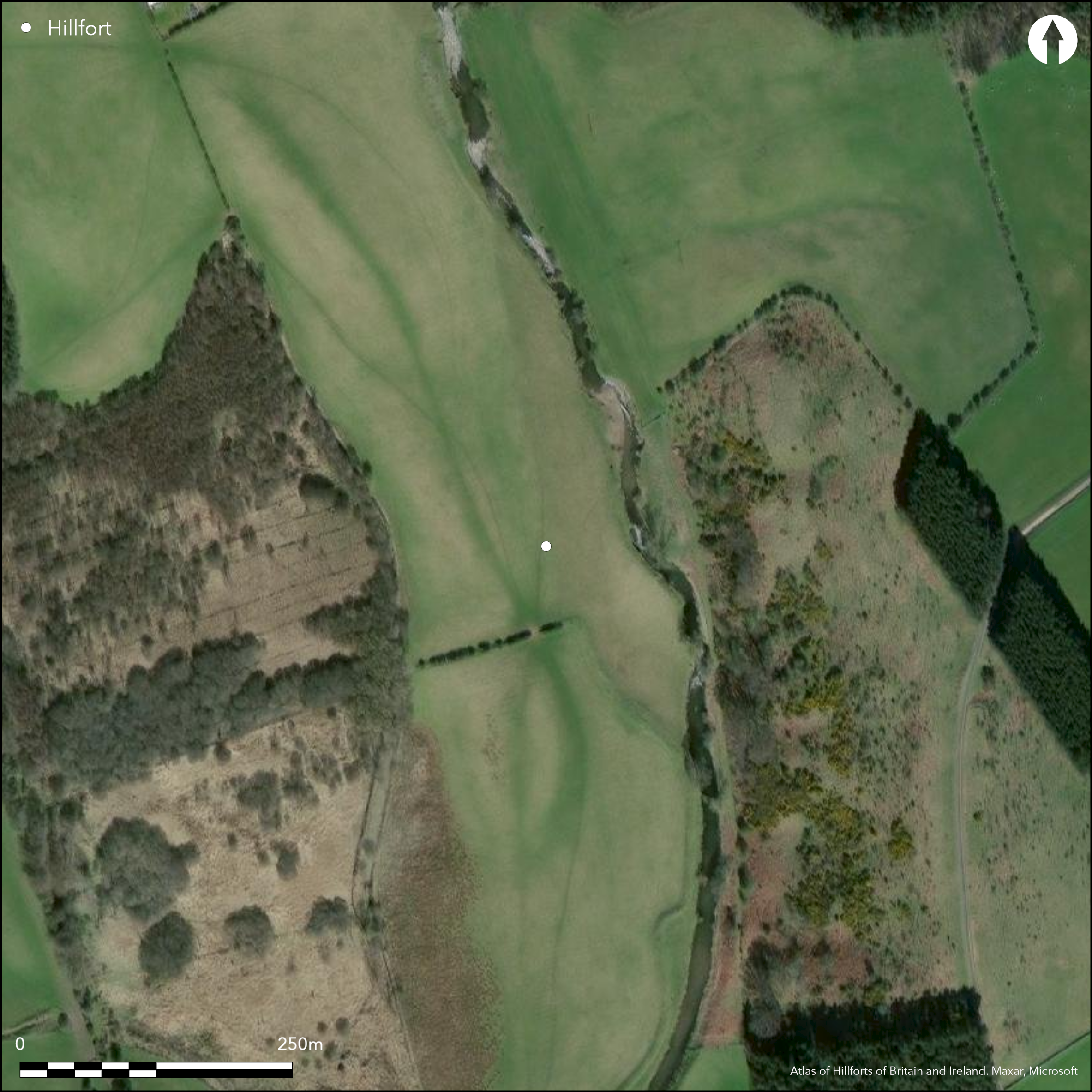
Satellite Imagery
LiDAR 1m DTM Hillshade
Satellite Imagery
Scroll left/right to view further images.
HER: Northumberland 2047 (None)
NMR: NT 93 SW 69 (1369610)
SM: None
NGR: NT 9049 3130
X: 390496 Y: 631301 (OSGB36)
Lying 400m to the SW of Crook House and directly to the NE of Cannomill Bog, the cropmarked remains of a small multivallate hillfort. It occupies a low ridge at 69m OD overlooking Bowmont Water in the E. The site is oval in form estimated at 120m N-S by 80m E-W covering approximately 3.0ha and comprising up to three concentric ditches set approximately 10m apart, within a further ditch separated by 15-20m. The internal area measures approximately 60m N-S by 50m E-W enclosing 0.9ha. An entrance cuts through all the inner ditches, and possibly the outer ditch in the N, a further break has been recorded in the inner ditch in the SE. No internal features have been identified. It is recorded only on aerial photographs and is undated (Passmore and Waddington 2012).
Citizen Science: ✗
Reliability of Data: Confirmed
Reliability of Interpretation: Confirmed
X: -239592 Y: 7474332 (EPSG: 3857)
Longitude: -2.1522874556166913 Latitude: 55.57530937119178 (EPSG:4326)
Country: England
Current County or Unitary Authority: Northumberland
Historic County: Northumberland
Current Parish/Community/Council/Townland: Kirknewton
None
| Extant | ✗ |
| Cropmark | ✓ |
| Likely Destroyed | ✗ |
None
| Woodland | ✗ |
| Commercial Forestry Plantation | ✗ |
| Parkland | ✗ |
| Pasture (Grazing) | ✓ |
| Arable | ✗ |
| Scrub/Bracken | ✗ |
| Bare Outcrop | ✗ |
| Heather/Moorland | ✗ |
| Heath | ✗ |
| Built-up | ✗ |
| Coastal Grassland | ✗ |
| Other | ✗ |
A level terrain form lying on a low ridge at 69m OD overlooking Bowmont Water
| Contour Fort | ✗ |
| Partial Contour Fort | ✗ |
| Promontory Fort | ✗ |
| Hillslope Fort | ✗ |
| Level Terrain Fort | ✓ |
| Marsh Fort | ✗ |
| Multiple Enclosure Fort | ✗ |
| Hilltop | ✗ |
| Coastal Promontory | ✗ |
| Inland Promontory | ✗ |
| Valley Bottom | ✗ |
| Knoll/Hillock/Outcrop | ✗ |
| Ridge | ✓ |
| Cliff/Plateau-edge/Scarp | ✗ |
| Hillslope | ✗ |
| Lowland | ✓ |
| Spur | ✗ |
Dominant Topographic Feature: Low ridge overlooking Bowmont Water
| North | ✗ |
| Northeast | ✗ |
| East | ✗ |
| Southeast | ✗ |
| South | ✗ |
| Southwest | ✗ |
| West | ✗ |
| Northwest | ✗ |
| Level | ✓ |
Altitude: 69.0m
N/A
The site is undated
Reliability: D - None
| Pre 1200BC | ✗ |
| 1200BC - 800BC | ✗ |
| 800BC - 400BC | ✗ |
| 400BC - AD50 | ✗ |
| AD50 - AD400 | ✗ |
| AD400 - AD 800 | ✗ |
| Post AD800 | ✗ |
| Unknown | ✓ |
| Pre Hillfort: | None |
| Post Hillfort: | None |
The site has been mapped from the air as part of the Milfield Geoarchaeology Project - archive object MD000295. Transcription by Rog Palmer shown in Passmore and Waddington (2012, 72)
| Other (2012): | None |
No internal features recorded
Bowmont Water to the E
| None | ✓ |
| Spring | ✗ |
| Stream | ✗ |
| Pool | ✗ |
| Flush | ✗ |
| Well | ✗ |
| Other | ✗ |
None
| No Known Features | ✓ |
| Round Stone Structures | ✗ |
| Rectangular Stone Structures | ✗ |
| Curvilinear Platforms | ✗ |
| Other Roundhouse Evidence | ✗ |
| Pits | ✗ |
| Quarry Hollows | ✗ |
| Other | ✗ |
None
| No Known Excavation | ✓ |
| Pits | ✗ |
| Postholes | ✗ |
| Roundhouses | ✗ |
| Rectangular Structures | ✗ |
| Roads/Tracks | ✗ |
| Quarry Hollows | ✗ |
| Other | ✗ |
| Nothing Found | ✗ |
None
| No Known Geophysics | ✓ |
| Pits | ✗ |
| Roundhouses | ✗ |
| Rectangular Structures | ✗ |
| Roads/Tracks | ✗ |
| Quarry Hollows | ✗ |
| Other | ✗ |
| Nothing Found | ✗ |
None
| No Known Finds | ✓ |
| Pottery | ✗ |
| Metal | ✗ |
| Metalworking | ✗ |
| Human Bones | ✗ |
| Animal Bones | ✗ |
| Lithics | ✗ |
| Environmental | ✗ |
| Other | ✗ |
None
| APs Not Checked | ✗ |
| None | ✓ |
| Roundhouses | ✗ |
| Rectangular Structures | ✗ |
| Pits | ✗ |
| Postholes | ✗ |
| Roads/Tracks | ✗ |
| Other | ✗ |
Entrances cut through all the inner ditches, and possibly the outer ditch in the N, a further break has been recorded in the inner ditch in the SE.
| 5: | None |
| 2: | None |
Guard Chambers: ✗
Chevaux de Frise: ✗
| 1. Simple Gap (North): | None |
| 1. Simple Gap (North): | None |
| 1. Simple Gap (North): | None |
| 1. Simple Gap (North): | None |
| 2. Simple Gap (South east): | Through inner ditch |
Multivallate, oval in form estimated at 120m N-S by 80m E-W. Up to three concentric ditches set approximately 10m apart within a further ditch separated by 15-20m. The internal area measures approximately 60m N-S by 50m E-W.
| Area 1: | 0.9ha. |
| Total: | 0.9ha. |
Total Footprint Area: 3.0ha.
None
| ✗ | None |
| ✓ | None |
| NE Quadrant: | 4 |
| SE Quadrant: | 4 |
| SW Quadrant: | 4 |
| NW Quadrant: | 4 |
| Total: | 4 |
| Partial Univallate | ✗ |
| Univallate | ✗ |
| Partial Bivallate | ✗ |
| Bivallate | ✗ |
| Partial Multivallate | ✗ |
| Multivallate | ✓ |
| Unknown | ✗ |
| Partial Univallate | ✗ |
| Univallate | ✗ |
| Partial Bivallate | ✗ |
| Bivallate | ✗ |
| Partial Multivallate | ✗ |
| Multivallate | ✗ |
None
| None | ✓ |
| Earthen Bank | ✗ |
| Stone Wall | ✗ |
| Rubble | ✗ |
| Wall-walk | ✗ |
| Evidence of Timber | ✗ |
| Vitrification | ✗ |
| Other Burning | ✗ |
| Palisade | ✗ |
| Counter Scarp Bank | ✗ |
| Berm | ✗ |
| Unfinished | ✗ |
| Other | ✗ |
None
| None | ✗ |
| Earthen Bank | ✗ |
| Stone Wall | ✗ |
| Murus Duplex | ✗ |
| Timber-framed | ✗ |
| Timber-laced | ✗ |
| Vitrification | ✗ |
| Other Burning | ✗ |
| Palisade | ✗ |
| Counter Scarp Bank | ✗ |
| Berm | ✗ |
| Unfinished | ✗ |
| No Known Excavation | ✓ |
| Other | ✗ |
| ✗ | None |
| ✓ | None |
Number of Ditches: 4
| ✗ | None |
Passmore, D.G. and Waddington, C. 2012. Archaeology and Environment in Northumberland. Till-Tweed studies, Vol 2. Oxbow
Atlas of Hillforts:
Wikidata:
This work is licensed under CC BY-SA 4.0

 and should be cited as:
Lock, Gary and Ralston, Ian. 2024. Atlas of Hillforts of Britain and Ireland. Available at: https://hillforts.arch.ox.ac.uk
Document Version 1.1