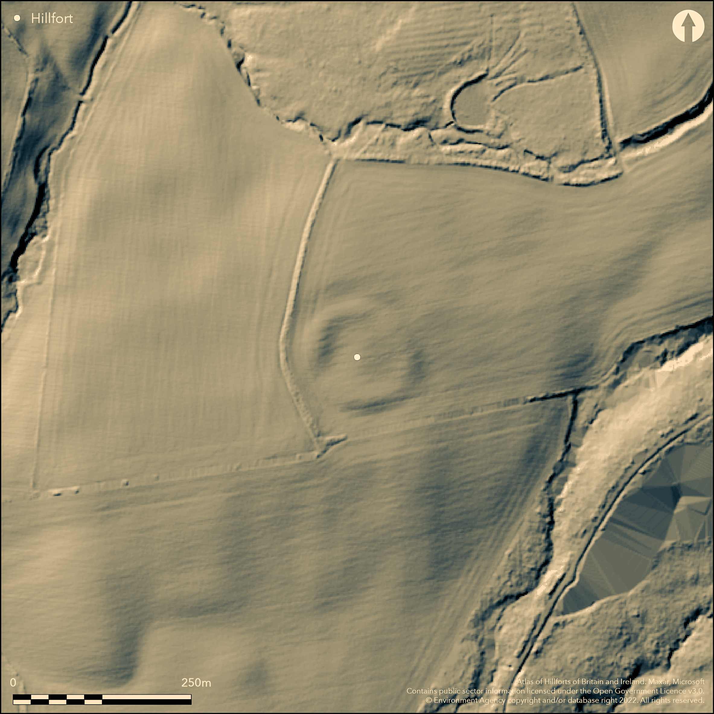
LiDAR 1m DTM Hillshade
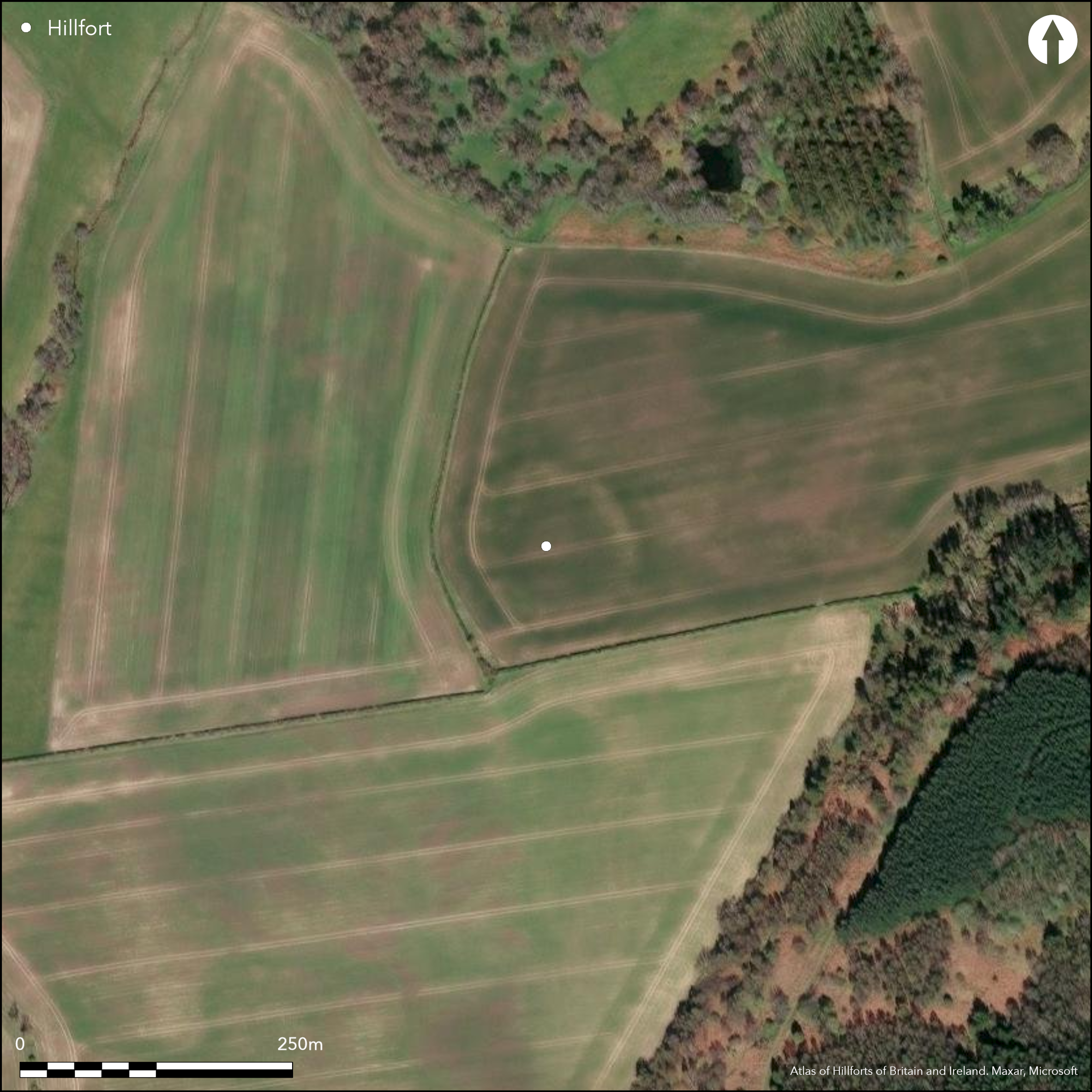
Satellite Imagery
LiDAR 1m DTM Hillshade
Satellite Imagery
Scroll left/right to view further images.
HER: Northumberland 3610 (None)
NMR: NU 02 SE 12 (5768)
SM: None
NGR: NU 0676 2351
X: 406760 Y: 623510 (OSGB36)
Lying 225m to the W of Hepburn Wood the remains of a bivallate hillfort. It lies at 98m OD on a hillslope with dead ground to the N and E. Oval in plan, it measures 122m NW-SE by 112m transversely and comprises two wide concentric banks with a medial ditch and a further narrow outer ditch. The internal area measures 0.4ha. On the inside of the defences, traces of a further narrow ditch have been recorded. It is uncertain if this is slot for an earlier palisade or part of a box rampart for the main defences. In the SE, a gap through the inner bank and a corresponding causeway across the ditch is possibly an entrance. The outer bank or counterscarp and ditch have been destroyed by later field boundaries and it is impossible to confirm corresponding breaks. Further gaps in the NE and SW are probably modern. The site was described as ploughed down by 1935 (Dodds 1935) but an RCHME field investigation in 1955 recorded the bank as 15m wide and 0.3-1.5m high and the ditch as 15m wide and 0.7m deep. Some stones were visible in the bank. Shown on 1885-1903 OS mapping. The site was recorded as part of The Till-Tweed air photo (AP) mapping project (Gates and Deegan 2009) but remains undated.
Citizen Science: ✗
Reliability of Data: Confirmed
Reliability of Interpretation: Confirmed
X: -210897 Y: 7460569 (EPSG: 3857)
Longitude: -1.8945231063951609 Latitude: 55.50535219110826 (EPSG:4326)
Country: England
Current County or Unitary Authority: Northumberland
Historic County: Northumberland
Current Parish/Community/Council/Townland: Chillingham
The site is visible on Google Earth satellite imagery
| Extant | ✓ |
| Cropmark | ✓ |
| Likely Destroyed | ✗ |
None
| Woodland | ✗ |
| Commercial Forestry Plantation | ✗ |
| Parkland | ✗ |
| Pasture (Grazing) | ✗ |
| Arable | ✓ |
| Scrub/Bracken | ✗ |
| Bare Outcrop | ✗ |
| Heather/Moorland | ✗ |
| Heath | ✗ |
| Built-up | ✗ |
| Coastal Grassland | ✗ |
| Other | ✗ |
Hillslope fort lying on a southwesterly slope at approximately 98m OD
| Contour Fort | ✗ |
| Partial Contour Fort | ✗ |
| Promontory Fort | ✗ |
| Hillslope Fort | ✓ |
| Level Terrain Fort | ✗ |
| Marsh Fort | ✗ |
| Multiple Enclosure Fort | ✗ |
| Hilltop | ✗ |
| Coastal Promontory | ✗ |
| Inland Promontory | ✗ |
| Valley Bottom | ✗ |
| Knoll/Hillock/Outcrop | ✗ |
| Ridge | ✗ |
| Cliff/Plateau-edge/Scarp | ✗ |
| Hillslope | ✓ |
| Lowland | ✓ |
| Spur | ✗ |
Dominant Topographic Feature: Hillslope
| North | ✗ |
| Northeast | ✗ |
| East | ✗ |
| Southeast | ✗ |
| South | ✗ |
| Southwest | ✓ |
| West | ✓ |
| Northwest | ✗ |
| Level | ✗ |
Altitude: 98.0m
N/A
Undated, but it is presumed the palisaded enclosure is earlier
Reliability: D - None
| Pre 1200BC | ✗ |
| 1200BC - 800BC | ✗ |
| 800BC - 400BC | ✗ |
| 400BC - AD50 | ✗ |
| AD50 - AD400 | ✗ |
| AD400 - AD 800 | ✗ |
| Post AD800 | ✗ |
| Unknown | ✓ |
| Pre Hillfort: | Palisade |
| Post Hillfort: | None |
Shown on 1885-1903 OS mapping RCHME, general reference in Dodds (1935). Field investigation in 1955
| 1st Identified Written Reference (1935): | None |
| Other (1955): | Field investigation |
| 1st Identified Map Depiction (None): | None |
No internal features recorded
Streams in N, S, E and W
| None | ✓ |
| Spring | ✗ |
| Stream | ✗ |
| Pool | ✗ |
| Flush | ✗ |
| Well | ✗ |
| Other | ✗ |
None
| No Known Features | ✓ |
| Round Stone Structures | ✗ |
| Rectangular Stone Structures | ✗ |
| Curvilinear Platforms | ✗ |
| Other Roundhouse Evidence | ✗ |
| Pits | ✗ |
| Quarry Hollows | ✗ |
| Other | ✗ |
None
| No Known Excavation | ✓ |
| Pits | ✗ |
| Postholes | ✗ |
| Roundhouses | ✗ |
| Rectangular Structures | ✗ |
| Roads/Tracks | ✗ |
| Quarry Hollows | ✗ |
| Other | ✗ |
| Nothing Found | ✗ |
None
| No Known Geophysics | ✓ |
| Pits | ✗ |
| Roundhouses | ✗ |
| Rectangular Structures | ✗ |
| Roads/Tracks | ✗ |
| Quarry Hollows | ✗ |
| Other | ✗ |
| Nothing Found | ✗ |
None
| No Known Finds | ✓ |
| Pottery | ✗ |
| Metal | ✗ |
| Metalworking | ✗ |
| Human Bones | ✗ |
| Animal Bones | ✗ |
| Lithics | ✗ |
| Environmental | ✗ |
| Other | ✗ |
None
| APs Not Checked | ✗ |
| None | ✓ |
| Roundhouses | ✗ |
| Rectangular Structures | ✗ |
| Pits | ✗ |
| Postholes | ✗ |
| Roads/Tracks | ✗ |
| Other | ✗ |
In the SE, a gap through the inner bank and a corresponding causeway across the ditch is possibly an entrance.
| 3: | None |
| 2: | None |
Guard Chambers: ✗
Chevaux de Frise: ✗
| 1. Simple Gap (South east): | None |
Oval in plan, it measures 122m NW-SE by 112m transversely and comprised two wide concentric banks with a medial ditch and a further narrow outer ditch. On the inside traces of a possible palisade trench or slot for a box rampart have been recorded.
| Area 1: | 0.4ha. |
| Total: | 0.4ha. |
Total Footprint Area: 1.06ha.
None
| ✓ | A third inner ditch, possibly for a box rampart or a palisade suggests more than one phase |
| ✓ | None |
| NE Quadrant: | 2 |
| SE Quadrant: | 2 |
| SW Quadrant: | 2 |
| NW Quadrant: | 2 |
| Total: | 2 |
| Partial Univallate | ✗ |
| Univallate | ✗ |
| Partial Bivallate | ✗ |
| Bivallate | ✓ |
| Partial Multivallate | ✗ |
| Multivallate | ✗ |
| Unknown | ✗ |
| Partial Univallate | ✗ |
| Univallate | ✗ |
| Partial Bivallate | ✗ |
| Bivallate | ✗ |
| Partial Multivallate | ✗ |
| Multivallate | ✗ |
Stone recorded but it is uncertain if the bank was faced
| None | ✗ |
| Earthen Bank | ✓ |
| Stone Wall | ✗ |
| Rubble | ✓ |
| Wall-walk | ✗ |
| Evidence of Timber | ✗ |
| Vitrification | ✗ |
| Other Burning | ✗ |
| Palisade | ✓ |
| Counter Scarp Bank | ✗ |
| Berm | ✗ |
| Unfinished | ✗ |
| Other | ✗ |
None
| None | ✗ |
| Earthen Bank | ✗ |
| Stone Wall | ✗ |
| Murus Duplex | ✗ |
| Timber-framed | ✗ |
| Timber-laced | ✗ |
| Vitrification | ✗ |
| Other Burning | ✗ |
| Palisade | ✗ |
| Counter Scarp Bank | ✗ |
| Berm | ✗ |
| Unfinished | ✗ |
| No Known Excavation | ✓ |
| Other | ✗ |
| ✗ | None |
| ✓ | None |
Number of Ditches: 2
| ✗ | None |
Dodds, M.H., 1935. A History of Northumberland, Volume 14 (Newcastle upon Tyne), 64.
Gates, T and Deegan, A. 2009. Monuments in the Landscape in Passmore, D.G. and Waddington, C. (eds). Managing Archaeological Landscapes in Northumberland. Till-Tweed Studies, Vol 1. Oxbow, 125-171
Jobey, G.1965. Hillforts and Settlements in Northumberland. Archaeol Aeliana (4th Series) 43
Atlas of Hillforts:
Wikidata:
This work is licensed under CC BY-SA 4.0

 and should be cited as:
Lock, Gary and Ralston, Ian. 2024. Atlas of Hillforts of Britain and Ireland. Available at: https://hillforts.arch.ox.ac.uk
Document Version 1.1