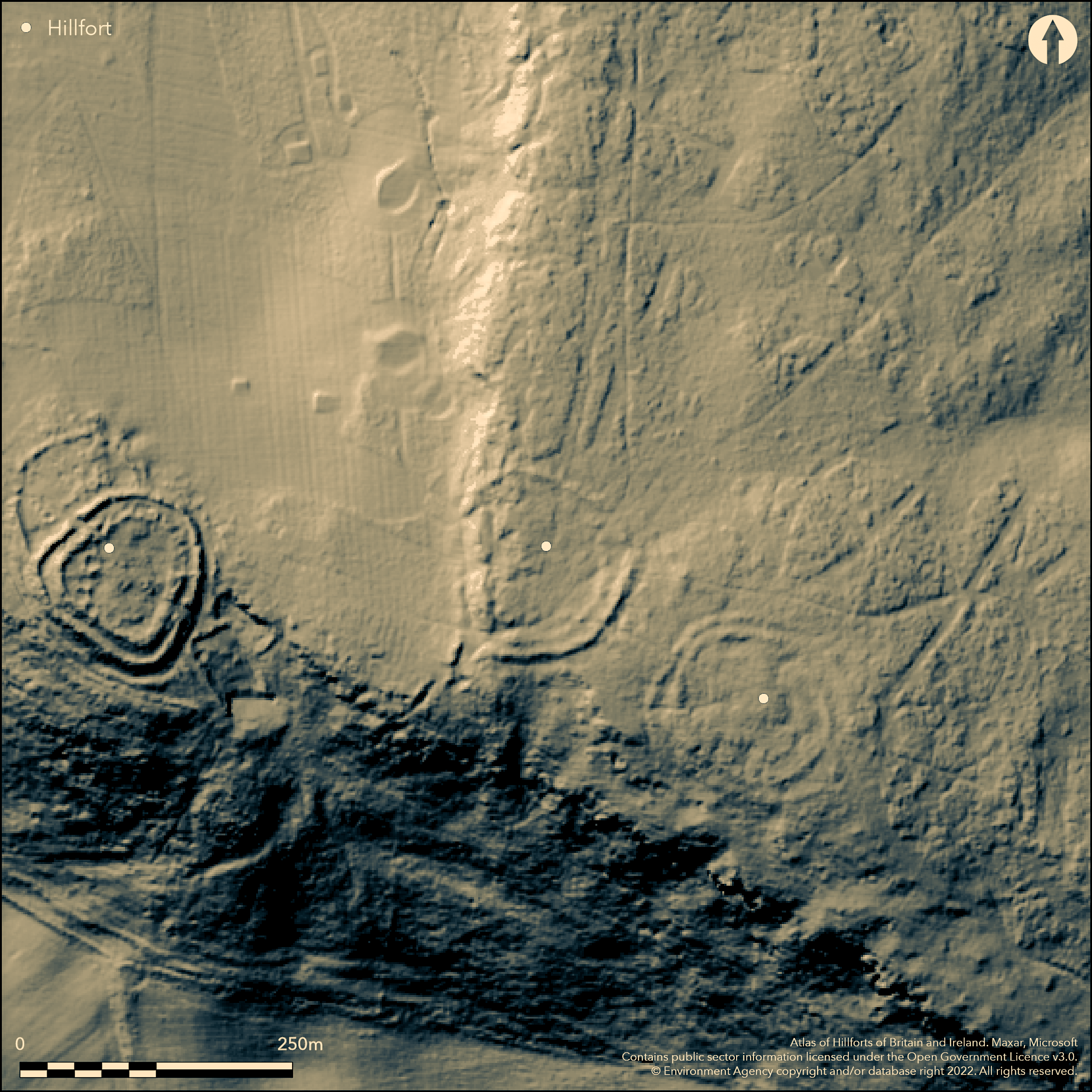
LiDAR 1m DTM Hillshade
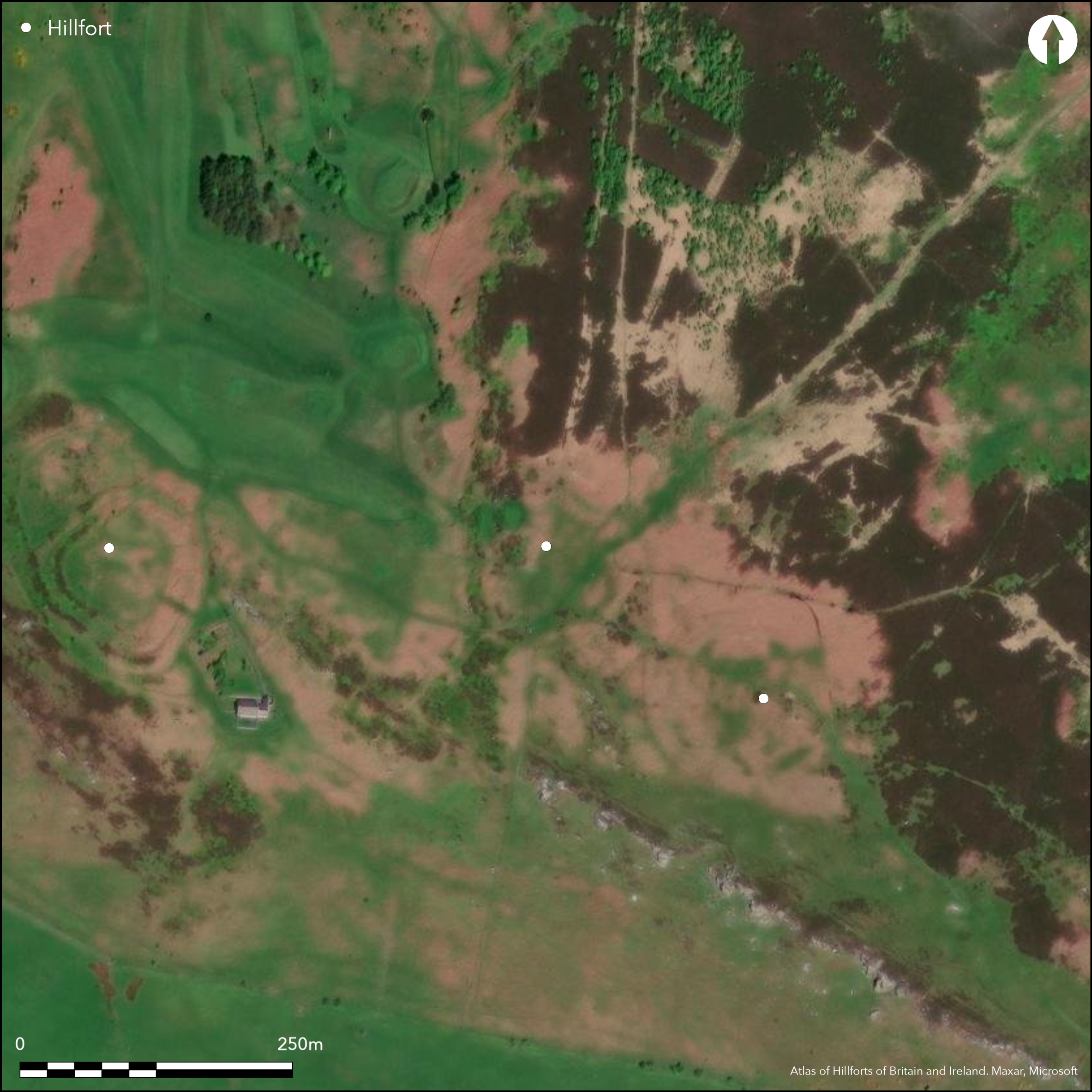
Satellite Imagery
LiDAR 1m DTM Hillshade
Satellite Imagery
Scroll left/right to view further images.
HER: Northumberland 3794 (None)
NMR: NU 03 SW 17 (6265)
SM: 1002946
NGR: NU 00637 31711
X: 400637 Y: 631711 (OSGB36)
Lying on Dod Law, 1km to the SE of Doddington and 135m to the E of the hillfort of Dod Law West (Atlas No. 0525) an enclosure of 0.5ha. Oval in plan approximately 85m by 90m, it comprises two banks and an outer ditch. It lies on level ground on the crest of a ridge at 198m OD which offers views in all directions. A gentle slope lies to the E. The inner bank survives poorly and is only measurable in the N where it is approximately 4m wide and 0.4m high. The rest of the circuit can be made out by the presence of a few stones protruding from the turf and it probably coincided with the top of a rocky escarpment in the W. The outer stone bank measures 3-5m wide and 0.3-1.4m high and is stronger in the W where it runs to the foot of the escarpment. The outer ditch has an average width of 8m and depth of 0.7m. Entrances lie in the NE and SW. The entrance in the NE gives access to the crest of the ridge and ground to the NE. The SW entrance has been disturbed through quarrying but the western terminal continues southwards beyond the entrance while the terminal in the E turns towards the W terminal forming a bottleneck. The entrance is further restricted by a bank placed centrally within the gap. Two further breaks which correspond with a track are probably modern. Hogg and Hogg (1956) reported hut circles, which was refuted by an RCHME field inspector in 1964. Jobey (1965) also reported stone huts as possibly secondary occupation. Shown on 1856-65 OS mapping and survives in poor condition. Further traces of bank have been recorded in the S and cup and ring marked stones lie in the vicinity. Scheduled but minimal investigations and remains undated.
Citizen Science: ✗
Reliability of Data: Confirmed
Reliability of Interpretation: Confirmed
X: -221687 Y: 7475076 (EPSG: 3857)
Longitude: -1.9914474088970122 Latitude: 55.57908770011829 (EPSG:4326)
Country: England
Current County or Unitary Authority: Northumberland
Historic County: Northumberland
Current Parish/Community/Council/Townland: Doddington
Poor condition, some quarrying
| Extant | ✓ |
| Cropmark | ✗ |
| Likely Destroyed | ✗ |
None
| Woodland | ✗ |
| Commercial Forestry Plantation | ✗ |
| Parkland | ✗ |
| Pasture (Grazing) | ✓ |
| Arable | ✗ |
| Scrub/Bracken | ✗ |
| Bare Outcrop | ✗ |
| Heather/Moorland | ✗ |
| Heath | ✗ |
| Built-up | ✗ |
| Coastal Grassland | ✗ |
| Other | ✗ |
A contour fort lying at 198m OD on the crest of a ridge on Dod Law
| Contour Fort | ✓ |
| Partial Contour Fort | ✗ |
| Promontory Fort | ✗ |
| Hillslope Fort | ✗ |
| Level Terrain Fort | ✗ |
| Marsh Fort | ✗ |
| Multiple Enclosure Fort | ✗ |
| Hilltop | ✓ |
| Coastal Promontory | ✗ |
| Inland Promontory | ✗ |
| Valley Bottom | ✗ |
| Knoll/Hillock/Outcrop | ✗ |
| Ridge | ✓ |
| Cliff/Plateau-edge/Scarp | ✗ |
| Hillslope | ✗ |
| Lowland | ✗ |
| Spur | ✗ |
Dominant Topographic Feature: Crest of a ridge on Dod Law
| North | ✗ |
| Northeast | ✗ |
| East | ✗ |
| Southeast | ✗ |
| South | ✗ |
| Southwest | ✗ |
| West | ✗ |
| Northwest | ✗ |
| Level | ✓ |
Altitude: 198.0m
N/A
Undated
Reliability: D - None
| Pre 1200BC | ✗ |
| 1200BC - 800BC | ✗ |
| 800BC - 400BC | ✗ |
| 400BC - AD50 | ✗ |
| AD50 - AD400 | ✗ |
| AD400 - AD 800 | ✗ |
| Post AD800 | ✗ |
| Unknown | ✓ |
| Pre Hillfort: | None |
| Post Hillfort: | Possibly secondary Romano-British occupation |
Recorded on 1856-65 OS mapping, general reference in Tate (1863-8). Field investigations in 1955, 1964 and 1968. Scheduled.
| Other (1955): | Field investigation |
| Other (1964): | Field investigation |
| Other (1968): | Field investigation |
| 1st Identified Map Depiction (None): | None |
| 1st Identified Written Reference (None): | None |
| Other (None): | Scheduled |
Possible hut circles, most likely secondary Romano-British occupation
A modern well outside the NW corner of the enclosure indicates an accessible water table
| None | ✓ |
| Spring | ✗ |
| Stream | ✗ |
| Pool | ✗ |
| Flush | ✗ |
| Well | ✗ |
| Other | ✗ |
None
| No Known Features | ✗ |
| Round Stone Structures | ✓ |
| Rectangular Stone Structures | ✗ |
| Curvilinear Platforms | ✗ |
| Other Roundhouse Evidence | ✗ |
| Pits | ✗ |
| Quarry Hollows | ✗ |
| Other | ✗ |
None
| No Known Excavation | ✓ |
| Pits | ✗ |
| Postholes | ✗ |
| Roundhouses | ✗ |
| Rectangular Structures | ✗ |
| Roads/Tracks | ✗ |
| Quarry Hollows | ✗ |
| Other | ✗ |
| Nothing Found | ✗ |
None
| No Known Geophysics | ✓ |
| Pits | ✗ |
| Roundhouses | ✗ |
| Rectangular Structures | ✗ |
| Roads/Tracks | ✗ |
| Quarry Hollows | ✗ |
| Other | ✗ |
| Nothing Found | ✗ |
None
| No Known Finds | ✓ |
| Pottery | ✗ |
| Metal | ✗ |
| Metalworking | ✗ |
| Human Bones | ✗ |
| Animal Bones | ✗ |
| Lithics | ✗ |
| Environmental | ✗ |
| Other | ✗ |
None
| APs Not Checked | ✓ |
| None | ✗ |
| Roundhouses | ✗ |
| Rectangular Structures | ✗ |
| Pits | ✗ |
| Postholes | ✗ |
| Roads/Tracks | ✗ |
| Other | ✗ |
Entrances lie in the NE and SW. The entrance in the NE gives access to the crest of the ridge and ground to the NE. The SW entrance has been disturbed through quarrying, but the western terminal continues southwards beyond the entrance while the terminal in the E turns towards the western terminal forming a bottleneck. The entrance is further narrowed by a bank placed centrally within the gap.
| 4: | None |
| 2: | None |
Guard Chambers: ✗
Chevaux de Frise: ✗
| 1. Simple Gap (North east): | Inner rampart |
| 1. Simple Gap (North east): | Outer rampart |
| 2. Other Forms (South west): | Inner rampart. Western terminal continues southwards |
| 2. Other Forms (South west): | Outer rampart. Western terminal continues southwards |
| 2. Other Forms (South west): | Inner rampart. Terminal in the E turns towards the western terminal forming a bottleneck |
| 2. Other Forms (South west): | Outer rampart. Terminal in the E turns towards the western terminal forming a bottleneck |
Oval in plan approximately 85m by 90m, comprising two banks and an outer ditch. The inner bank survives poorly and only measurable in the N where it is approximately 4m wide and 0.4m high. The rest of the circuit can be made out by the presence of a few stones protruding from the turf and it probably coincided with the top of a rocky escarpment in the W. The outer stone bank measures 3-5m wide and 0.3-1.4m high and is stronger in the W where it runs to the foot of the escarpment. The outer ditch has an average width of 8m and depth of 0.7.
| Area 1: | 0.5ha. |
| Total: | 0.5ha. |
Total Footprint Area: Noneha.
None
| ✗ | None |
| ✗ | None |
| NE Quadrant: | 2 |
| SE Quadrant: | 2 |
| SW Quadrant: | 2 |
| NW Quadrant: | 2 |
| Total: | 2 |
| Partial Univallate | ✗ |
| Univallate | ✗ |
| Partial Bivallate | ✗ |
| Bivallate | ✓ |
| Partial Multivallate | ✗ |
| Multivallate | ✗ |
| Unknown | ✗ |
| Partial Univallate | ✗ |
| Univallate | ✗ |
| Partial Bivallate | ✗ |
| Bivallate | ✗ |
| Partial Multivallate | ✗ |
| Multivallate | ✗ |
None
| None | ✗ |
| Earthen Bank | ✓ |
| Stone Wall | ✗ |
| Rubble | ✗ |
| Wall-walk | ✗ |
| Evidence of Timber | ✗ |
| Vitrification | ✗ |
| Other Burning | ✗ |
| Palisade | ✗ |
| Counter Scarp Bank | ✗ |
| Berm | ✗ |
| Unfinished | ✗ |
| Other | ✗ |
None
| None | ✗ |
| Earthen Bank | ✗ |
| Stone Wall | ✗ |
| Murus Duplex | ✗ |
| Timber-framed | ✗ |
| Timber-laced | ✗ |
| Vitrification | ✗ |
| Other Burning | ✗ |
| Palisade | ✗ |
| Counter Scarp Bank | ✗ |
| Berm | ✗ |
| Unfinished | ✗ |
| No Known Excavation | ✓ |
| Other | ✗ |
| ✗ | None |
| ✓ | None |
Number of Ditches: 1
| ✗ | None |
Hogg, A.H.A. and Hogg, N. 1956. Doddington and Horton Moors. Archaeol Aeliana (4th Series) 34, 145 and 147.
Jobey, G. 1965. Hill Forts and Settlements in Northumberland. Archaeol Aeliana (4th Series) 43, 62 No. 76.
Atlas of Hillforts:
Wikidata:
This work is licensed under CC BY-SA 4.0

 and should be cited as:
Lock, Gary and Ralston, Ian. 2024. Atlas of Hillforts of Britain and Ireland. Available at: https://hillforts.arch.ox.ac.uk
Document Version 1.1