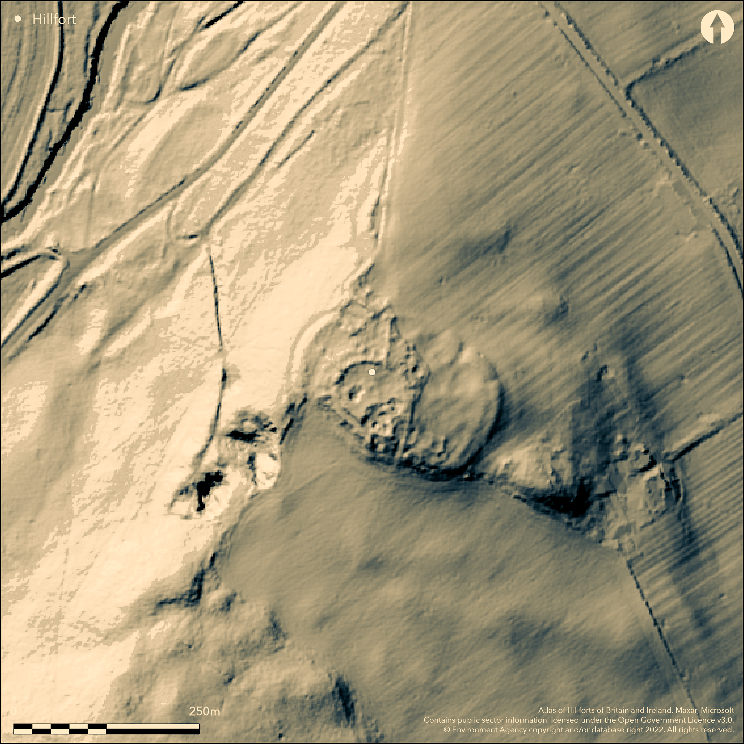
LiDAR 1m DTM Hillshade
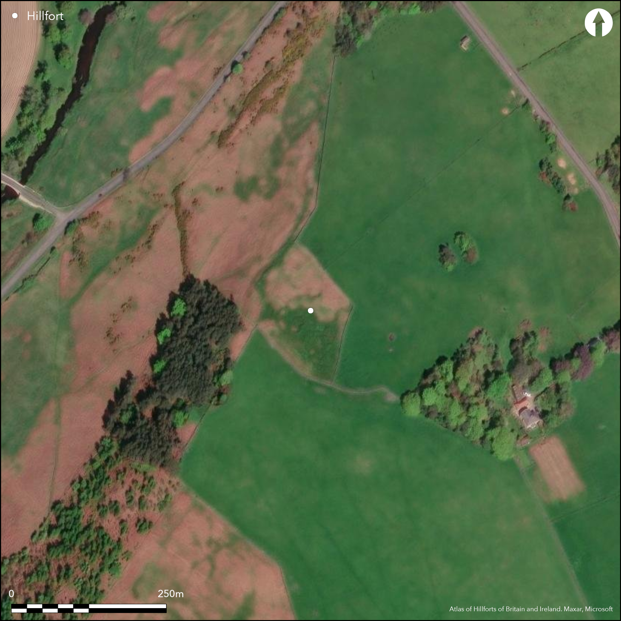
Satellite Imagery
LiDAR 1m DTM Hillshade
Satellite Imagery
Scroll left/right to view further images.
HER: Northumberland 3301 (None)
NMR: NU 02 NW 24 (5634)
SM: 1002907
NGR: NU 02125 29352
X: 402125 Y: 629352 (OSGB36)
Lying 250m to the SE of Weetwood Bridge, an enclosure described as a hillfort (Hogg 1979) but now difficult to discern on the ground. The site has been damaged by overlying Romano-British settlement, quarrying, farming, forestry and field walls. It lies at 120m OD on the summit of a spur. It was described by MacLauchlan in 1864 as being oval in form, with a small annex in the NW which was divided into compartments and a larger annex in the N and E. A plan of the site was drawn at that time which shows a single rampart. It was later described by both Hogg (1947) and Jobey (1964) as multivallate with two possible ditches, an interpretation confirmed by parchmarks on satellite imagery from 2006, which show fragments of ramparts and double ditches 3m in breadth and set 7m apart enclosing an area measuring up to 140m from ESE to WNW by 90m transversely, an area of about 1.2ha. Tate (1863-8) records a porphory quern, round manufactured stone balls and a stone trough being found there. Romano-British stone-founded huts and yards overlie the enclosure on the E side. The site shows well on 2006 Google Earth imagery. It is recorded on 1856-65 OS mapping. Minimal investigations, undated but presumed to have underlying Iron Age origins.
Citizen Science: ✗
Reliability of Data: Confirmed
Reliability of Interpretation: Confirmed
X: -219061 Y: 7470902 (EPSG: 3857)
Longitude: -1.9678623504199113 Latitude: 55.55788699401688 (EPSG:4326)
Country: England
Current County or Unitary Authority: Northumberland
Historic County: Northumberland
Current Parish/Community/Council/Townland: Chatton
Damaged by quarrying, farming, forestry, field walls overlying settlement and moderate stock erosion
| Extant | ✓ |
| Cropmark | ✗ |
| Likely Destroyed | ✗ |
None
| Woodland | ✗ |
| Commercial Forestry Plantation | ✗ |
| Parkland | ✗ |
| Pasture (Grazing) | ✓ |
| Arable | ✗ |
| Scrub/Bracken | ✗ |
| Bare Outcrop | ✗ |
| Heather/Moorland | ✗ |
| Heath | ✗ |
| Built-up | ✗ |
| Coastal Grassland | ✗ |
| Other | ✗ |
A contour fort lying on level ground at the summit of a spur at 120m OD
| Contour Fort | ✓ |
| Partial Contour Fort | ✗ |
| Promontory Fort | ✗ |
| Hillslope Fort | ✗ |
| Level Terrain Fort | ✗ |
| Marsh Fort | ✗ |
| Multiple Enclosure Fort | ✗ |
| Hilltop | ✓ |
| Coastal Promontory | ✗ |
| Inland Promontory | ✗ |
| Valley Bottom | ✗ |
| Knoll/Hillock/Outcrop | ✗ |
| Ridge | ✗ |
| Cliff/Plateau-edge/Scarp | ✗ |
| Hillslope | ✗ |
| Lowland | ✗ |
| Spur | ✓ |
Dominant Topographic Feature: Summit of a spur
| North | ✗ |
| Northeast | ✗ |
| East | ✗ |
| Southeast | ✗ |
| South | ✗ |
| Southwest | ✗ |
| West | ✓ |
| Northwest | ✗ |
| Level | ✗ |
Altitude: 120.0m
N/A
Undated but presumed Iron Age with overlying Romano-British settlement
Reliability: D - None
| Pre 1200BC | ✗ |
| 1200BC - 800BC | ✗ |
| 800BC - 400BC | ✗ |
| 400BC - AD50 | ✗ |
| AD50 - AD400 | ✗ |
| AD400 - AD 800 | ✗ |
| Post AD800 | ✗ |
| Unknown | ✓ |
| Pre Hillfort: | None |
| Post Hillfort: | Quarrying, forestry, field walls and overlying Romano-British settlement |
The site is recorded on 1856-65 OS mapping. A plan of Weetwood (Simonside) Camp was drawn by MacLauchlan in 1858. Mapped from aerial photographs as part of the Milfield Geoarchaeology Project - archive object MD000297. RCHME field visits in 1957 and 1969. Scheduled
| Earthwork Survey (1858): | None |
| 1st Identified Written Reference (1858): | None |
| Other (1957): | Field investigation |
| Other (1969): | Field investigation |
| 1st Identified Map Depiction (None): | None |
| Other (None): | Scheduled |
Romano-British stone-founded huts and yards overlie the enclosure on the eastern side. Surface finds of porphory quern, round manufactured stone balls and a stone trough
River Till lies to the NW
| None | ✓ |
| Spring | ✗ |
| Stream | ✗ |
| Pool | ✗ |
| Flush | ✗ |
| Well | ✗ |
| Other | ✗ |
None
| No Known Features | ✗ |
| Round Stone Structures | ✓ |
| Rectangular Stone Structures | ✗ |
| Curvilinear Platforms | ✗ |
| Other Roundhouse Evidence | ✗ |
| Pits | ✗ |
| Quarry Hollows | ✗ |
| Other | ✗ |
None
| No Known Excavation | ✓ |
| Pits | ✗ |
| Postholes | ✗ |
| Roundhouses | ✗ |
| Rectangular Structures | ✗ |
| Roads/Tracks | ✗ |
| Quarry Hollows | ✗ |
| Other | ✗ |
| Nothing Found | ✗ |
None
| No Known Geophysics | ✓ |
| Pits | ✗ |
| Roundhouses | ✗ |
| Rectangular Structures | ✗ |
| Roads/Tracks | ✗ |
| Quarry Hollows | ✗ |
| Other | ✗ |
| Nothing Found | ✗ |
Porphory quern, round manufactured stone balls and a stone trough
| No Known Finds | ✗ |
| Pottery | ✗ |
| Metal | ✗ |
| Metalworking | ✗ |
| Human Bones | ✗ |
| Animal Bones | ✗ |
| Lithics | ✗ |
| Environmental | ✗ |
| Other | ✓ |
None
| APs Not Checked | ✓ |
| None | ✗ |
| Roundhouses | ✗ |
| Rectangular Structures | ✗ |
| Pits | ✗ |
| Postholes | ✗ |
| Roads/Tracks | ✗ |
| Other | ✗ |
None recorded
| 1: | None |
| 2: | At least one entrance |
Guard Chambers: ✗
Chevaux de Frise: ✗
| 1. Simple Gap (South east): | Worn hollow showing as parchmark through the entrance |
Oval in form, enclosing 1.2ha, ramparts difficult to discern, but two ditches.
| Area 1: | 1.2ha. |
| Total: | 1.2ha. |
Total Footprint Area: 2.0ha.
None
| ✓ | Areas estimated. It is clear that there are enclosures overlying the main defences of the fort |
| ✓ | None |
| NE Quadrant: | 2 |
| SE Quadrant: | 2 |
| SW Quadrant: | 2 |
| NW Quadrant: | 2 |
| Total: | 2 |
| Partial Univallate | ✗ |
| Univallate | ✗ |
| Partial Bivallate | ✗ |
| Bivallate | ✓ |
| Partial Multivallate | ✗ |
| Multivallate | ✗ |
| Unknown | ✗ |
| Partial Univallate | ✗ |
| Univallate | ✗ |
| Partial Bivallate | ✗ |
| Bivallate | ✗ |
| Partial Multivallate | ✗ |
| Multivallate | ✗ |
None
| None | ✗ |
| Earthen Bank | ✓ |
| Stone Wall | ✗ |
| Rubble | ✗ |
| Wall-walk | ✗ |
| Evidence of Timber | ✗ |
| Vitrification | ✗ |
| Other Burning | ✗ |
| Palisade | ✗ |
| Counter Scarp Bank | ✗ |
| Berm | ✗ |
| Unfinished | ✗ |
| Other | ✗ |
None
| None | ✗ |
| Earthen Bank | ✗ |
| Stone Wall | ✗ |
| Murus Duplex | ✗ |
| Timber-framed | ✗ |
| Timber-laced | ✗ |
| Vitrification | ✗ |
| Other Burning | ✗ |
| Palisade | ✗ |
| Counter Scarp Bank | ✗ |
| Berm | ✗ |
| Unfinished | ✗ |
| No Known Excavation | ✓ |
| Other | ✗ |
| ✗ | None |
| ✓ | It has the appearance of two ditches on GE satellite imagery 2006 |
Number of Ditches: 2
| ✓ | Small annex described by Maclauchlan on the NW divided into compartments and a larger annex in the N and E, but he may have misunderstood elements of the underlying fort and overlying enclosures. |
Hogg, A.H.A.1979. British Hill-Forts. An Index. British Archaeological Reports, British Series 62
Hogg A.H.A. 1947, A new list of the native sites of Northumberland, Proc Soc Antiq Newcastle (4th Series) vol.11. 158
Jobey G. 1964, Enclosed stone built settlements in north Northumberland, Archaeol Aeliana (4th Series) vol. 42. 52 & 63
MacLauchlan, H. 1864. Memoir Written During a Survey of the Eastern Branch of Watling Street (London), 41-2
Tate, G. 1863-68. Hist Berwickshire Natur Club 5, 154-5
Atlas of Hillforts:
Wikidata:
This work is licensed under CC BY-SA 4.0

 and should be cited as:
Lock, Gary and Ralston, Ian. 2024. Atlas of Hillforts of Britain and Ireland. Available at: https://hillforts.arch.ox.ac.uk
Document Version 1.1