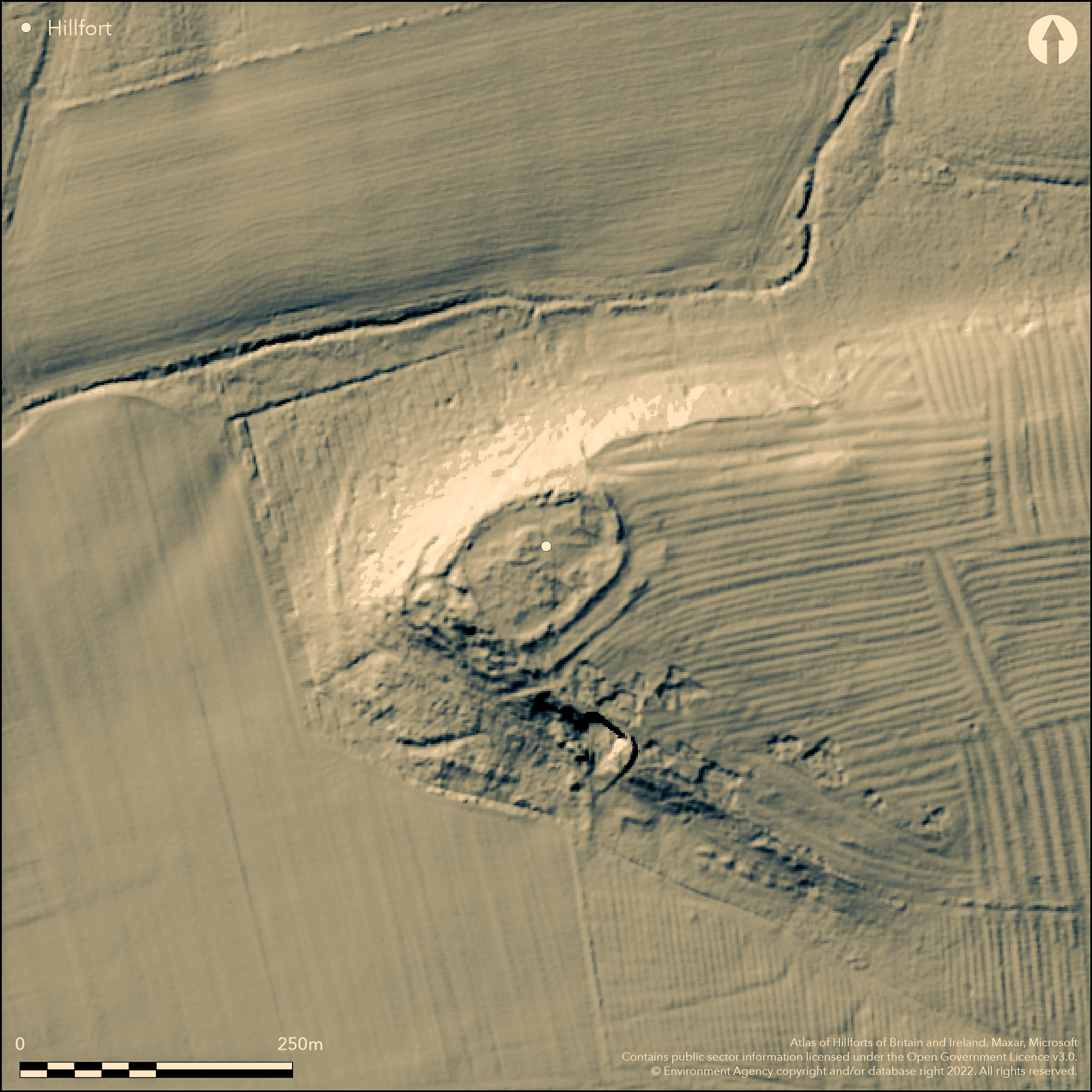
LiDAR 1m DTM Hillshade
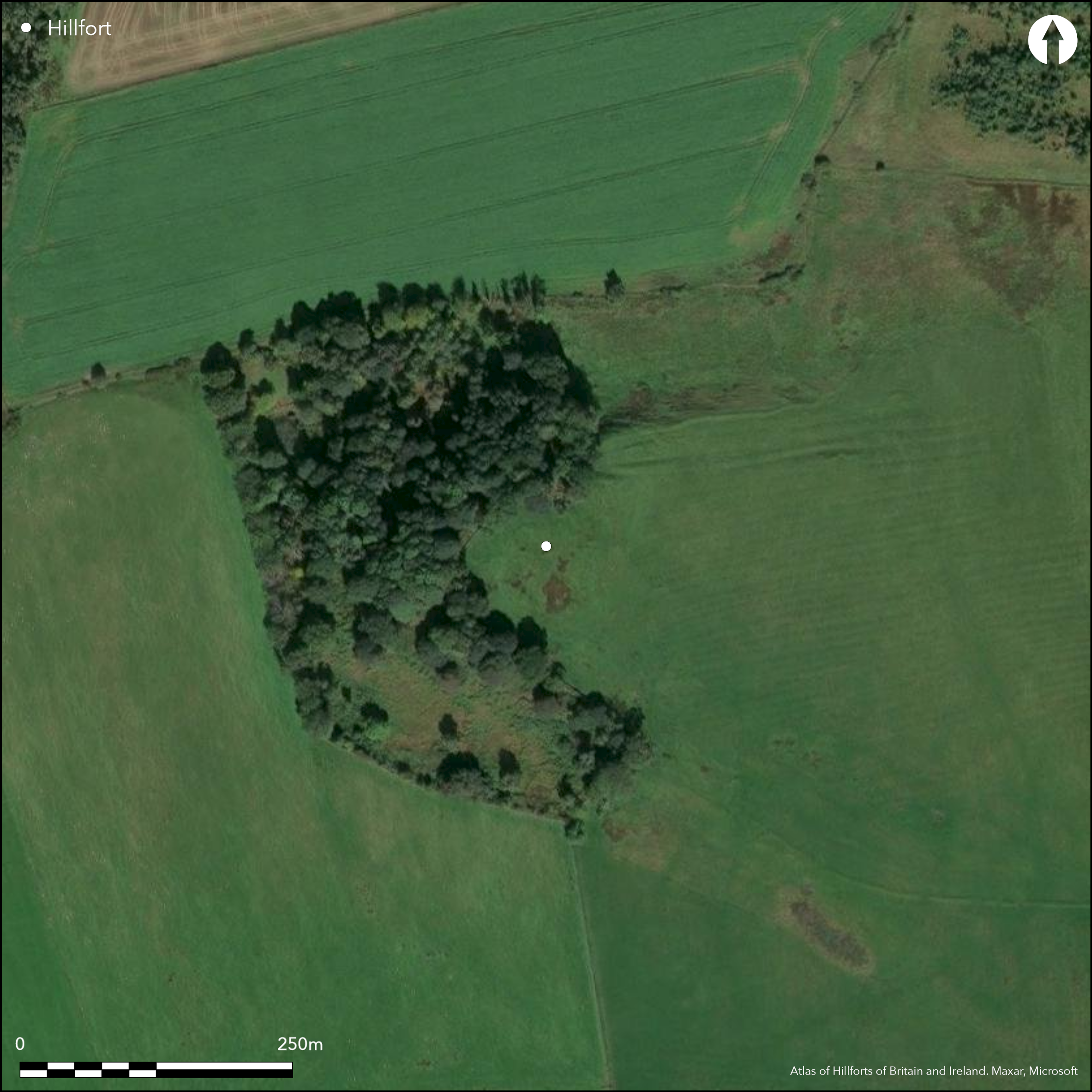
Satellite Imagery
LiDAR 1m DTM Hillshade
Satellite Imagery
Scroll left/right to view further images.
HER: Northumberland 10579 (None)
NMR: NZ 08 SE 14 (21056)
SM: 1011838
NGR: NZ 07292 82819
X: 407292 Y: 582819 (OSGB36)
Lying 430m to the NE of Bolam West Houses a multiperiod site comprising a palisaded enclosure, an Iron Age defended settlement or hillfort and a later Roman period metalworking site. It lies at 157m OD on a promontory above the tributary of the River Wansbeck and is defended in the N and W by steep slopes. Four phases of occupation have been identified beginning around the 6th century BC with a palisaded enclosure of three concentric oak palisades (Jobey 1968). Overlying this an oval enclosure 94m NE-SW by 72m transversely enclosed by two stone-faced ramparts, approximately 0.5ha, the inner measuring 4m wide and 0.8m high, the outer, separated from the inner rampart by 10m, visible only on the S and E sides. Outside the ramparts a shallow depression represents the remains of a ditch. A 5m wide entrance lies in the E side the inner rampart. Internally, roundhouses and walled enclosures represent secondary, Romano-British activity. Iron slag and a possible iron workers hearth have been used to interpret this as a 2nd century iron working site. One rectangular and two sub-rectangular buildings have been interpreted as post Roman houses. An investigation in 1967 to take samples for radiocarbon dating from a palisade trench to the W of the gateway demonstrated that the palisaded perimeter had been replaced almost immediately after burning, and on the same circuit, by the walled enclosure (Jobey, 1968). The dating from oak charcoal from the burnt palisade gave a date of 780-400BC. It is recorded on 1856-65 OS mapping and was excavated between 1955 and 1957 (Jobey 1959). Finds from excavations suggest the site was occupied into the late 5th-early 6th century AD (Thomas 1959). Scheduled
Citizen Science: ✗
Reliability of Data: Confirmed
Reliability of Interpretation: Confirmed
X: -210076 Y: 7389027 (EPSG: 3857)
Longitude: -1.8871439475960325 Latitude: 55.13970163520349 (EPSG:4326)
Country: England; None
Current County or Unitary Authority: Northumberland
Historic County: Northumberland
Current Parish/Community/Council/Townland: Belsay; Wallington Demesne
Heritage at Risk Register - vulnerable from ploughing
| Extant | ✓ |
| Cropmark | ✗ |
| Likely Destroyed | ✗ |
None
| Woodland | ✓ |
| Commercial Forestry Plantation | ✗ |
| Parkland | ✗ |
| Pasture (Grazing) | ✗ |
| Arable | ✓ |
| Scrub/Bracken | ✗ |
| Bare Outcrop | ✗ |
| Heather/Moorland | ✗ |
| Heath | ✗ |
| Built-up | ✗ |
| Coastal Grassland | ✗ |
| Other | ✗ |
Possible contour fort lying at 157m OD on an inland promontory
| Contour Fort | ✓ |
| Partial Contour Fort | ✗ |
| Promontory Fort | ✗ |
| Hillslope Fort | ✗ |
| Level Terrain Fort | ✗ |
| Marsh Fort | ✗ |
| Multiple Enclosure Fort | ✗ |
| Hilltop | ✓ |
| Coastal Promontory | ✗ |
| Inland Promontory | ✓ |
| Valley Bottom | ✗ |
| Knoll/Hillock/Outcrop | ✗ |
| Ridge | ✗ |
| Cliff/Plateau-edge/Scarp | ✗ |
| Hillslope | ✗ |
| Lowland | ✗ |
| Spur | ✗ |
Dominant Topographic Feature: Inland promontory
| North | ✗ |
| Northeast | ✗ |
| East | ✗ |
| Southeast | ✗ |
| South | ✗ |
| Southwest | ✗ |
| West | ✗ |
| Northwest | ✓ |
| Level | ✗ |
Altitude: 157.0m
Parish boundary between Belsay and Wallington Demesne runs approximately 70m to the N
Boundary Type: Parish/Townland
Multiperiod site. Palisade dated from trunkwood oak charcoal from burnt palisade 780-400 cal BC. Roman period activity represented by coin of AD119, Samian ware and sherds of Romano-British coarse pottery from 2nd to 4th century in date. Some post-Roman sherds (late 5th or early 6th century)
Reliability: B - Medium
| Pre 1200BC | ✗ |
| 1200BC - 800BC | ✗ |
| 800BC - 400BC | ✓ |
| 400BC - AD50 | ✓ |
| AD50 - AD400 | ✓ |
| AD400 - AD 800 | ✗ |
| Post AD800 | ✗ |
| Unknown | ✗ |
| Pre Hillfort: | None |
| Post Hillfort: | None |
| Artefactual: | Thomas (1959) |
| C14: | Jobey (1968) |
Excavation between 1955-57 (Jobey 1959). Field investigation in 1968. Scheduled.
| 1st Identified Written Reference (1959): | Jobey (1959) |
| Other (1968): | Field investigation |
| Other (1995): | Scheduled |
| 1st Identified Map Depiction (None): | None |
| Excavation (None): | None |
Roundhouses and walled enclosures represent secondary, Romano-British activity. Iron workers hearth. Coin of AD 119, Samian ware and Romano-British coarse pottery c. 2nd to 4th century. Some post-Roman sherds (late 5th or early 6th century). Iron slag
Tributary of the River Wansbeck to the N
| None | ✓ |
| Spring | ✗ |
| Stream | ✗ |
| Pool | ✗ |
| Flush | ✗ |
| Well | ✗ |
| Other | ✗ |
Walled enclosures. One rectangular and two sub-rectangular buildings interpreted as post Roman houses
| No Known Features | ✗ |
| Round Stone Structures | ✓ |
| Rectangular Stone Structures | ✓ |
| Curvilinear Platforms | ✗ |
| Other Roundhouse Evidence | ✗ |
| Pits | ✗ |
| Quarry Hollows | ✗ |
| Other | ✓ |
None
| No Known Excavation | ✗ |
| Pits | ✗ |
| Postholes | ✗ |
| Roundhouses | ✓ |
| Rectangular Structures | ✓ |
| Roads/Tracks | ✗ |
| Quarry Hollows | ✗ |
| Other | ✗ |
| Nothing Found | ✗ |
None
| No Known Geophysics | ✓ |
| Pits | ✗ |
| Roundhouses | ✗ |
| Rectangular Structures | ✗ |
| Roads/Tracks | ✗ |
| Quarry Hollows | ✗ |
| Other | ✗ |
| Nothing Found | ✗ |
Coin of AD 119, Samian ware and Romano-British coarse pottery c. 2nd to 4th century. Some post-Roman sherds (late 5th or early 6th century). Iron slag
| No Known Finds | ✗ |
| Pottery | ✓ |
| Metal | ✗ |
| Metalworking | ✓ |
| Human Bones | ✗ |
| Animal Bones | ✗ |
| Lithics | ✗ |
| Environmental | ✗ |
| Other | ✓ |
None
| APs Not Checked | ✓ |
| None | ✗ |
| Roundhouses | ✗ |
| Rectangular Structures | ✗ |
| Pits | ✗ |
| Postholes | ✗ |
| Roads/Tracks | ✗ |
| Other | ✗ |
5m wide simple gap entrance in the E
| 1: | None |
| 2: | None |
Guard Chambers: ✗
Chevaux de Frise: ✗
| 1. Simple Gap (East): | Inner rampart |
6th century BC palisaded enclosure of three concentric oak palisades (Jobey 1968). Overlying this an oval enclosure 94m NE-SW by 72m transversely enclosed by two stone-faced ramparts, the inner measuring 4m wide and 0.8m high, the outer, separated from the inner rampart by 10m, visible only on the S and E sides. Outside the ramparts a shallow depression represents the remains of a ditch.
| Area 1: | 0.5ha. |
| Total: | 0.5ha. |
Total Footprint Area: Noneha.
None
| ✓ | None |
| ✓ | Inner rampart only visible in the S and E |
| NE Quadrant: | 1 |
| SE Quadrant: | 2 |
| SW Quadrant: | 1 |
| NW Quadrant: | 1 |
| Total: | 2 |
| Partial Univallate | ✓ |
| Univallate | ✗ |
| Partial Bivallate | ✓ |
| Bivallate | ✗ |
| Partial Multivallate | ✗ |
| Multivallate | ✗ |
| Unknown | ✗ |
| Partial Univallate | ✗ |
| Univallate | ✓ |
| Partial Bivallate | ✗ |
| Bivallate | ✓ |
| Partial Multivallate | ✗ |
| Multivallate | ✗ |
None
| None | ✗ |
| Earthen Bank | ✗ |
| Stone Wall | ✓ |
| Rubble | ✗ |
| Wall-walk | ✗ |
| Evidence of Timber | ✗ |
| Vitrification | ✗ |
| Other Burning | ✗ |
| Palisade | ✗ |
| Counter Scarp Bank | ✗ |
| Berm | ✗ |
| Unfinished | ✗ |
| Other | ✗ |
None
| None | ✗ |
| Earthen Bank | ✗ |
| Stone Wall | ✓ |
| Murus Duplex | ✗ |
| Timber-framed | ✗ |
| Timber-laced | ✗ |
| Vitrification | ✗ |
| Other Burning | ✓ |
| Palisade | ✓ |
| Counter Scarp Bank | ✗ |
| Berm | ✗ |
| Unfinished | ✗ |
| No Known Excavation | ✗ |
| Other | ✗ |
| ✗ | None |
| ✓ | None |
Number of Ditches: 1
| ✗ | None |
Jobey, G. 1959. Excavations At The Native Settlement At Huckhoe. Archaeol Aeliana 4 ser 37, 217-78
Jobey, G. 1968. A Radiocarbon Date For The Palisaded Settlement At Huckhoe. Archaeol Aeliana 4 ser 46,
Thomas, C . 1959. Wheel Made Post-Roman Sherd. Archaeol Aeliana 4 ser 37, 258-61
Atlas of Hillforts:
Wikidata:
This work is licensed under CC BY-SA 4.0

 and should be cited as:
Lock, Gary and Ralston, Ian. 2024. Atlas of Hillforts of Britain and Ireland. Available at: https://hillforts.arch.ox.ac.uk
Document Version 1.1