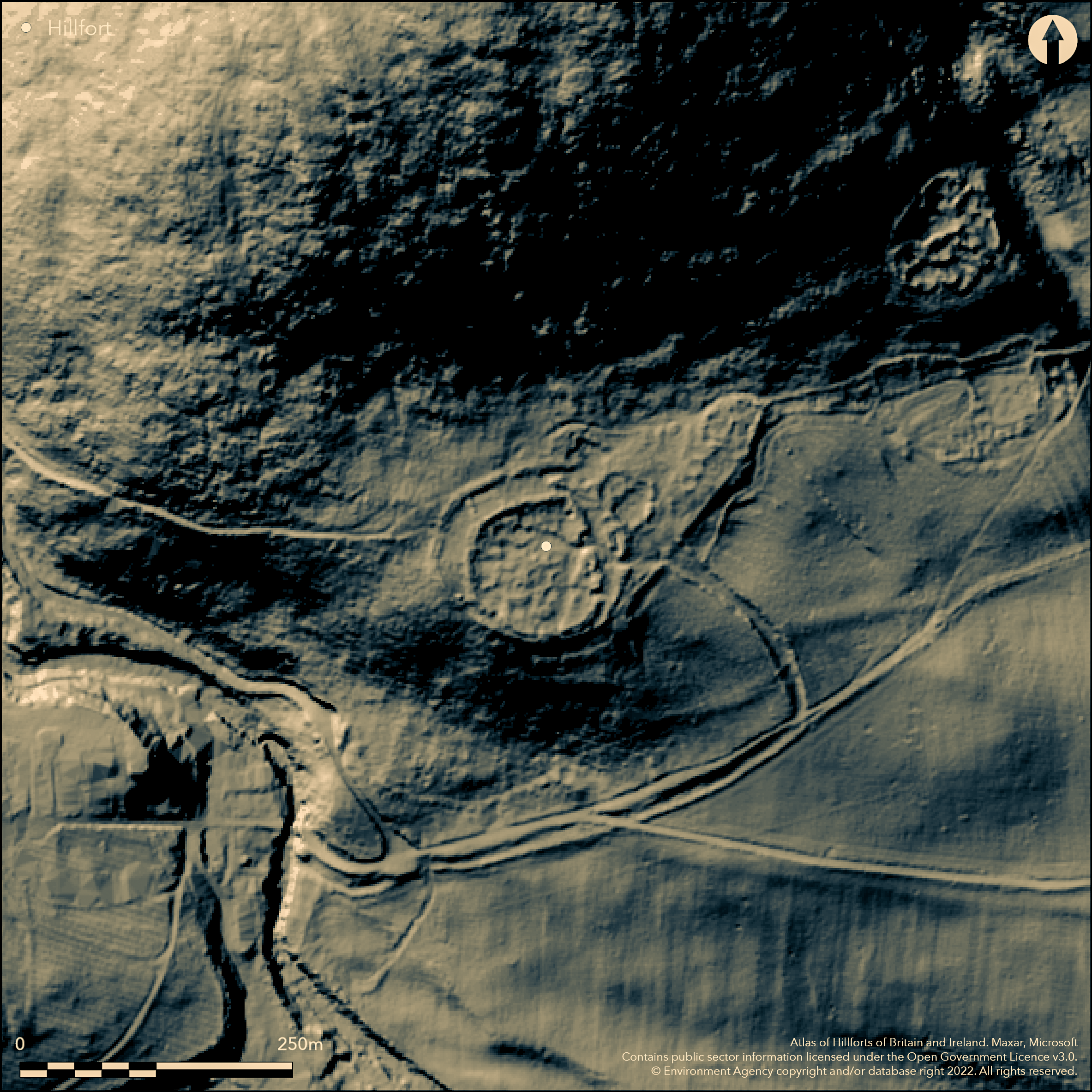
LiDAR 1m DTM Hillshade
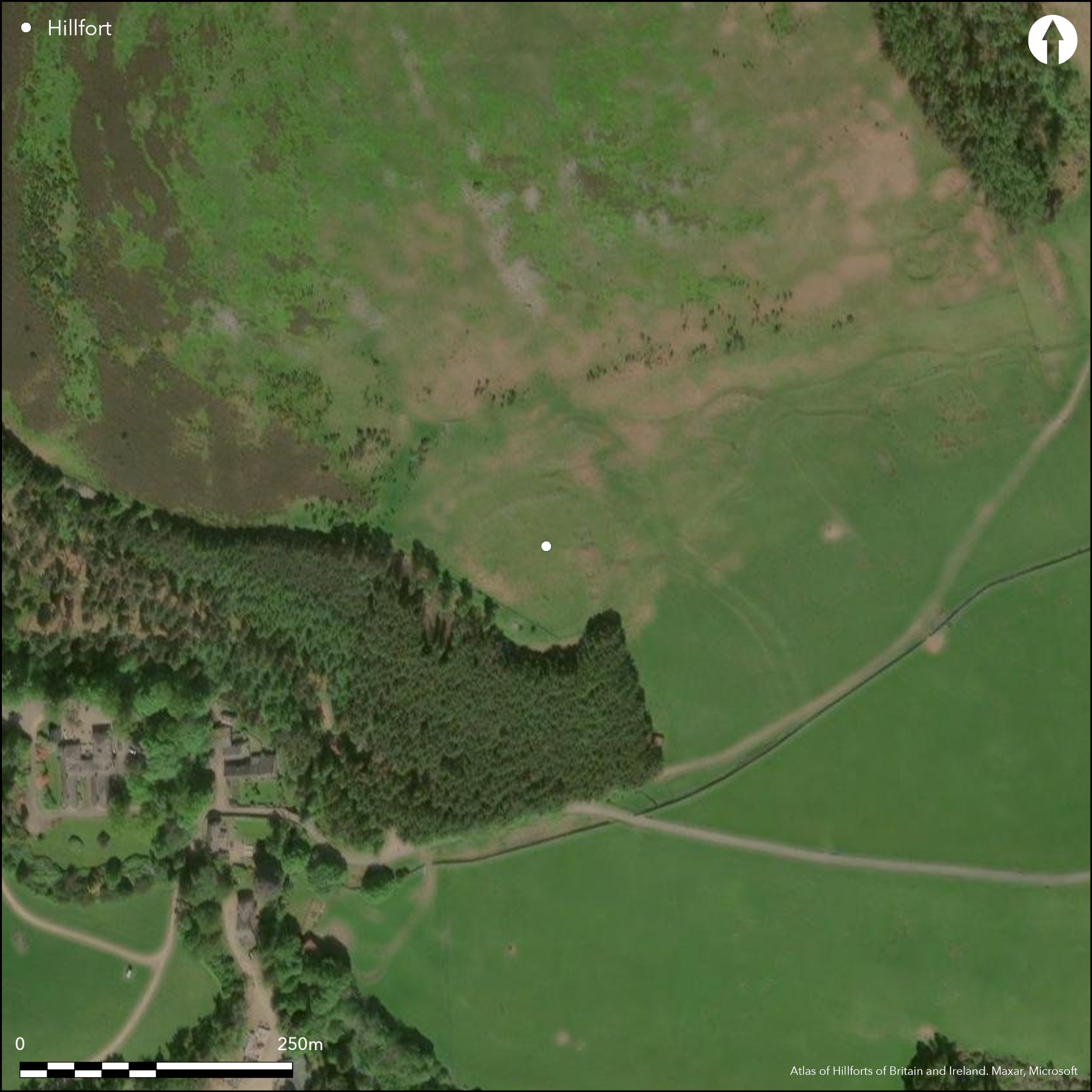
Satellite Imagery
LiDAR 1m DTM Hillshade
Satellite Imagery
Scroll left/right to view further images.
HER: Northumberland 1254 (None)
NMR: NT 91 NE 1 (1917)
SM: 1006588
NGR: NT 96530 16374
X: 396530 Y: 616374 (OSGB36)
Lying 180m to the NE of Linhope on an elevated spur to the S of the summit of Greaves Ash, a complex of Iron Age and Romano-British settlements, including the bivallate hillfort of Greaves Ash Camp. The hillfort lies to the W of the later settlement to which it is linked by a series of trackways and field systems. It overlies and partially destroys an earlier sub-oval enclosure. The bivallate fort is almost circular in plan with two concentric ramparts formed from parallel rows of boulders with rubble infill approximately 70m and 100m in diameter. The inner rampart measures 2.10m wide and 1.7m high and the more massive outer rampart 3.65m wide and 1.10m wide. Within the rampart core, transverse courses of stone provide greater structural stability to the rubble core of the rampart (Tate 1862, 295-6). No evidence of ditches. The NE extremity of the spur has been utilised to form a triangular annex enclosed by a single rampart of similar but slighter construction to the hillfort. Within this is a smaller sub-circular enclosure in the W. An enclosed settlement of four huts utilises the NE rampart of the annex. The outer rampart cuts through the earlier enclosed settlement in the NNE. The ramparts are separated by a berm up to 14.0m wide in places which has been sub-divided by small radial banks/walls. A small sub-oval enclosure overlies the outer rampart in the E. Internally 18 roundhouses were recorded during excavations in 1861 ranging from 3.3m to 8.2m in diameter with crudely faced walls up to 2m wide and 0.9 high and entrances facing E (Tate 1862, 313). The largest of these produced a fragment from a 2nd-4th century AD Roman glass bangle (Hope-Dodds 1935, 31). Querns were also recovered. The most probable entrance lies in the SE where a sunken trackway leads up to the hillfort. Recorded on 1856-65 OS mapping. Scheduled
Citizen Science: ✗
Reliability of Data: Confirmed
Reliability of Interpretation: Confirmed
X: -228917 Y: 7447982 (EPSG: 3857)
Longitude: -2.056394486434631 Latitude: 55.441263090008796 (EPSG:4326)
Country: England
Current County or Unitary Authority: Northumberland
Historic County: Northumberland
Current Parish/Community/Council/Townland: Ingram
None
| Extant | ✓ |
| Cropmark | ✗ |
| Likely Destroyed | ✗ |
None
| Woodland | ✗ |
| Commercial Forestry Plantation | ✗ |
| Parkland | ✗ |
| Pasture (Grazing) | ✓ |
| Arable | ✗ |
| Scrub/Bracken | ✗ |
| Bare Outcrop | ✗ |
| Heather/Moorland | ✓ |
| Heath | ✗ |
| Built-up | ✗ |
| Coastal Grassland | ✗ |
| Other | ✗ |
On a S-facing slope to the S of the summit of Greaves Ash a hillslope fort lying at approximately 272m OD
| Contour Fort | ✗ |
| Partial Contour Fort | ✗ |
| Promontory Fort | ✗ |
| Hillslope Fort | ✓ |
| Level Terrain Fort | ✗ |
| Marsh Fort | ✗ |
| Multiple Enclosure Fort | ✓ |
| Hilltop | ✗ |
| Coastal Promontory | ✗ |
| Inland Promontory | ✗ |
| Valley Bottom | ✗ |
| Knoll/Hillock/Outcrop | ✗ |
| Ridge | ✗ |
| Cliff/Plateau-edge/Scarp | ✗ |
| Hillslope | ✓ |
| Lowland | ✗ |
| Spur | ✓ |
Dominant Topographic Feature: S of the summit of Greaves Ash
| North | ✗ |
| Northeast | ✗ |
| East | ✗ |
| Southeast | ✗ |
| South | ✓ |
| Southwest | ✗ |
| West | ✗ |
| Northwest | ✗ |
| Level | ✗ |
Altitude: 272.0m
N/A
Undated, but based on morphology and its relationship to other features is probably Iron Age with later settlement
Reliability: D - None
| Pre 1200BC | ✗ |
| 1200BC - 800BC | ✗ |
| 800BC - 400BC | ✗ |
| 400BC - AD50 | ✗ |
| AD50 - AD400 | ✗ |
| AD400 - AD 800 | ✗ |
| Post AD800 | ✗ |
| Unknown | ✓ |
| Pre Hillfort: | Outer rampart cuts through the earlier enclosed settlement in the NNE. |
| Post Hillfort: | Overlying, probable Romano-British settlement |
| Artefactual: | Querns and fragment from a Romano-British glass bangle |
| Morphology/Earthwork/Typology: | None |
Recorded on 1856-65 OS mapping. Excavations by the Berwickshire Naturalists Club (Tate 1856-62) OS Archaeology Division Field Investigations in 1957, 1969 and 1976, RCHME survey for the SE Cheviots Project in 1986, ref. no. 662366. Scheduled
| Other (1957): | Field investigation |
| Other (1969): | Field investigation |
| None (1976): | Field investigation |
| Earthwork Survey (1986): | SE Cheviots Project |
| Excavation (None): | None |
| 1st Identified Map Depiction (None): | None |
| Other (None): | Scheduled |
A well was recorded during the 19th century excavations but could not be located during a later survey and was possibly destroyed by forestation
Waterfall, river and burn lie in the vicinity
| None | ✓ |
| Spring | ✗ |
| Stream | ✗ |
| Pool | ✗ |
| Flush | ✗ |
| Well | ✓ |
| Other | ✗ |
None
| No Known Features | ✗ |
| Round Stone Structures | ✓ |
| Rectangular Stone Structures | ✗ |
| Curvilinear Platforms | ✗ |
| Other Roundhouse Evidence | ✗ |
| Pits | ✗ |
| Quarry Hollows | ✗ |
| Other | ✗ |
None
| No Known Excavation | ✗ |
| Pits | ✗ |
| Postholes | ✗ |
| Roundhouses | ✓ |
| Rectangular Structures | ✗ |
| Roads/Tracks | ✗ |
| Quarry Hollows | ✗ |
| Other | ✗ |
| Nothing Found | ✗ |
None
| No Known Geophysics | ✓ |
| Pits | ✗ |
| Roundhouses | ✗ |
| Rectangular Structures | ✗ |
| Roads/Tracks | ✗ |
| Quarry Hollows | ✗ |
| Other | ✗ |
| Nothing Found | ✗ |
Fragment of a glass 'armlet'; three quernstones, red deer bone and antler
| No Known Finds | ✗ |
| Pottery | ✓ |
| Metal | ✗ |
| Metalworking | ✗ |
| Human Bones | ✗ |
| Animal Bones | ✓ |
| Lithics | ✗ |
| Environmental | ✗ |
| Other | ✓ |
None
| APs Not Checked | ✓ |
| None | ✗ |
| Roundhouses | ✗ |
| Rectangular Structures | ✗ |
| Pits | ✗ |
| Postholes | ✗ |
| Roads/Tracks | ✗ |
| Other | ✗ |
The most probable entrance lies in the SE where a sunken trackway leads up to the hillfort
| 1: | None |
| 2: | None |
Guard Chambers: ✗
Chevaux de Frise: ✗
| 1. Simple Gap (South east): | None |
Almost circular in plan with two concentric ramparts formed from parallel rows of boulders with rubble infill approximately 70m and 100m in diameter. The inner rampart measures 2.10m wide and 1.7m high and the more massive outer rampart 3.65m wide and 1.10m wide. Within the rampart core, transverse courses of stone provide greater structural stability to the rubble core of the rampart (Tate 1862, 295-6). No evidence of ditches.
| Area 1: | 0.28ha. |
| Total: | 0.28ha. |
Total Footprint Area: Noneha.
None
| ✗ | None |
| ✓ | None |
| NE Quadrant: | 2 |
| SE Quadrant: | 2 |
| SW Quadrant: | 2 |
| NW Quadrant: | 2 |
| Total: | 2 |
| Partial Univallate | ✗ |
| Univallate | ✗ |
| Partial Bivallate | ✗ |
| Bivallate | ✓ |
| Partial Multivallate | ✗ |
| Multivallate | ✗ |
| Unknown | ✗ |
| Partial Univallate | ✗ |
| Univallate | ✗ |
| Partial Bivallate | ✗ |
| Bivallate | ✗ |
| Partial Multivallate | ✗ |
| Multivallate | ✗ |
Boulders and rubble
| None | ✗ |
| Earthen Bank | ✗ |
| Stone Wall | ✓ |
| Rubble | ✓ |
| Wall-walk | ✗ |
| Evidence of Timber | ✗ |
| Vitrification | ✗ |
| Other Burning | ✗ |
| Palisade | ✗ |
| Counter Scarp Bank | ✗ |
| Berm | ✓ |
| Unfinished | ✗ |
| Other | ✗ |
Transverse courses of stone wthin the core
| None | ✗ |
| Earthen Bank | ✗ |
| Stone Wall | ✗ |
| Murus Duplex | ✗ |
| Timber-framed | ✗ |
| Timber-laced | ✗ |
| Vitrification | ✗ |
| Other Burning | ✗ |
| Palisade | ✗ |
| Counter Scarp Bank | ✗ |
| Berm | ✗ |
| Unfinished | ✗ |
| No Known Excavation | ✗ |
| Other | ✓ |
| ✗ | None |
| ✗ | None |
Number of Ditches: None
| ✓ | The NE extremity of the spur has been utilised to form a triangular annex enclosed by a single rampart of similar but slighter construction to the hillfort within which is a smaller subcircular enclosure in the W. |
Dodds, M.H. 1940. A History of Northumberland, Volume 15 (Newcastle upon Tyne), 56. 31-64
Jobey, G. 1965. Hillforts and Settlements in Northumberland. Archaeol Aeliana (4th Series) 43
Oswald, A. Ainsworth, S. and Pearson, T 2006 Hillforts: Prehistoric Strongholds of Northumberland National Park. English Heritage
Topping, P. and Pearson, T. 1988. The South-East Cheviots Project: A Descriptive Account of the Prehistoric Landscape. Research Department Report Series no. 83-2003
Tate, G. 1856-62. On the old Celtic town at Greaves Ash, near Linhope, Northumberland, with an account of diggings recently made into this and other ancient remains in the valley of Beamish. Berwickshire Natur. Club, iv. 292-316;
Atlas of Hillforts:
Wikidata:
This work is licensed under CC BY-SA 4.0

 and should be cited as:
Lock, Gary and Ralston, Ian. 2024. Atlas of Hillforts of Britain and Ireland. Available at: https://hillforts.arch.ox.ac.uk
Document Version 1.1