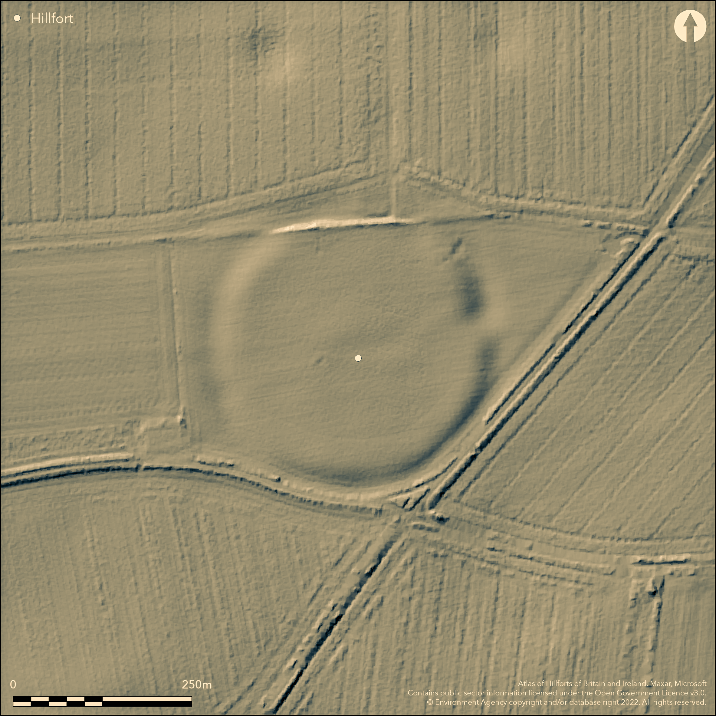
LiDAR 1m DTM Hillshade
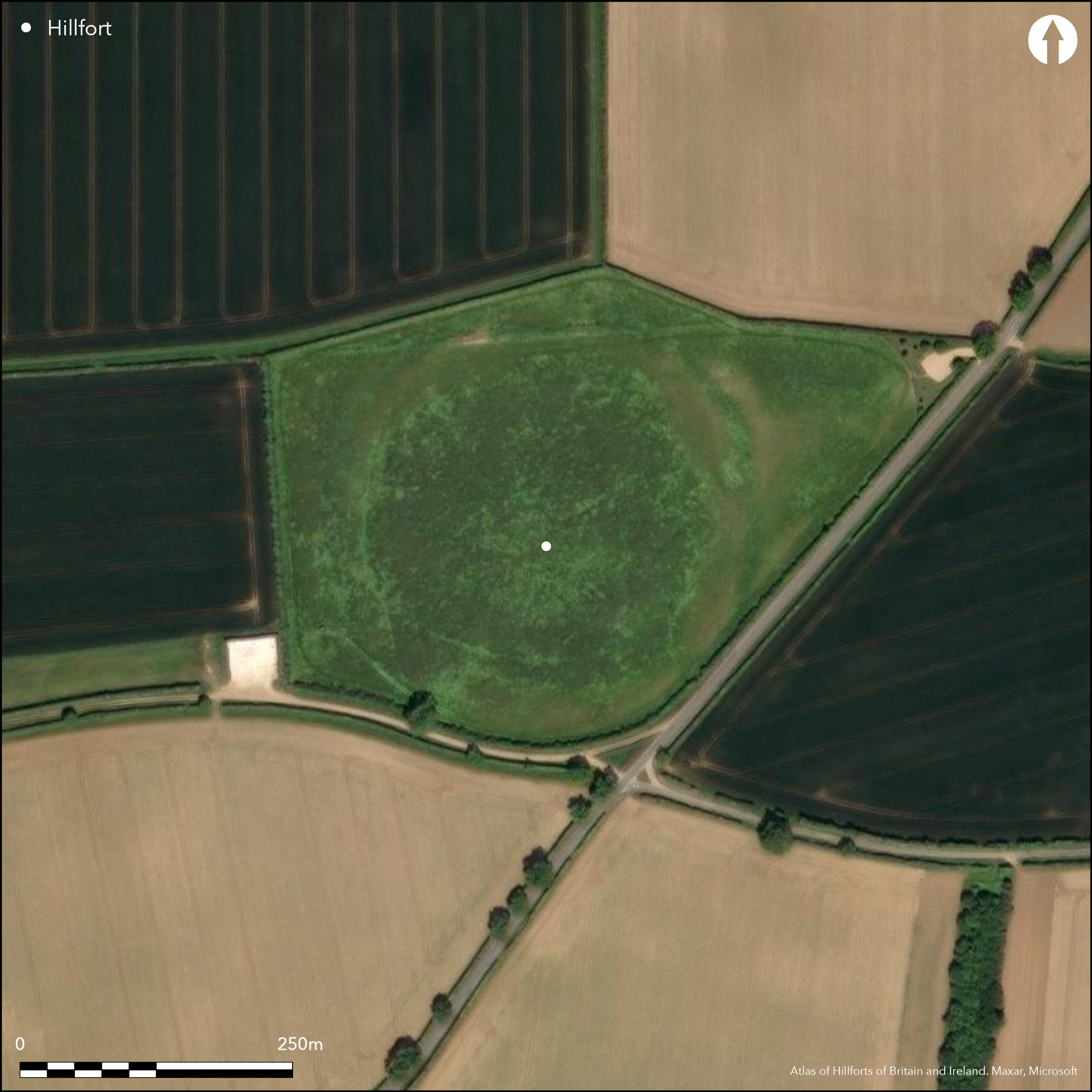
Satellite Imagery
LiDAR 1m DTM Hillshade
Satellite Imagery
Scroll left/right to view further images.
HER: Norfolk 1910 (None)
NMR: TF 8 3 NW 7 (358321)
SM: 1018342
NGR: TF 8482 3525
X: 584830 Y: 335250 (OSGB36)
Located SW of South Creake on plateau end overlooking the valley of the River Burn with good views in all directions. Recorded on a map of 1797, earthworks were levelled in the 19th century, now ploughed but visible on aerial photographs (Rickett 1991). On 1st Ed OS map (1885-1900). A sub-circular enclosure measuring about 200m diameter, enclosing 3.5ha. A single bank and ditch, bank now survives as a slight rise of earth and flint rubble, the ditch to a maximum of 1.4m depth and 22m wide on the E. A single entrance at the NE, might be in-turned, shows on aerial photographs and earthwork survey, two small other possible entrances to N. Excavation (Penn 2006) shows ditch to be re-cut after primary silting, C14 date from silting of 400-170 cal BC. In the interior a pit contained Iron Age pottery and daub. On the highest point in the interior is a circular inner enclosure, c.45m diameter, shown by aerial photography, with two 'antennae' ditches. Geophysics and excavation (Penn 2006) showed the inner ditch to be V-shaped, 5m wide and 3m deep with Iron Age pottery in its fill and with an internal bank. The relationship between the inner enclosure and the hillfort is unclear although both are probably Iron Age. Surface finds of Iron Age pottery, flints, a fragment of human skull and Roman coins.
Citizen Science: ✗
Reliability of Data: Confirmed
Reliability of Interpretation: Confirmed
X: 82989 Y: 6961370 (EPSG: 3857)
Longitude: 0.7455023537083548 Latitude: 52.882916114063974 (EPSG:4326)
Country: England
Current County or Unitary Authority: Norfolk
Historic County: Norfolk
Current Parish/Community/Council/Townland: South Creake
None
| Extant | ✗ |
| Cropmark | ✓ |
| Likely Destroyed | ✗ |
None
| Woodland | ✗ |
| Commercial Forestry Plantation | ✗ |
| Parkland | ✗ |
| Pasture (Grazing) | ✗ |
| Arable | ✓ |
| Scrub/Bracken | ✗ |
| Bare Outcrop | ✗ |
| Heather/Moorland | ✗ |
| Heath | ✗ |
| Built-up | ✗ |
| Coastal Grassland | ✗ |
| Other | ✗ |
A partial contour fort on plateau end overlooking a river valley, sloping to SW.
| Contour Fort | ✗ |
| Partial Contour Fort | ✓ |
| Promontory Fort | ✗ |
| Hillslope Fort | ✗ |
| Level Terrain Fort | ✗ |
| Marsh Fort | ✗ |
| Multiple Enclosure Fort | ✗ |
| Hilltop | ✗ |
| Coastal Promontory | ✗ |
| Inland Promontory | ✗ |
| Valley Bottom | ✗ |
| Knoll/Hillock/Outcrop | ✗ |
| Ridge | ✗ |
| Cliff/Plateau-edge/Scarp | ✓ |
| Hillslope | ✗ |
| Lowland | ✗ |
| Spur | ✗ |
Dominant Topographic Feature: on hilltop overlooking a river valley.
| North | ✗ |
| Northeast | ✗ |
| East | ✗ |
| Southeast | ✗ |
| South | ✗ |
| Southwest | ✓ |
| West | ✗ |
| Northwest | ✗ |
| Level | ✗ |
Altitude: 61.0m
N/A
Dated by pottery from excavation, one C14 date. Roman coins from surface.
Reliability: B - Medium
| Pre 1200BC | ✗ |
| 1200BC - 800BC | ✗ |
| 800BC - 400BC | ✗ |
| 400BC - AD50 | ✓ |
| AD50 - AD400 | ✗ |
| AD400 - AD 800 | ✗ |
| Post AD800 | ✗ |
| Unknown | ✗ |
| Pre Hillfort: | None |
| Post Hillfort: | None |
| Artefactual: | None |
| C14: | None |
In Aubrey's Monumenta Britannica (1665-1693). Shown on Faden's map of 1973, on 1st Ed OS map (1885-1900). Earthwork survey in 1973. Geophysics and excavation in 2003 (Penn 2006). Aerial photographs (HER).
| 1st Identified Map Depiction (1797): | None |
| Earthwork Survey (1973): | None |
| Geophysical Survey (2003): | None |
| Excavation (2003): | None |
| 1st Identified Written Reference (None): | None |
Geophysics shows pits and an internal enclosure, confirmed by excavation. Excavated finds of pottery, surface finds of flints, a fragment of human skull and Roman coins.
None
| None | ✓ |
| Spring | ✗ |
| Stream | ✗ |
| Pool | ✗ |
| Flush | ✗ |
| Well | ✗ |
| Other | ✗ |
None
| No Known Features | ✓ |
| Round Stone Structures | ✗ |
| Rectangular Stone Structures | ✗ |
| Curvilinear Platforms | ✗ |
| Other Roundhouse Evidence | ✗ |
| Pits | ✗ |
| Quarry Hollows | ✗ |
| Other | ✗ |
None
| No Known Excavation | ✗ |
| Pits | ✓ |
| Postholes | ✗ |
| Roundhouses | ✗ |
| Rectangular Structures | ✗ |
| Roads/Tracks | ✗ |
| Quarry Hollows | ✗ |
| Other | ✓ |
| Nothing Found | ✗ |
None
| No Known Geophysics | ✗ |
| Pits | ✓ |
| Roundhouses | ✗ |
| Rectangular Structures | ✗ |
| Roads/Tracks | ✗ |
| Quarry Hollows | ✗ |
| Other | ✓ |
| Nothing Found | ✗ |
None
| No Known Finds | ✗ |
| Pottery | ✓ |
| Metal | ✗ |
| Metalworking | ✗ |
| Human Bones | ✓ |
| Animal Bones | ✓ |
| Lithics | ✗ |
| Environmental | ✗ |
| Other | ✗ |
Internal enclosure
| APs Not Checked | ✗ |
| None | ✗ |
| Roundhouses | ✗ |
| Rectangular Structures | ✗ |
| Pits | ✗ |
| Postholes | ✗ |
| Roads/Tracks | ✗ |
| Other | ✓ |
Aerial photography and earthwork survey survey show a single entrance to the NE, possibly in-turned. Two small breaks to the N are possible entrances.
| 3: | None |
| 2: | None |
Guard Chambers: ✗
Chevaux de Frise: ✗
| 1. In-turned (North east): | None |
A single bank and ditch, bank now survives as a slight rise of earth and flint rubble, the ditch to a maximum of 1.4m depth and 22m wide on the E. Excavation (Penn 2006) shows ditch to be re-cut after primary silting,
| Area 1: | 3.5ha. |
| Total: | 3.5ha. |
Total Footprint Area: Noneha.
None
| ✓ | None |
| ✓ | None |
| NE Quadrant: | 1 |
| SE Quadrant: | 1 |
| SW Quadrant: | 1 |
| NW Quadrant: | 1 |
| Total: | 1 |
| Partial Univallate | ✗ |
| Univallate | ✓ |
| Partial Bivallate | ✗ |
| Bivallate | ✗ |
| Partial Multivallate | ✗ |
| Multivallate | ✗ |
| Unknown | ✗ |
| Partial Univallate | ✗ |
| Univallate | ✗ |
| Partial Bivallate | ✗ |
| Bivallate | ✗ |
| Partial Multivallate | ✗ |
| Multivallate | ✗ |
None
| None | ✗ |
| Earthen Bank | ✓ |
| Stone Wall | ✗ |
| Rubble | ✓ |
| Wall-walk | ✗ |
| Evidence of Timber | ✗ |
| Vitrification | ✗ |
| Other Burning | ✗ |
| Palisade | ✗ |
| Counter Scarp Bank | ✗ |
| Berm | ✗ |
| Unfinished | ✗ |
| Other | ✗ |
None
| None | ✗ |
| Earthen Bank | ✓ |
| Stone Wall | ✗ |
| Murus Duplex | ✗ |
| Timber-framed | ✗ |
| Timber-laced | ✗ |
| Vitrification | ✗ |
| Other Burning | ✗ |
| Palisade | ✗ |
| Counter Scarp Bank | ✗ |
| Berm | ✗ |
| Unfinished | ✗ |
| No Known Excavation | ✗ |
| Other | ✗ |
| ✗ | None |
| ✓ | None |
Number of Ditches: 1
| ✗ | None |
Gaffney, C. 2003 BLOODGATE HILL, NORFOLK. GEOPHYSICAL SURVEYS OF BRADFORD 2003/69.
Penn, K. 2006. Excavation and Survey at the Iron Age fort at Bloodgate Hill, South Creake, 2003. Norfolk Archaeol. Vol XLV, 1-27.
Rickett, R. 1991. The other forts of Norfolk, in The Iron Age forts of Norfolk, E Anglian Archaeol Rep. No. 54, 62-3.
Atlas of Hillforts:
Wikidata:
This work is licensed under CC BY-SA 4.0

 and should be cited as:
Lock, Gary and Ralston, Ian. 2024. Atlas of Hillforts of Britain and Ireland. Available at: https://hillforts.arch.ox.ac.uk
Document Version 1.1