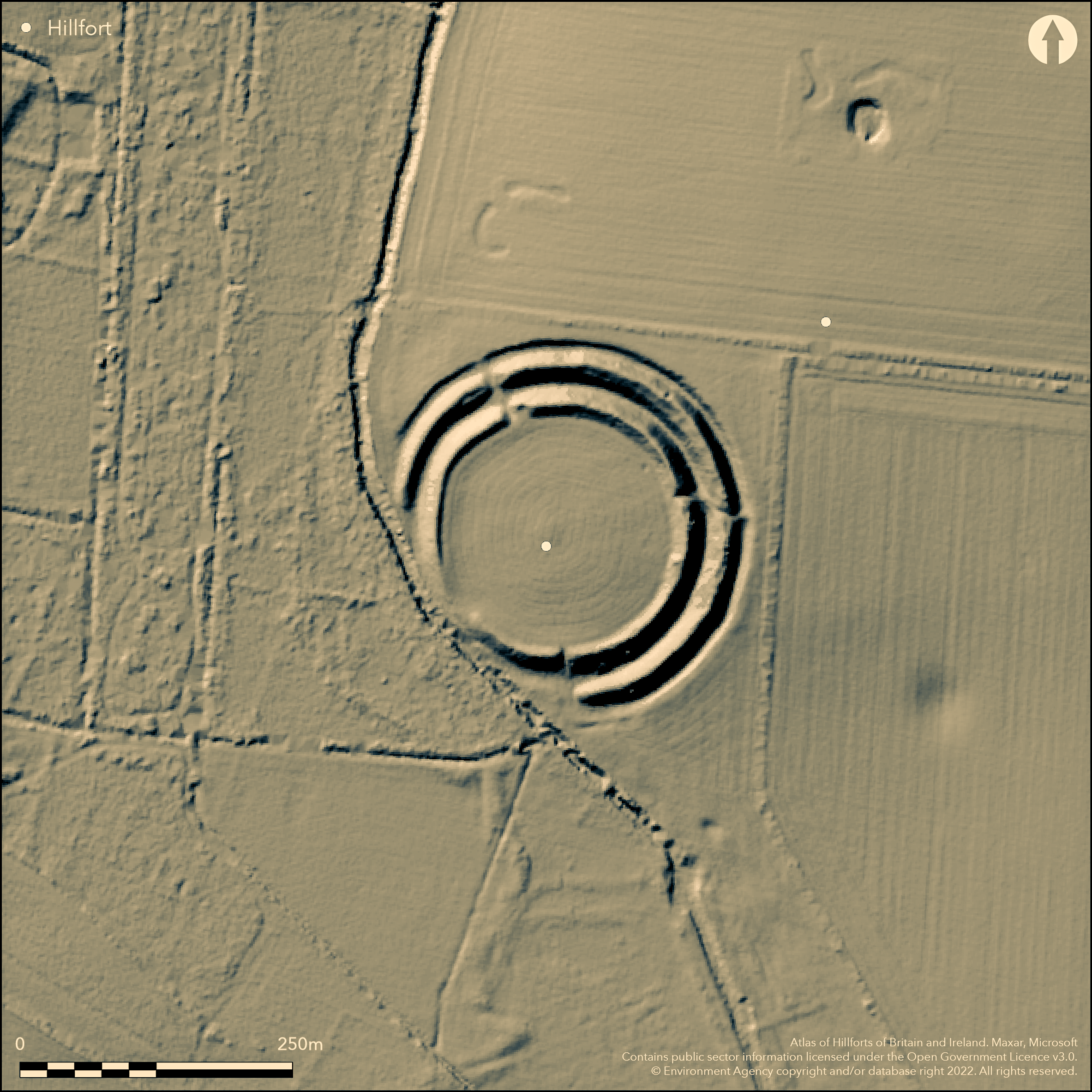
LiDAR 1m DTM Hillshade
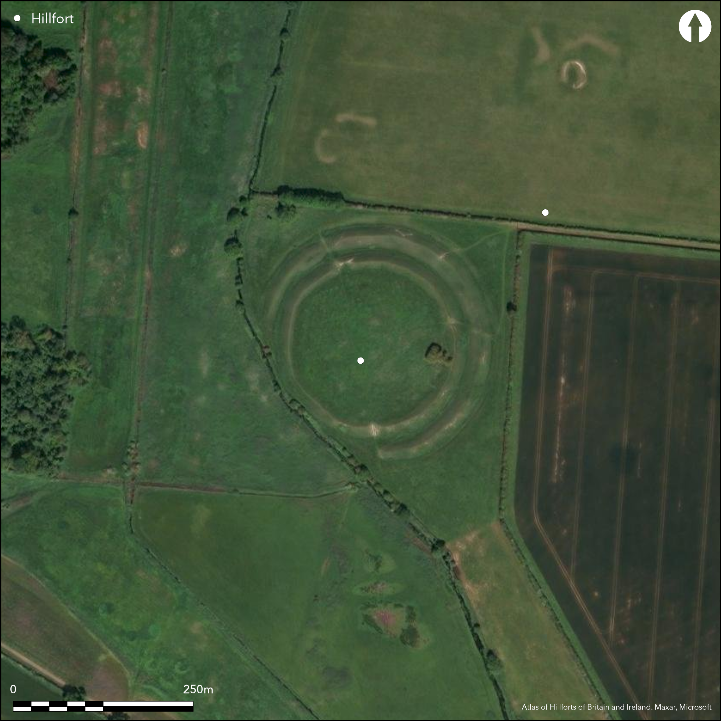
Satellite Imagery
LiDAR 1m DTM Hillshade
Satellite Imagery
Scroll left/right to view further images.
HER: Norfolk 1828 (None)
NMR: TF 9 4 SW 8 (359249)
SM: 1018015
NGR: TF 9438 4088
X: 594360 Y: 340880 (OSGB36)
Located S of Warham St. Mary on a hillslope overlooking the River Stiffkey. Two impressive banks and ditches, circular 140m internal diameter enclosing 1.4ha. Originally the river was further away but 18th century landscaping removed the outer rampart in the SW quadrant and established the river on its current course where the rampart was. Shown on a map of 1712 as complete (Rickett 1991), on 1st Ed OS map (1885-1900). Several breaks through the ramparts are modern, the original entrance could have been in the SW and is now destroyed. Banks survive to 3m high in places and the ditches 3m deep. Excavations in 1914 (Gray 1933) and 1959 (Gregory 1986) have shown the outer ditch to be 2m deeper and the inner rampart to have been built of chalk with two slots in the top interpreted as the base of a wooden platform with a possible palisade at the front, there was also a rear revetment. No evidence for structures in the interior. Pottery dates the site to the Iron Age, probably 200 BC to 1st century AD, Romano-British pottery and building materials suggest a building within the enclosure.
Citizen Science: ✓
Reliability of Data: Confirmed
Reliability of Interpretation: Confirmed
X: 99109 Y: 6970080 (EPSG: 3857)
Longitude: 0.8903112383441661 Latitude: 52.93010625616615 (EPSG:4326)
Country: England
Current County or Unitary Authority: Norfolk
Historic County: Norfolk
Current Parish/Community/Council/Townland: Warham
None
| Extant | ✓ |
| Cropmark | ✗ |
| Likely Destroyed | ✗ |
None
| Woodland | ✗ |
| Commercial Forestry Plantation | ✗ |
| Parkland | ✗ |
| Pasture (Grazing) | ✓ |
| Arable | ✗ |
| Scrub/Bracken | ✗ |
| Bare Outcrop | ✗ |
| Heather/Moorland | ✗ |
| Heath | ✗ |
| Built-up | ✗ |
| Coastal Grassland | ✗ |
| Other | ✗ |
On a hillslope overlooking the valley of the River Stiffkey
| Contour Fort | ✗ |
| Partial Contour Fort | ✗ |
| Promontory Fort | ✗ |
| Hillslope Fort | ✓ |
| Level Terrain Fort | ✗ |
| Marsh Fort | ✗ |
| Multiple Enclosure Fort | ✗ |
| Hilltop | ✗ |
| Coastal Promontory | ✗ |
| Inland Promontory | ✗ |
| Valley Bottom | ✗ |
| Knoll/Hillock/Outcrop | ✗ |
| Ridge | ✗ |
| Cliff/Plateau-edge/Scarp | ✗ |
| Hillslope | ✓ |
| Lowland | ✗ |
| Spur | ✗ |
Dominant Topographic Feature: On a hillslope overlooking the valley of the River Stiffkey
| North | ✗ |
| Northeast | ✗ |
| East | ✗ |
| Southeast | ✗ |
| South | ✗ |
| Southwest | ✗ |
| West | ✓ |
| Northwest | ✗ |
| Level | ✗ |
Altitude: 15.0m
N/A
Pottery from excavation dates it to 200 BC to 1st century AD. Romano-British pottery and building materials suggest a building within the enclosure.
Reliability: B - Medium
| Pre 1200BC | ✗ |
| 1200BC - 800BC | ✗ |
| 800BC - 400BC | ✗ |
| 400BC - AD50 | ✓ |
| AD50 - AD400 | ✗ |
| AD400 - AD 800 | ✗ |
| Post AD800 | ✗ |
| Unknown | ✗ |
| Pre Hillfort: | None |
| Post Hillfort: | None |
| Artefactual: | None |
Shown on a map of 1712 as complete (Rickett 1991), on 1st Ed OS map (1885-1900), many aerial photographs (HER). Excavations in 1914 (Gray 1933) and 1959 (Gregory 1986)
| 1st Identified Map Depiction (1712): | None |
| Excavation (1914): | None |
| Excavation (1959): | None |
No evidence for internal structures from aerial photographs and limited excavation. Pottery from excavation.
None
| None | ✓ |
| Spring | ✗ |
| Stream | ✗ |
| Pool | ✗ |
| Flush | ✗ |
| Well | ✗ |
| Other | ✗ |
None
| No Known Features | ✓ |
| Round Stone Structures | ✗ |
| Rectangular Stone Structures | ✗ |
| Curvilinear Platforms | ✗ |
| Other Roundhouse Evidence | ✗ |
| Pits | ✗ |
| Quarry Hollows | ✗ |
| Other | ✗ |
None
| No Known Excavation | ✗ |
| Pits | ✗ |
| Postholes | ✗ |
| Roundhouses | ✗ |
| Rectangular Structures | ✗ |
| Roads/Tracks | ✗ |
| Quarry Hollows | ✗ |
| Other | ✗ |
| Nothing Found | ✓ |
None
| No Known Geophysics | ✓ |
| Pits | ✗ |
| Roundhouses | ✗ |
| Rectangular Structures | ✗ |
| Roads/Tracks | ✗ |
| Quarry Hollows | ✗ |
| Other | ✗ |
| Nothing Found | ✗ |
None
| No Known Finds | ✗ |
| Pottery | ✓ |
| Metal | ✗ |
| Metalworking | ✗ |
| Human Bones | ✗ |
| Animal Bones | ✗ |
| Lithics | ✗ |
| Environmental | ✗ |
| Other | ✗ |
NO APPARENT FEATURES
| APs Not Checked | ✗ |
| None | ✓ |
| Roundhouses | ✗ |
| Rectangular Structures | ✗ |
| Pits | ✗ |
| Postholes | ✗ |
| Roads/Tracks | ✗ |
| Other | ✗ |
Modern gaps at the N and E, original entrance probably at the SW although the outer rampart is removed here and evidence isn't clear.
| 3: | None |
| 2: | None |
Guard Chambers: ✗
Chevaux de Frise: ✗
| 1. Simple Gap (South west): | None |
Banks survive to 3m high in places and the ditches 3m deep. Excavations in 1914 (Gray 1933) and 1959 (Gregory 1986) have shown the outer ditch to be 2m deeper and the inner rampart to have been built of chalk with two slots in the top interpreted as the base of a wooden platform with a possible palisade at the front, there was also a rear revetment.
| Area 1: | 1.4ha. |
| Total: | 1.4ha. |
Total Footprint Area: 3.6ha.
None
| ✗ | None |
| ✓ | None |
| NE Quadrant: | 2 |
| SE Quadrant: | 2 |
| SW Quadrant: | 2 |
| NW Quadrant: | 2 |
| Total: | 2 |
| Partial Univallate | ✗ |
| Univallate | ✗ |
| Partial Bivallate | ✗ |
| Bivallate | ✓ |
| Partial Multivallate | ✗ |
| Multivallate | ✗ |
| Unknown | ✗ |
| Partial Univallate | ✗ |
| Univallate | ✗ |
| Partial Bivallate | ✗ |
| Bivallate | ✗ |
| Partial Multivallate | ✗ |
| Multivallate | ✗ |
None
| None | ✗ |
| Earthen Bank | ✓ |
| Stone Wall | ✗ |
| Rubble | ✗ |
| Wall-walk | ✗ |
| Evidence of Timber | ✗ |
| Vitrification | ✗ |
| Other Burning | ✗ |
| Palisade | ✗ |
| Counter Scarp Bank | ✗ |
| Berm | ✗ |
| Unfinished | ✗ |
| Other | ✗ |
None
| None | ✗ |
| Earthen Bank | ✓ |
| Stone Wall | ✗ |
| Murus Duplex | ✗ |
| Timber-framed | ✗ |
| Timber-laced | ✗ |
| Vitrification | ✗ |
| Other Burning | ✗ |
| Palisade | ✓ |
| Counter Scarp Bank | ✗ |
| Berm | ✗ |
| Unfinished | ✗ |
| No Known Excavation | ✗ |
| Other | ✓ |
| ✗ | None |
| ✓ | None |
Number of Ditches: 2
| ✗ | None |
Davies, J.A., Gregory, T., Lawson, A. L., Rickett, R., and Rogerson, A. 1992. The Iron Age Hill Forts of Norfolk. Dereham
Gray, H. St G. 1933. Trial excavations at the so-called 'Danish Camp' at Warham, near Wells, Norfolk. Antiq. J. 13, 399-413.
Gregory, T. 1986. Warham Camp, in Excavations at Thornham, Warham, Wighton and Caister, Norfolk, E Anglian Archaeol Rep. No. 30, 22-26.
Rickett, R. 1991. The other forts of Norfolk, in The Iron Age forts of Norfolk, E Anglian Archaeol Rep. No. 54, 59-61.
Atlas of Hillforts:
Wikidata:
This work is licensed under CC BY-SA 4.0

 and should be cited as:
Lock, Gary and Ralston, Ian. 2024. Atlas of Hillforts of Britain and Ireland. Available at: https://hillforts.arch.ox.ac.uk
Document Version 1.1