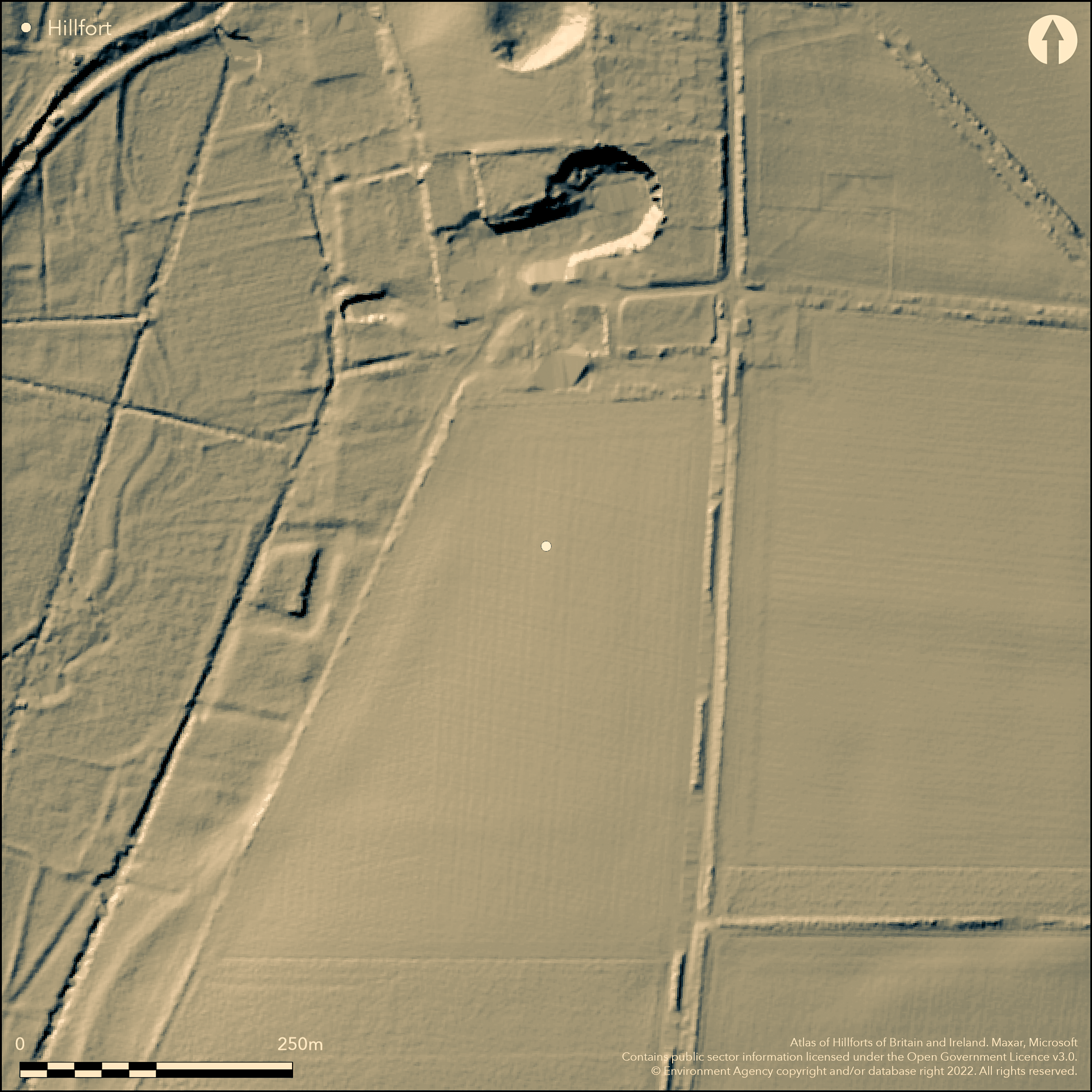
LiDAR 1m DTM Hillshade
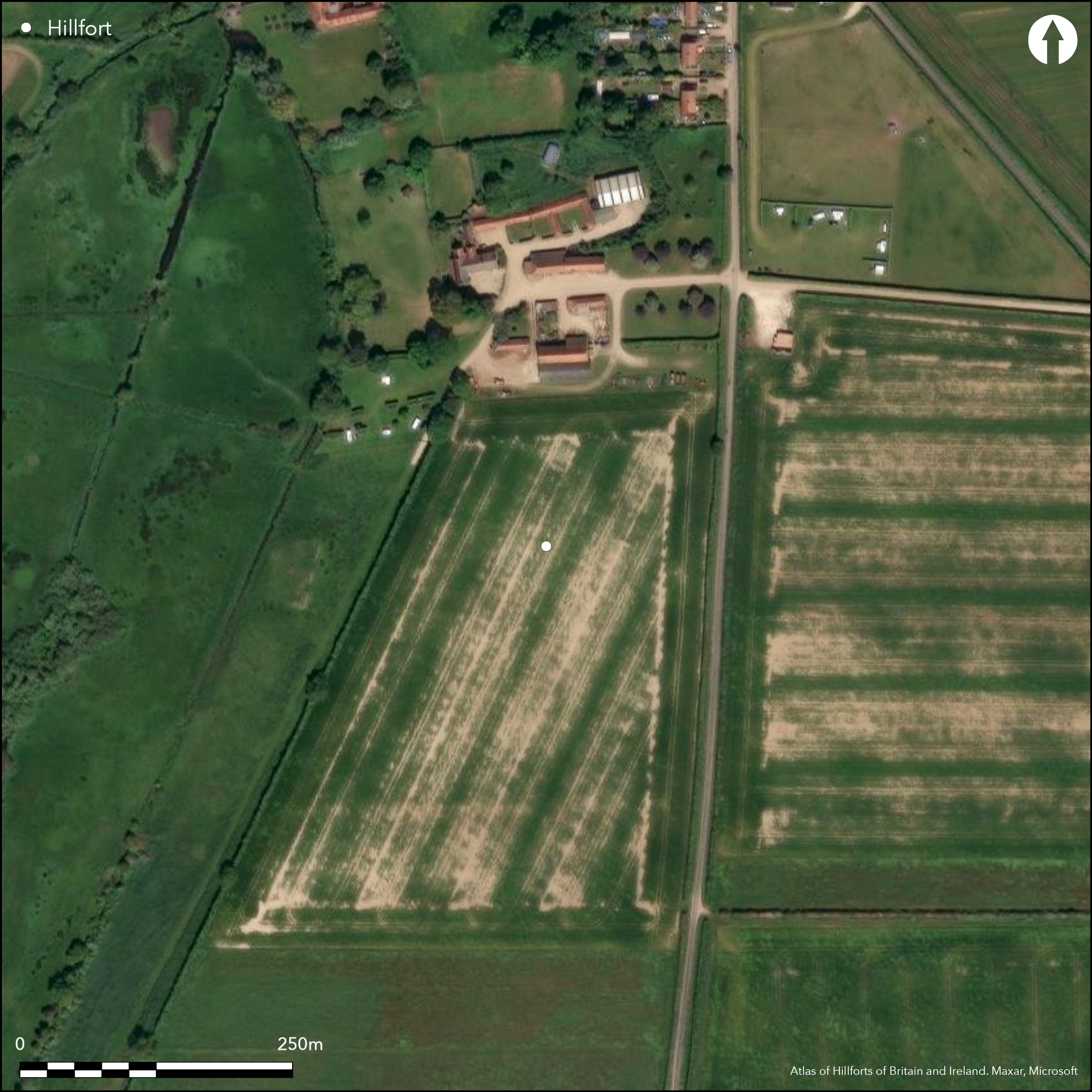
Satellite Imagery
LiDAR 1m DTM Hillshade
Satellite Imagery
Scroll left/right to view further images.
HER: Norfolk 1113 (None)
NMR: None (None)
SM: None
NGR: TF 943 390
X: 594350 Y: 339080 (OSGB36)
S of Wighton, on a hill slope overlooking the River Stiffkey. A D-shaped embanked enclosure first recorded in the 18th-19th century, ploughed out and rediscovered by aerial photography in 1974 when partly excavated (Lawson 1976). First phase bank and ditch, 2.8m wide and 2.0m deep, replaced by main phase ditch, V-shaped 7m wide and 3.2m deep and bank of earth layers 12.5m wide. A single entrance at the NW shown by aerial photography. Inhumations and Romano-British pottery associated with first phase and in second phase ditch. Pits, hearths and gully in the interior with Romano-British pottery. Documentary research has also demonstrated that in the post-medieval period a windmill was situated here, and this was shown on Faden's Map of 1797. A large number of finds have been found on the site over the years and these include Roman coins, Roman brooches, a medieval buckle, an undated lead weight, an Early Saxon girdle hanger and a medieval/post medieval thimble. Metal detecting between 2004 and 2013 recovered metal finds of Roman, Early Saxon, Middle Saxon, Late Saxon, medieval and post-medieval date. This is probably not a hillfort as the earliest ditch is C14 dated to the second half of the 1st century AD although there may have been Iron Age activity on the site.
Citizen Science: ✗
Reliability of Data: Confirmed
Reliability of Interpretation: Unconfirmed
X: 98973 Y: 6967097 (EPSG: 3857)
Longitude: 0.8890858644314059 Latitude: 52.913949420256564 (EPSG:4326)
Country: England
Current County or Unitary Authority: Norfolk
Historic County: Norfolk
Current Parish/Community/Council/Townland: Wighton
None
| Extant | ✗ |
| Cropmark | ✓ |
| Likely Destroyed | ✗ |
None
| Woodland | ✗ |
| Commercial Forestry Plantation | ✗ |
| Parkland | ✗ |
| Pasture (Grazing) | ✗ |
| Arable | ✓ |
| Scrub/Bracken | ✗ |
| Bare Outcrop | ✗ |
| Heather/Moorland | ✗ |
| Heath | ✗ |
| Built-up | ✗ |
| Coastal Grassland | ✗ |
| Other | ✗ |
on a hill slope overlooking the River Stiffkey.
| Contour Fort | ✗ |
| Partial Contour Fort | ✗ |
| Promontory Fort | ✗ |
| Hillslope Fort | ✓ |
| Level Terrain Fort | ✗ |
| Marsh Fort | ✗ |
| Multiple Enclosure Fort | ✗ |
| Hilltop | ✗ |
| Coastal Promontory | ✗ |
| Inland Promontory | ✗ |
| Valley Bottom | ✗ |
| Knoll/Hillock/Outcrop | ✗ |
| Ridge | ✗ |
| Cliff/Plateau-edge/Scarp | ✗ |
| Hillslope | ✓ |
| Lowland | ✗ |
| Spur | ✗ |
Dominant Topographic Feature: on a hill slope overlooking the River Stiffkey.
| North | ✗ |
| Northeast | ✗ |
| East | ✗ |
| Southeast | ✗ |
| South | ✗ |
| Southwest | ✗ |
| West | ✗ |
| Northwest | ✗ |
| Level | ✓ |
Altitude: 15.0m
N/A
Excavated evidence and C14 date for Romano-British occupation. Surface finds of Roman coins, Roman brooches, a medieval buckle, an undated lead weight, an Early Saxon girdle hanger and a medieval/post medieval thimble. Metal detecting between 2004 and 2013 recovered metal finds of Roman, Early Saxon, Middle Saxon, Late Saxon, medieval and post-medieval date. Post-medieval windmill.
Reliability: B - Medium
| Pre 1200BC | ✗ |
| 1200BC - 800BC | ✗ |
| 800BC - 400BC | ✗ |
| 400BC - AD50 | ✗ |
| AD50 - AD400 | ✓ |
| AD400 - AD 800 | ✗ |
| Post AD800 | ✗ |
| Unknown | ✗ |
| Pre Hillfort: | None |
| Post Hillfort: | None |
| Artefactual: | None |
| C14: | None |
Aerial photography (in HER) and excavation in 1974 (Lawson 1976), metal detecting between 2004 and 2013.
| Excavation (1974): | None |
| Other (1974): | aerial photography |
| Other (None): | None |
Excavation has shown pits, gullies and hearths with Romano-British pottery, animal bones and inhumation burials. Surface finds of Roman coins, Roman brooches, a medieval buckle, an undated lead weight, an Early Saxon girdle hanger and a medieval/post medieval thimble. Metal detecting between 2004 and 2013 recovered metal finds of Roman, Early Saxon, Middle Saxon, Late Saxon, medieval and post-medieval date.
None
| None | ✓ |
| Spring | ✗ |
| Stream | ✗ |
| Pool | ✗ |
| Flush | ✗ |
| Well | ✗ |
| Other | ✗ |
None
| No Known Features | ✓ |
| Round Stone Structures | ✗ |
| Rectangular Stone Structures | ✗ |
| Curvilinear Platforms | ✗ |
| Other Roundhouse Evidence | ✗ |
| Pits | ✗ |
| Quarry Hollows | ✗ |
| Other | ✗ |
Gullies and hearths
| No Known Excavation | ✗ |
| Pits | ✓ |
| Postholes | ✗ |
| Roundhouses | ✗ |
| Rectangular Structures | ✗ |
| Roads/Tracks | ✗ |
| Quarry Hollows | ✗ |
| Other | ✓ |
| Nothing Found | ✗ |
None
| No Known Geophysics | ✓ |
| Pits | ✗ |
| Roundhouses | ✗ |
| Rectangular Structures | ✗ |
| Roads/Tracks | ✗ |
| Quarry Hollows | ✗ |
| Other | ✗ |
| Nothing Found | ✗ |
None
| No Known Finds | ✗ |
| Pottery | ✓ |
| Metal | ✓ |
| Metalworking | ✗ |
| Human Bones | ✓ |
| Animal Bones | ✓ |
| Lithics | ✗ |
| Environmental | ✗ |
| Other | ✓ |
None
| APs Not Checked | ✗ |
| None | ✓ |
| Roundhouses | ✗ |
| Rectangular Structures | ✗ |
| Pits | ✗ |
| Postholes | ✗ |
| Roads/Tracks | ✗ |
| Other | ✗ |
A single entrance to the NW, a simple gap shown on aerial photography.
| 1: | None |
| 2: | None |
Guard Chambers: ✗
Chevaux de Frise: ✗
| 1. Simple Gap (North west): | None |
First phase bank and ditch, 2.8m wide and 2.0m deep, replaced by main phase ditch, V-shaped 7m wide and 3.2m deep and bank of earth layers 12.5m wide.
| Area 1: | Noneha. |
| Total: | Noneha. |
Total Footprint Area: Noneha.
None
| ✗ | None |
| ✓ | None |
| NE Quadrant: | 1 |
| SE Quadrant: | 1 |
| SW Quadrant: | 1 |
| NW Quadrant: | 1 |
| Total: | 1 |
| Partial Univallate | ✗ |
| Univallate | ✓ |
| Partial Bivallate | ✗ |
| Bivallate | ✗ |
| Partial Multivallate | ✗ |
| Multivallate | ✗ |
| Unknown | ✗ |
| Partial Univallate | ✗ |
| Univallate | ✗ |
| Partial Bivallate | ✗ |
| Bivallate | ✗ |
| Partial Multivallate | ✗ |
| Multivallate | ✗ |
None
| None | ✗ |
| Earthen Bank | ✓ |
| Stone Wall | ✗ |
| Rubble | ✗ |
| Wall-walk | ✗ |
| Evidence of Timber | ✗ |
| Vitrification | ✗ |
| Other Burning | ✗ |
| Palisade | ✗ |
| Counter Scarp Bank | ✗ |
| Berm | ✗ |
| Unfinished | ✗ |
| Other | ✗ |
None
| None | ✗ |
| Earthen Bank | ✓ |
| Stone Wall | ✗ |
| Murus Duplex | ✗ |
| Timber-framed | ✗ |
| Timber-laced | ✗ |
| Vitrification | ✗ |
| Other Burning | ✗ |
| Palisade | ✗ |
| Counter Scarp Bank | ✗ |
| Berm | ✗ |
| Unfinished | ✗ |
| No Known Excavation | ✗ |
| Other | ✗ |
| ✗ | None |
| ✓ | None |
Number of Ditches: 1
| ✗ | None |
Lawson, A. 1976. Excavations at Whey Curd Farm, Wighton. E Anglian Archaeol Rep. No. 2, 65-129.
Atlas of Hillforts:
Wikidata:
This work is licensed under CC BY-SA 4.0

 and should be cited as:
Lock, Gary and Ralston, Ian. 2024. Atlas of Hillforts of Britain and Ireland. Available at: https://hillforts.arch.ox.ac.uk
Document Version 1.1