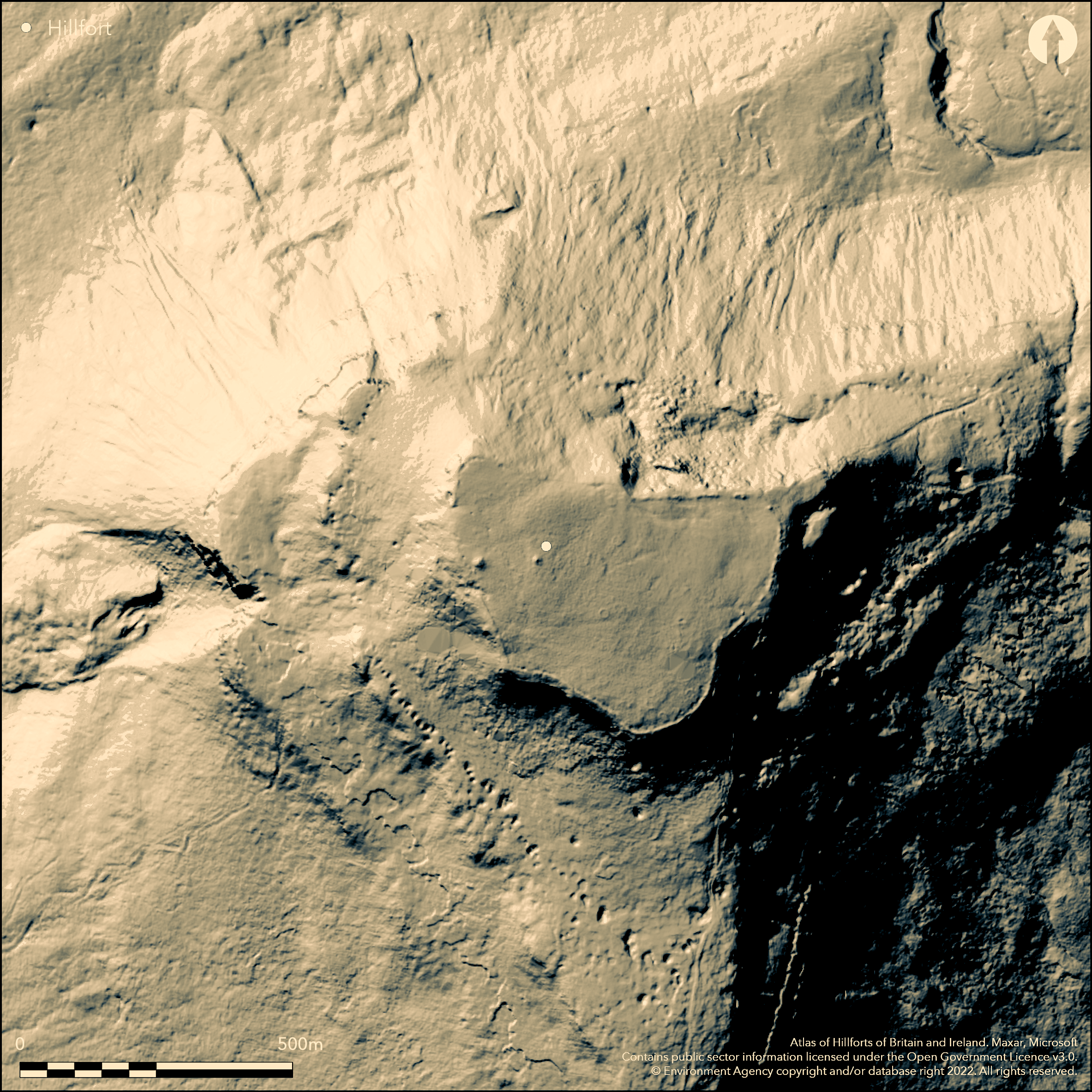
LiDAR 1m DTM Hillshade
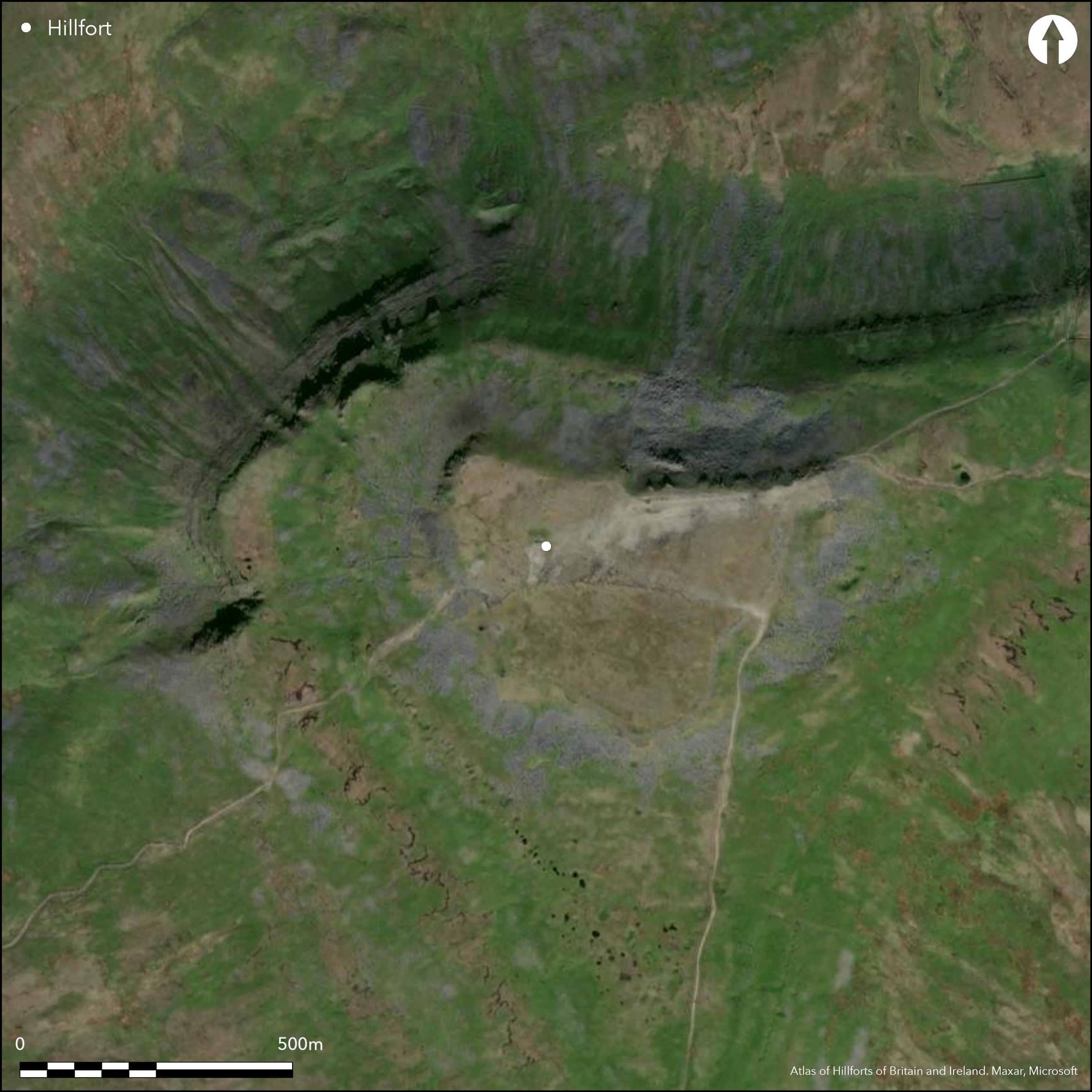
Satellite Imagery
LiDAR 1m DTM Hillshade
Satellite Imagery
Scroll left/right to view further images.
HER: Yorkshire Dales National Park MYD3700 (None)
NMR: SD 77 SW 1 (44959)
SM: 1008876
NGR: SD 7413 7459
X: 374136 Y: 474599 (OSGB36)
Within the Yorkshire Dales National Park, a large univallate hillfort of 6ha enclosing a flat plateau on the summit of Ingleborough HIll. At 720m OD it is the highest hillfort in England and commands extensive views in all directions. The construction of the ramparts is unique for England, although there are possible parallels in Wales and Scotland. The rear face of the wall is formed from large vertical orthostats and the outer wall of drystone construction, giving an overall width of 3-5m. Internally the wall survives up to 1m high and externally to a maximum of 3m at the SE corner. It has been constructed as compartments with stones set at right angles to the outer face. The compartments are filled with stone rubble. The wall is now mostly obscured by tumbled material and is best seen in the NE corner where five or six courses survive. It is absent along the northern edge and was once thought to be incomplete but later investigation suggests it is probably eroded and robbed. In the W it is interrupted by the natural slope. The location of any entrances is uncertain but they were possibly in the E and NE. A berm up to 10m wide lies between the outer face of the rampart and the break of slope. Internally 20 stone-founded huts lie in the more sheltered eastern side, ranging from 5.5-8m in diameter. Entrances have been identified in some facing SE. The turf-covered stone walls survive up to 0.3m with the stonework spread up to 3m. Possible drainage gullies 1m wide and 0.1m deep can be seen on their uphill sides. Massive dry stone walls lie below the N and W sides of the fort, more crudely constructed than the main rampart, which incorporate large boulders. Their date and function is unknown but might be of a broadly similar date to the hillfort. Hollows at the rear of the rampart and slight ditches outside probably result from quarrying. Damage is documented from the Victorian period. Lying on the Three Peaks route it is suffering damage from the construction of walkers' cairns which are constructed from rampart material. The site is undated and is thought to be a hillfort of the pre-Roman Iron Age but other dates are possible. The hillfort was first noted in literature by Phillips in 1855 who provided a detailed description including an accurate small scale plan by James Farrer, but it was not identified as a hillfort on OS mapping until 1937-61. An examination of aerial photograph during snow melt conditions revealed a number of previously unseen features including a sub-circular feature approximately 40m diameter in the NW corner of the summit (Yvonne Luke, paper prepared for the HIllfort Study Group meeting). A small, 20m by 40m geophysical survey was carried out by Ingleton Archaeology Group in 2000 (Batty and Crack 2000). A further interpretation is a 'hilltop sanctuary', with the stone founded huts being ring cairns similar to those found on sites in the Dales.
Citizen Science: ✗
Reliability of Data: Confirmed
Reliability of Interpretation: Confirmed
X: -266905 Y: 7201760 (EPSG: 3857)
Longitude: -2.397650212896314 Latitude: 54.16653965489551 (EPSG:4326)
Country: England; None
Current County or Unitary Authority: North Yorkshire
Historic County: Yorkshire
Current Parish/Community/Council/Townland: Ingleton; Clapham cum Newby
Lies within the Yorkshire Dales National Park. Included in the Heritage at Risk Register 2015. Vulnerable from extensive visitor erosion. On Heritage at Risk Register (2015).
| Extant | ✓ |
| Cropmark | ✗ |
| Likely Destroyed | ✗ |
Grassland, possibly grazed
| Woodland | ✗ |
| Commercial Forestry Plantation | ✗ |
| Parkland | ✗ |
| Pasture (Grazing) | ✓ |
| Arable | ✗ |
| Scrub/Bracken | ✗ |
| Bare Outcrop | ✗ |
| Heather/Moorland | ✗ |
| Heath | ✗ |
| Built-up | ✗ |
| Coastal Grassland | ✗ |
| Other | ✗ |
A large univallate contour fort lying at 720m OD on a flat plateau on the summit of Ingleborough Hill. The location commands extensive views in all directions
| Contour Fort | ✓ |
| Partial Contour Fort | ✗ |
| Promontory Fort | ✗ |
| Hillslope Fort | ✗ |
| Level Terrain Fort | ✗ |
| Marsh Fort | ✗ |
| Multiple Enclosure Fort | ✗ |
| Hilltop | ✓ |
| Coastal Promontory | ✗ |
| Inland Promontory | ✗ |
| Valley Bottom | ✗ |
| Knoll/Hillock/Outcrop | ✗ |
| Ridge | ✗ |
| Cliff/Plateau-edge/Scarp | ✗ |
| Hillslope | ✗ |
| Lowland | ✗ |
| Spur | ✗ |
Dominant Topographic Feature: Flat plateau on the summit of Ingleborough Hill.
| North | ✗ |
| Northeast | ✗ |
| East | ✗ |
| Southeast | ✗ |
| South | ✗ |
| Southwest | ✗ |
| West | ✗ |
| Northwest | ✗ |
| Level | ✓ |
Altitude: 720.0m
The boundaries of the parishes of Clapham cum Newby and Ingleton cut through the centre of the hillfort.
Boundary Type: Parish/Townland
The site is undated
Reliability: D - None
| Pre 1200BC | ✗ |
| 1200BC - 800BC | ✗ |
| 800BC - 400BC | ✗ |
| 400BC - AD50 | ✗ |
| AD50 - AD400 | ✗ |
| AD400 - AD 800 | ✗ |
| Post AD800 | ✗ |
| Unknown | ✓ |
| Pre Hillfort: | None |
| Post Hillfort: | Trig point |
The hillfort was first noted in literature by Phillips (1855) who provided a detailed description and an accurate small scale plan by James Farrer. Field investigation in 1965 and 1977. Detailed survey by RCHME in 1989 (Bowden et al. 1988 and 1989), ref. no. 621877. A small, 20m by 40m geophysical survey was carried out by Ingleton Archaeology Group in 2000 (Batty and Crack 2000). Features interpreted as possible postholes were detected. They also noted that no magnetic anomalies which might indicate hearths, were detected within the vicinity of the hut circles
| Earthwork Survey (1855): | James Farrer |
| 1st Identified Written Reference (1855): | None |
| Other (1935): | Scheduled |
| Other (1965): | Field investigation |
| Other (1977): | Field investigation |
| Geophysical Survey (2000): | None |
| Earthwork Survey (None): | None |
Twenty stone-founded huts lie in the more sheltered eastern side, ranging from 5.5-8m in diameter with entrances identified in some, facing SE. The turf-covered stone walls survive up to 0.3m with the stonework spread up to 3m. Possible drainage gullies 1m wide and 0.1m deep can be seen on their uphill sides.
None
| None | ✓ |
| Spring | ✗ |
| Stream | ✗ |
| Pool | ✗ |
| Flush | ✗ |
| Well | ✗ |
| Other | ✗ |
None
| No Known Features | ✗ |
| Round Stone Structures | ✓ |
| Rectangular Stone Structures | ✗ |
| Curvilinear Platforms | ✗ |
| Other Roundhouse Evidence | ✗ |
| Pits | ✗ |
| Quarry Hollows | ✗ |
| Other | ✗ |
None
| No Known Excavation | ✓ |
| Pits | ✗ |
| Postholes | ✗ |
| Roundhouses | ✗ |
| Rectangular Structures | ✗ |
| Roads/Tracks | ✗ |
| Quarry Hollows | ✗ |
| Other | ✗ |
| Nothing Found | ✗ |
Possible postholes
| No Known Geophysics | ✗ |
| Pits | ✗ |
| Roundhouses | ✗ |
| Rectangular Structures | ✗ |
| Roads/Tracks | ✗ |
| Quarry Hollows | ✗ |
| Other | ✓ |
| Nothing Found | ✗ |
None
| No Known Finds | ✓ |
| Pottery | ✗ |
| Metal | ✗ |
| Metalworking | ✗ |
| Human Bones | ✗ |
| Animal Bones | ✗ |
| Lithics | ✗ |
| Environmental | ✗ |
| Other | ✗ |
None
| APs Not Checked | ✓ |
| None | ✗ |
| Roundhouses | ✗ |
| Rectangular Structures | ✗ |
| Pits | ✗ |
| Postholes | ✗ |
| Roads/Tracks | ✗ |
| Other | ✗ |
The location of any entrances is uncertain but they were possibly in the E and NE.
| 2: | None |
| 2: | Uncertain |
Guard Chambers: ✗
Chevaux de Frise: ✗
| 1. Simple Gap (East): | Uncertain |
| 2. Simple Gap (North east): | Uncertain |
Univallate wall enclosing 6 ha. The rear face of the wall is formed from large vertical orthostats and the outer wall of drystone construction, giving an overall width of 3-5m. Internally the wall survives up to 1m high and externally to a maximum of 3m at the SE corner. It has been constructed as compartments with stones set at right angles to the outer face. The compartments are filled with stone rubble. The wall is now mostly obscured by tumbled material and is best seen in the NE corner where five or six courses survive. It is absent along the northern edge and was once thought to be incomplete but later investigation suggests it is probably eroded and robbed. In the W it is interrupted by the natural slope.
| Area 1: | 6.0ha. |
| Total: | 6.0ha. |
Total Footprint Area: Noneha.
None
| ✗ | None |
| ✗ | Absent in the N, possibly destroyed |
| NE Quadrant: | None |
| SE Quadrant: | 1 |
| SW Quadrant: | 1 |
| NW Quadrant: | None |
| Total: | 1 |
| Partial Univallate | ✓ |
| Univallate | ✗ |
| Partial Bivallate | ✗ |
| Bivallate | ✗ |
| Partial Multivallate | ✗ |
| Multivallate | ✗ |
| Unknown | ✗ |
| Partial Univallate | ✗ |
| Univallate | ✗ |
| Partial Bivallate | ✗ |
| Bivallate | ✗ |
| Partial Multivallate | ✗ |
| Multivallate | ✗ |
None
| None | ✗ |
| Earthen Bank | ✗ |
| Stone Wall | ✓ |
| Rubble | ✓ |
| Wall-walk | ✗ |
| Evidence of Timber | ✗ |
| Vitrification | ✗ |
| Other Burning | ✗ |
| Palisade | ✗ |
| Counter Scarp Bank | ✗ |
| Berm | ✓ |
| Unfinished | ✗ |
| Other | ✗ |
None
| None | ✗ |
| Earthen Bank | ✗ |
| Stone Wall | ✗ |
| Murus Duplex | ✗ |
| Timber-framed | ✗ |
| Timber-laced | ✗ |
| Vitrification | ✗ |
| Other Burning | ✗ |
| Palisade | ✗ |
| Counter Scarp Bank | ✗ |
| Berm | ✗ |
| Unfinished | ✗ |
| No Known Excavation | ✓ |
| Other | ✗ |
| ✗ | None |
| ✗ | None |
Number of Ditches: None
| ✗ | None |
Batty A and Crack N. 2000. Ingleborough HiIlfort Geophysical Survey September 2000. https://www.ingleborougharchaeology.org.uk/Ingleborough%20Geophysical%20survey.pdf. Accessed Feb. 2015
Bowden, M, Mackay, D and Blood, K RCHME: Ingleborough Survey 1988. Unpublished
Bowden, M, Mackay, D and Blood, K 1989. A new survey of Ingleborough hillfort. Proc Prehist Soc. 55 267-71
Luke, Y. Rethinking Ingleborough. Dept of Archaeology York. Paper given to the Hillfort Study Group. https://www.hillfortsstudygroup.org.uk/Ingleborough.pdf. Accessed Feb 2015
Phillips, J. 1855. The Rivers, Mountains and Sea Coast of Yorkshire: With Essays On The Climate, Scenery, And Ancient Inhabitants Of The County. Nabu Press 2011
Atlas of Hillforts:
Wikidata:
This work is licensed under CC BY-SA 4.0

 and should be cited as:
Lock, Gary and Ralston, Ian. 2024. Atlas of Hillforts of Britain and Ireland. Available at: https://hillforts.arch.ox.ac.uk
Document Version 1.1