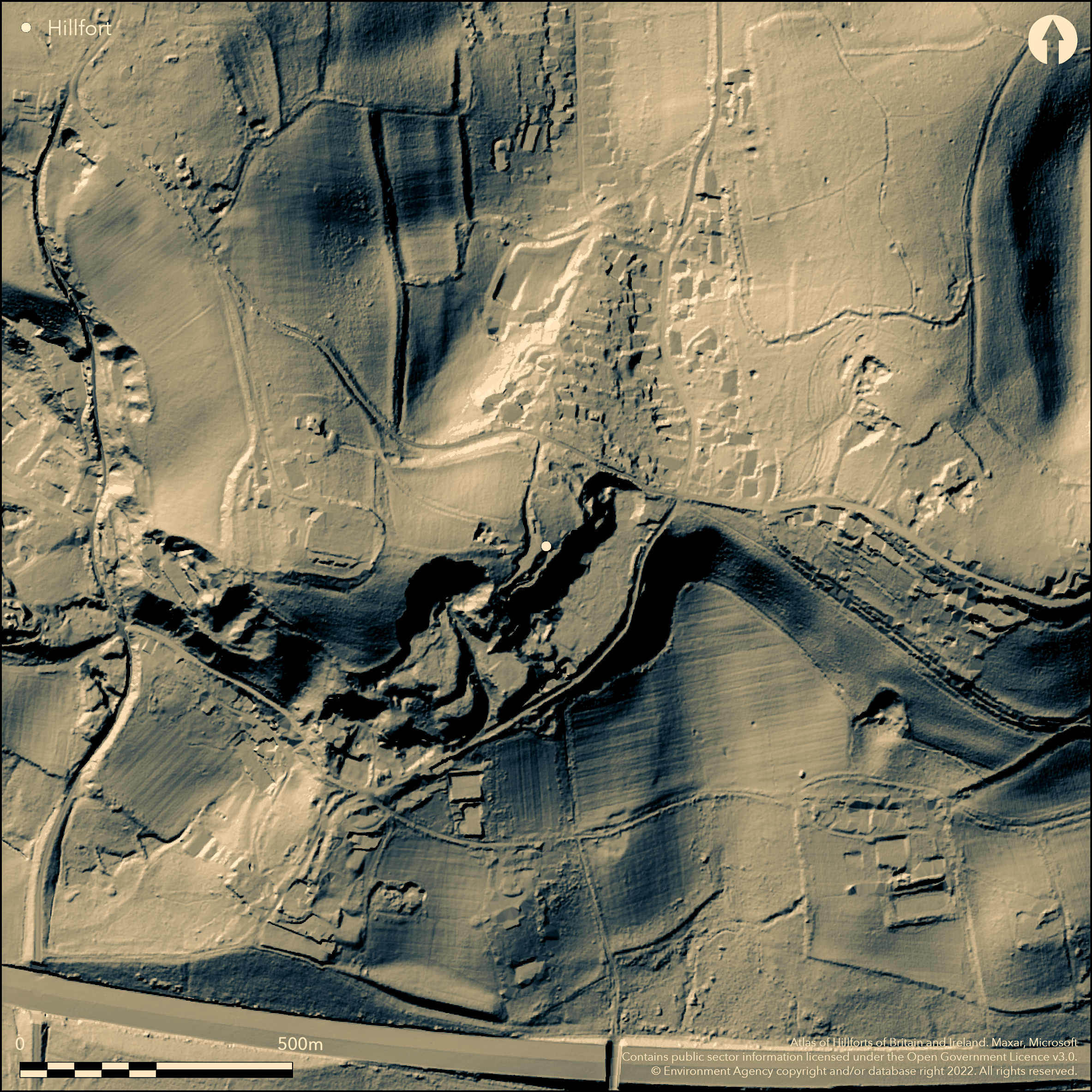
LiDAR 1m DTM Hillshade
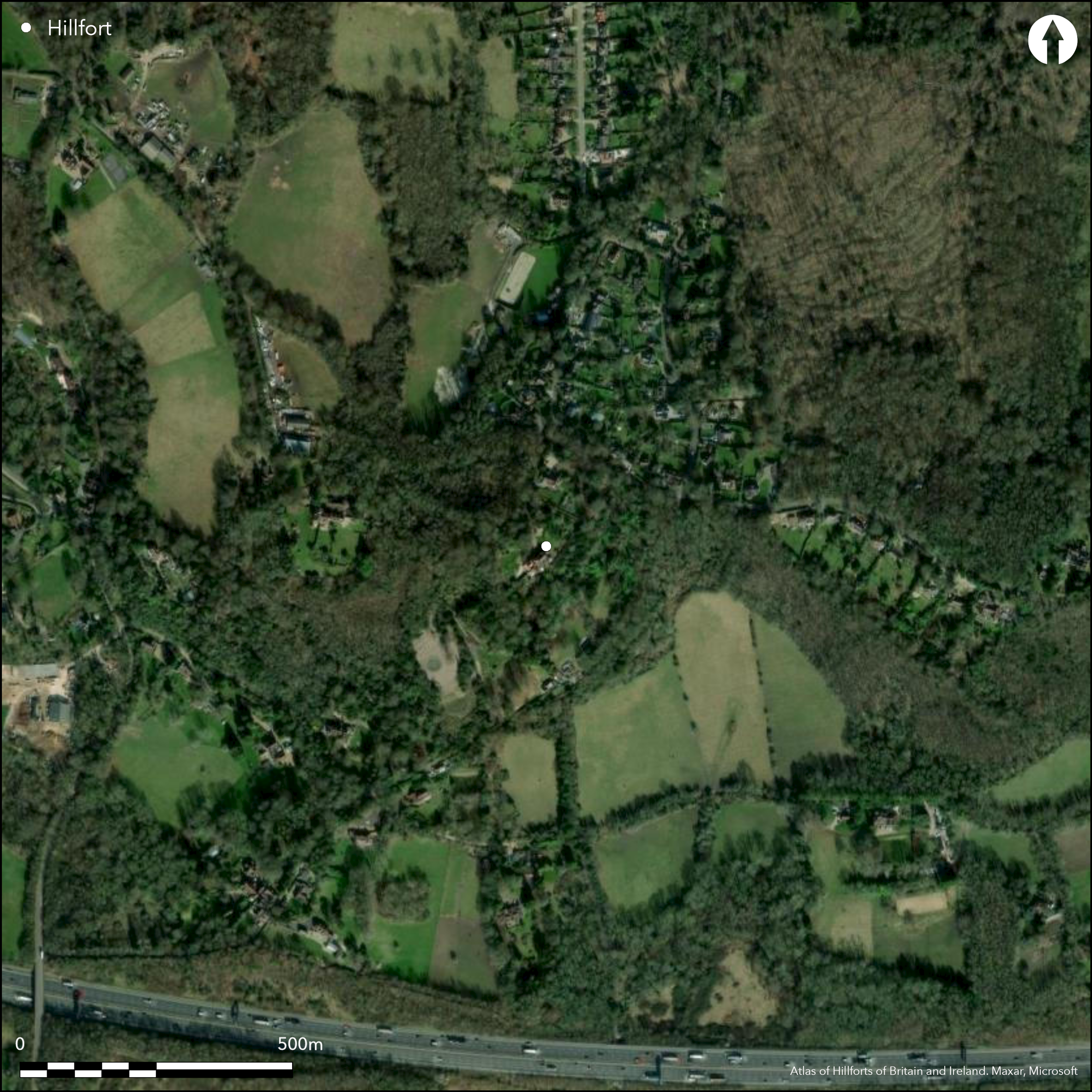
Satellite Imagery
LiDAR 1m DTM Hillshade
Satellite Imagery
Scroll left/right to view further images.
HER: Surrey 1233 (None)
NMR: TQ 35 SW 18 (403965)
SM: 1008498
NGR: TQ 3315 5325
X: 533150 Y: 153250 (OSGB36)
To the S of War Coppice Garden Village, on the crest of a chalk spur above the S face of the North Downs. Multivallate, approximately 400m E-W and 250m N-S, roughly oval in shape enclosing 8.0ha, appears on Ist Ed OS map (1885-1900). To the SW is a double bank and ditch with additional scarping lower down the slope. The inner bank is c.5m wide and 0.4m high with a ditch 7m wide and 0.3m deep situated 2m below the crest. To the W of the ditch is a second bank 8m wide and 0.5m high,. Beyond this is a second ditch now infilled but visible as a 8m wide terrace. Further down the slope is additional scarping. To the NE is an inner bank 5m wide and 0.5m high from the interior and 4m high from the exterior with a ditch 8m wide and 0.6m deep. Beyond this is a counterscarp bank 6m wide and a maximum of 1m high. Further out to the NE is a 35m long section of a second ditch, now infilled. The SE side has been entirely destroyed by old chalk quarries and part of the N side by the construction of Warcoppice Road. No original entrance is known, no evidence for internal features. Earlier interpretations of the site as Neolithic or Roman were shown to be wrong by small-scale excavation (Hope-Taylor 1950) which also showed that the two inner ramparts were palisaded and revetted. Based on this the site is probably Iron Age.
Citizen Science: ✗
Reliability of Data: Confirmed
Reliability of Interpretation: Confirmed
X: -10352 Y: 6667914 (EPSG: 3857)
Longitude: -0.09299592934022077 Latitude: 51.262806878899525 (EPSG:4326)
Country: England; None
Current County or Unitary Authority: Surrey
Historic County: Surrey
Current Parish/Community/Council/Townland: Caterham; Bletchingley
Included in the 2015 Heritage at Risk Register as having major localised problems which are declining
| Extant | ✓ |
| Cropmark | ✗ |
| Likely Destroyed | ✓ |
None
| Woodland | ✓ |
| Commercial Forestry Plantation | ✗ |
| Parkland | ✗ |
| Pasture (Grazing) | ✗ |
| Arable | ✗ |
| Scrub/Bracken | ✗ |
| Bare Outcrop | ✗ |
| Heather/Moorland | ✗ |
| Heath | ✗ |
| Built-up | ✗ |
| Coastal Grassland | ✗ |
| Other | ✗ |
A multivallate partial contour fort on the crest of a chalk spur above the S face of the North Downs
| Contour Fort | ✗ |
| Partial Contour Fort | ✓ |
| Promontory Fort | ✗ |
| Hillslope Fort | ✗ |
| Level Terrain Fort | ✗ |
| Marsh Fort | ✗ |
| Multiple Enclosure Fort | ✗ |
| Hilltop | ✗ |
| Coastal Promontory | ✗ |
| Inland Promontory | ✗ |
| Valley Bottom | ✗ |
| Knoll/Hillock/Outcrop | ✗ |
| Ridge | ✗ |
| Cliff/Plateau-edge/Scarp | ✗ |
| Hillslope | ✗ |
| Lowland | ✗ |
| Spur | ✓ |
Dominant Topographic Feature: on the crest of a chalk spur above the S face of the North Downs
| North | ✗ |
| Northeast | ✗ |
| East | ✗ |
| Southeast | ✗ |
| South | ✗ |
| Southwest | ✗ |
| West | ✗ |
| Northwest | ✗ |
| Level | ✓ |
Altitude: 220.0m
Boundary Type: Parish/Townland
Excavation of ramparts suggests Iron Age.
Reliability: C - Low
| Pre 1200BC | ✗ |
| 1200BC - 800BC | ✗ |
| 800BC - 400BC | ✓ |
| 400BC - AD50 | ✓ |
| AD50 - AD400 | ✗ |
| AD400 - AD 800 | ✗ |
| Post AD800 | ✗ |
| Unknown | ✗ |
| Pre Hillfort: | None |
| Post Hillfort: | None |
| Morphology/Earthwork/Typology: | None |
In Aubrey's Monumenta Britannica (1665-1693). On 1st Ed OS map (1885-1900), in VCH 1902.. Small excavation by Hope-Taylor in 1950.
| Excavation (1950): | None |
| 1st Identified Written Reference (None): | None |
| 1st Identified Map Depiction (None): | None |
No evidence for internal features.
None
| None | ✓ |
| Spring | ✗ |
| Stream | ✗ |
| Pool | ✗ |
| Flush | ✗ |
| Well | ✗ |
| Other | ✗ |
None
| No Known Features | ✓ |
| Round Stone Structures | ✗ |
| Rectangular Stone Structures | ✗ |
| Curvilinear Platforms | ✗ |
| Other Roundhouse Evidence | ✗ |
| Pits | ✗ |
| Quarry Hollows | ✗ |
| Other | ✗ |
None
| No Known Excavation | ✓ |
| Pits | ✗ |
| Postholes | ✗ |
| Roundhouses | ✗ |
| Rectangular Structures | ✗ |
| Roads/Tracks | ✗ |
| Quarry Hollows | ✗ |
| Other | ✗ |
| Nothing Found | ✗ |
None
| No Known Geophysics | ✓ |
| Pits | ✗ |
| Roundhouses | ✗ |
| Rectangular Structures | ✗ |
| Roads/Tracks | ✗ |
| Quarry Hollows | ✗ |
| Other | ✗ |
| Nothing Found | ✗ |
None
| No Known Finds | ✓ |
| Pottery | ✗ |
| Metal | ✗ |
| Metalworking | ✗ |
| Human Bones | ✗ |
| Animal Bones | ✗ |
| Lithics | ✗ |
| Environmental | ✗ |
| Other | ✗ |
NO APPARENT FEATURES
| APs Not Checked | ✓ |
| None | ✗ |
| Roundhouses | ✗ |
| Rectangular Structures | ✗ |
| Pits | ✗ |
| Postholes | ✗ |
| Roads/Tracks | ✗ |
| Other | ✗ |
No evidence for entrances.
| None: | None |
| 2: | None |
Guard Chambers: ✗
Chevaux de Frise: ✗
To the SW is a double bank and ditch with additional scarping lower down the slope. The inner bank is c.5m wide and 0.4m high with a ditch 7m wide and 0.3m deep situated 2m below the crest. To the W of the ditch is a second bank 8m wide and 0.5m high. Beyond this is a second ditch now infilled but visible as a 8m wide terrace. Further down the slope is additional scarping. To the NE is an inner bank 5m wide and 0.5m high from the interior and 4m high from the exterior with a ditch 8m wide and 0.6m deep. Beyond this is a counterscarp bank 6m wide and a maximum of 1m high. Further out to the NE is a 35m long section of a second ditch, now infilled. The SE side has been entirely destroyed by old chalk quarries and part of the N side by the construction of Warcoppice Road. Excavation (Hope-Taylor 1950) showed that the two inner ramparts were palisaded and revetted.
| Area 1: | 8.0ha. |
| Total: | 8.0ha. |
Total Footprint Area: Noneha.
None
| ✗ | None |
| ✗ | None |
| NE Quadrant: | 2 |
| SE Quadrant: | None |
| SW Quadrant: | 2 |
| NW Quadrant: | None |
| Total: | 2 |
| Partial Univallate | ✗ |
| Univallate | ✗ |
| Partial Bivallate | ✓ |
| Bivallate | ✗ |
| Partial Multivallate | ✗ |
| Multivallate | ✗ |
| Unknown | ✗ |
| Partial Univallate | ✗ |
| Univallate | ✗ |
| Partial Bivallate | ✗ |
| Bivallate | ✗ |
| Partial Multivallate | ✗ |
| Multivallate | ✗ |
None
| None | ✗ |
| Earthen Bank | ✓ |
| Stone Wall | ✗ |
| Rubble | ✗ |
| Wall-walk | ✗ |
| Evidence of Timber | ✗ |
| Vitrification | ✗ |
| Other Burning | ✗ |
| Palisade | ✗ |
| Counter Scarp Bank | ✓ |
| Berm | ✗ |
| Unfinished | ✗ |
| Other | ✗ |
None
| None | ✗ |
| Earthen Bank | ✗ |
| Stone Wall | ✓ |
| Murus Duplex | ✗ |
| Timber-framed | ✗ |
| Timber-laced | ✗ |
| Vitrification | ✗ |
| Other Burning | ✗ |
| Palisade | ✓ |
| Counter Scarp Bank | ✗ |
| Berm | ✗ |
| Unfinished | ✗ |
| No Known Excavation | ✗ |
| Other | ✗ |
| ✗ | None |
| ✓ | None |
Number of Ditches: 2
| ✗ | None |
Hamilton, S. and Manley, J. 2001. Hillforts, monumentality and place: a chronological and topographical review of First millennium BC hillforts of South-East England. European J Archaeol, 4(1), 7-42.
Hope-Taylor, B. 1950. War Coppice Iron Age Camp, Catertham. Surrey Archaeol Collect, 52, 101.
Malden, H.E. (ed). 1902. The Victoria History of the County of Surrey. Vol 1, 251.
Atlas of Hillforts:
Wikidata:
This work is licensed under CC BY-SA 4.0

 and should be cited as:
Lock, Gary and Ralston, Ian. 2024. Atlas of Hillforts of Britain and Ireland. Available at: https://hillforts.arch.ox.ac.uk
Document Version 1.1