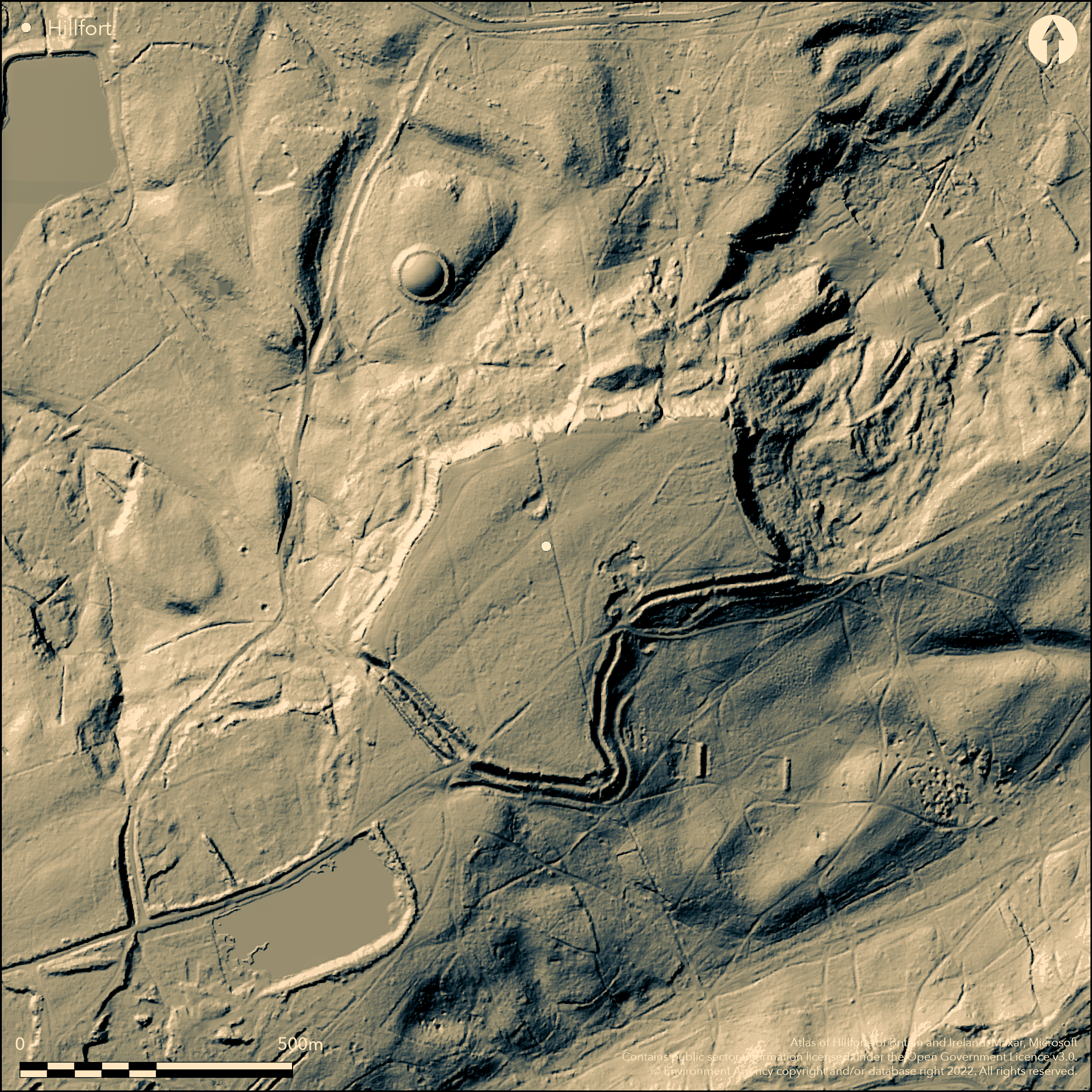
LiDAR 1m DTM Hillshade
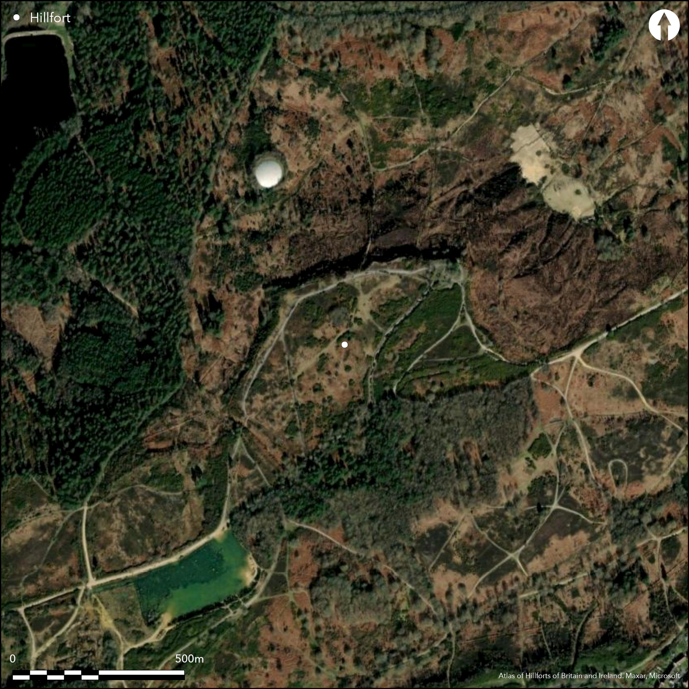
Satellite Imagery
LiDAR 1m DTM Hillshade
Satellite Imagery
Scroll left/right to view further images.
HER: Surrey 1425 (None); Hampshire 28636
NMR: SU 85 SW 1 (247709)
SM: 1007895
NGR: SU 83540 50104
X: 483540 Y: 150104 (OSGB36)
Situated to the W of Aldershot on an inland promontory in a commanding position with good views, on Speed's 17th century map of Hampshire, 1st Ed OS map (1885-1900) and in an 1862-3 survey of Aldershot District (Festing). The county boundary with Hampshire runs through it. A multivallate hillfort enclosing 10.5ha, much damaged by roads and other military works. There are no traces of banks and ditches on the N and NE although the natural slope is steeply scarped. On the E side are two banks, the inner 10m wide and 3m high, the outer 2m high and 6m wide, a ditch between is 5m wide and 2m deep, an outer ditch is 1m deep. The SE corner has three banks with traces of a counterscarp bank around the S side. The ramparts are best preserved to the S where they cut off the promontory. There is an area of wet boggy ground to the SW which seems to be incorporated into the enclosing works. The original entrance is mid-way along the E side although quarrying has damaged it, the outer bank on one side forms a hornwork. A break through the S ramparts with a trackway is probably not original. The W side is complicated by a medieval park pale. In 1970 small scale excavations across the W bank showed four phases of construction: phase A, a univallate site consisting of a palisade in a trench with a small bank behind it; phase B, a multivallate hillfort with trench palisade replaced by a posthole palisade plus an outer bank; phase C, a dump rampart constructed over the timbers of Phase B which have rotted in situ. There was no evidence of further activity until the medieval period, phase D, when the park pale was excavated and spoil from it thrown up onto the remains of the phase C Iron Age defences (Riall 1983). In the 13th century the hillfort was part of the parks attached to Farnham Castle.
Citizen Science: ✓
Reliability of Data: Confirmed
Reliability of Interpretation: Confirmed
X: -89563 Y: 6664559 (EPSG: 3857)
Longitude: -0.804561922281208 Latitude: 51.2439466601973 (EPSG:4326)
Country: England; England
Current County or Unitary Authority: Surrey; Hampshire
Historic County: Surrey
Current Parish/Community/Council/Townland: Farnham; Rushmoor
None
| Extant | ✓ |
| Cropmark | ✗ |
| Likely Destroyed | ✓ |
None
| Woodland | ✓ |
| Commercial Forestry Plantation | ✗ |
| Parkland | ✗ |
| Pasture (Grazing) | ✗ |
| Arable | ✗ |
| Scrub/Bracken | ✓ |
| Bare Outcrop | ✗ |
| Heather/Moorland | ✗ |
| Heath | ✗ |
| Built-up | ✗ |
| Coastal Grassland | ✗ |
| Other | ✗ |
A contour fort on an inland promontory in a commanding position with good views
| Contour Fort | ✓ |
| Partial Contour Fort | ✗ |
| Promontory Fort | ✗ |
| Hillslope Fort | ✗ |
| Level Terrain Fort | ✗ |
| Marsh Fort | ✗ |
| Multiple Enclosure Fort | ✗ |
| Hilltop | ✗ |
| Coastal Promontory | ✗ |
| Inland Promontory | ✓ |
| Valley Bottom | ✗ |
| Knoll/Hillock/Outcrop | ✗ |
| Ridge | ✗ |
| Cliff/Plateau-edge/Scarp | ✗ |
| Hillslope | ✗ |
| Lowland | ✗ |
| Spur | ✗ |
Dominant Topographic Feature: on an inland promontory in a commanding position with good views
| North | ✗ |
| Northeast | ✗ |
| East | ✗ |
| Southeast | ✗ |
| South | ✗ |
| Southwest | ✗ |
| West | ✗ |
| Northwest | ✗ |
| Level | ✓ |
Altitude: 175.0m
The Surrey/Hampshire border runs through the site
Boundary Type: County
Excavated evidence for the ramparts suggests Iron Age although there is no direct dating evidence. Medieval park pale.
Reliability: C - Low
| Pre 1200BC | ✗ |
| 1200BC - 800BC | ✗ |
| 800BC - 400BC | ✓ |
| 400BC - AD50 | ✓ |
| AD50 - AD400 | ✗ |
| AD400 - AD 800 | ✗ |
| Post AD800 | ✗ |
| Unknown | ✗ |
| Pre Hillfort: | None |
| Post Hillfort: | None |
In Aubrey's Monumenta Britannica (1665-1693). On Speed's map of Hampshire (17th century). On 1st Ed OS map (1885-1900). Described 1862-3 (Festing). Small excavation 1970 (Riall 1983). LiDAR analysis (BEVARS Citizen Science, 2015).
| Excavation (1970): | None |
| LiDAR Survey (2015): | None |
| 1st Identified Written Reference (None): | None |
| 1st Identified Map Depiction (None): | None |
No evidence for interior features
There is an area of wet boggy ground to the SW which seems to be incorporated into the enclosing works.
| None | ✗ |
| Spring | ✓ |
| Stream | ✗ |
| Pool | ✗ |
| Flush | ✗ |
| Well | ✗ |
| Other | ✗ |
None
| No Known Features | ✓ |
| Round Stone Structures | ✗ |
| Rectangular Stone Structures | ✗ |
| Curvilinear Platforms | ✗ |
| Other Roundhouse Evidence | ✗ |
| Pits | ✗ |
| Quarry Hollows | ✗ |
| Other | ✗ |
None
| No Known Excavation | ✓ |
| Pits | ✗ |
| Postholes | ✗ |
| Roundhouses | ✗ |
| Rectangular Structures | ✗ |
| Roads/Tracks | ✗ |
| Quarry Hollows | ✗ |
| Other | ✗ |
| Nothing Found | ✗ |
None
| No Known Geophysics | ✓ |
| Pits | ✗ |
| Roundhouses | ✗ |
| Rectangular Structures | ✗ |
| Roads/Tracks | ✗ |
| Quarry Hollows | ✗ |
| Other | ✗ |
| Nothing Found | ✗ |
None
| No Known Finds | ✓ |
| Pottery | ✗ |
| Metal | ✗ |
| Metalworking | ✗ |
| Human Bones | ✗ |
| Animal Bones | ✗ |
| Lithics | ✗ |
| Environmental | ✗ |
| Other | ✗ |
NO APPARENT FEATURES
| APs Not Checked | ✓ |
| None | ✗ |
| Roundhouses | ✗ |
| Rectangular Structures | ✗ |
| Pits | ✗ |
| Postholes | ✗ |
| Roads/Tracks | ✗ |
| Other | ✗ |
The original entrance is mid-way along the E side although quarrying has damaged it, the outer bank on one side forms a hornwork. A break through the S ramparts with a trackway is probably not original.
| 4: | None |
| 2: | None |
Guard Chambers: ✗
Chevaux de Frise: ✗
| 1. Hornwork (East): | None |
There are no traces of banks and ditches on the N and NE although the natural slope is steeply scarped. On the E side are two banks, the inner 10m wide and 3m high, the outer 2m high and 6m wide, a ditch between is 5m wide and 2m deep, an outer ditch is 1m deep. The SE corner has three banks with traces of a counterscarp bank around the S side. The ramparts are best preserved to the S where they cut off the promontory. There is an area of wet boggy ground to the SW which seems to be incorporated into the enclosing works. In 1970 small scale excavations across the W ramparts showed four phases of construction: phase A, a univallate site consisting of a palisade in a trench with a small bank behind it; phase B, a multivallate hillfort with trench palisade replaced by a posthole palisade plus an outer bank; phase C, a dump rampart constructed over the timbers of Phase B which have rotted in situ. There was no evidence of further activity until the medieval period, phase D, when the park pale was excavated and spoil from it thrown up onto the remains of the phase C Iron Age defences (Riall 1983).
| Area 1: | 10.5ha. |
| Total: | 10.5ha. |
Total Footprint Area: Noneha.
None
| ✗ | None |
| ✗ | None |
| NE Quadrant: | None |
| SE Quadrant: | 3 |
| SW Quadrant: | 2 |
| NW Quadrant: | None |
| Total: | 3 |
| Partial Univallate | ✗ |
| Univallate | ✗ |
| Partial Bivallate | ✓ |
| Bivallate | ✗ |
| Partial Multivallate | ✓ |
| Multivallate | ✗ |
| Unknown | ✗ |
| Partial Univallate | ✗ |
| Univallate | ✗ |
| Partial Bivallate | ✗ |
| Bivallate | ✗ |
| Partial Multivallate | ✗ |
| Multivallate | ✗ |
None
| None | ✗ |
| Earthen Bank | ✓ |
| Stone Wall | ✗ |
| Rubble | ✗ |
| Wall-walk | ✗ |
| Evidence of Timber | ✗ |
| Vitrification | ✗ |
| Other Burning | ✗ |
| Palisade | ✗ |
| Counter Scarp Bank | ✓ |
| Berm | ✗ |
| Unfinished | ✗ |
| Other | ✗ |
None
| None | ✗ |
| Earthen Bank | ✓ |
| Stone Wall | ✗ |
| Murus Duplex | ✗ |
| Timber-framed | ✗ |
| Timber-laced | ✗ |
| Vitrification | ✗ |
| Other Burning | ✗ |
| Palisade | ✓ |
| Counter Scarp Bank | ✓ |
| Berm | ✗ |
| Unfinished | ✗ |
| No Known Excavation | ✗ |
| Other | ✗ |
| ✗ | None |
| ✓ | None |
Number of Ditches: 2
| ✗ | None |
Festing, J. 1862-3. A survey of Aldershot District.
Hamilton, S. and Manley, J. 2001. Hillforts, monumentality and place: a chronological and topographical review of First millennium BC hillforts of South-East England. European J Archaeol, 4(1), 7-42.
Riall, N. 1983. Excavations at Caesar's Camp. Aldershot, Hampshire, Proc Hampshire Fld Club Archaeol Soc., 39, 47-56.
Atlas of Hillforts:
Wikidata:
This work is licensed under CC BY-SA 4.0

 and should be cited as:
Lock, Gary and Ralston, Ian. 2024. Atlas of Hillforts of Britain and Ireland. Available at: https://hillforts.arch.ox.ac.uk
Document Version 1.1