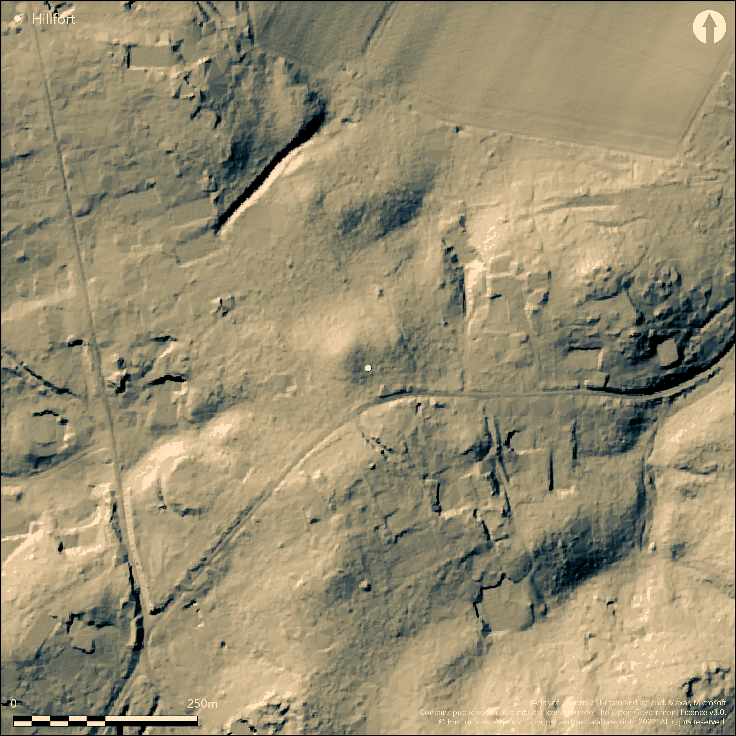
LiDAR 1m DTM Hillshade
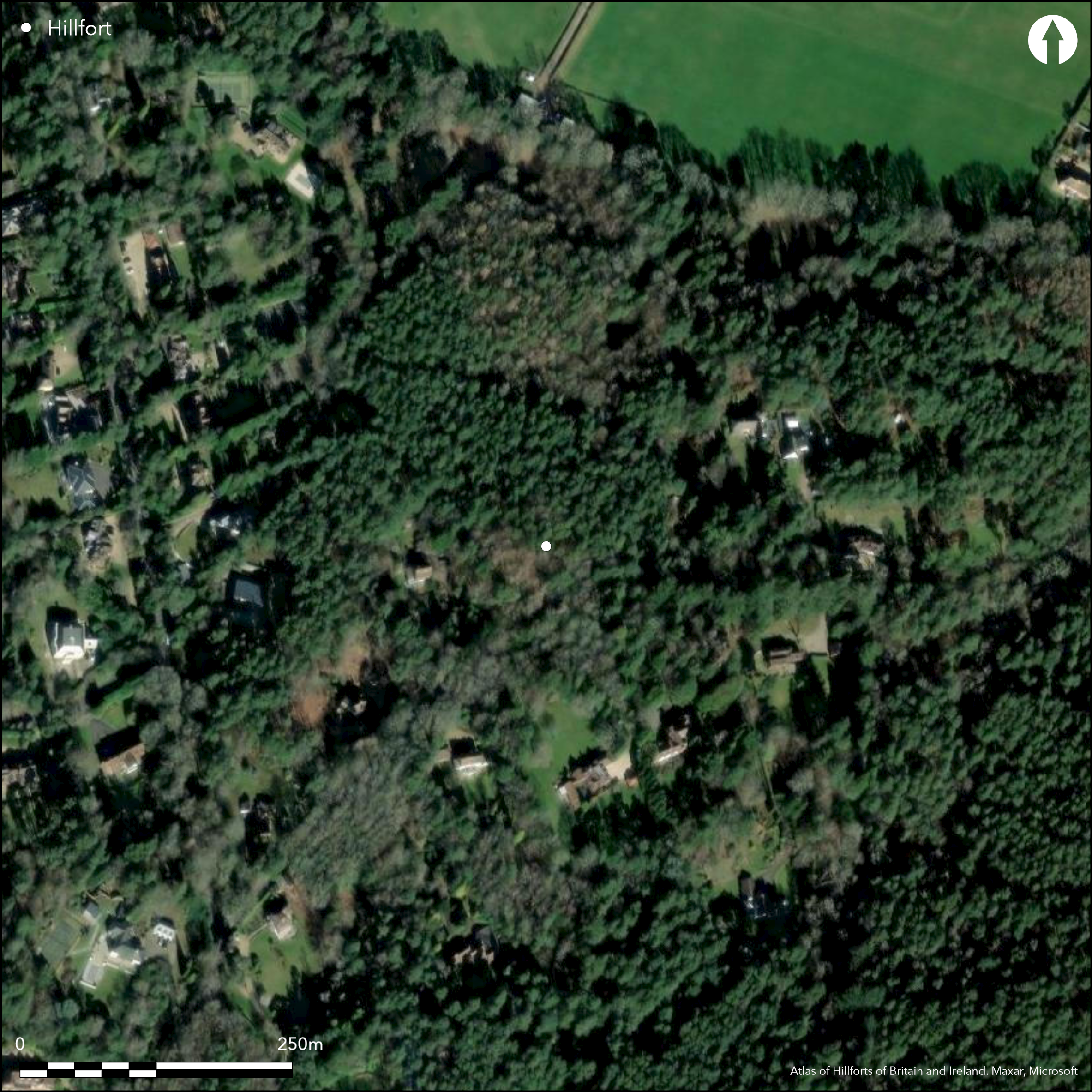
Satellite Imagery
LiDAR 1m DTM Hillshade
Satellite Imagery
Scroll left/right to view further images.
HER: Surrey 1727 (None)
NMR: SU 84 NE 17 (247197)
SM: 1013869
NGR: SU 8766 4636
X: 487660 Y: 146360 (OSGB36)
Situated to the SW of The Sands, on a steep sided knoll on the SW slope of Botany Hill, 500m W of Soldier's Ring (Atlas number 2573) and similar in size and form. C-shaped in plan, univallate with a bank and outer ditch, open to the E, enclosed area measures approximately 40m N-S, enclosing approximately 0.2ha. On the SW the bank is 6m wide and 0.5m high, the ditch is 6m wide and 1m deep, the ditch shows to the W and N as a 4m wide terrace c. 2m below the level of the hilltop. To the W and N the natural steep slope of the hill has been scarped for additional effect. Beyond the ditch to the SW is a counterscarp bank 5m wide and 1.2m high. A small-scale excavation (Reeves 1993) suggested that the ramparts did not form a continuous circuit and the site was possibly unfinished. No evidence for interior features or an entrance. Surface finds of calcined stone. Shown on OS 6" map (1961). Undated. Originally thought to be a barrow, also perhaps medieval (Hanworth 1976), but scheduled as a slight univallate hillfort.
Citizen Science: ✗
Reliability of Data: Confirmed
Reliability of Interpretation: Confirmed
X: -83096 Y: 6658466 (EPSG: 3857)
Longitude: -0.7464661939059235 Latitude: 51.20967081600829 (EPSG:4326)
Country: England
Current County or Unitary Authority: Surrey
Historic County: Surrey
Current Parish/Community/Council/Townland: Farnham
None
| Extant | ✓ |
| Cropmark | ✗ |
| Likely Destroyed | ✗ |
None
| Woodland | ✓ |
| Commercial Forestry Plantation | ✗ |
| Parkland | ✗ |
| Pasture (Grazing) | ✗ |
| Arable | ✗ |
| Scrub/Bracken | ✗ |
| Bare Outcrop | ✗ |
| Heather/Moorland | ✗ |
| Heath | ✗ |
| Built-up | ✗ |
| Coastal Grassland | ✗ |
| Other | ✗ |
A hillslope fort facing west
| Contour Fort | ✗ |
| Partial Contour Fort | ✗ |
| Promontory Fort | ✗ |
| Hillslope Fort | ✓ |
| Level Terrain Fort | ✗ |
| Marsh Fort | ✗ |
| Multiple Enclosure Fort | ✗ |
| Hilltop | ✗ |
| Coastal Promontory | ✗ |
| Inland Promontory | ✗ |
| Valley Bottom | ✗ |
| Knoll/Hillock/Outcrop | ✗ |
| Ridge | ✗ |
| Cliff/Plateau-edge/Scarp | ✗ |
| Hillslope | ✓ |
| Lowland | ✗ |
| Spur | ✗ |
Dominant Topographic Feature: None
| North | ✗ |
| Northeast | ✗ |
| East | ✗ |
| Southeast | ✗ |
| South | ✗ |
| Southwest | ✗ |
| West | ✓ |
| Northwest | ✗ |
| Level | ✗ |
Altitude: 120.0m
N/A
No dating evidence
Reliability: D - None
| Pre 1200BC | ✗ |
| 1200BC - 800BC | ✗ |
| 800BC - 400BC | ✗ |
| 400BC - AD50 | ✗ |
| AD50 - AD400 | ✗ |
| AD400 - AD 800 | ✗ |
| Post AD800 | ✗ |
| Unknown | ✓ |
| Pre Hillfort: | None |
| Post Hillfort: | None |
Shown on OS 6" map (1961). Excavation 1993.
| 1st Identified Map Depiction (1961): | None |
| Excavation (1993): | None |
No evidence for interior. Surface finds of calcined stone.
None
| None | ✓ |
| Spring | ✗ |
| Stream | ✗ |
| Pool | ✗ |
| Flush | ✗ |
| Well | ✗ |
| Other | ✗ |
None
| No Known Features | ✓ |
| Round Stone Structures | ✗ |
| Rectangular Stone Structures | ✗ |
| Curvilinear Platforms | ✗ |
| Other Roundhouse Evidence | ✗ |
| Pits | ✗ |
| Quarry Hollows | ✗ |
| Other | ✗ |
None
| No Known Excavation | ✓ |
| Pits | ✗ |
| Postholes | ✗ |
| Roundhouses | ✗ |
| Rectangular Structures | ✗ |
| Roads/Tracks | ✗ |
| Quarry Hollows | ✗ |
| Other | ✗ |
| Nothing Found | ✗ |
None
| No Known Geophysics | ✓ |
| Pits | ✗ |
| Roundhouses | ✗ |
| Rectangular Structures | ✗ |
| Roads/Tracks | ✗ |
| Quarry Hollows | ✗ |
| Other | ✗ |
| Nothing Found | ✗ |
None
| No Known Finds | ✗ |
| Pottery | ✗ |
| Metal | ✗ |
| Metalworking | ✗ |
| Human Bones | ✗ |
| Animal Bones | ✗ |
| Lithics | ✓ |
| Environmental | ✗ |
| Other | ✗ |
NO APPARENT FEATURES
| APs Not Checked | ✓ |
| None | ✗ |
| Roundhouses | ✗ |
| Rectangular Structures | ✗ |
| Pits | ✗ |
| Postholes | ✗ |
| Roads/Tracks | ✗ |
| Other | ✗ |
No evidence for entrances
| None: | None |
| 2: | None |
Guard Chambers: ✗
Chevaux de Frise: ✗
C-shaped in plan, univallate with a bank and outer ditch, open to the E, enclosed area measures c40m N-S, c0.18ha. On the SW the bank is 6m wide and 0.5m high, the ditch is 6m wide and 1m deep, the ditch shows to the W and N as a 4m wide terrace c2m below the level of the hilltop. To the W and N the natural steep slope of the hill has been scarped for additional effect. Beyond the ditch to the SW is a counterscarp bank 5m wide and 1.2m high.
| Area 1: | 0.2ha. |
| Total: | 0.2ha. |
Total Footprint Area: Noneha.
None
| ✗ | None |
| ✗ | None |
| NE Quadrant: | None |
| SE Quadrant: | None |
| SW Quadrant: | 1 |
| NW Quadrant: | 1 |
| Total: | 1 |
| Partial Univallate | ✓ |
| Univallate | ✗ |
| Partial Bivallate | ✗ |
| Bivallate | ✗ |
| Partial Multivallate | ✗ |
| Multivallate | ✗ |
| Unknown | ✗ |
| Partial Univallate | ✗ |
| Univallate | ✗ |
| Partial Bivallate | ✗ |
| Bivallate | ✗ |
| Partial Multivallate | ✗ |
| Multivallate | ✗ |
None
| None | ✗ |
| Earthen Bank | ✓ |
| Stone Wall | ✗ |
| Rubble | ✗ |
| Wall-walk | ✗ |
| Evidence of Timber | ✗ |
| Vitrification | ✗ |
| Other Burning | ✗ |
| Palisade | ✗ |
| Counter Scarp Bank | ✗ |
| Berm | ✗ |
| Unfinished | ✓ |
| Other | ✗ |
None
| None | ✗ |
| Earthen Bank | ✓ |
| Stone Wall | ✗ |
| Murus Duplex | ✗ |
| Timber-framed | ✗ |
| Timber-laced | ✗ |
| Vitrification | ✗ |
| Other Burning | ✗ |
| Palisade | ✗ |
| Counter Scarp Bank | ✗ |
| Berm | ✗ |
| Unfinished | ✓ |
| No Known Excavation | ✗ |
| Other | ✗ |
| ✗ | None |
| ✓ | None |
Number of Ditches: 1
| ✗ | None |
Grinsell, L.V. 1934. An analysis and list of Surrey barrows.Surrey Archaeol Collect, 42, 54.
Hamilton, S. and Manley, J. 2001. Hillforts, monumentality and place: a chronological and topographical review of First millennium BC hillforts of South-East England. European J Archaeol, 4(1), 7-42.
Hanworth, R. 1976. Seale, Crooksbury: Two dubious hillforts. Surrey Archael Bulletin, 123, January 1976.
Lowther, A. 1939. Survey of the prehistory of the Farnham district, Surrey, Surrey Archaeological Society, 204.
Reeves, P. 1993. Report on the evaluation excavation of earthworks on Botany Hill. CAS Code 491, in HER, Unpublished.
Atlas of Hillforts:
Wikidata:
This work is licensed under CC BY-SA 4.0

 and should be cited as:
Lock, Gary and Ralston, Ian. 2024. Atlas of Hillforts of Britain and Ireland. Available at: https://hillforts.arch.ox.ac.uk
Document Version 1.1