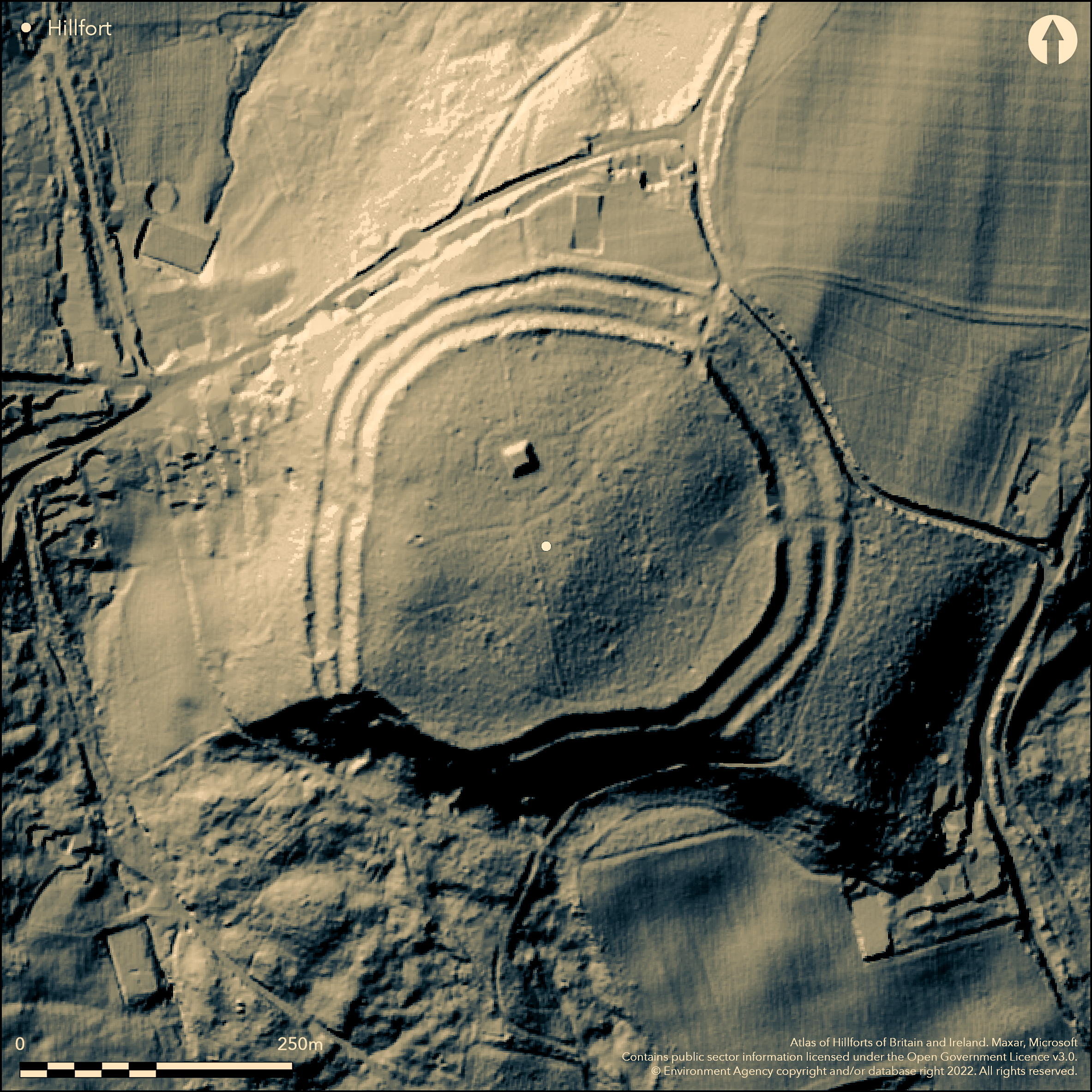
LiDAR 1m DTM Hillshade
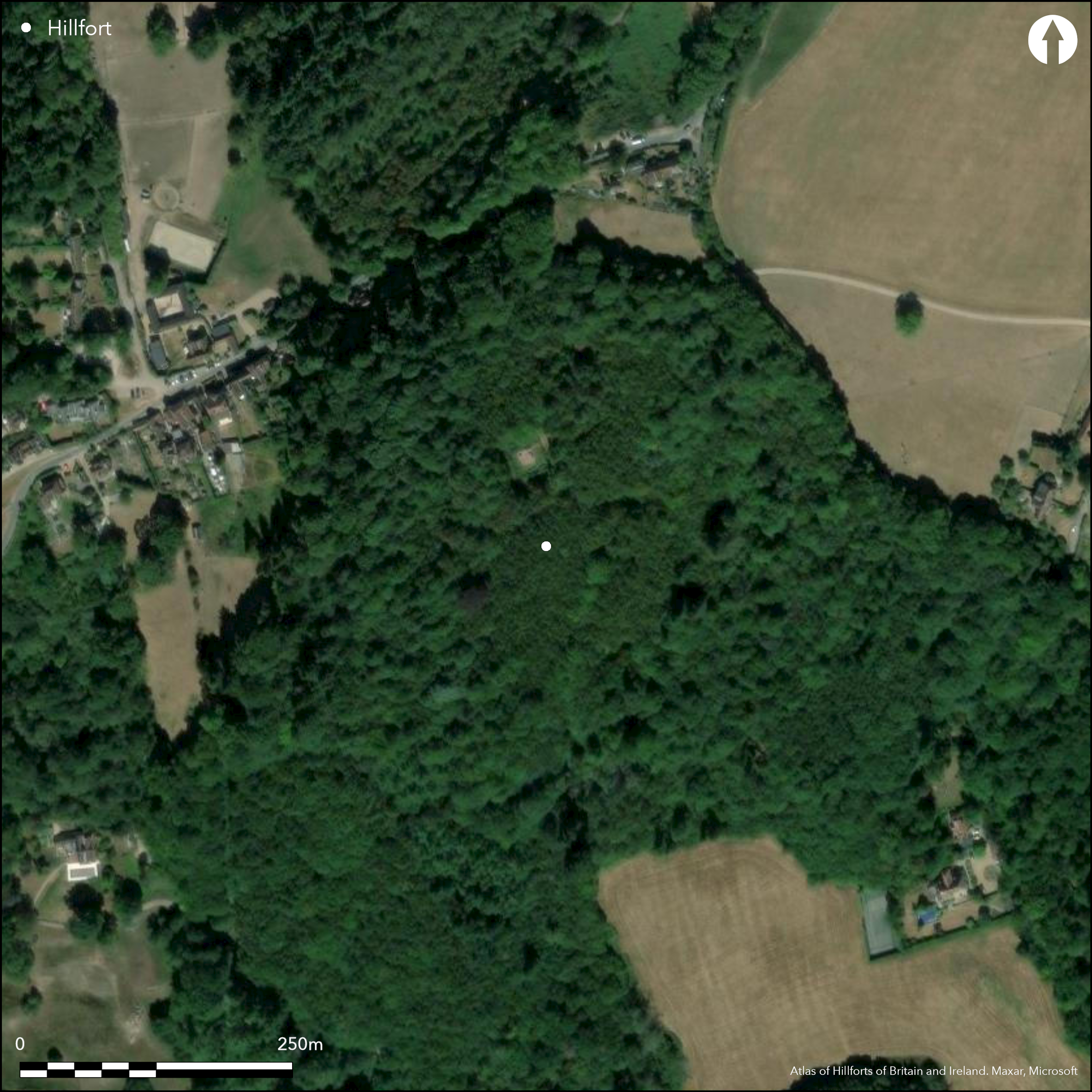
Satellite Imagery
LiDAR 1m DTM Hillshade
Satellite Imagery
Scroll left/right to view further images.
HER: Surrey 23 (None)
NMR: TQ 14 SE 7 (397073)
SM: 1007891
NGR: TQ 1535 4400
X: 515350 Y: 144000 (OSGB36)
Located on the top of a rounded spur overlooking the village of Coldharbour, one of several hillforts on the Greensand Ridge overlooking the Weald to the S. Multivallate, sub-circular enclosing 5.0ha. Triple ramparts and ditches around the whole circuit except for the S side where the slope is steep possibly as the result of a landslip, part of the inner rampart survives. The natural slope is also steep to the W where artifical terraces enhance the ramparts. The inner rampart is 4m high and 15m wide in places with its ditch being 6m wide and 1m deep. To the N and E is an 11m wide berm before the second rampart which is 2m high and 15m wide, its ditch is 5m wide and 0.5m deep. The outer bank may be a counterscarp at 8m wide and 1m high maximum although there is evidence for a third ditch in places. The entrance is a simple gap 10m wide at the E. Excavations in 1972-3 (Thompson 1979) showed that the inner rampart was faced with massive sandstone blocks. It was also suggested that the entrance and ramparts were of one build and to the N were unfinished and may be associated with the demolition of the main rampart due to Caesar's landings in 55 and 54BC. Further small scale excavation (Bird et. al. 1990; Hayman 2008) showed some pits and Iron Age and Roman pottery. It is suggested that the hillfort is late and was re-occupied in the Roman period (Seager Thomas 2010). Shown on 1st Edition OS maps (1885-1900), an early plan by Downman (1904). Pottery suggests the site was re-occupied in the Roman period.
Citizen Science: ✓
Reliability of Data: Confirmed
Reliability of Interpretation: Confirmed
X: -39070 Y: 6653825 (EPSG: 3857)
Longitude: -0.35097083468118967 Latitude: 51.18354178886027 (EPSG:4326)
Country: England
Current County or Unitary Authority: Surrey
Historic County: Surrey
Current Parish/Community/Council/Townland: Capel
Included in the 2015 Heritage at Risk Register as generally unsatisfactory with principal vulnerability from tree and shrub growth
| Extant | ✓ |
| Cropmark | ✗ |
| Likely Destroyed | ✗ |
None
| Woodland | ✓ |
| Commercial Forestry Plantation | ✗ |
| Parkland | ✗ |
| Pasture (Grazing) | ✗ |
| Arable | ✗ |
| Scrub/Bracken | ✓ |
| Bare Outcrop | ✗ |
| Heather/Moorland | ✗ |
| Heath | ✗ |
| Built-up | ✗ |
| Coastal Grassland | ✗ |
| Other | ✗ |
On the top of a rounded spur on the Greensand Ridge, partial contour fort, overlooking the Weald
| Contour Fort | ✗ |
| Partial Contour Fort | ✓ |
| Promontory Fort | ✗ |
| Hillslope Fort | ✗ |
| Level Terrain Fort | ✗ |
| Marsh Fort | ✗ |
| Multiple Enclosure Fort | ✗ |
| Hilltop | ✗ |
| Coastal Promontory | ✗ |
| Inland Promontory | ✗ |
| Valley Bottom | ✗ |
| Knoll/Hillock/Outcrop | ✗ |
| Ridge | ✓ |
| Cliff/Plateau-edge/Scarp | ✗ |
| Hillslope | ✗ |
| Lowland | ✗ |
| Spur | ✗ |
Dominant Topographic Feature: Ridge overlooking the Weald
| North | ✗ |
| Northeast | ✗ |
| East | ✗ |
| Southeast | ✗ |
| South | ✗ |
| Southwest | ✗ |
| West | ✗ |
| Northwest | ✗ |
| Level | ✓ |
Altitude: 245.0m
N/A
One C14 date, dated by potterySmall reservoir in the centre.
Reliability: B - Medium
| Pre 1200BC | ✗ |
| 1200BC - 800BC | ✗ |
| 800BC - 400BC | ✗ |
| 400BC - AD50 | ✓ |
| AD50 - AD400 | ✗ |
| AD400 - AD 800 | ✗ |
| Post AD800 | ✗ |
| Unknown | ✗ |
| Pre Hillfort: | None |
| Post Hillfort: | None |
| Artefactual: | None |
In Aubrey's Monumenta Britannica (1665-1693). Shown on 1st Edition OS maps (1885-1900), an early plan by Downman (1904). Excavation and geophysics in 1972-73 (Thompson), further small scale excavation and geophysics in 1987 (Bird et al 1990), excavation in 1989/91 (Hayman 2008). RCHME survey, ref. no. 832700.
| Earthwork Survey (1904): | None |
| Other (1975): | Visit by Hillfort Study Group |
| Geophysical Survey (1987): | None |
| Excavation (1987): | None |
| 1st Identified Written Reference (None): | None |
| 1st Identified Map Depiction (None): | None |
| Geophysical Survey (None): | None |
| Excavation (None): | None |
| Earthwork Survey (None): | None |
| Excavation (None): | None |
Pits from excavation, Iron Age and Roman pottery, sling stones
None
| None | ✓ |
| Spring | ✗ |
| Stream | ✗ |
| Pool | ✗ |
| Flush | ✗ |
| Well | ✗ |
| Other | ✗ |
None
| No Known Features | ✓ |
| Round Stone Structures | ✗ |
| Rectangular Stone Structures | ✗ |
| Curvilinear Platforms | ✗ |
| Other Roundhouse Evidence | ✗ |
| Pits | ✗ |
| Quarry Hollows | ✗ |
| Other | ✗ |
None
| No Known Excavation | ✗ |
| Pits | ✓ |
| Postholes | ✗ |
| Roundhouses | ✗ |
| Rectangular Structures | ✗ |
| Roads/Tracks | ✗ |
| Quarry Hollows | ✗ |
| Other | ✗ |
| Nothing Found | ✗ |
None
| No Known Geophysics | ✗ |
| Pits | ✓ |
| Roundhouses | ✗ |
| Rectangular Structures | ✗ |
| Roads/Tracks | ✗ |
| Quarry Hollows | ✗ |
| Other | ✗ |
| Nothing Found | ✗ |
None
| No Known Finds | ✗ |
| Pottery | ✓ |
| Metal | ✗ |
| Metalworking | ✗ |
| Human Bones | ✗ |
| Animal Bones | ✗ |
| Lithics | ✗ |
| Environmental | ✗ |
| Other | ✓ |
NO APPARENT FEATURES
| APs Not Checked | ✓ |
| None | ✗ |
| Roundhouses | ✗ |
| Rectangular Structures | ✗ |
| Pits | ✗ |
| Postholes | ✗ |
| Roads/Tracks | ✗ |
| Other | ✗ |
A simple gap 10m wide to the E. A further break to the NE is modern.
| 2: | None |
| 2: | None |
Guard Chambers: ✗
Chevaux de Frise: ✗
| 1. Simple Gap (East): | None |
Triple ramparts and ditches around the whole circuit except for the S side where the slope is steep possibly as the result of a landslip and part of the inner rampart survives. The natural slope is also steep to the W where artifical terraces enhance the ramparts. The inner rampart is 4m high and 15m wide in places with its ditch being 6m wide and 1m deep, facing of large sandstone blocks shown by excavation. To the N and E is an 11m wide berm before the second rampart which is 2m high and 15m wide, its ditch is 5m wide and 0.5m deep. The outer bank may be a counterscarp at 8m wide and 1m high maximum although there is evidence for a third ditch in places.
| Area 1: | 5.0ha. |
| Total: | 5.0ha. |
Total Footprint Area: Noneha.
None
| ✗ | None |
| ✗ | None |
| NE Quadrant: | 3 |
| SE Quadrant: | 3 |
| SW Quadrant: | 3 |
| NW Quadrant: | 3 |
| Total: | 3 |
| Partial Univallate | ✗ |
| Univallate | ✗ |
| Partial Bivallate | ✗ |
| Bivallate | ✗ |
| Partial Multivallate | ✗ |
| Multivallate | ✓ |
| Unknown | ✗ |
| Partial Univallate | ✗ |
| Univallate | ✗ |
| Partial Bivallate | ✗ |
| Bivallate | ✗ |
| Partial Multivallate | ✗ |
| Multivallate | ✗ |
None
| None | ✗ |
| Earthen Bank | ✓ |
| Stone Wall | ✗ |
| Rubble | ✗ |
| Wall-walk | ✗ |
| Evidence of Timber | ✗ |
| Vitrification | ✗ |
| Other Burning | ✗ |
| Palisade | ✗ |
| Counter Scarp Bank | ✓ |
| Berm | ✗ |
| Unfinished | ✓ |
| Other | ✗ |
None
| None | ✗ |
| Earthen Bank | ✓ |
| Stone Wall | ✓ |
| Murus Duplex | ✗ |
| Timber-framed | ✗ |
| Timber-laced | ✗ |
| Vitrification | ✗ |
| Other Burning | ✗ |
| Palisade | ✗ |
| Counter Scarp Bank | ✓ |
| Berm | ✗ |
| Unfinished | ✓ |
| No Known Excavation | ✗ |
| Other | ✗ |
| ✗ | None |
| ✓ | None |
Number of Ditches: 3
| ✗ | None |
Bird, D., Crocker, G. and McCracken, J. 1990. Archaeology in Surrey 1988-1989. Surrey Archaeol Coll, 80, 206.
Hamilton, S. and Manley, J. 2001. Hillforts, monumentality and place: a chronological and topographical review of First millennium BC hillforts of South-East England. European J Archaeol, 4(1), 7-42.
Hayman, G. 2008. Archaeological excavations at Anstiebury Hillfort, Coldharbour, in 1989 and 1991. Surrey Archaeol Coll, 94, 191-207.
Seager Thomas, M. 2010. A re-contextualization of the prehistoric pottery from the Surrey hillforts of Hascombe, Holmbury and Anstiebury, Surrey Archaeol Coll, 95, 1-33.
Thompson, F.H. 1979. Three Surrey hillforts: excavations at Anstiebury, Holmbury and Hascombe, 1972-77, Antiq J. 59, 245-318.
Atlas of Hillforts:
Wikidata:
This work is licensed under CC BY-SA 4.0

 and should be cited as:
Lock, Gary and Ralston, Ian. 2024. Atlas of Hillforts of Britain and Ireland. Available at: https://hillforts.arch.ox.ac.uk
Document Version 1.1