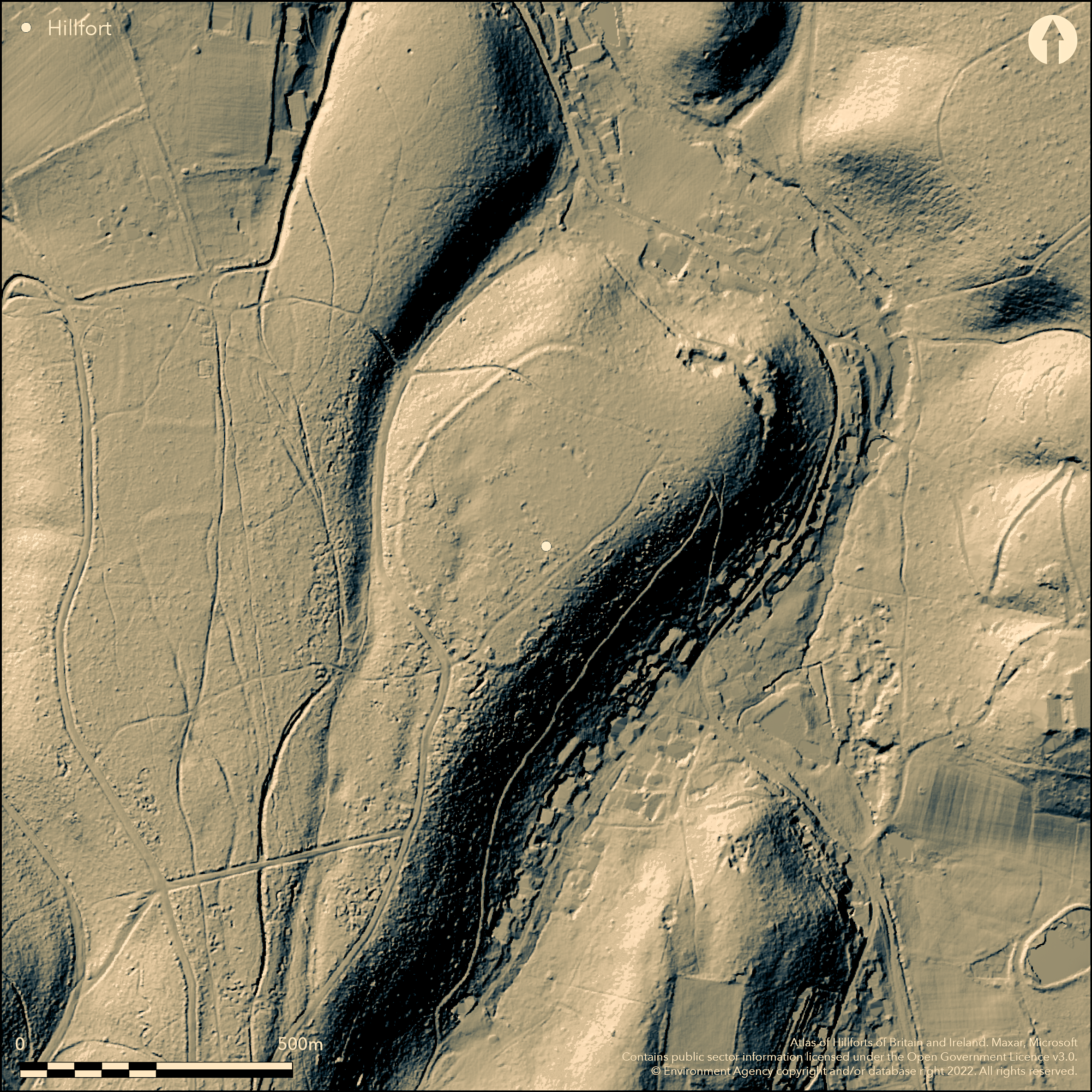
LiDAR 1m DTM Hillshade
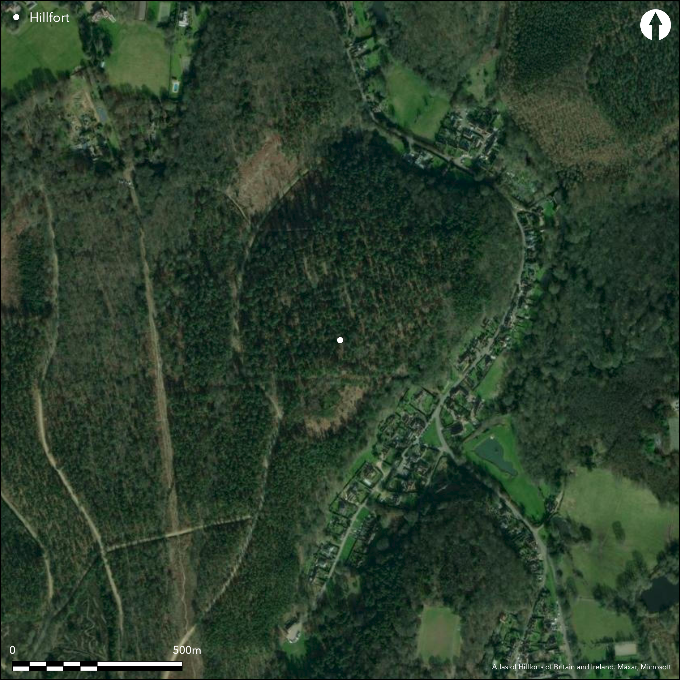
Satellite Imagery
LiDAR 1m DTM Hillshade
Satellite Imagery
Scroll left/right to view further images.
HER: Surrey 2970 (None)
NMR: TQ 14 SW 23 (963712)
SM: 1007984
NGR: TQ 10800 44700
X: 510800 Y: 144700 (OSGB36)
Situated above the village of Holmbury St Mary on a NE facing spur of the Greensand Ridge, one of several hillforts overlooking the Weald to the S, only 2k from Holmbury Camp (Atlas No. 2574). Only recognised as a hillfort in the 1980s, it is a univallate C-shaped enclosure of 7ha. On the N, W and S sides the rampart is 12m wide and 1m high with an external ditch of 5m wide and 0.7m deep, there are traces of a counterscarp bank up to 8m wide and 0.3m high. To the E the natural slope is much steeper and it has been scarped to form a rampart/terrace surviving to 7m wide and 2m below the natural slope, land slipping in this area may have affected it or it may be unfinished. Minor excavations (Field 1989) revealed a V-shaped ditch c. 2m deep and a rampart with a laid rubble core. Pottery from the mid 1st century AD was found in the mid fills of the ditch suggesting to the excavator that its construction was earlier and it was not in use at this date. Entrance may be to the S where a ditch terminal was excavated, no internal features. Not on OS mapping. Situated in the S area of the enclosure are the remains of a WW1 prisoner of war camp.
Citizen Science: ✓
Reliability of Data: Confirmed
Reliability of Interpretation: Confirmed
X: -46290 Y: 6655102 (EPSG: 3857)
Longitude: -0.41582930060255485 Latitude: 51.19073315017895 (EPSG:4326)
Country: England
Current County or Unitary Authority: Surrey
Historic County: Surrey
Current Parish/Community/Council/Townland: Shere
None
| Extant | ✓ |
| Cropmark | ✗ |
| Likely Destroyed | ✗ |
None
| Woodland | ✓ |
| Commercial Forestry Plantation | ✗ |
| Parkland | ✗ |
| Pasture (Grazing) | ✗ |
| Arable | ✗ |
| Scrub/Bracken | ✗ |
| Bare Outcrop | ✗ |
| Heather/Moorland | ✗ |
| Heath | ✗ |
| Built-up | ✗ |
| Coastal Grassland | ✗ |
| Other | ✗ |
A partial contour fort on the Greensand Ridge overlooking the Weald to the S
| Contour Fort | ✗ |
| Partial Contour Fort | ✓ |
| Promontory Fort | ✗ |
| Hillslope Fort | ✗ |
| Level Terrain Fort | ✗ |
| Marsh Fort | ✗ |
| Multiple Enclosure Fort | ✗ |
| Hilltop | ✗ |
| Coastal Promontory | ✗ |
| Inland Promontory | ✗ |
| Valley Bottom | ✗ |
| Knoll/Hillock/Outcrop | ✗ |
| Ridge | ✓ |
| Cliff/Plateau-edge/Scarp | ✗ |
| Hillslope | ✗ |
| Lowland | ✗ |
| Spur | ✗ |
Dominant Topographic Feature: On Greensand Ridge overlooking the Weald to the S
| North | ✗ |
| Northeast | ✗ |
| East | ✗ |
| Southeast | ✗ |
| South | ✗ |
| Southwest | ✗ |
| West | ✗ |
| Northwest | ✗ |
| Level | ✓ |
Altitude: 185.0m
N/A
Lithics and polished stone axe from hilltop. Dated by excavated pottery and one archaeomagnetic date. 18th century landscaping, WW1 prisoner of war camp.
Reliability: B - Medium
| Pre 1200BC | ✗ |
| 1200BC - 800BC | ✗ |
| 800BC - 400BC | ✗ |
| 400BC - AD50 | ✓ |
| AD50 - AD400 | ✗ |
| AD400 - AD 800 | ✗ |
| Post AD800 | ✗ |
| Unknown | ✗ |
| Pre Hillfort: | None |
| Post Hillfort: | None |
| Artefactual: | None |
Only recognised as a hillfort in the 1980s, excavations in 1985-6 (Field), surveyed in 2013 (Newell and Winser)
| Earthwork Survey (2013): | None |
| Excavation (None): | None |
No internal features. Pottery from excavations of rampart and ditch
None
| None | ✓ |
| Spring | ✗ |
| Stream | ✗ |
| Pool | ✗ |
| Flush | ✗ |
| Well | ✗ |
| Other | ✗ |
None
| No Known Features | ✓ |
| Round Stone Structures | ✗ |
| Rectangular Stone Structures | ✗ |
| Curvilinear Platforms | ✗ |
| Other Roundhouse Evidence | ✗ |
| Pits | ✗ |
| Quarry Hollows | ✗ |
| Other | ✗ |
None
| No Known Excavation | ✗ |
| Pits | ✗ |
| Postholes | ✗ |
| Roundhouses | ✗ |
| Rectangular Structures | ✗ |
| Roads/Tracks | ✗ |
| Quarry Hollows | ✗ |
| Other | ✗ |
| Nothing Found | ✓ |
None
| No Known Geophysics | ✓ |
| Pits | ✗ |
| Roundhouses | ✗ |
| Rectangular Structures | ✗ |
| Roads/Tracks | ✗ |
| Quarry Hollows | ✗ |
| Other | ✗ |
| Nothing Found | ✗ |
None
| No Known Finds | ✗ |
| Pottery | ✓ |
| Metal | ✗ |
| Metalworking | ✗ |
| Human Bones | ✗ |
| Animal Bones | ✗ |
| Lithics | ✗ |
| Environmental | ✗ |
| Other | ✗ |
NO APPARENT FEATURES
| APs Not Checked | ✓ |
| None | ✗ |
| Roundhouses | ✗ |
| Rectangular Structures | ✗ |
| Pits | ✗ |
| Postholes | ✗ |
| Roads/Tracks | ✗ |
| Other | ✗ |
Two modern breaks, entrance may be to the S where a ditch terminal was excavated,
| 3: | None |
| 2: | None |
Guard Chambers: ✗
Chevaux de Frise: ✗
| 1. Simple Gap (South): | None |
On the N, W and S sides the rampart is 12m wide and 1m high with an external ditch of 5m wide and 0.7m deep, there are traces of a counterscarp bank up to 8m wide and 0.3m high. To the E the natural slope is much steeper and it has been scarped to form a rampart/terrace surviving to 7m wide and 2m below the natural slope. Minor excavations (Field 1989) revealed a V-shaped ditch c. 2m deep and a rampart with a laid rubble core.
| Area 1: | 7.0ha. |
| Total: | 7.0ha. |
Total Footprint Area: Noneha.
None
| ✗ | None |
| ✓ | None |
| NE Quadrant: | 1 |
| SE Quadrant: | 1 |
| SW Quadrant: | 1 |
| NW Quadrant: | 1 |
| Total: | 1 |
| Partial Univallate | ✗ |
| Univallate | ✓ |
| Partial Bivallate | ✗ |
| Bivallate | ✗ |
| Partial Multivallate | ✗ |
| Multivallate | ✗ |
| Unknown | ✗ |
| Partial Univallate | ✗ |
| Univallate | ✗ |
| Partial Bivallate | ✗ |
| Bivallate | ✗ |
| Partial Multivallate | ✗ |
| Multivallate | ✗ |
None
| None | ✗ |
| Earthen Bank | ✓ |
| Stone Wall | ✗ |
| Rubble | ✗ |
| Wall-walk | ✗ |
| Evidence of Timber | ✗ |
| Vitrification | ✗ |
| Other Burning | ✗ |
| Palisade | ✗ |
| Counter Scarp Bank | ✓ |
| Berm | ✗ |
| Unfinished | ✓ |
| Other | ✗ |
None
| None | ✗ |
| Earthen Bank | ✓ |
| Stone Wall | ✗ |
| Murus Duplex | ✗ |
| Timber-framed | ✗ |
| Timber-laced | ✗ |
| Vitrification | ✗ |
| Other Burning | ✗ |
| Palisade | ✗ |
| Counter Scarp Bank | ✗ |
| Berm | ✗ |
| Unfinished | ✗ |
| No Known Excavation | ✗ |
| Other | ✗ |
| ✗ | None |
| ✓ | None |
Number of Ditches: 1
| ✗ | None |
Field, D. 1989. Felday, Holmbury St. Mary: an earthwork enclosure of the 1st Century AD. Surrey Archaeol Coll, 80, 99-116.
Hamilton, S. and Manley, J. 2001. Hillforts, monumentality and place: a chronological and topographical review of First millennium BC hillforts of South-East England. European J Archaeol, 4(1), 7-42.
Hanworth, R. 1987. The Iron Age in Surrey, in Bird, J. and Bird, D.G. (eds) The archaeology of Surrey to 1540. Guidford: Surrey Archaeological Society.
Newell, J. and Winser, K. 2103. Felday World War 1 Prisoner of War camp, an archaeological survey. Online at: https://academia.edu/5568657/Archaeological-survey-of-Felday-Iron-Age-enclosure-and-WW1-Po-W-Camp-Dorking-Surry-UK
Atlas of Hillforts:
Wikidata:
This work is licensed under CC BY-SA 4.0

 and should be cited as:
Lock, Gary and Ralston, Ian. 2024. Atlas of Hillforts of Britain and Ireland. Available at: https://hillforts.arch.ox.ac.uk
Document Version 1.1