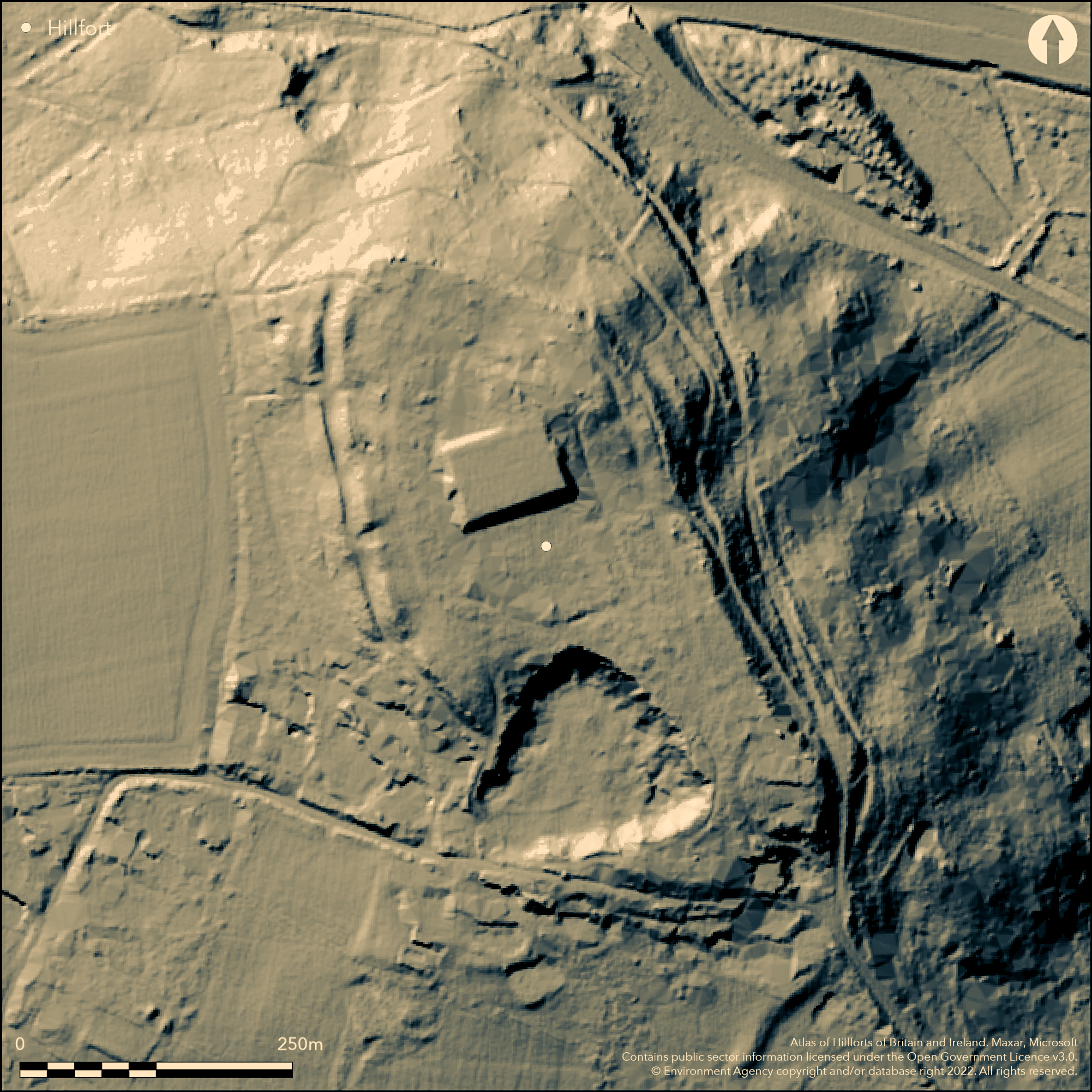
LiDAR 1m DTM Hillshade
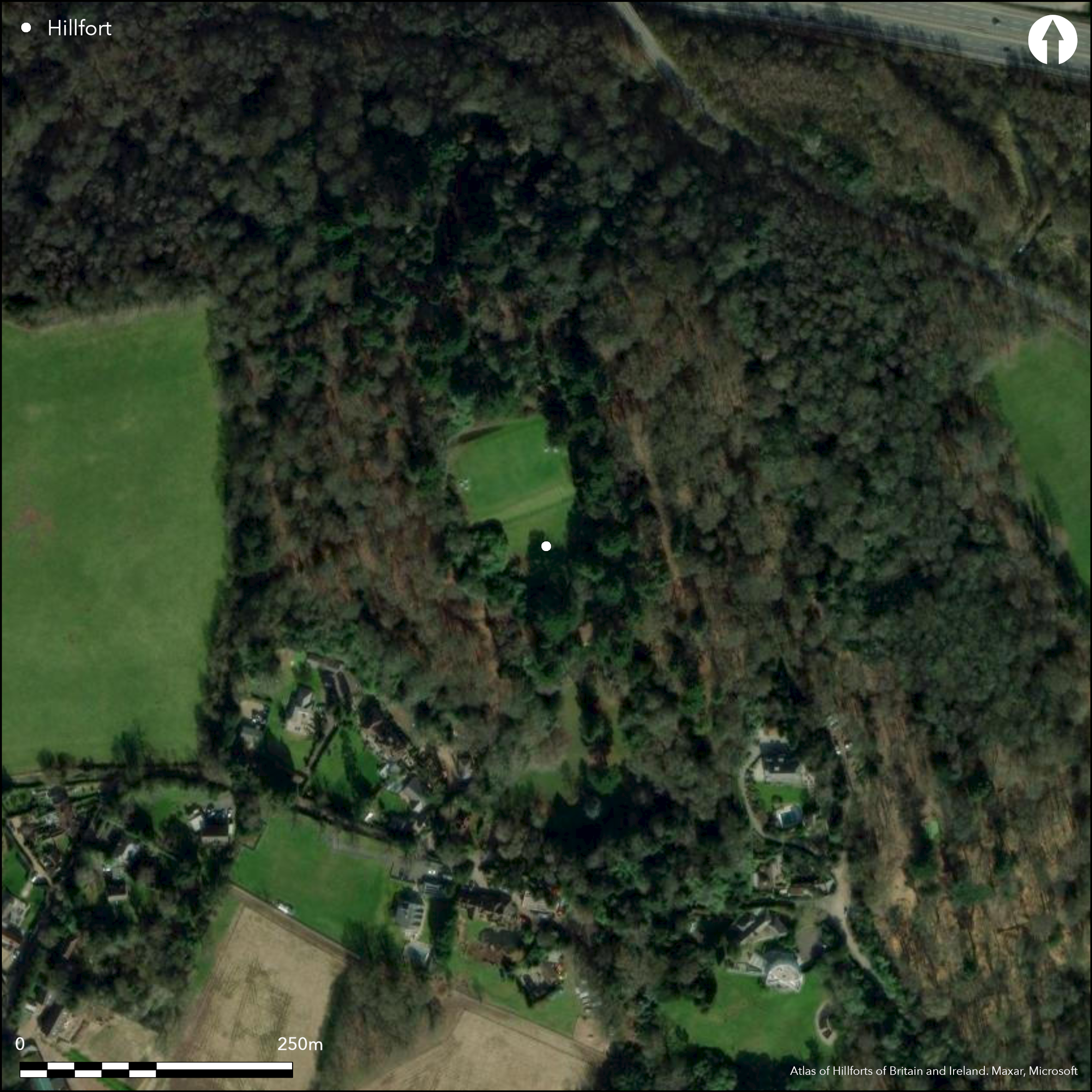
Satellite Imagery
LiDAR 1m DTM Hillshade
Satellite Imagery
Scroll left/right to view further images.
HER: Surrey 590 (None)
NMR: TQ 06 NW 14 (394403)
SM: 1016204
NGR: TQ 0265 6758
X: 502650 Y: 167580 (OSGB36)
Located on a prominent hilltop rising out of the Thames Valley NW of Chertsey. Possibly univallate enclosing 4.7ha although the ramparts are hard to follow due to tree cover and destruction by quarrying, a reservoir and trackways that cut across the hilltop. Roughly oval in plan, aligned NW-SE, univallate with an outer ditch and counterscarp bank, the earthworks are best preserved along the W side where the broad rampart, standing to a height of c.1.0m, is fronted by a ditch, c.1.5m-3.0m wide and up to c.0.5m deep, partially interrupted by a footpath. Beyond is a broad counterscarp bank less than 0.5m high. Within the fort the main rampart is only c.0.1m-0.3m above the interior. Damage to the S caused by the Dingle, a gravel quarry. There are traces of a second, outer rampart flanking the SE area of the circuit. Small excavations in 1990 showed the rampart to the NW to be of two phases, material from the ditch forming a dump rampart which was then increased in height with the ditch being re-cut. A small trench in the interior revealed domestic structures, pits, postholes, beam slots, together with early and middle Iron Age pottery suggested to be of three phases (Bird et. al. 1991). No evidence for an entrance. In the NE of the enclosure are the ruined remains of the 14th century St. Ann's chapel, possibly once associated with nearby Chertsey Abbey. Late 18th century, and later, landscaping. A reservoir and associated buildings in the interior. A Late Bronze Age spearhead found in topsoil. On OS 1:25,000 map (1937-61), RCHME survey (McOmish and Field 1994).
Citizen Science: ✓
Reliability of Data: Confirmed
Reliability of Interpretation: Confirmed
X: -58536 Y: 6691986 (EPSG: 3857)
Longitude: -0.5258415564324112 Latitude: 51.39792215376187 (EPSG:4326)
Country: England
Current County or Unitary Authority: Surrey
Historic County: Surrey
Current Parish/Community/Council/Townland: Chertsey
None
| Extant | ✓ |
| Cropmark | ✗ |
| Likely Destroyed | ✓ |
None
| Woodland | ✓ |
| Commercial Forestry Plantation | ✗ |
| Parkland | ✗ |
| Pasture (Grazing) | ✗ |
| Arable | ✗ |
| Scrub/Bracken | ✗ |
| Bare Outcrop | ✗ |
| Heather/Moorland | ✗ |
| Heath | ✗ |
| Built-up | ✓ |
| Coastal Grassland | ✗ |
| Other | ✗ |
Located on a prominent hilltop rising out of the Thames Valley, a contour fort.
| Contour Fort | ✓ |
| Partial Contour Fort | ✗ |
| Promontory Fort | ✗ |
| Hillslope Fort | ✗ |
| Level Terrain Fort | ✗ |
| Marsh Fort | ✗ |
| Multiple Enclosure Fort | ✗ |
| Hilltop | ✓ |
| Coastal Promontory | ✗ |
| Inland Promontory | ✗ |
| Valley Bottom | ✗ |
| Knoll/Hillock/Outcrop | ✗ |
| Ridge | ✗ |
| Cliff/Plateau-edge/Scarp | ✗ |
| Hillslope | ✗ |
| Lowland | ✗ |
| Spur | ✗ |
Dominant Topographic Feature: prominent hilltop in Thames Valley
| North | ✗ |
| Northeast | ✗ |
| East | ✗ |
| Southeast | ✗ |
| South | ✗ |
| Southwest | ✗ |
| West | ✗ |
| Northwest | ✗ |
| Level | ✓ |
Altitude: 60.0m
N/A
Dated to Early and Middle Iron Age by pottery from excavation. 14th century St. Ann's chapel in the interior, plus reservoir and associated buildings.
Reliability: B - Medium
| Pre 1200BC | ✗ |
| 1200BC - 800BC | ✗ |
| 800BC - 400BC | ✓ |
| 400BC - AD50 | ✓ |
| AD50 - AD400 | ✗ |
| AD400 - AD 800 | ✗ |
| Post AD800 | ✗ |
| Unknown | ✗ |
| Pre Hillfort: | None |
| Post Hillfort: | None |
| Artefactual: | None |
In Aubrey's Monumenta Britannica (1665-1693). On OS 1:25,000 map (1937-61), small scale excavation (Bird et. al. 1991), RCHME survey (McOmish and Field 1994), ref. no. 888942.
| Excavation (1990): | None |
| Earthwork Survey (1994): | None |
| 1st Identified Written Reference (None): | None |
| 1st Identified Map Depiction (None): | None |
Excavation in the interior revealed 53 Iron Age features, postholes, pits and gullies, of at least 3 phases, dated by pottery
None
| None | ✓ |
| Spring | ✗ |
| Stream | ✗ |
| Pool | ✗ |
| Flush | ✗ |
| Well | ✗ |
| Other | ✗ |
None
| No Known Features | ✓ |
| Round Stone Structures | ✗ |
| Rectangular Stone Structures | ✗ |
| Curvilinear Platforms | ✗ |
| Other Roundhouse Evidence | ✗ |
| Pits | ✗ |
| Quarry Hollows | ✗ |
| Other | ✗ |
None
| No Known Excavation | ✗ |
| Pits | ✓ |
| Postholes | ✓ |
| Roundhouses | ✗ |
| Rectangular Structures | ✗ |
| Roads/Tracks | ✗ |
| Quarry Hollows | ✗ |
| Other | ✓ |
| Nothing Found | ✗ |
None
| No Known Geophysics | ✓ |
| Pits | ✗ |
| Roundhouses | ✗ |
| Rectangular Structures | ✗ |
| Roads/Tracks | ✗ |
| Quarry Hollows | ✗ |
| Other | ✗ |
| Nothing Found | ✗ |
None
| No Known Finds | ✗ |
| Pottery | ✓ |
| Metal | ✗ |
| Metalworking | ✗ |
| Human Bones | ✗ |
| Animal Bones | ✗ |
| Lithics | ✗ |
| Environmental | ✗ |
| Other | ✗ |
NO APPARENT FEATURES
| APs Not Checked | ✓ |
| None | ✗ |
| Roundhouses | ✗ |
| Rectangular Structures | ✗ |
| Pits | ✗ |
| Postholes | ✗ |
| Roads/Tracks | ✗ |
| Other | ✗ |
No evidence for an entrance
| None: | None |
| 2: | None |
Guard Chambers: ✗
Chevaux de Frise: ✗
Roughly oval in plan, aligned NW-SE, univallate with outer ditch and counterscarp bank. The earthworks are best preserved along the W side where the broad rampart, standing to a height of c.1.0m, is fronted by a ditch, c.1.5m-3.0m wide and up to c.0.5m deep, partially interrupted by a footpath. Beyond this is a broad counterscarp bank less than 0.5m high. Within the fort the main rampart is only c.0.1m-0.3m above the interior. Damage to the S caused by the Dingle, a gravel quarry. There are traces of a second, outer rampart flanking the SE area of the circuit. Small excavations in 1990 showed the rampart to the NW to be of two phases, material from the ditch forming a dump rampart which was then increased in height with the ditch being re-cut.
| Area 1: | 4.7ha. |
| Total: | 4.7ha. |
Total Footprint Area: Noneha.
None
| ✗ | size checked on map |
| ✗ | None |
| NE Quadrant: | 1 |
| SE Quadrant: | 2 |
| SW Quadrant: | 1 |
| NW Quadrant: | 1 |
| Total: | 2 |
| Partial Univallate | ✓ |
| Univallate | ✗ |
| Partial Bivallate | ✓ |
| Bivallate | ✗ |
| Partial Multivallate | ✗ |
| Multivallate | ✗ |
| Unknown | ✗ |
| Partial Univallate | ✗ |
| Univallate | ✗ |
| Partial Bivallate | ✗ |
| Bivallate | ✗ |
| Partial Multivallate | ✗ |
| Multivallate | ✗ |
None
| None | ✗ |
| Earthen Bank | ✓ |
| Stone Wall | ✗ |
| Rubble | ✗ |
| Wall-walk | ✗ |
| Evidence of Timber | ✗ |
| Vitrification | ✗ |
| Other Burning | ✗ |
| Palisade | ✗ |
| Counter Scarp Bank | ✓ |
| Berm | ✗ |
| Unfinished | ✗ |
| Other | ✗ |
None
| None | ✗ |
| Earthen Bank | ✓ |
| Stone Wall | ✗ |
| Murus Duplex | ✗ |
| Timber-framed | ✗ |
| Timber-laced | ✗ |
| Vitrification | ✗ |
| Other Burning | ✗ |
| Palisade | ✗ |
| Counter Scarp Bank | ✗ |
| Berm | ✗ |
| Unfinished | ✗ |
| No Known Excavation | ✗ |
| Other | ✗ |
| ✗ | None |
| ✓ | None |
Number of Ditches: 1
| ✗ | None |
Bird, D., Crocker, G. and McCracken, J. 1991. Archaeology in Surrey 1988-1989. Surrey Archaeol Coll, 81, 153.
Hamilton, S. and Manley, J. 2001. Hillforts, monumentality and place: a chronological and topographical review of First millennium BC hillforts of South-East England. European J Archaeol, 4(1), 7-42.
Needham, S. 1987. The Bronze Age, in J. Bird and D.G. Bird (eds), The archaeology of Surrey to 1540. Surrey Archaeological Society, 97-137.
McOmish, D. and Field, D. 1994. A survey of the earthworks at St. Ann's Hill, Chertsey. Surrey Archaeol Coll, 82, 223-4.
Atlas of Hillforts:
Wikidata:
This work is licensed under CC BY-SA 4.0

 and should be cited as:
Lock, Gary and Ralston, Ian. 2024. Atlas of Hillforts of Britain and Ireland. Available at: https://hillforts.arch.ox.ac.uk
Document Version 1.1