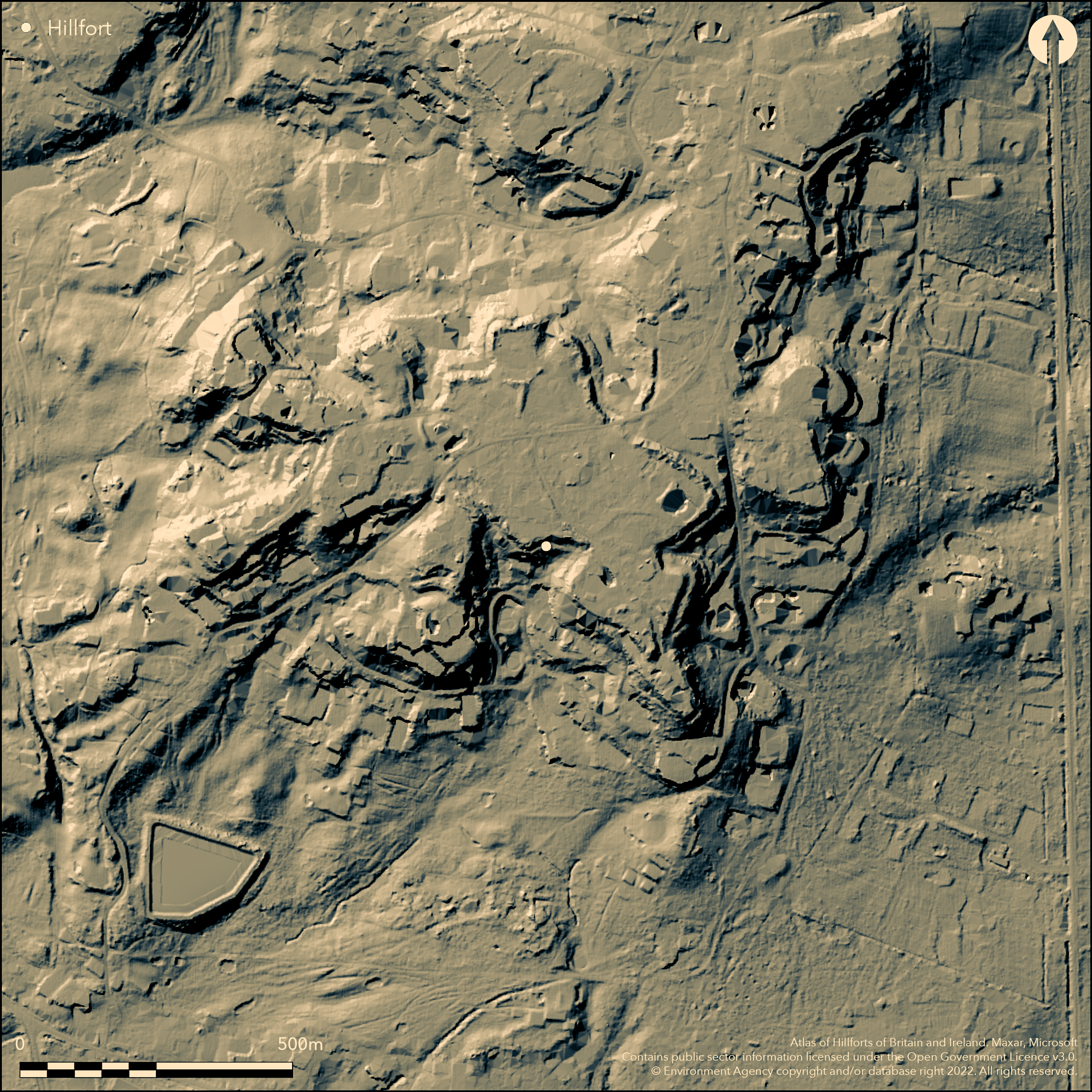
LiDAR 1m DTM Hillshade
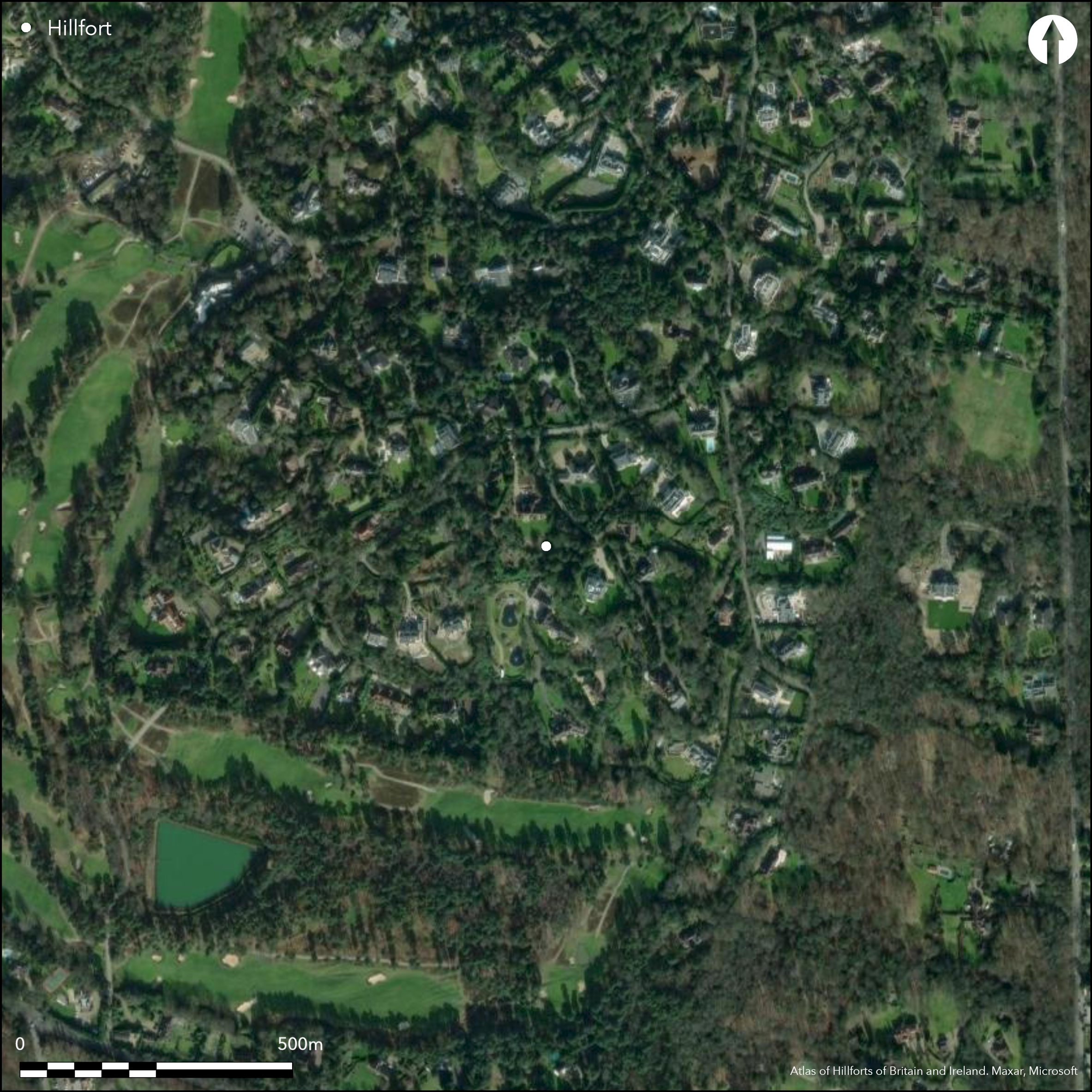
Satellite Imagery
LiDAR 1m DTM Hillshade
Satellite Imagery
Scroll left/right to view further images.
HER: Surrey 717 (None)
NMR: TQ 06 SE 6 (394464)
SM: 1008475
NGR: TQ 08500 61700
X: 508500 Y: 161700 (OSGB36)
Situated NW of Cobham, on the crest of a prominent hill overlooking the valleys of the Thames, Wey and Mole rivers. Irregularly shaped, damaged by several roads crossing the site and buildings within it. Generally univallate with an outer ditch and counterscarp bank enclosing 5.5ha. To the W, however, where the natural slope is less there are three banks and two ditches and to the NE is a D-shaped annex with an additional bank which encloses a stream. To the SW the earthworks cut off 3 spurs of the hill. The main inner rampart survives up to 10m wide and 2.2m high with the ditch up to 7m wide in places and up to 4m below the rampart, this is completely infilled in stretches and visible as a terrace c.3m wide. The counterscarp bank is up to 10m wide and 1m high. The additional works to the W include a second ditch now infilled and 3m wide and two extra banks, one 7m wide and 0.3m high and the other 12m wide and 2,2m high. The annex is defined by a single bank, up to 8m wide and 1.8m high, and an outer ditch 7m wide and 2m deep. The entrance through the main inner rampart is a simple gap into the annex, the terminal ends of the rampart are increased in height and width. A section of bank runs from the entrance and out from the annex, this may be associated with an ancient trackway. Excavations through the rampart and ditch in 1911 (Gardner) showed the site to be Iron Age, the building of houses in the SW sector revealed early, middle and late Iron Age pottery and iron working slag. Further excavations in 1981 (Poulton and O'Connell) showed that the ramparts were of two phases, the earlier one collapsing, and that the annex could have been a second phase addition. A watching brief in 1973 suggested a possible second ditch in the SE (Bird (1973). There are early plans of the site by Manning and Bray (1804) and Downman (1889), it is on the 1st Ed OS map (1885-1900).
Citizen Science: ✗
Reliability of Data: Confirmed
Reliability of Interpretation: Confirmed
X: -49379 Y: 6682367 (EPSG: 3857)
Longitude: -0.44357534828918077 Latitude: 51.343981938011396 (EPSG:4326)
Country: England
Current County or Unitary Authority: Surrey
Historic County: Surrey
Current Parish/Community/Council/Townland: Walton-on-Thames
None
| Extant | ✓ |
| Cropmark | ✗ |
| Likely Destroyed | ✓ |
None
| Woodland | ✓ |
| Commercial Forestry Plantation | ✗ |
| Parkland | ✗ |
| Pasture (Grazing) | ✗ |
| Arable | ✗ |
| Scrub/Bracken | ✓ |
| Bare Outcrop | ✗ |
| Heather/Moorland | ✗ |
| Heath | ✗ |
| Built-up | ✗ |
| Coastal Grassland | ✗ |
| Other | ✗ |
a contour fort on the crest of a prominent hill overlooking the valleys of the Thames, Wey and Mole rivers
| Contour Fort | ✓ |
| Partial Contour Fort | ✗ |
| Promontory Fort | ✗ |
| Hillslope Fort | ✗ |
| Level Terrain Fort | ✗ |
| Marsh Fort | ✗ |
| Multiple Enclosure Fort | ✗ |
| Hilltop | ✓ |
| Coastal Promontory | ✗ |
| Inland Promontory | ✗ |
| Valley Bottom | ✗ |
| Knoll/Hillock/Outcrop | ✗ |
| Ridge | ✗ |
| Cliff/Plateau-edge/Scarp | ✗ |
| Hillslope | ✗ |
| Lowland | ✗ |
| Spur | ✗ |
Dominant Topographic Feature: on the crest of a prominent hill overlooking the valleys of the Thames, Wey and Mole rivers
| North | ✗ |
| Northeast | ✗ |
| East | ✗ |
| Southeast | ✗ |
| South | ✗ |
| Southwest | ✗ |
| West | ✗ |
| Northwest | ✗ |
| Level | ✓ |
Altitude: 75.0m
N/A
Pottery from excavations
Reliability: B - Medium
| Pre 1200BC | ✗ |
| 1200BC - 800BC | ✗ |
| 800BC - 400BC | ✓ |
| 400BC - AD50 | ✓ |
| AD50 - AD400 | ✗ |
| AD400 - AD 800 | ✗ |
| Post AD800 | ✗ |
| Unknown | ✗ |
| Pre Hillfort: | None |
| Post Hillfort: | None |
| Artefactual: | None |
In Aubrey's Monumenta Britannica (1665-1693). There are early plans of the site by Manning and Bray (1804) and Downman (1889), it is on the 1st Ed OS map (1885-1900). Excavations in 1911 (Gardner) and 1981 (Poulton and O'Connell), watching brief in 1973 (Bird).
| Earthwork Survey (1804): | None |
| Earthwork Survey (1889): | None |
| Excavation (1911): | None |
| Other (1973): | None |
| Excavation (1981): | None |
| 1st Identified Written Reference (None): | None |
| 1st Identified Map Depiction (None): | None |
Pottery and iron working slag from excavation. Stream enclosed within the D-shaped annex at NE
None
| None | ✗ |
| Spring | ✗ |
| Stream | ✓ |
| Pool | ✗ |
| Flush | ✗ |
| Well | ✗ |
| Other | ✗ |
None
| No Known Features | ✓ |
| Round Stone Structures | ✗ |
| Rectangular Stone Structures | ✗ |
| Curvilinear Platforms | ✗ |
| Other Roundhouse Evidence | ✗ |
| Pits | ✗ |
| Quarry Hollows | ✗ |
| Other | ✗ |
None
| No Known Excavation | ✗ |
| Pits | ✗ |
| Postholes | ✗ |
| Roundhouses | ✗ |
| Rectangular Structures | ✗ |
| Roads/Tracks | ✗ |
| Quarry Hollows | ✗ |
| Other | ✗ |
| Nothing Found | ✓ |
None
| No Known Geophysics | ✓ |
| Pits | ✗ |
| Roundhouses | ✗ |
| Rectangular Structures | ✗ |
| Roads/Tracks | ✗ |
| Quarry Hollows | ✗ |
| Other | ✗ |
| Nothing Found | ✗ |
None
| No Known Finds | ✗ |
| Pottery | ✓ |
| Metal | ✗ |
| Metalworking | ✓ |
| Human Bones | ✗ |
| Animal Bones | ✗ |
| Lithics | ✗ |
| Environmental | ✗ |
| Other | ✗ |
NO APPARENT FEATURES
| APs Not Checked | ✓ |
| None | ✗ |
| Roundhouses | ✗ |
| Rectangular Structures | ✗ |
| Pits | ✗ |
| Postholes | ✗ |
| Roads/Tracks | ✗ |
| Other | ✗ |
At least six breaks caused by roads and other damage. The original entrance is within the annex and through the main inner rampart, a simple gap, the terminal ends of the rampart are increased in height and width.
| 6: | None |
| 2: | None |
Guard Chambers: ✗
Chevaux de Frise: ✗
| 1. Simple Gap (North east): | None |
Generally univallate with an outer ditch and counterscarp bank enclosing 5.5ha. To the W, however, where the natural slope is less there are three banks and two ditches and to the NE is a D-shaped annex with an additional bank which encloses a stream. The main inner rampart survives up to 10m wide and 2.2m high with the ditch up to 7m wide in places and up to 4m below the rampart, this is completely infilled in stretches and visible as a terrace c.3m wide. The counterscarp bank is up to 10m wide and 1m high. The additional works to the W include a second ditch now infilled and 3m wide and two extra banks, one 7m wide and 0.3m high and the other 12m wide and 2.2m high.
| Area 1: | 5.5ha. |
| Total: | 5.5ha. |
Total Footprint Area: Noneha.
None
| ✗ | None |
| ✓ | None |
| NE Quadrant: | 1 |
| SE Quadrant: | 1 |
| SW Quadrant: | 3 |
| NW Quadrant: | 3 |
| Total: | 3 |
| Partial Univallate | ✓ |
| Univallate | ✗ |
| Partial Bivallate | ✗ |
| Bivallate | ✗ |
| Partial Multivallate | ✓ |
| Multivallate | ✗ |
| Unknown | ✗ |
| Partial Univallate | ✗ |
| Univallate | ✗ |
| Partial Bivallate | ✗ |
| Bivallate | ✗ |
| Partial Multivallate | ✗ |
| Multivallate | ✗ |
None
| None | ✗ |
| Earthen Bank | ✓ |
| Stone Wall | ✗ |
| Rubble | ✗ |
| Wall-walk | ✗ |
| Evidence of Timber | ✗ |
| Vitrification | ✗ |
| Other Burning | ✗ |
| Palisade | ✗ |
| Counter Scarp Bank | ✓ |
| Berm | ✗ |
| Unfinished | ✗ |
| Other | ✗ |
None
| None | ✗ |
| Earthen Bank | ✓ |
| Stone Wall | ✗ |
| Murus Duplex | ✗ |
| Timber-framed | ✗ |
| Timber-laced | ✗ |
| Vitrification | ✗ |
| Other Burning | ✗ |
| Palisade | ✗ |
| Counter Scarp Bank | ✓ |
| Berm | ✗ |
| Unfinished | ✗ |
| No Known Excavation | ✗ |
| Other | ✗ |
| ✗ | None |
| ✓ | None |
Number of Ditches: 2
| ✓ | D-shaped annex to the NE, defined by a single bank, up to 8m wide and 1.8m high, and an outer ditch 7m wide and 2m deep. |
Bird, D. 1973. Note in Surrey Archael Bulletin, 100.
Gardner, E. 1911. The British stronghold of St. George's Hill, Weybridge. Surrey Archaeol Coll, 24, 40-55.
Hamilton, S. and Manley, J. 2001. Hillforts, monumentality and place: a chronological and topographical review of First millennium BC hillforts of South-East England. European J Archaeol, 4(1), 7-42.
Lowther, A. 1950. Iron Age pottery from St. George's Hill Camp, Weybridge. Surrey Archaeol Coll, 51, 144-7.
Poulton, R. and O'Connell, M. 1984. St George's hillfort: excavations in 1981. Surrey Archaeol Coll, 75, 275-80.
Atlas of Hillforts:
Wikidata:
This work is licensed under CC BY-SA 4.0

 and should be cited as:
Lock, Gary and Ralston, Ian. 2024. Atlas of Hillforts of Britain and Ireland. Available at: https://hillforts.arch.ox.ac.uk
Document Version 1.1