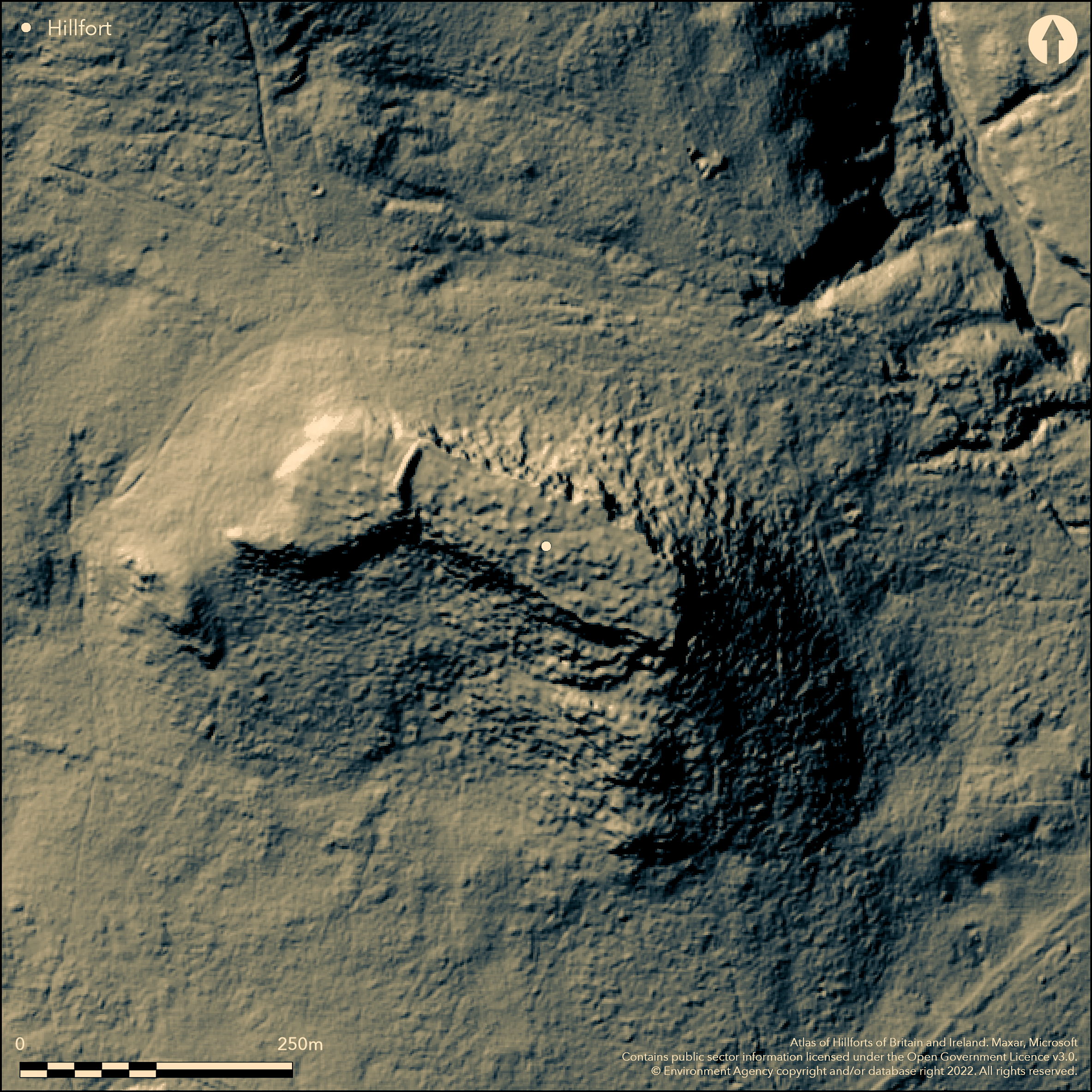
LiDAR 1m DTM Hillshade
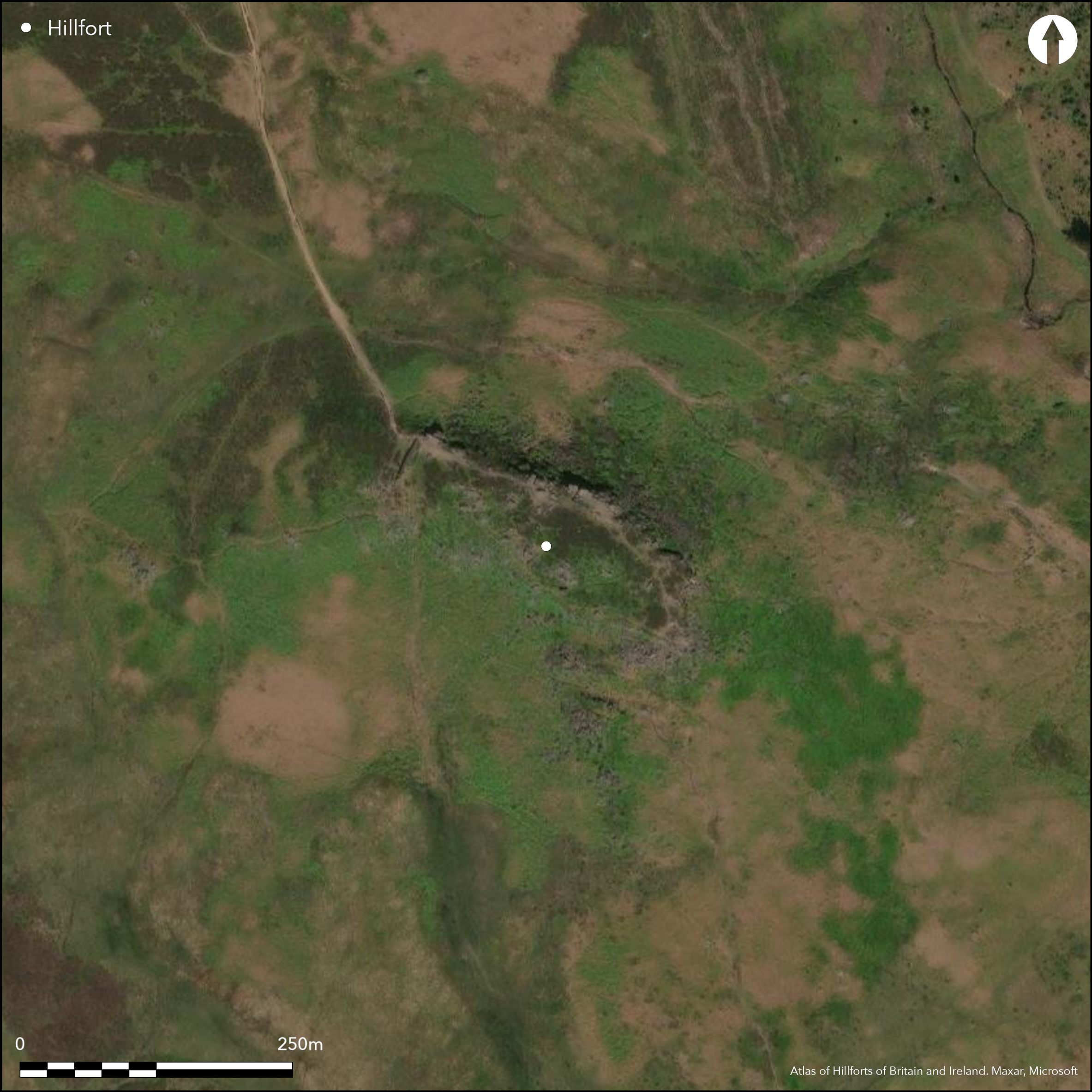
Satellite Imagery
LiDAR 1m DTM Hillshade
Satellite Imagery
Scroll left/right to view further images.
HER: South Yorkshire 00130/01 (None)
NMR: SK 28 SE 2 (312285)
SM: 1017504
NGR: SK 25941 81457
X: 425941 Y: 381457 (OSGB36)
A possible univallate hillfort on Hathersage Moor overlooking the Burbage Valley in the E. The site utilises a prominent westerly sloping millstone grit outcrop, with steep-sided rock faces and an almost level plateau. It is overlooked by the peak of Higger Tor to the N. Approximately rectangular in form measuring 180m long by 60m wide covering 0.7ha, with stone walls and earthen banks where the natural slopes are weakest. It is enclosed at the western end by a wall 3m high, 40m long and 8m wide at its base, capped with roughly dressed semi-upright boulders 1m long and 0.45m wide. An earthen bank lies to its E. Tool marks, now weathered have been recorded on the stones. Steep slopes to the N and E but reinforced with undressed stone blocks at the most easily accessible points. In the E a raised platform behind the wall was used to enhance the height of the enclosing works by approximately 1.0m. A wall of undressed stone blocks runs along the entire length in the S raising the height by 1m. For the last 30m of this wall, dressed, gritstone blocks approach an inturned entrance in the SW. The entrance forms a 7m long passageway 2.5m wide at the inside and approximately 1.7m high. Earthfast stone boulders lie across most of the interior except in the region of the entrance and immediately to its W where they appear to have been cleared. No hut sites have been identified. Externally in the W are the foundations of a small building formed from stone robbed from the revetments and in the S a rainwater collection trough carved into one of the boulders, both of which are considered to post date the revetments. Some stone robbing has occurred, and in the 19th century quarrying was carried out for millstones. The site is unusual in this area for having stone revetments rather than earthen banks, and for its possible reuse in the Roman period. It was interpreted as a 5th to 6th century dark age site by Piggott (1951) following an excavation by F.G. Simpson in 1950. This was based on what was seen as a turf-sod construction for the earthen bank. It is now scheduled as a slight univallate hillfort, it remains undated. The site is recorded on 1885-1900 OS mapping.
Citizen Science: ✗
Reliability of Data: Confirmed
Reliability of Interpretation: Confirmed
X: -179442 Y: 7044159 (EPSG: 3857)
Longitude: -1.6119580032326306 Latitude: 53.3293846860757 (EPSG:4326)
Country: England; None
Current County or Unitary Authority: South Yorkshire
Historic County: Derbyshire
Current Parish/Community/Council/Townland: Sheffield
Some stone robbing and quarrying has occurred
| Extant | ✓ |
| Cropmark | ✗ |
| Likely Destroyed | ✗ |
None
| Woodland | ✗ |
| Commercial Forestry Plantation | ✗ |
| Parkland | ✗ |
| Pasture (Grazing) | ✗ |
| Arable | ✗ |
| Scrub/Bracken | ✗ |
| Bare Outcrop | ✗ |
| Heather/Moorland | ✓ |
| Heath | ✗ |
| Built-up | ✗ |
| Coastal Grassland | ✗ |
| Other | ✗ |
A possible contour fort lying on level ground on a south-westerly side of a sloping millstone grit outcrop at 381m OD.
| Contour Fort | ✓ |
| Partial Contour Fort | ✗ |
| Promontory Fort | ✗ |
| Hillslope Fort | ✗ |
| Level Terrain Fort | ✗ |
| Marsh Fort | ✗ |
| Multiple Enclosure Fort | ✗ |
| Hilltop | ✓ |
| Coastal Promontory | ✗ |
| Inland Promontory | ✗ |
| Valley Bottom | ✗ |
| Knoll/Hillock/Outcrop | ✓ |
| Ridge | ✗ |
| Cliff/Plateau-edge/Scarp | ✗ |
| Hillslope | ✗ |
| Lowland | ✗ |
| Spur | ✗ |
Dominant Topographic Feature: Millstone grit outcrop
| North | ✗ |
| Northeast | ✗ |
| East | ✗ |
| Southeast | ✗ |
| South | ✗ |
| Southwest | ✗ |
| West | ✓ |
| Northwest | ✗ |
| Level | ✗ |
Altitude: 381.0m
It lies just inside the boundary of Sheffield in the Peak District National Park
Boundary Type: None
The site is undated, possible Roman and Dark Age activity.
Reliability: D - None
| Pre 1200BC | ✗ |
| 1200BC - 800BC | ✗ |
| 800BC - 400BC | ✗ |
| 400BC - AD50 | ✗ |
| AD50 - AD400 | ✗ |
| AD400 - AD 800 | ✗ |
| Post AD800 | ✗ |
| Unknown | ✓ |
| Pre Hillfort: | None |
| Post Hillfort: | None |
The site was considered to be a celtic sacred site or court of justice by antiquarian Hayman Rook in 1785. Plans were drawn by Isaac Chalkley Gould in 1903 and C.M. Piggott 1951. Limited excavations carried out by F.G. Simpson in 1950. It is recorded on 1885-1900 OS mapping. RCHME field investigations in 1965 and 1978. Scheduled.
| 1st Identified Written Reference (1785): | None |
| Other (1933): | Scheduled |
| Excavation (1950): | None |
| Other (1965): | Field investigation |
| Other (1978): | Field investigation |
| Other (1999): | Visited by Hillfort Study Group |
| 1st Identified Map Depiction (None): | None |
Earthfast stone boulders lie across most of the interior except in the region of the entrance and immediately to its W where they appear to have been cleared. No hut sites have been identified.
Burgage Brook to the E
| None | ✓ |
| Spring | ✗ |
| Stream | ✗ |
| Pool | ✗ |
| Flush | ✗ |
| Well | ✗ |
| Other | ✗ |
None
| No Known Features | ✓ |
| Round Stone Structures | ✗ |
| Rectangular Stone Structures | ✗ |
| Curvilinear Platforms | ✗ |
| Other Roundhouse Evidence | ✗ |
| Pits | ✗ |
| Quarry Hollows | ✗ |
| Other | ✗ |
None
| No Known Excavation | ✗ |
| Pits | ✗ |
| Postholes | ✗ |
| Roundhouses | ✗ |
| Rectangular Structures | ✗ |
| Roads/Tracks | ✗ |
| Quarry Hollows | ✗ |
| Other | ✗ |
| Nothing Found | ✓ |
None
| No Known Geophysics | ✓ |
| Pits | ✗ |
| Roundhouses | ✗ |
| Rectangular Structures | ✗ |
| Roads/Tracks | ✗ |
| Quarry Hollows | ✗ |
| Other | ✗ |
| Nothing Found | ✗ |
None
| No Known Finds | ✓ |
| Pottery | ✗ |
| Metal | ✗ |
| Metalworking | ✗ |
| Human Bones | ✗ |
| Animal Bones | ✗ |
| Lithics | ✗ |
| Environmental | ✗ |
| Other | ✗ |
None
| APs Not Checked | ✓ |
| None | ✗ |
| Roundhouses | ✗ |
| Rectangular Structures | ✗ |
| Pits | ✗ |
| Postholes | ✗ |
| Roads/Tracks | ✗ |
| Other | ✗ |
Inturned entrance in the SW forming a 7m long passageway 2.5m wide at the inside and approximately 1.7m high
| 1: | None |
| 2: | None |
Guard Chambers: ✗
Chevaux de Frise: ✗
| 1. Passage-way/Corridor (South west): | None |
Approximately rectangular in form measuring 180m long by 60m wide covering 0.7ha, with stone walls and earthen banks where the natural defences are weakest. Defended at the western end by a wall 3m high, 40m long and 8m wide at its base, capped with roughly dressed semi-upright boulders 1m long and 0.45m wide. An earthen bank lies to its E. Naturally defended in the N and E but reinforced with undressed stone blocks at the most easily accessible points. In the E a raised platform behind the wall was used to enhance the height of the defences by approximately 1.0m. A wall of undressed stone blocks runs along the entire length in the S raising the height by 1m. For the last 30m of this wall, dressed, gritstone blocks approach the entrance in the SW.
| Area 1: | 0.7ha. |
| Total: | 0.7ha. |
Total Footprint Area: Noneha.
None
| ✗ | None |
| ✓ | None |
| NE Quadrant: | 1 |
| SE Quadrant: | 1 |
| SW Quadrant: | 1 |
| NW Quadrant: | 1 |
| Total: | 1 |
| Partial Univallate | ✗ |
| Univallate | ✓ |
| Partial Bivallate | ✗ |
| Bivallate | ✗ |
| Partial Multivallate | ✗ |
| Multivallate | ✗ |
| Unknown | ✗ |
| Partial Univallate | ✗ |
| Univallate | ✗ |
| Partial Bivallate | ✗ |
| Bivallate | ✗ |
| Partial Multivallate | ✗ |
| Multivallate | ✗ |
Raised platform behind the wall used to enhance the height of the defences by approximately 1.0m
| None | ✗ |
| Earthen Bank | ✓ |
| Stone Wall | ✓ |
| Rubble | ✗ |
| Wall-walk | ✗ |
| Evidence of Timber | ✗ |
| Vitrification | ✗ |
| Other Burning | ✗ |
| Palisade | ✗ |
| Counter Scarp Bank | ✗ |
| Berm | ✗ |
| Unfinished | ✗ |
| Other | ✓ |
Turf sod construction
| None | ✗ |
| Earthen Bank | ✗ |
| Stone Wall | ✗ |
| Murus Duplex | ✗ |
| Timber-framed | ✗ |
| Timber-laced | ✗ |
| Vitrification | ✗ |
| Other Burning | ✗ |
| Palisade | ✗ |
| Counter Scarp Bank | ✗ |
| Berm | ✗ |
| Unfinished | ✗ |
| No Known Excavation | ✗ |
| Other | ✓ |
| ✗ | None |
| ✗ | None |
Number of Ditches: None
| ✗ | None |
Chalkley Gould, I.1903. Carl's Wark. Derbyshire Archaeol J, volume 25, 175-80
Piggott, C.M. 1951. Notes and News. Antiquity 25, 210-212.
Rooke, H. 1785. A Further Account of Some Druidical Remains in Derbyshire. Archaeologica VII: 175-177
Atlas of Hillforts:
Wikidata:
This work is licensed under CC BY-SA 4.0

 and should be cited as:
Lock, Gary and Ralston, Ian. 2024. Atlas of Hillforts of Britain and Ireland. Available at: https://hillforts.arch.ox.ac.uk
Document Version 1.1