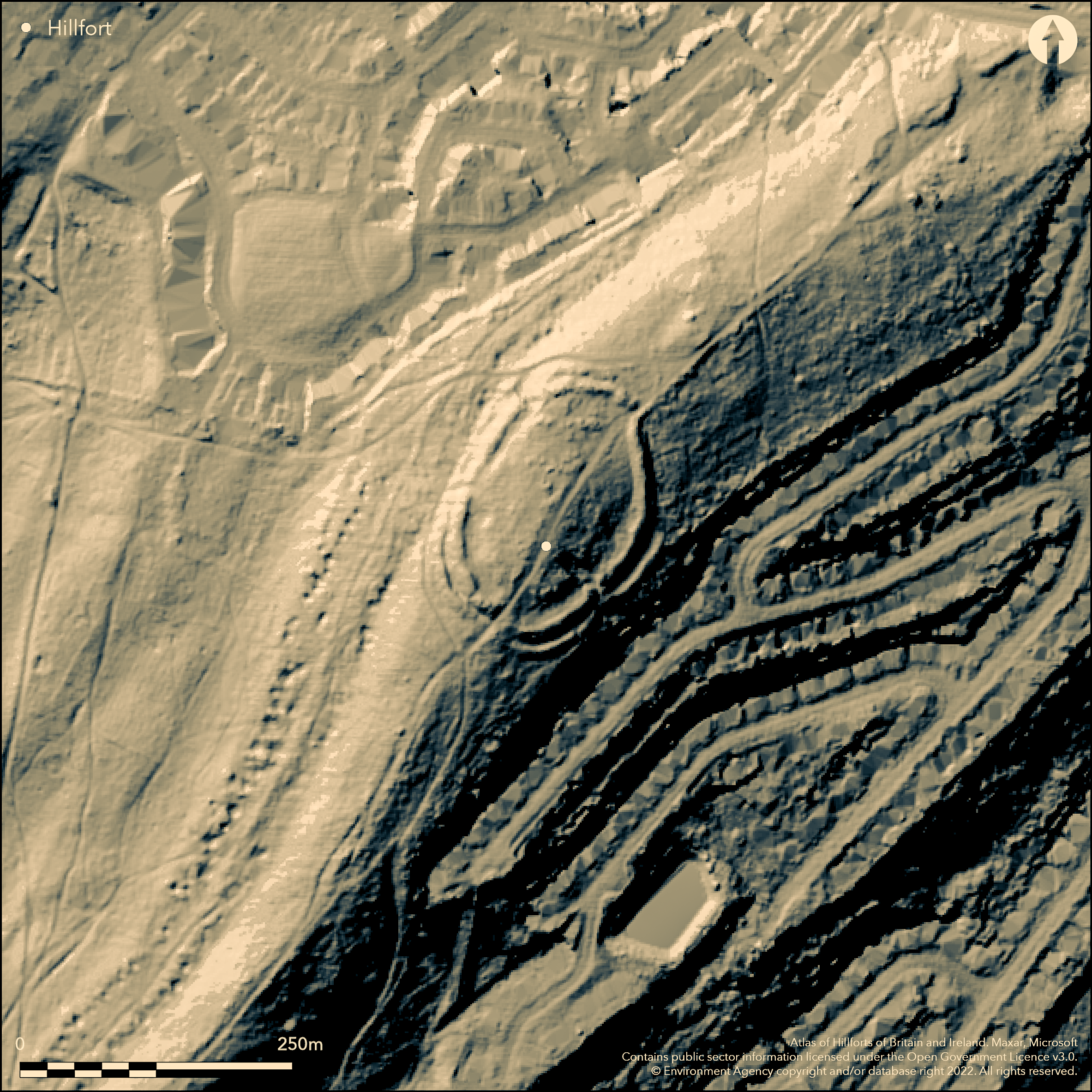
LiDAR 1m DTM Hillshade
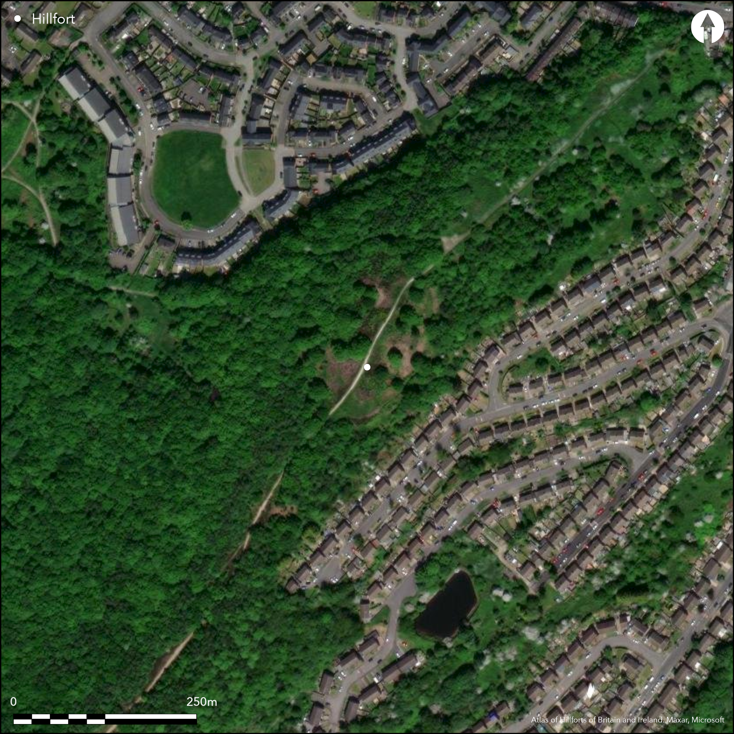
Satellite Imagery
LiDAR 1m DTM Hillshade
Satellite Imagery
Scroll left/right to view further images.
HER: South Yorkshire 00650/01 (None)
NMR: SK 39 SE 21 (314855)
SM: 1017615
NGR: SK 3777 9098
X: 437770 Y: 390980 (OSGB36)
An univallate hillfort of 1.1ha overlooking the valley of the River Don in the NW and a few metres to the N of a prehistoric linear earthwork known as the Roman Ridge. It comprises an oval enclosure measuring 125m N-S by 85m E-W surrounded by a single rampart with an external ditch and counterscarp bank. It lies on the highest point of Wincobank HIll at 160m OD, commanding views in all directions. The rampart survives up to 2.8m high from the bottom of the ditch and has an average width of 10m. An excavation by Sheffield City Council in 1899 showed that the rampart was originally constructed as a substantial wall 5.5m thick consisting of large stones facing a core of earth and rubble, bonded by timber lacing. The counterscarp bank formed from earth and stone cast up from the ditch. A further undocumented excavation took place in 1903 (ArcHeritage 2011). There are openings in the bank in the NE, SW and SE. The terminals in the SE turn slightly inwards and this is believed to be the original entrance. An old track, Wincobank Wood Lane, passes through the SW and NE openings. Local antiquarian Sidney Addy believed an ancient track let to the hillfort leading up the southern slope close to the SE entrance and down the N connecting to the Roman Ridge. Lidar has revealed a substantial linear feature that follows the proposed route although it remains undated (ArcHeritage 2011). No internal features are known and there is currently no archaeological evidence for prehistoric activity within the fort. Howard's 1899 excavation of the rampart and counterscarp bank found burnt and vitrified stone and charred timber. It is uncertain if this was intentional. C. Merrony and R. Doonan of Sheffield University suggest this is may be ironworking slag dumped against the rampart further supported by anomalies recorded during geophysical survey. Geochemical analysis has also been undertaken by Doonan in which zinc, phosphorous, copper, lead, arsenic and Iron have been identified (ArcHeritage 2011). A mound set close to the rampart is thought to be the site of a guard tower. During a watching brief in 1979 for the cutting of a drainage ditch through the NE rampart, charcoal from the timber ramparts was taken for radiocarbon dating, which gave dates of 470 BC (+/- 80 years) and 530 BC (+/- 80 years) (Beswick 1985, 32) for the construction of the hillfort. A flattened area for an anti-aircraft gun emplacement constructed in WWI and reused in WWII lies at the southern opening of the hillfort removed in 1970's. Evidence for Mesolithic, Neolithic and Bronze Age occupation has been found on the lower slopes outside the hillfort. Recorded on 1885-1900 OS mapping. A desk-based assessment of Wincobank HIll (ArcHeritage 2011) outlines various investigations and interpretations of the hillfort and the surrounding area and includes plans, sections and photographs taken of the ramparts during the 1899 excavations and a recent lidar survey.
Citizen Science: ✗
Reliability of Data: Confirmed
Reliability of Interpretation: Confirmed
X: -159545 Y: 7059998 (EPSG: 3857)
Longitude: -1.4332155012843542 Latitude: 53.41427094578886 (EPSG:4326)
Country: England
Current County or Unitary Authority: South Yorkshire
Historic County: Yorkshire
Current Parish/Community/Council/Townland: Sheffield
Survives in good condition however a survey showed extensive erosion had reduced the height of the banks, and silting had reduced the depth of the ditch in places (NAA 2001). The site has unrestricted access with a guide to the hillfort on the Sheffield City Council website. It has been adopted by a volunteer group, The Friends of Wincobank Hill.
| Extant | ✓ |
| Cropmark | ✗ |
| Likely Destroyed | ✗ |
None
| Woodland | ✓ |
| Commercial Forestry Plantation | ✗ |
| Parkland | ✗ |
| Pasture (Grazing) | ✗ |
| Arable | ✗ |
| Scrub/Bracken | ✓ |
| Bare Outcrop | ✗ |
| Heather/Moorland | ✗ |
| Heath | ✗ |
| Built-up | ✗ |
| Coastal Grassland | ✗ |
| Other | ✗ |
A univallate contour fort lying at 160m OD on the summit of Wincobank Hill
| Contour Fort | ✓ |
| Partial Contour Fort | ✗ |
| Promontory Fort | ✗ |
| Hillslope Fort | ✗ |
| Level Terrain Fort | ✗ |
| Marsh Fort | ✗ |
| Multiple Enclosure Fort | ✗ |
| Hilltop | ✓ |
| Coastal Promontory | ✗ |
| Inland Promontory | ✗ |
| Valley Bottom | ✗ |
| Knoll/Hillock/Outcrop | ✗ |
| Ridge | ✗ |
| Cliff/Plateau-edge/Scarp | ✗ |
| Hillslope | ✗ |
| Lowland | ✗ |
| Spur | ✓ |
Dominant Topographic Feature: Summit of Wincobank Hill
| North | ✗ |
| Northeast | ✗ |
| East | ✗ |
| Southeast | ✗ |
| South | ✗ |
| Southwest | ✗ |
| West | ✗ |
| Northwest | ✗ |
| Level | ✓ |
Altitude: 160.0m
N/A
Two radiocarbon dates taken from sealed deposits in the rampart: HAR 4536 470+/-80 b.c. and HAR 4537 530+/-80 b.c. Finds of flints, jet, iron 'lance head' Roman pottery and 4th century coin, deposited with Weston Park Museum
Reliability: B - Medium
| Pre 1200BC | ✗ |
| 1200BC - 800BC | ✗ |
| 800BC - 400BC | ✓ |
| 400BC - AD50 | ✓ |
| AD50 - AD400 | ✗ |
| AD400 - AD 800 | ✗ |
| Post AD800 | ✗ |
| Unknown | ✗ |
| Pre Hillfort: | None |
| Post Hillfort: | None |
| Artefactual: | Flints, jet, iron 'lance head' Roman pottery, coin. |
| C14: | Two samples |
Recorded on 1885-1900 OS mapping. General reference in Hunter (1869) Excavations in 1899, 1903 and 1979. Samples for C-14 dating taken in 1979. Field investigation 1965. Scheduled. Desk-based assessment of Wincobank HIll (ArcHeritage 2011). C. 2011 geophysical and geochemical investigations. Scheduled
| 1st Identified Written Reference (1869): | None |
| Excavation (1899): | None |
| Excavation (1903): | Undocumented |
| Other (1927): | Scheduled |
| Other (1965): | Field investigation |
| Other (1979): | Watching brief |
| Other (1979): | Visit by Hillfort Study Group |
| Other (2011): | Desk-based assessment |
| LiDAR Survey (2011): | None |
| 1st Identified Map Depiction (None): | None |
| Other (None): | Geochemical |
| Geophysical Survey (None): | None |
No internal features, metalworking slag from excavation.
River Don lies to the NW
| None | ✓ |
| Spring | ✗ |
| Stream | ✗ |
| Pool | ✗ |
| Flush | ✗ |
| Well | ✗ |
| Other | ✗ |
None
| No Known Features | ✓ |
| Round Stone Structures | ✗ |
| Rectangular Stone Structures | ✗ |
| Curvilinear Platforms | ✗ |
| Other Roundhouse Evidence | ✗ |
| Pits | ✗ |
| Quarry Hollows | ✗ |
| Other | ✗ |
Ramparts only excavated.
| No Known Excavation | ✗ |
| Pits | ✗ |
| Postholes | ✗ |
| Roundhouses | ✗ |
| Rectangular Structures | ✗ |
| Roads/Tracks | ✗ |
| Quarry Hollows | ✗ |
| Other | ✗ |
| Nothing Found | ✓ |
None
| No Known Geophysics | ✗ |
| Pits | ✗ |
| Roundhouses | ✗ |
| Rectangular Structures | ✗ |
| Roads/Tracks | ✗ |
| Quarry Hollows | ✗ |
| Other | ✗ |
| Nothing Found | ✓ |
None
| No Known Finds | ✗ |
| Pottery | ✗ |
| Metal | ✗ |
| Metalworking | ✓ |
| Human Bones | ✗ |
| Animal Bones | ✗ |
| Lithics | ✗ |
| Environmental | ✗ |
| Other | ✗ |
NO APPARENT FEATURES
| APs Not Checked | ✓ |
| None | ✗ |
| Roundhouses | ✗ |
| Rectangular Structures | ✗ |
| Pits | ✗ |
| Postholes | ✗ |
| Roads/Tracks | ✗ |
| Other | ✗ |
Slightly interned banks at the opening in the SE suggest this was the original entrance. Breaks in the SW and NE carry an old track
| 3: | NE, SE, SW |
| 2: | None |
Guard Chambers: ✗
Chevaux de Frise: ✗
| 1. In-turned (South east): | None |
Oval in form, comprising a bank measuring 125m N-S by 85m E-W, external ditch and counterscarp enclosing 1.1ha. The rampart measures up to 2.8m high from the bottom of the ditch and has an average width of 10m. Originally constructed as a substantial wall 5.5m thick consisting of large stones facing a core of earth and rubble, bonded by timber lacing. The counterscarp bank was formed from earth and stone cast up from the ditch.
| Area 1: | 1.1ha. |
| Total: | 1.1ha. |
Total Footprint Area: Noneha.
None
| ✗ | None |
| ✓ | None |
| NE Quadrant: | 1 |
| SE Quadrant: | 1 |
| SW Quadrant: | 1 |
| NW Quadrant: | 1 |
| Total: | 1 |
| Partial Univallate | ✗ |
| Univallate | ✓ |
| Partial Bivallate | ✗ |
| Bivallate | ✗ |
| Partial Multivallate | ✗ |
| Multivallate | ✗ |
| Unknown | ✗ |
| Partial Univallate | ✗ |
| Univallate | ✗ |
| Partial Bivallate | ✗ |
| Bivallate | ✗ |
| Partial Multivallate | ✗ |
| Multivallate | ✗ |
Grass covered
| None | ✗ |
| Earthen Bank | ✓ |
| Stone Wall | ✗ |
| Rubble | ✗ |
| Wall-walk | ✗ |
| Evidence of Timber | ✗ |
| Vitrification | ✗ |
| Other Burning | ✗ |
| Palisade | ✗ |
| Counter Scarp Bank | ✓ |
| Berm | ✗ |
| Unfinished | ✗ |
| Other | ✗ |
Earth and rubble core
| None | ✗ |
| Earthen Bank | ✗ |
| Stone Wall | ✓ |
| Murus Duplex | ✗ |
| Timber-framed | ✗ |
| Timber-laced | ✓ |
| Vitrification | ✓ |
| Other Burning | ✓ |
| Palisade | ✗ |
| Counter Scarp Bank | ✓ |
| Berm | ✗ |
| Unfinished | ✗ |
| No Known Excavation | ✗ |
| Other | ✓ |
| ✗ | None |
| ✓ | None |
Number of Ditches: 1
| ✗ | None |
ArcHeritage. Wincobank Hill Desk Based Assessment Report Number 2011/42 August 2011. https://www.wincobanklivinghistory.co.uk/Libraries/Desk-based-assessment-PDF/5462-Wincobank-Hill-final-reduced.sflb.ashx. Accessed Feb. 2015
Beswick, P. 1985. Wincobank Hillfort. Drainage Scheme: Archaeological Report. Trans Hunter Archaeol Soc. 13, 29-33
Hunter, J, 1869. Hallamshire. The History and Topography of the Parish of Sheffield in the County of York.
Atlas of Hillforts:
Wikidata:
This work is licensed under CC BY-SA 4.0

 and should be cited as:
Lock, Gary and Ralston, Ian. 2024. Atlas of Hillforts of Britain and Ireland. Available at: https://hillforts.arch.ox.ac.uk
Document Version 1.1