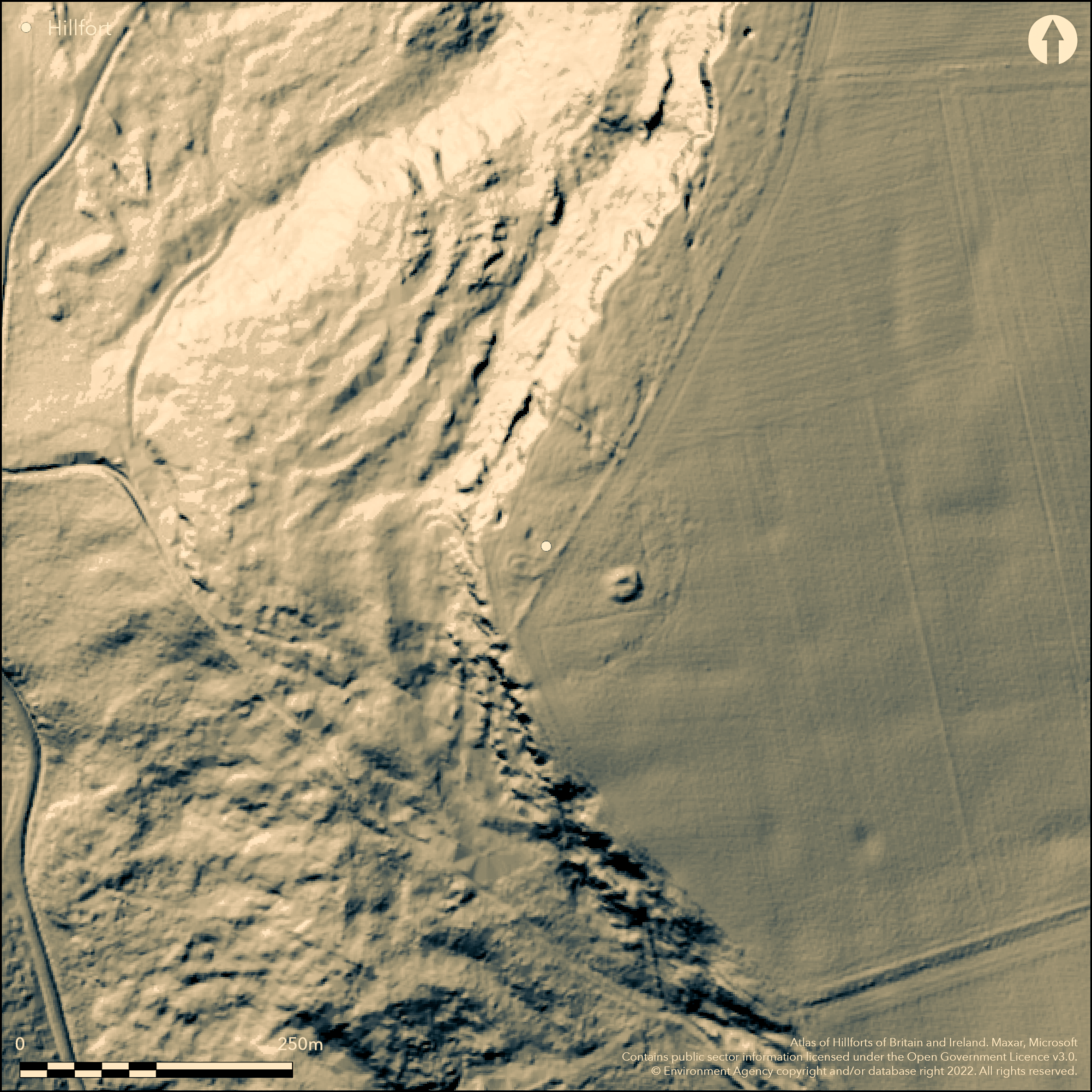
LiDAR 1m DTM Hillshade
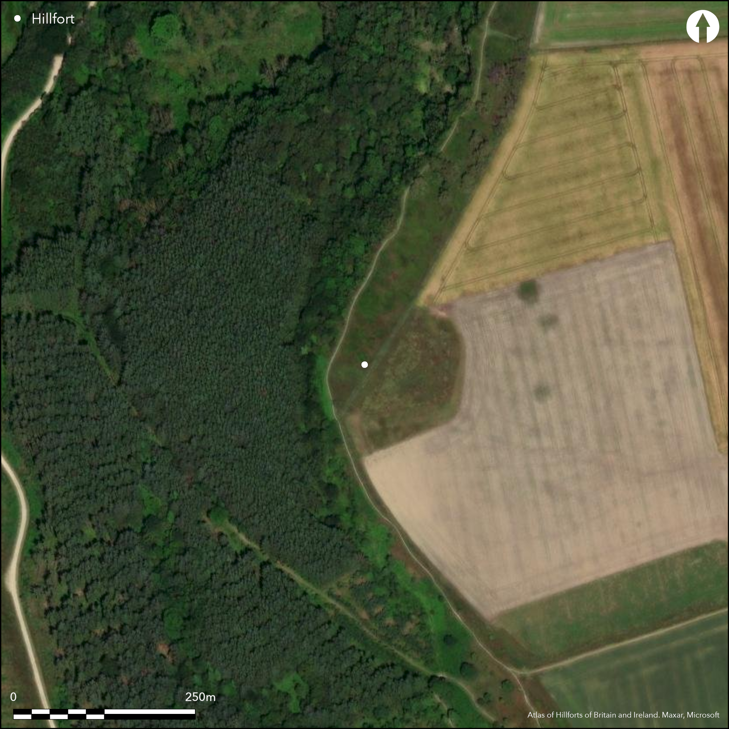
Satellite Imagery
LiDAR 1m DTM Hillshade
Satellite Imagery
Scroll left/right to view further images.
HER: North York Moors National Park 1320 (None)
NMR: SE 58 NW 20 (57120)
SM: 1013086
NGR: SE 5059 8565
X: 450590 Y: 485650 (OSGB36)
To the W of Hambleton Down on the western edge of the North Yorkshire Moors National Park, a univallate fort and earlier palisaded enclosure on the edge of Boltby Scar. The ramparts once described an arc to the E where there is a small projection, with the terminals resting on the sheer cliff edge, enclosing approximately 1ha. Sections of the rampart and one of two round barrows within the interior were illegally destroyed in 1961 and only 55m of the ramparts remain. These comprise a 15m length of bank 1m high and a ditch 3m wide and 1m deep in the S, and a low bank 3.5m wide and shallow ditch 0.8m deep in the N. A low counterscarp has also been observed to the W of the field boundary. An entrance lies in the NE. The ramparts and barrows were investigated by Wilmot in 1938-9 who found the bank to be composed of stone and rubble, later considered by Challis and Harding (1975) to be upcast from the ditch. The excavation by Wilmot was never published and only a sketch plan survives. There is now some confusion regarding the description of the barrows (Powlesland 2011a). A pair of early Bronze Age gold 'basket-shaped' earrings held in the British Museum were recovered from the turfline below the rampart in the SE and a hearth was noted at the bottom of the ditch. These are believed by Powlesland (ibid.) to have accompanied an undiscovered burial. The NE entrance recorded on a photograph taken in 1958 was confirmed by a geophysical survey in 2009 (ibid.) Internally the enclosure is divided in two by a drystone wall running SW-NE. A rectangular platform 20m by 12m with an external ditch is enclosed within the ramparts near the scarp edge. Its interpretation in 1868 by Henry Denny, a local antiquarian as an Çoblong tumulus' is considered unlikely, and it is possibly a medieval or post medieval pillow mound. The barrows and a limited investigation of the hillfort was carried out in 2009-2011 (Ibid.). This showed that the ramparts and much of the interior had been severely truncated during the destruction of the ramparts in 1961, further exacerbated through ploughing. A small number of worked flints were recovered from the interior but no domestic or other features were identified. A trench located at the entrance revealed that in this area the rampart had been 5m wide and the ditch a little over 3m wide and 1.5m deep reducing to 1m away from the entrance with a narrow berm between. A collapsed segment of the rampart recovered from a solution fissure showed that it had been fronted by a turf stack. At the rear, large irregular stones placed at the back of the ramparts were possibly intended to reduce erosion. Traces of a counterscarp was also identified beyond the ditch. The enclosing works were preceded by a palisade with closely set stones packed within a narrow slot approximately 0.25m wide and 0.35m deep, with the entrance in the NE maintained when the hillfort was constructed. Two phases of a possible timber gatehouse were determined from groups of post-holes on either side of the entrance in the interior of the fort, the first associated with the palisade and the second possibly with the ramparts. Radiocarbon dates for the enclosure ditch appear to span the Early Bronze Age to the Saxon period (Powlesland 2011b). Further details are given Powlesland (2011a and b). The site is scheduled as a promontory fort but the ramparts do not cut off the neck of a promontory and would be better described as a cliff-edge fort. Recorded on 1885-1900 OS mapping. The hillfort is contemporary with Roulston Scar (Atlas No. 1504).
Citizen Science: ✗
Reliability of Data: Confirmed
Reliability of Interpretation: Confirmed
X: -136344 Y: 7220319 (EPSG: 3857)
Longitude: -1.224795237818647 Latitude: 54.264025141062426 (EPSG:4326)
Country: England
Current County or Unitary Authority: North Yorkshire
Historic County: Yorkshire
Current Parish/Community/Council/Townland: Boltby
None
| Extant | ✓ |
| Cropmark | ✗ |
| Likely Destroyed | ✓ |
None
| Woodland | ✗ |
| Commercial Forestry Plantation | ✗ |
| Parkland | ✗ |
| Pasture (Grazing) | ✗ |
| Arable | ✓ |
| Scrub/Bracken | ✗ |
| Bare Outcrop | ✗ |
| Heather/Moorland | ✗ |
| Heath | ✗ |
| Built-up | ✗ |
| Coastal Grassland | ✗ |
| Other | ✗ |
A partial contour fort lying on a cliff-edge at between 320-335m OD at the edge of Boltby Scar
| Contour Fort | ✗ |
| Partial Contour Fort | ✓ |
| Promontory Fort | ✗ |
| Hillslope Fort | ✗ |
| Level Terrain Fort | ✗ |
| Marsh Fort | ✗ |
| Multiple Enclosure Fort | ✗ |
| Hilltop | ✗ |
| Coastal Promontory | ✗ |
| Inland Promontory | ✗ |
| Valley Bottom | ✗ |
| Knoll/Hillock/Outcrop | ✗ |
| Ridge | ✗ |
| Cliff/Plateau-edge/Scarp | ✓ |
| Hillslope | ✗ |
| Lowland | ✗ |
| Spur | ✗ |
Dominant Topographic Feature: Edge of Boltby Scar
| North | ✗ |
| Northeast | ✗ |
| East | ✗ |
| Southeast | ✗ |
| South | ✗ |
| Southwest | ✗ |
| West | ✓ |
| Northwest | ✗ |
| Level | ✗ |
Altitude: 328.0m
N/A
Three samples taken for radiocarbon dating with date ranges from the early Bronze Age-Saxon period. Small amounts of Neolithic flints, Late Bronze Age-early Iron Age pottery.
Reliability: B - Medium
| Pre 1200BC | ✗ |
| 1200BC - 800BC | ✓ |
| 800BC - 400BC | ✓ |
| 400BC - AD50 | ✓ |
| AD50 - AD400 | ✗ |
| AD400 - AD 800 | ✗ |
| Post AD800 | ✗ |
| Unknown | ✗ |
| Pre Hillfort: | None |
| Post Hillfort: | None |
| Artefactual: | Neolithic flints, late Bronze Age, Early Iron Age pottery sherds. |
| C14: | Three samples taken |
| Morphology/Earthwork/Typology: | None |
Recorded on 1885-1900 OS mapping. Excavated in 1938-9 (unpublished). A Programme of archaeological research was initiated in 2009 through collaboration between the North York Moors National Park and the Landscape Research Centre (Powlesland 2011).
| Excavation (2001): | None |
| 1st Identified Map Depiction (None): | None |
| Excavation (None): | None |
Roundbarrows and Çoblong tumulus, possibly a pillow mound. Two phases of a possible timber gatehouse were determined from groups of post-holes on either side of the entrance. No structures of a domestic nature were recorded. Neolithic worked flint found on the old ground surface, late Bronze Age-early Iron Age pottery fragments. Gold 'basket-shaped' earrings.
None
| None | ✓ |
| Spring | ✗ |
| Stream | ✗ |
| Pool | ✗ |
| Flush | ✗ |
| Well | ✗ |
| Other | ✗ |
Rectangular platform
| No Known Features | ✗ |
| Round Stone Structures | ✗ |
| Rectangular Stone Structures | ✗ |
| Curvilinear Platforms | ✗ |
| Other Roundhouse Evidence | ✗ |
| Pits | ✗ |
| Quarry Hollows | ✗ |
| Other | ✓ |
None
| No Known Excavation | ✗ |
| Pits | ✗ |
| Postholes | ✓ |
| Roundhouses | ✗ |
| Rectangular Structures | ✗ |
| Roads/Tracks | ✗ |
| Quarry Hollows | ✗ |
| Other | ✗ |
| Nothing Found | ✗ |
None
| No Known Geophysics | ✗ |
| Pits | ✗ |
| Roundhouses | ✗ |
| Rectangular Structures | ✗ |
| Roads/Tracks | ✗ |
| Quarry Hollows | ✗ |
| Other | ✗ |
| Nothing Found | ✓ |
Early Bronze Age gold earrings
| No Known Finds | ✗ |
| Pottery | ✓ |
| Metal | ✓ |
| Metalworking | ✗ |
| Human Bones | ✗ |
| Animal Bones | ✗ |
| Lithics | ✓ |
| Environmental | ✗ |
| Other | ✗ |
None
| APs Not Checked | ✓ |
| None | ✗ |
| Roundhouses | ✗ |
| Rectangular Structures | ✗ |
| Pits | ✗ |
| Postholes | ✗ |
| Roads/Tracks | ✗ |
| Other | ✗ |
Simple gap entrance in the NE with groups of postholes suggestive of gatehouses either side
| 1: | None |
| 2: | None |
Guard Chambers: ✓
Chevaux de Frise: ✗
| 1. Recesses/Guard Chambers (North east): | None |
Univallate, originally arc-shaped ramparts with terminals resting on cliff edge enclosing approximately 1.0ha. Surviving ramparts comprise a 15m length of bank 1m high and a ditch 3m wide and 1m deep in the S, and a low bank 3.5m wide and shallow ditch 0.8m deep in the N. Investigations near the entrance showed the rampart had been 5m wide and the ditch a little over 3m wide and 1.5m deep reducing to 1m away from the entrance with a narrow berm between. The rampart was fronted by a turf stack with large irregular stones at the rear possibly intended to reduce erosion. Traces of a counterscarp was also identified beyond the ditch. The enclosing works were preceded by a palisade with closely set stones packed within a narrow slot approximately 0.25m wide and 0.35m deep,
| Area 1: | 1.0ha. |
| Total: | 1.0ha. |
Total Footprint Area: Noneha.
None
| ✓ | Earlier palisaded enclosure. Two phases of a possible timber gatehouse were determined from groups of post-holes on either side of the entrance in the interior of the fort, the first associated with the palisade and the second possibly with the ramparts. |
| ✗ | None |
| NE Quadrant: | 1 |
| SE Quadrant: | 1 |
| SW Quadrant: | None |
| NW Quadrant: | None |
| Total: | 1 |
| Partial Univallate | ✓ |
| Univallate | ✗ |
| Partial Bivallate | ✗ |
| Bivallate | ✗ |
| Partial Multivallate | ✗ |
| Multivallate | ✗ |
| Unknown | ✗ |
| Partial Univallate | ✗ |
| Univallate | ✗ |
| Partial Bivallate | ✗ |
| Bivallate | ✗ |
| Partial Multivallate | ✗ |
| Multivallate | ✗ |
None
| None | ✗ |
| Earthen Bank | ✓ |
| Stone Wall | ✗ |
| Rubble | ✓ |
| Wall-walk | ✗ |
| Evidence of Timber | ✗ |
| Vitrification | ✗ |
| Other Burning | ✗ |
| Palisade | ✗ |
| Counter Scarp Bank | ✗ |
| Berm | ✗ |
| Unfinished | ✗ |
| Other | ✗ |
Fronted by a turf stack
| None | ✗ |
| Earthen Bank | ✓ |
| Stone Wall | ✗ |
| Murus Duplex | ✗ |
| Timber-framed | ✗ |
| Timber-laced | ✗ |
| Vitrification | ✗ |
| Other Burning | ✗ |
| Palisade | ✓ |
| Counter Scarp Bank | ✓ |
| Berm | ✓ |
| Unfinished | ✗ |
| No Known Excavation | ✗ |
| Other | ✓ |
| ✗ | None |
| ✓ | None |
Number of Ditches: 1
| ✗ | None |
Challis, A.J. and Harding, D.W., 1975. Later prehistory from the Trent to the Tyne. BAR British series 1 (1974)
Powlesland, D. 2011(a). Excavations at Boltby Scar Hillfort 2011 An Interim Report (draft). https://www.landscaperesearchcentre.org/Boltby-Scar-2011-Interim.pdf. Accessed Feb 2015
Powlesland, D. 2011(b). Investigation of Boltby Scar Promontory Fort SM26932 North York Moors National Park. Updated Research Design 2011. https://www.landscaperesearchcentre.org/Boltby-PD-2011.pdf. Accessed Feb 2015
Atlas of Hillforts:
Wikidata:
This work is licensed under CC BY-SA 4.0

 and should be cited as:
Lock, Gary and Ralston, Ian. 2024. Atlas of Hillforts of Britain and Ireland. Available at: https://hillforts.arch.ox.ac.uk
Document Version 1.1