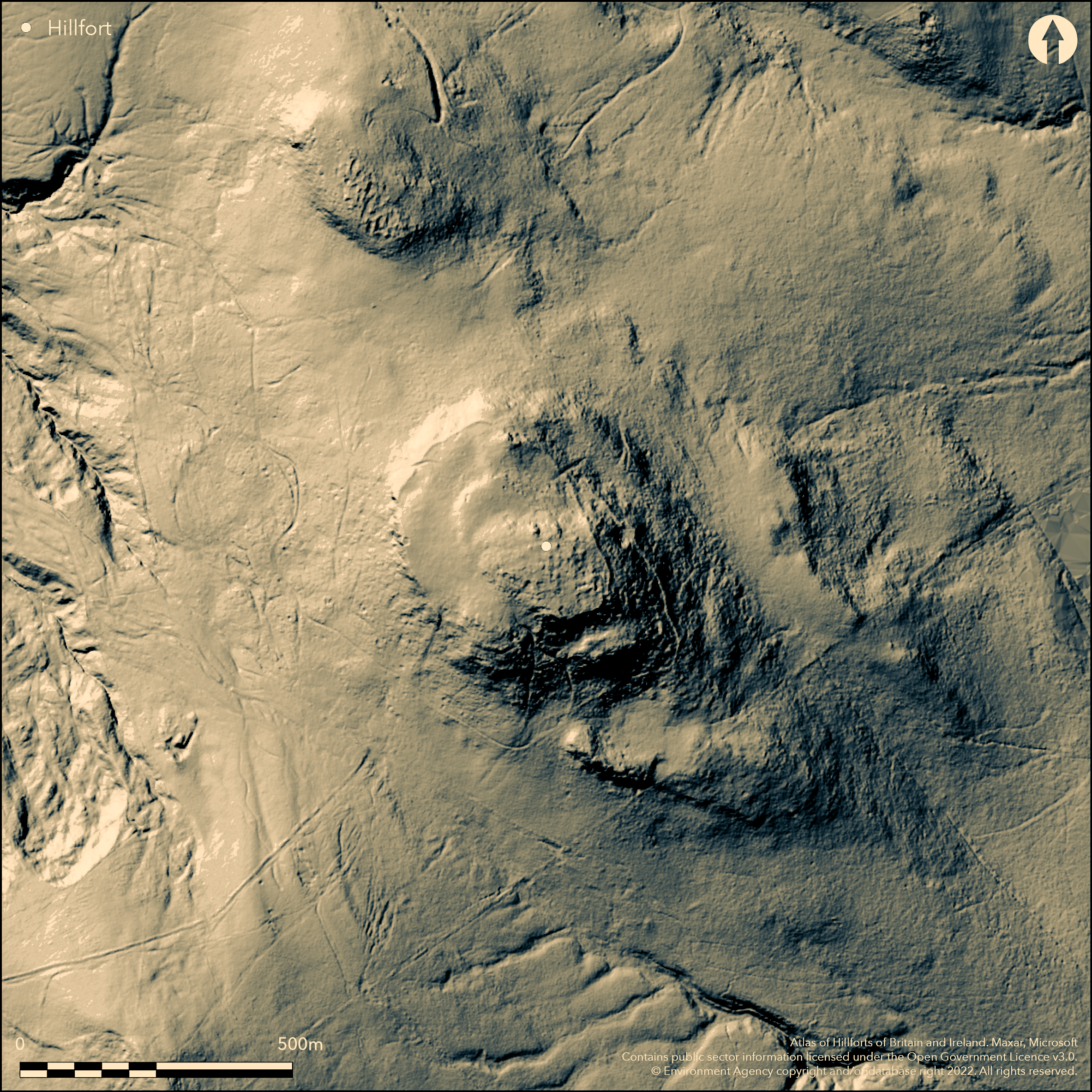
LiDAR 1m DTM Hillshade
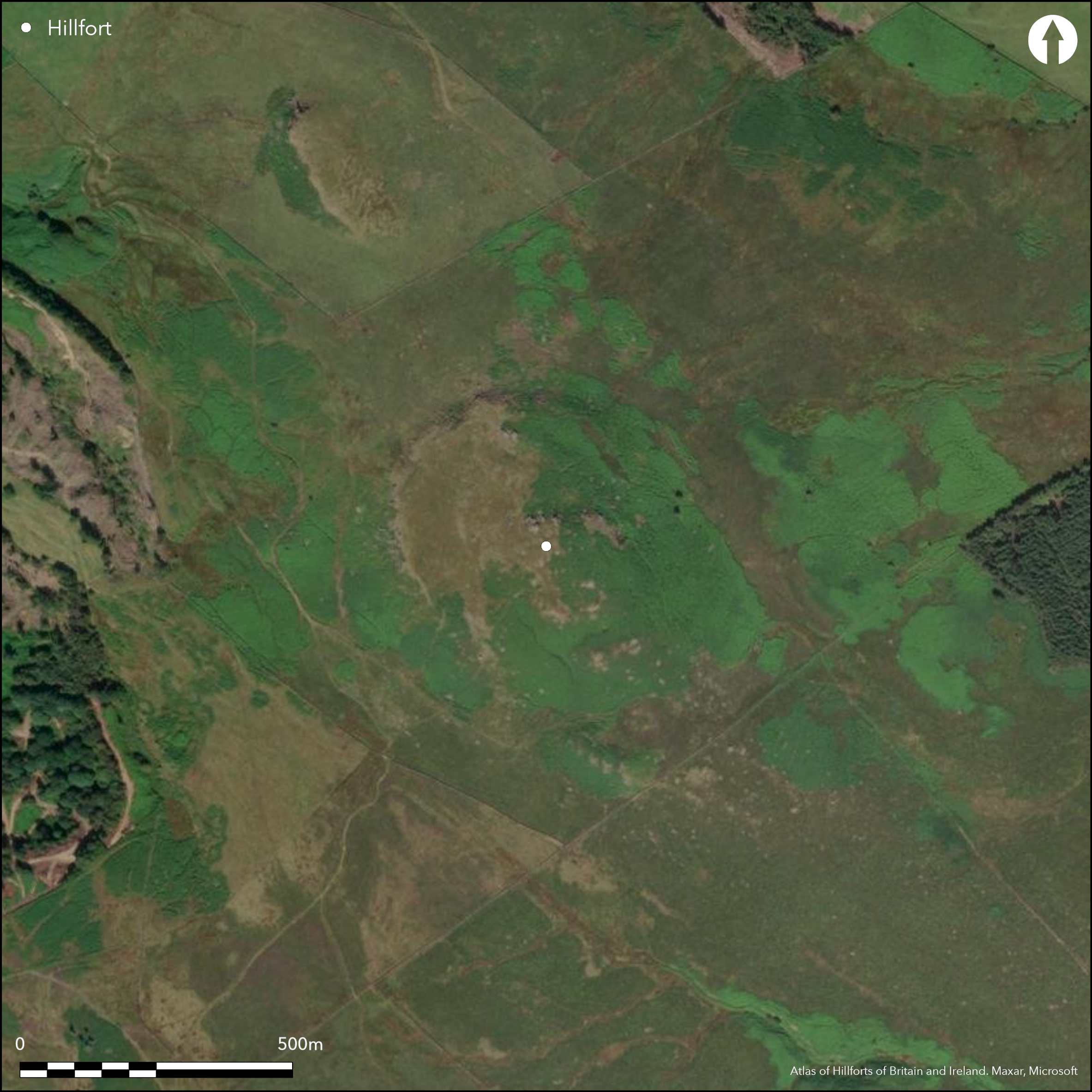
Satellite Imagery
LiDAR 1m DTM Hillshade
Satellite Imagery
Scroll left/right to view further images.
HER: Yorkshire Dales National Park MYD40808 (None)
NMR: SD 95 NE 70 (1058879)
SM: None
NGR: SD 9634 5587
X: 396347 Y: 455879 (OSGB36)
On Flasby Fell, a stone built enclosure on a natural rocky outcrop on the summit of Rough Haw. The site was identified from poor quality aerial photographs taken in 1975 and tentatively described on their index card as a hillfort by Cambridge University Committee on Aerial Photography. It underwent a rapid ground inspection by the RCHME in 1996-1997. An English Heritage MORPH summary describes it as a possible hillfort, but it has also been suggested as Neolithic and Bronze Age in date by various RCHME inspectors. Visible on satellite imagery. Sub-rectangular in form, it measures 330m by 230m with a single unstructured stone dump rampart with some unbedded orthostats which follows the edge of a steep scarp, enclosing in the region of 7ha. The rampart measures on average 2.5 wide and 0.8-1.8m high on the outer face and incorporates several small rocky outcrops, no evidence for a ditch. The enclosed area is divided into two parts where the hilltop steps up some 10m at the southern end. No internal features have been recorded. Four breaks have been identified in the wall, with one midway along the NE side having slightly out-turned terminals and considered to possibly be original. All openings are approached by holloways, although those associated with the other breaks might be associated with later stone quarrying which is widespread across the site. The rampart itself has suffered from stone robbing. The site is not recorded on OS mapping. Stone outcrops, some with almost anthropomorphic shapes within the interior has been suggested by Bowden (1997) to possibly have had some significant bearing on the existence of the site.
Citizen Science: ✗
Reliability of Data: Confirmed
Reliability of Interpretation: Unconfirmed
X: -229009 Y: 7169954 (EPSG: 3857)
Longitude: -2.0572189628973647 Latitude: 53.99893251388469 (EPSG:4326)
Country: England; None
Current County or Unitary Authority: North Yorkshire
Historic County: Yorkshire
Current Parish/Community/Council/Townland: Flasby with Winterburn
None
| Extant | ✓ |
| Cropmark | ✗ |
| Likely Destroyed | ✗ |
Grass and heather moor with flush and bog communities in wetter parts
| Woodland | ✗ |
| Commercial Forestry Plantation | ✗ |
| Parkland | ✗ |
| Pasture (Grazing) | ✗ |
| Arable | ✗ |
| Scrub/Bracken | ✗ |
| Bare Outcrop | ✗ |
| Heather/Moorland | ✓ |
| Heath | ✗ |
| Built-up | ✗ |
| Coastal Grassland | ✗ |
| Other | ✓ |
An enclosure following the contours of a natural rocky outcrop at 323m OD on the summit of Rough Haw
| Contour Fort | ✓ |
| Partial Contour Fort | ✗ |
| Promontory Fort | ✗ |
| Hillslope Fort | ✗ |
| Level Terrain Fort | ✗ |
| Marsh Fort | ✗ |
| Multiple Enclosure Fort | ✗ |
| Hilltop | ✓ |
| Coastal Promontory | ✗ |
| Inland Promontory | ✗ |
| Valley Bottom | ✗ |
| Knoll/Hillock/Outcrop | ✗ |
| Ridge | ✗ |
| Cliff/Plateau-edge/Scarp | ✗ |
| Hillslope | ✗ |
| Lowland | ✗ |
| Spur | ✗ |
Dominant Topographic Feature: Natural rocky outcrop on the summit of Rough Haw
| North | ✗ |
| Northeast | ✗ |
| East | ✗ |
| Southeast | ✗ |
| South | ✗ |
| Southwest | ✗ |
| West | ✗ |
| Northwest | ✗ |
| Level | ✓ |
Altitude: 323.0m
The parish boundaries of Flasby with Winterburn and Stirton with Thorlby run to the S of the enclosure
Boundary Type: Parish/Townland
The site is undated and could be earlier than Iron Age
Reliability: D - None
| Pre 1200BC | ✗ |
| 1200BC - 800BC | ✗ |
| 800BC - 400BC | ✗ |
| 400BC - AD50 | ✗ |
| AD50 - AD400 | ✗ |
| AD400 - AD 800 | ✗ |
| Post AD800 | ✗ |
| Unknown | ✓ |
| Pre Hillfort: | None |
| Post Hillfort: | None |
Identified during aerial reconnaissanceby J.K. St Joseph in 1975 Rapid ground inspection by the RCHME in 1996 and 1997 when peat cores were also taken from a small bog close to the enclosure. Further field investigation in 2007
| Other (1975): | Recorded on AP |
| Other (1992): | Sketch plot undertaken as part of the Yorkshire Dales Project |
| Other (1996): | Field investigation |
| Other (1996): | Field investigation |
| Other (1997): | Peat cores taken. No published results located |
| Other (2007): | Reconnoitred by members of English Heritage teams at York in advance of possible field survey action |
No internal features are known
The site is surrounded by a number of springs and flushes
| None | ✓ |
| Spring | ✗ |
| Stream | ✗ |
| Pool | ✗ |
| Flush | ✗ |
| Well | ✗ |
| Other | ✗ |
None
| No Known Features | ✓ |
| Round Stone Structures | ✗ |
| Rectangular Stone Structures | ✗ |
| Curvilinear Platforms | ✗ |
| Other Roundhouse Evidence | ✗ |
| Pits | ✗ |
| Quarry Hollows | ✗ |
| Other | ✗ |
None
| No Known Excavation | ✓ |
| Pits | ✗ |
| Postholes | ✗ |
| Roundhouses | ✗ |
| Rectangular Structures | ✗ |
| Roads/Tracks | ✗ |
| Quarry Hollows | ✗ |
| Other | ✗ |
| Nothing Found | ✗ |
None
| No Known Geophysics | ✓ |
| Pits | ✗ |
| Roundhouses | ✗ |
| Rectangular Structures | ✗ |
| Roads/Tracks | ✗ |
| Quarry Hollows | ✗ |
| Other | ✗ |
| Nothing Found | ✗ |
None
| No Known Finds | ✓ |
| Pottery | ✗ |
| Metal | ✗ |
| Metalworking | ✗ |
| Human Bones | ✗ |
| Animal Bones | ✗ |
| Lithics | ✗ |
| Environmental | ✗ |
| Other | ✗ |
None
| APs Not Checked | ✓ |
| None | ✗ |
| Roundhouses | ✗ |
| Rectangular Structures | ✗ |
| Pits | ✗ |
| Postholes | ✗ |
| Roads/Tracks | ✗ |
| Other | ✗ |
Four breaks have been identified in the wall, with one midway along the NE side having slightly out-turned terminals and considered to possibly be original.
| 4: | None |
| 2: | None |
Guard Chambers: ✗
Chevaux de Frise: ✗
| 1. Out-turned (North east): | None |
Rectangular in form, measuring 330m by 230m with a single unstructured stone dump rampart with some unbedded orthostats which follows the edge of a steep scarp, enclosing in the region of 7ha. The rampart measures on average 2.5 wide and 0.8-1.8m high on the outer face and incorporates several small rocky outcrops, no evidence for a ditch.
| Area 1: | 7.0ha. |
| Total: | 7.0ha. |
Total Footprint Area: Noneha.
None
| ✗ | None |
| ✓ | None |
| NE Quadrant: | 1 |
| SE Quadrant: | 1 |
| SW Quadrant: | 1 |
| NW Quadrant: | 1 |
| Total: | 1 |
| Partial Univallate | ✗ |
| Univallate | ✓ |
| Partial Bivallate | ✗ |
| Bivallate | ✗ |
| Partial Multivallate | ✗ |
| Multivallate | ✗ |
| Unknown | ✗ |
| Partial Univallate | ✗ |
| Univallate | ✗ |
| Partial Bivallate | ✗ |
| Bivallate | ✗ |
| Partial Multivallate | ✗ |
| Multivallate | ✗ |
Stone dump rampart
| None | ✗ |
| Earthen Bank | ✗ |
| Stone Wall | ✗ |
| Rubble | ✓ |
| Wall-walk | ✗ |
| Evidence of Timber | ✗ |
| Vitrification | ✗ |
| Other Burning | ✗ |
| Palisade | ✗ |
| Counter Scarp Bank | ✗ |
| Berm | ✗ |
| Unfinished | ✗ |
| Other | ✗ |
None
| None | ✗ |
| Earthen Bank | ✗ |
| Stone Wall | ✗ |
| Murus Duplex | ✗ |
| Timber-framed | ✗ |
| Timber-laced | ✗ |
| Vitrification | ✗ |
| Other Burning | ✗ |
| Palisade | ✗ |
| Counter Scarp Bank | ✗ |
| Berm | ✗ |
| Unfinished | ✗ |
| No Known Excavation | ✓ |
| Other | ✗ |
| ✗ | None |
| ✗ | None |
Number of Ditches: None
| ✗ | None |
RCHME: Industry and Enclosure in the Neolithic Period: Rough Haw Survey. Unpublished
Mark Bowden/17-MAR-1997/RCHME Newcastle. Unpublished
Atlas of Hillforts:
Wikidata:
This work is licensed under CC BY-SA 4.0

 and should be cited as:
Lock, Gary and Ralston, Ian. 2024. Atlas of Hillforts of Britain and Ireland. Available at: https://hillforts.arch.ox.ac.uk
Document Version 1.1