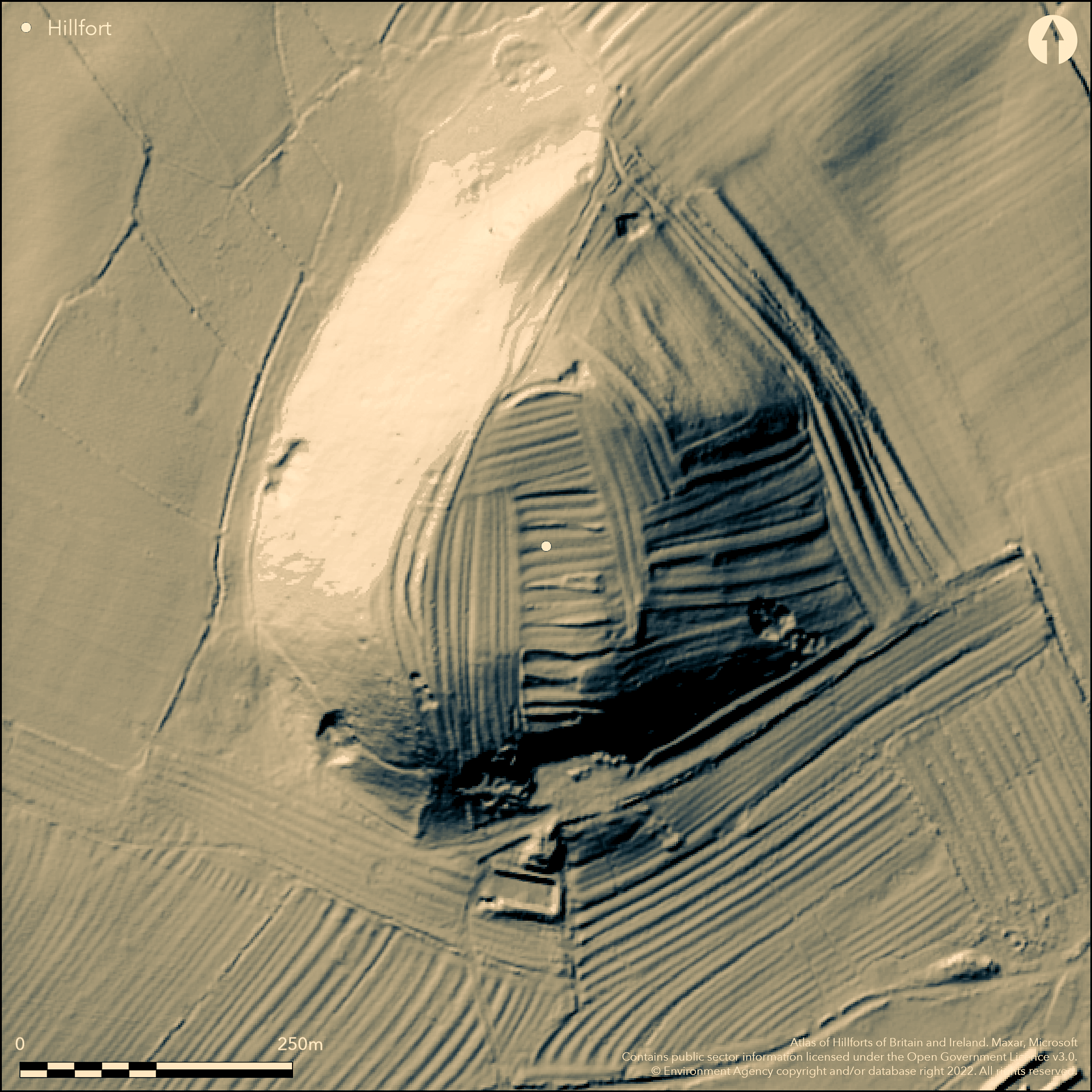
LiDAR 1m DTM Hillshade
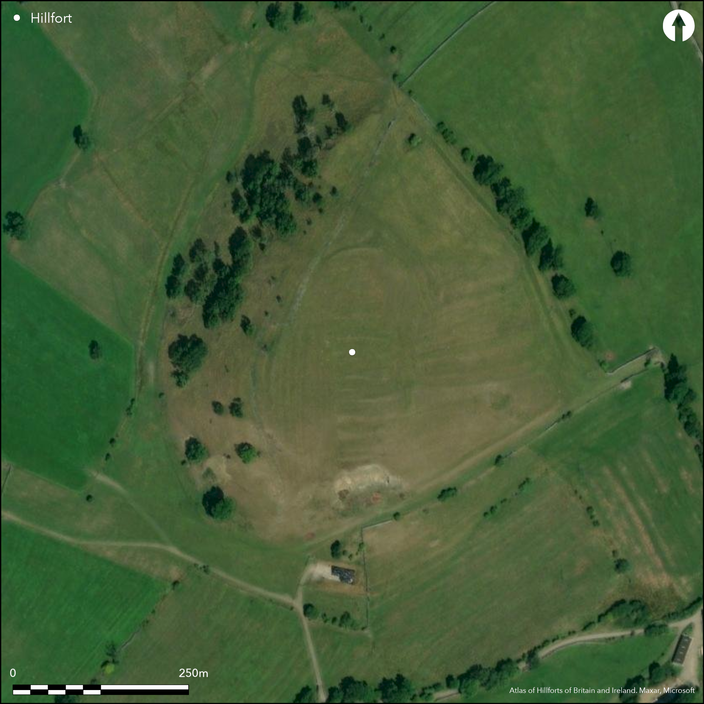
Satellite Imagery
LiDAR 1m DTM Hillshade
Satellite Imagery
Scroll left/right to view further images.
HER: Yorkshire Dales National Park MYD5166 (None)
NMR: SE 19 NW 4 (50957)
SM: 1012604
NGR: SE 1080 9795
X: 410808 Y: 497949 (OSGB36)
To the W of Downholme, a large univallate hillfort on the summit of How Hill. Its prominent position commands views across Upper Swaledale and the route S to the Vale of York. Ploughing in the middle ages on the S and E side of the hill has partially destroyed the defences on these sides and they survive best on the N and W where the ground is steepest. The enclosed area measures c. 2.0ha. The defences comprise a 2.5m wide rampart which stands 0.3m above the ground surface and a 5.8m wide shallow outer ditch. Beyond this lies a counterscarp bank 1.9m wide and 0.5m deep above the ditch. The ramparts in the S and E can still be seen on aerial photographs. Topographic and photographic survey carried out by Archaeological Services, Durham University recorded the Iron Age earthworks, medieval cultivation and evidence for post medieval stock management. A 1ha gradiometer survey within the interior identified five probable ring-ditch features most likely the remains of roundhouses and a number of probable pits. Historic OS mapping from 1883-1913, records strip lynchets in the NE and S sides of the hill although these might follow the original rampart. The hillfort is only recorded as such on OS mapping from the 1970's onwards.
Citizen Science: ✗
Reliability of Data: Confirmed
Reliability of Interpretation: Confirmed
X: -204284 Y: 7241870 (EPSG: 3857)
Longitude: -1.8351174214349113 Latitude: 54.37693997016173 (EPSG:4326)
Country: England
Current County or Unitary Authority: North Yorkshire
Historic County: Yorkshire
Current Parish/Community/Council/Townland: Downholm
Survives in the N and W
| Extant | ✓ |
| Cropmark | ✗ |
| Likely Destroyed | ✓ |
Lies within the Yorkshire Dales National Park
| Woodland | ✗ |
| Commercial Forestry Plantation | ✗ |
| Parkland | ✗ |
| Pasture (Grazing) | ✓ |
| Arable | ✗ |
| Scrub/Bracken | ✗ |
| Bare Outcrop | ✗ |
| Heather/Moorland | ✗ |
| Heath | ✗ |
| Built-up | ✗ |
| Coastal Grassland | ✗ |
| Other | ✗ |
The remains of a contour fort lying at 244m OD on the summit of How Hill
| Contour Fort | ✓ |
| Partial Contour Fort | ✗ |
| Promontory Fort | ✗ |
| Hillslope Fort | ✗ |
| Level Terrain Fort | ✗ |
| Marsh Fort | ✗ |
| Multiple Enclosure Fort | ✗ |
| Hilltop | ✓ |
| Coastal Promontory | ✗ |
| Inland Promontory | ✗ |
| Valley Bottom | ✗ |
| Knoll/Hillock/Outcrop | ✗ |
| Ridge | ✗ |
| Cliff/Plateau-edge/Scarp | ✗ |
| Hillslope | ✗ |
| Lowland | ✗ |
| Spur | ✗ |
Dominant Topographic Feature: Summit of How Hill
| North | ✗ |
| Northeast | ✗ |
| East | ✗ |
| Southeast | ✗ |
| South | ✗ |
| Southwest | ✗ |
| West | ✗ |
| Northwest | ✗ |
| Level | ✓ |
Altitude: 244.0m
N/A
The site is undated
Reliability: D - None
| Pre 1200BC | ✗ |
| 1200BC - 800BC | ✗ |
| 800BC - 400BC | ✗ |
| 400BC - AD50 | ✗ |
| AD50 - AD400 | ✗ |
| AD400 - AD 800 | ✗ |
| Post AD800 | ✗ |
| Unknown | ✓ |
| Pre Hillfort: | None |
| Post Hillfort: | None |
Topographic and photographic survey carried out by Archaeological Services, Durham University recorded the Iron Age earthworks, medieval cultivation and evidence for post medieval stock management. Recorded on OS mapping from the 1970's. Scheduled in 1995
| Other (1995): | Scheduled |
| Other (2008): | Photographic survey |
| Geophysical Survey (2008): | None |
| Earthwork Survey (2008): | None |
| 1st Identified Map Depiction (None): | None |
A 1ha gradiometer survey within the interior identified five probable ring-ditch features most likely the remains of roundhouses and a number of probable pits features.
None
| None | ✓ |
| Spring | ✗ |
| Stream | ✗ |
| Pool | ✗ |
| Flush | ✗ |
| Well | ✗ |
| Other | ✗ |
None
| No Known Features | ✓ |
| Round Stone Structures | ✗ |
| Rectangular Stone Structures | ✗ |
| Curvilinear Platforms | ✗ |
| Other Roundhouse Evidence | ✗ |
| Pits | ✗ |
| Quarry Hollows | ✗ |
| Other | ✗ |
None
| No Known Excavation | ✓ |
| Pits | ✗ |
| Postholes | ✗ |
| Roundhouses | ✗ |
| Rectangular Structures | ✗ |
| Roads/Tracks | ✗ |
| Quarry Hollows | ✗ |
| Other | ✗ |
| Nothing Found | ✗ |
Five probable ring-ditch features most likely the remains of roundhouses and a number of probable pits features.
| No Known Geophysics | ✗ |
| Pits | ✓ |
| Roundhouses | ✓ |
| Rectangular Structures | ✗ |
| Roads/Tracks | ✗ |
| Quarry Hollows | ✗ |
| Other | ✗ |
| Nothing Found | ✗ |
None
| No Known Finds | ✓ |
| Pottery | ✗ |
| Metal | ✗ |
| Metalworking | ✗ |
| Human Bones | ✗ |
| Animal Bones | ✗ |
| Lithics | ✗ |
| Environmental | ✗ |
| Other | ✗ |
None
| APs Not Checked | ✓ |
| None | ✗ |
| Roundhouses | ✗ |
| Rectangular Structures | ✗ |
| Pits | ✗ |
| Postholes | ✗ |
| Roads/Tracks | ✗ |
| Other | ✗ |
The location of entrances is unknown
| None: | None |
| 2: | None |
Guard Chambers: ✗
Chevaux de Frise: ✗
Surviving best on the N and W sides where the ground is steepest. They comprise a 2.5m wide rampart which stands 0.3m about the ground surface and a 5.8m wide shallow outer ditch. Beyond this a counterscarp bank 1.9m wide and 0.5m deep above the ditch.
| Area 1: | 2.0ha. |
| Total: | 2.0ha. |
Total Footprint Area: Noneha.
None
| ✗ | None |
| ✓ | Interpreted from the visible remains and cropmark evidence |
| NE Quadrant: | 1 |
| SE Quadrant: | 1 |
| SW Quadrant: | 1 |
| NW Quadrant: | 1 |
| Total: | 1 |
| Partial Univallate | ✗ |
| Univallate | ✓ |
| Partial Bivallate | ✗ |
| Bivallate | ✗ |
| Partial Multivallate | ✗ |
| Multivallate | ✗ |
| Unknown | ✗ |
| Partial Univallate | ✗ |
| Univallate | ✗ |
| Partial Bivallate | ✗ |
| Bivallate | ✗ |
| Partial Multivallate | ✗ |
| Multivallate | ✗ |
None
| None | ✗ |
| Earthen Bank | ✓ |
| Stone Wall | ✗ |
| Rubble | ✗ |
| Wall-walk | ✗ |
| Evidence of Timber | ✗ |
| Vitrification | ✗ |
| Other Burning | ✗ |
| Palisade | ✗ |
| Counter Scarp Bank | ✓ |
| Berm | ✗ |
| Unfinished | ✗ |
| Other | ✗ |
None
| None | ✗ |
| Earthen Bank | ✗ |
| Stone Wall | ✗ |
| Murus Duplex | ✗ |
| Timber-framed | ✗ |
| Timber-laced | ✗ |
| Vitrification | ✗ |
| Other Burning | ✗ |
| Palisade | ✗ |
| Counter Scarp Bank | ✗ |
| Berm | ✗ |
| Unfinished | ✗ |
| No Known Excavation | ✓ |
| Other | ✗ |
| ✗ | None |
| ✓ | None |
Number of Ditches: 1
| ✗ | None |
Archaeological Services University of Durham (2008) How Hill, Downholme, Defence Training Estate Catterick, North Yorkshire. Unpublished (OASIS rep: archaeol3-42501)
Atlas of Hillforts:
Wikidata:
This work is licensed under CC BY-SA 4.0

 and should be cited as:
Lock, Gary and Ralston, Ian. 2024. Atlas of Hillforts of Britain and Ireland. Available at: https://hillforts.arch.ox.ac.uk
Document Version 1.1