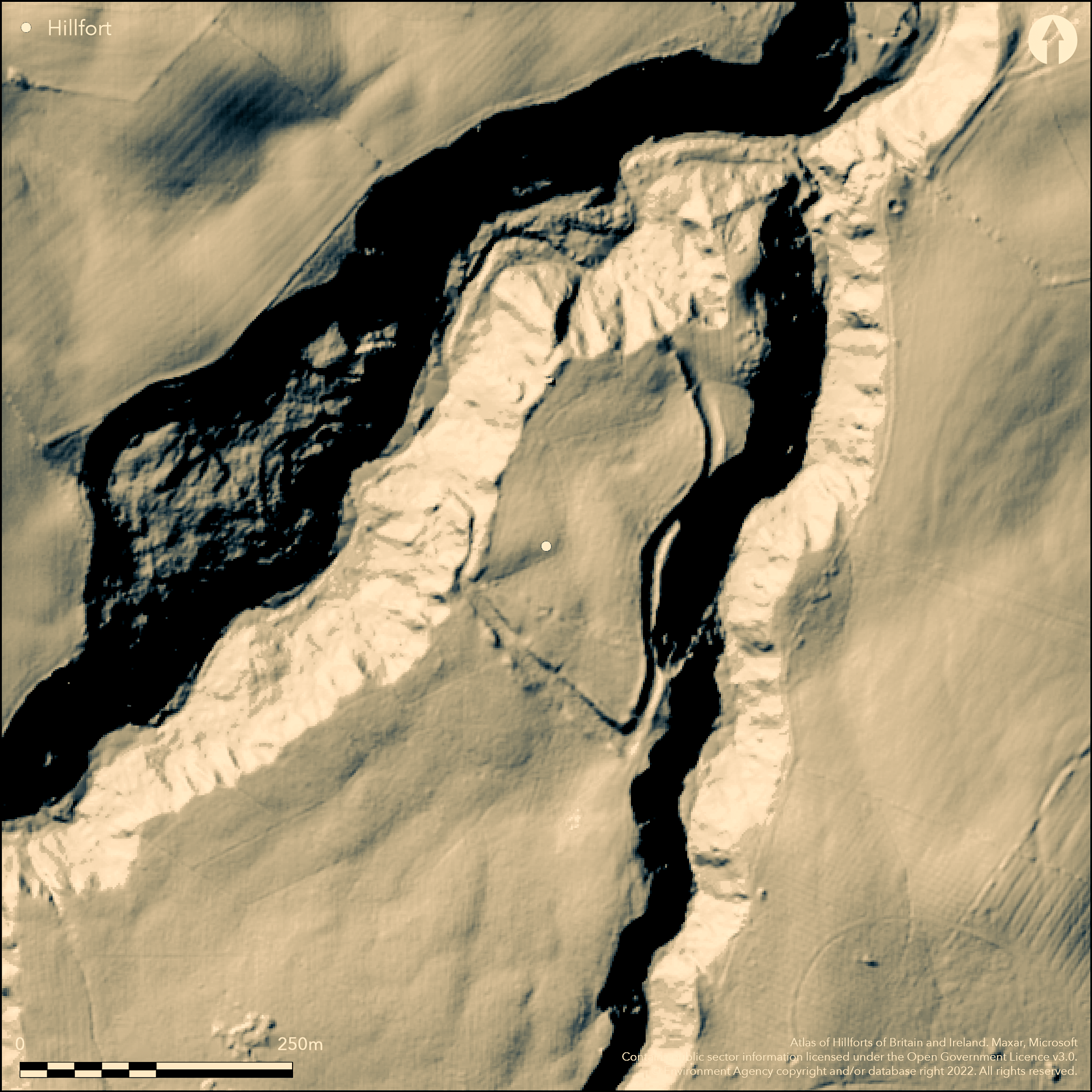
LiDAR 1m DTM Hillshade
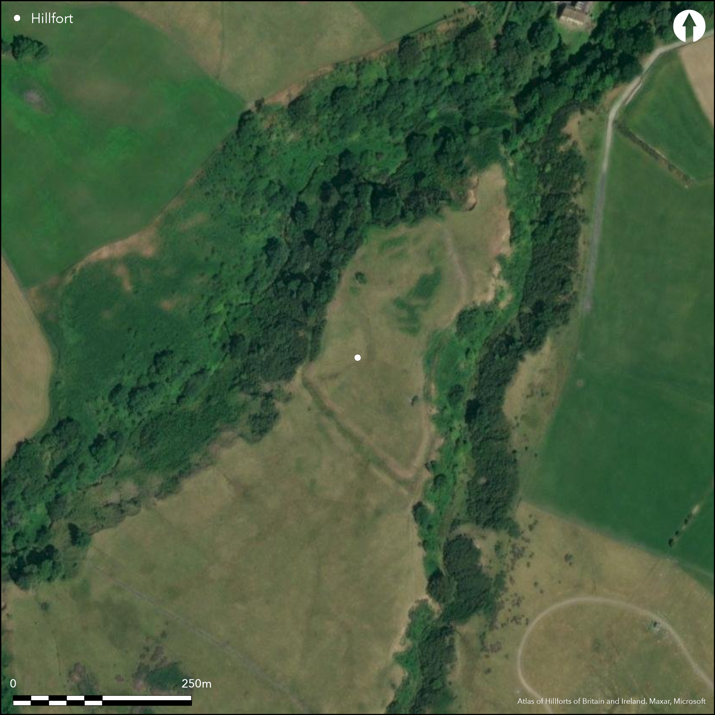
Satellite Imagery
LiDAR 1m DTM Hillshade
Satellite Imagery
Scroll left/right to view further images.
HER: North Yorkshire MNY32534 (None)
NMR: NZ 10 NW 9; NZ10NW 10 (21584; 21587)
SM: 1009320
NGR: NZ 1111 0741
X: 411100 Y: 507400 (OSGB36)
Approximately 1km to the W of Gayles, a univallate enclosure on a north sloping steep-sided spur at approximately 236-251m OD, defined on either side by two streams which converge in the N as Dalton Beck. It measures approximately 230m N-S by 130m E-W. Continuing erosion and stone robbing is destroying the defences in the W and NW and to a lesser extent in the E. Where surviving, the ramparts consist of a wall of tumbled stone which is now turf-covered, an outer ditch and a counterscarp bank. In the E and NE the wall survives to a height of 4.3m above the base of the ditch and up to 0.4m internally. A surviving fragment of the inner and outer faces of the wall suggests it had a width of 1.8-2m and the counterscarp up to 1.4m above the ditch. In the W and N the wall survives up to 0.4m high internally and up to 3.1m above the ditch. In the S where the defences cut across the neck of the spur, the defences appear to consist of an earthen bank that survives 0.6m high internally and 2.6m above the ditch. A 4.5m wide entrance with slightly in-turned terminals lies in the S with a causeway across the ditch and a further break in the counterscarp approximately 7m wide. A second entrance lies in the N, 2m wide with a 4m wide causeway over the ditch allows access to the flat area at the northern extremity of the spur. The interior was once wooded and no features were recorded but possibly survive beneath peaty deposits. A further earthwork approximately 400m to the S of the fort, comprising a bank 6.5m wide and 1.5m high and a ditch 10m wide and 1m deep running E-W (NZ10NW 10) is described as a possible stock annex to Castle Steads. A 100m section of this was ploughed in the 19th century but the line of the ditch can still be seen. A 6.5m wide causewayed entrance lies near the eastern end. The site is recorded on 1885-1903 OS mapping. Undated. Scheduled
Citizen Science: ✗
Reliability of Data: Confirmed
Reliability of Interpretation: Confirmed
X: -203745 Y: 7258119 (EPSG: 3857)
Longitude: -1.8302715880938198 Latitude: 54.46187147289766 (EPSG:4326)
Country: England; None
Current County or Unitary Authority: North Yorkshire
Historic County: Yorkshire
Current Parish/Community/Council/Townland: Gayles; Dalton
None
| Extant | ✓ |
| Cropmark | ✗ |
| Likely Destroyed | ✗ |
Lies in an area of grass moor and heather with flushes and bogs. Appears to be rough grazing within the enclosure. The possible annex is situated in the active sector of the army firing range,
| Woodland | ✗ |
| Commercial Forestry Plantation | ✗ |
| Parkland | ✗ |
| Pasture (Grazing) | ✓ |
| Arable | ✗ |
| Scrub/Bracken | ✗ |
| Bare Outcrop | ✗ |
| Heather/Moorland | ✓ |
| Heath | ✗ |
| Built-up | ✗ |
| Coastal Grassland | ✗ |
| Other | ✓ |
A hillslope fort occupying a north-sloping, steep-sided spur at approximately 236-251m OD, defined on either side by two streams which converge in the N as Dalton Beck
| Contour Fort | ✗ |
| Partial Contour Fort | ✗ |
| Promontory Fort | ✗ |
| Hillslope Fort | ✓ |
| Level Terrain Fort | ✗ |
| Marsh Fort | ✗ |
| Multiple Enclosure Fort | ✗ |
| Hilltop | ✗ |
| Coastal Promontory | ✗ |
| Inland Promontory | ✗ |
| Valley Bottom | ✗ |
| Knoll/Hillock/Outcrop | ✗ |
| Ridge | ✗ |
| Cliff/Plateau-edge/Scarp | ✗ |
| Hillslope | ✓ |
| Lowland | ✗ |
| Spur | ✓ |
Dominant Topographic Feature: Steep-sided spur
| North | ✓ |
| Northeast | ✗ |
| East | ✗ |
| Southeast | ✗ |
| South | ✗ |
| Southwest | ✗ |
| West | ✗ |
| Northwest | ✗ |
| Level | ✗ |
Altitude: 243.0m
The parish boundary between Gayles and Dalton runs along the western side of the spur
Boundary Type: Parish/Townland
The site is undated
Reliability: D - None
| Pre 1200BC | ✗ |
| 1200BC - 800BC | ✗ |
| 800BC - 400BC | ✗ |
| 400BC - AD50 | ✗ |
| AD50 - AD400 | ✗ |
| AD400 - AD 800 | ✗ |
| Post AD800 | ✗ |
| Unknown | ✓ |
| Pre Hillfort: | None |
| Post Hillfort: | None |
Recorded on 1885-1900 OS mapping. Included in VCH York (1912). Field investigation in 1974. Surveyed by RCHME at 1:1000 scale as a part of the Castle Steads, Gayles Survey in 1992, ref. no. 661084.
| 1st Identified Written Reference (1912): | None |
| Other (1935): | Scheduled |
| Other (1974): | Feld investiation |
| Earthwork Survey (1992): | None |
| 1st Identified Map Depiction (None): | None |
No internal features are known but possibly survive beneath peaty deposits
Streams lie to the E, W and N of the spur
| None | ✓ |
| Spring | ✗ |
| Stream | ✗ |
| Pool | ✗ |
| Flush | ✗ |
| Well | ✗ |
| Other | ✗ |
None
| No Known Features | ✓ |
| Round Stone Structures | ✗ |
| Rectangular Stone Structures | ✗ |
| Curvilinear Platforms | ✗ |
| Other Roundhouse Evidence | ✗ |
| Pits | ✗ |
| Quarry Hollows | ✗ |
| Other | ✗ |
None
| No Known Excavation | ✓ |
| Pits | ✗ |
| Postholes | ✗ |
| Roundhouses | ✗ |
| Rectangular Structures | ✗ |
| Roads/Tracks | ✗ |
| Quarry Hollows | ✗ |
| Other | ✗ |
| Nothing Found | ✗ |
None
| No Known Geophysics | ✓ |
| Pits | ✗ |
| Roundhouses | ✗ |
| Rectangular Structures | ✗ |
| Roads/Tracks | ✗ |
| Quarry Hollows | ✗ |
| Other | ✗ |
| Nothing Found | ✗ |
None
| No Known Finds | ✓ |
| Pottery | ✗ |
| Metal | ✗ |
| Metalworking | ✗ |
| Human Bones | ✗ |
| Animal Bones | ✗ |
| Lithics | ✗ |
| Environmental | ✗ |
| Other | ✗ |
None
| APs Not Checked | ✓ |
| None | ✗ |
| Roundhouses | ✗ |
| Rectangular Structures | ✗ |
| Pits | ✗ |
| Postholes | ✗ |
| Roads/Tracks | ✗ |
| Other | ✗ |
A 4.5m wide entrance with slightly inturned terminals lies in the S with a causeway across the ditch and a further break in the counterscarp approximately 7m wide. A second entrance lies in the N 2m wide with a 4m wide causeway over the ditch. This allows access to a level area at the northern extremity of the spur.
| 5: | None |
| 2: | None |
Guard Chambers: ✗
Chevaux de Frise: ✗
| 1. In-turned (South): | None |
| 2. Simple Gap (North): | None |
Approximately 230m N-S by 130m E-W. Continuing erosion and stone robbing is destroying the defences in W and NW and to a lesser extent in the E. Where surviving the ramparts consist of a wall of tumbled stone which are now turf-covered, an outer ditch and a counterscarp. In the E and NE the wall survives to a height of 4.3m above the base of the ditch and up to 0.4m internally. A surviving fragment of the inner and outer faces of the wall suggests it had a width of 1.8-2m and the counterscarp up to 1.4m above the ditch. In the W and N the wall survives up to 0.4m high internally and up to 3.1m above the ditch. In the S where the defences cut across the neck of the spur the defences appear to consist of an earthen bank which survives 0.6m high internally and 2.6m above the ditch.
| Area 1: | 1.4ha. |
| Total: | 1.4ha. |
Total Footprint Area: Noneha.
None
| ✗ | Area estimated from satellite imagery |
| ✓ | Now almost destroyed in some areas |
| NE Quadrant: | 1 |
| SE Quadrant: | 1 |
| SW Quadrant: | 1 |
| NW Quadrant: | 1 |
| Total: | 1 |
| Partial Univallate | ✗ |
| Univallate | ✓ |
| Partial Bivallate | ✗ |
| Bivallate | ✗ |
| Partial Multivallate | ✗ |
| Multivallate | ✗ |
| Unknown | ✗ |
| Partial Univallate | ✗ |
| Univallate | ✗ |
| Partial Bivallate | ✗ |
| Bivallate | ✗ |
| Partial Multivallate | ✗ |
| Multivallate | ✗ |
None
| None | ✗ |
| Earthen Bank | ✓ |
| Stone Wall | ✓ |
| Rubble | ✗ |
| Wall-walk | ✗ |
| Evidence of Timber | ✗ |
| Vitrification | ✗ |
| Other Burning | ✗ |
| Palisade | ✗ |
| Counter Scarp Bank | ✓ |
| Berm | ✗ |
| Unfinished | ✗ |
| Other | ✗ |
None
| None | ✗ |
| Earthen Bank | ✗ |
| Stone Wall | ✗ |
| Murus Duplex | ✗ |
| Timber-framed | ✗ |
| Timber-laced | ✗ |
| Vitrification | ✗ |
| Other Burning | ✗ |
| Palisade | ✗ |
| Counter Scarp Bank | ✗ |
| Berm | ✗ |
| Unfinished | ✗ |
| No Known Excavation | ✓ |
| Other | ✗ |
| ✗ | None |
| ✓ | None |
Number of Ditches: 1
| ✓ | An earthwork lying approximately 400m to the S of the fort, comprising a bank 6.5m wide and 1.5m high and ditch 10m wide and 1m deep running E-W (NZ10NW 10). Described as a possible stock annex to Castle Steads. |
Keith Blood/29-OCT-1992/RCHME: Castle Steads, Gayles Survey. Unpublished
Atlas of Hillforts:
Wikidata:
This work is licensed under CC BY-SA 4.0

 and should be cited as:
Lock, Gary and Ralston, Ian. 2024. Atlas of Hillforts of Britain and Ireland. Available at: https://hillforts.arch.ox.ac.uk
Document Version 1.1