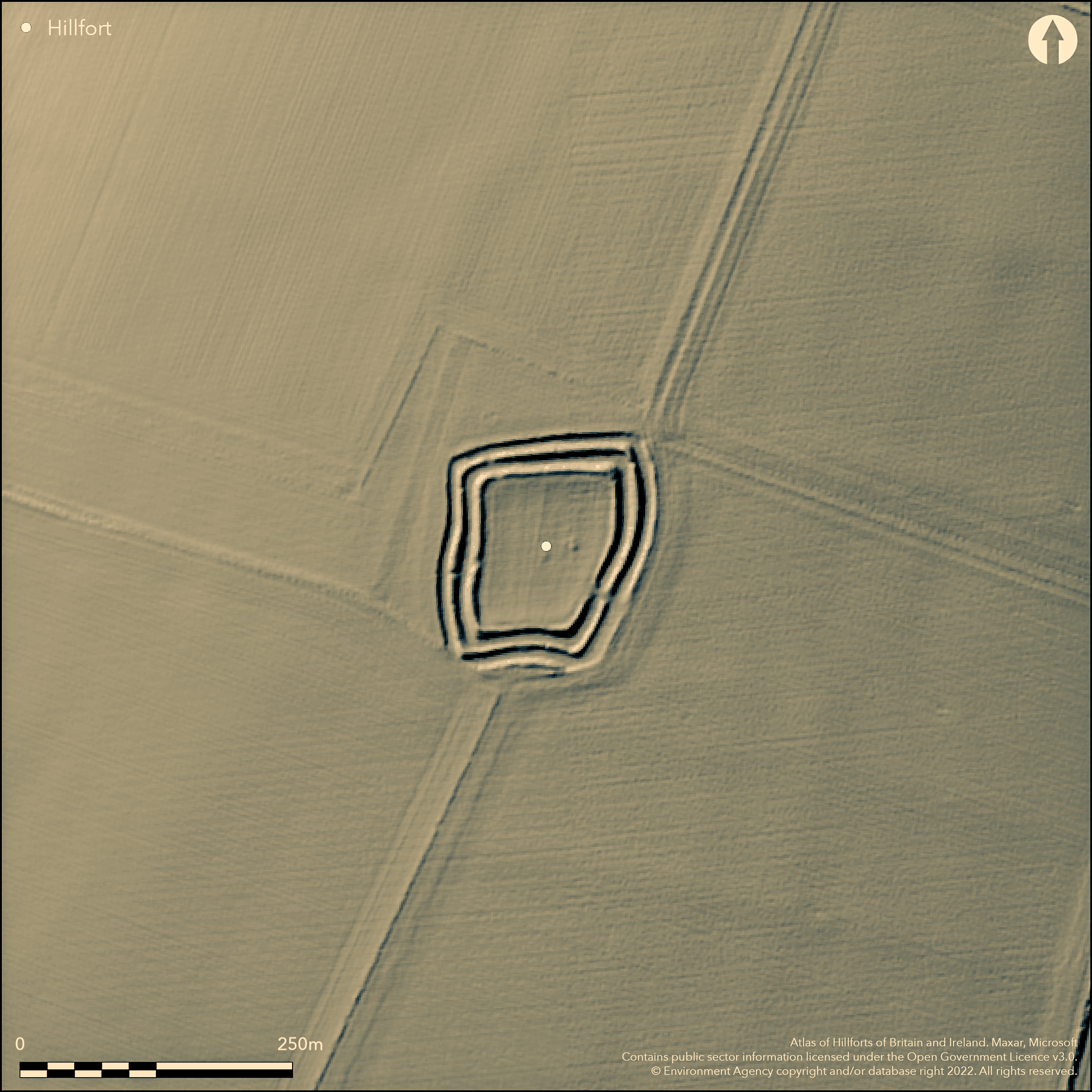
LiDAR 1m DTM Hillshade
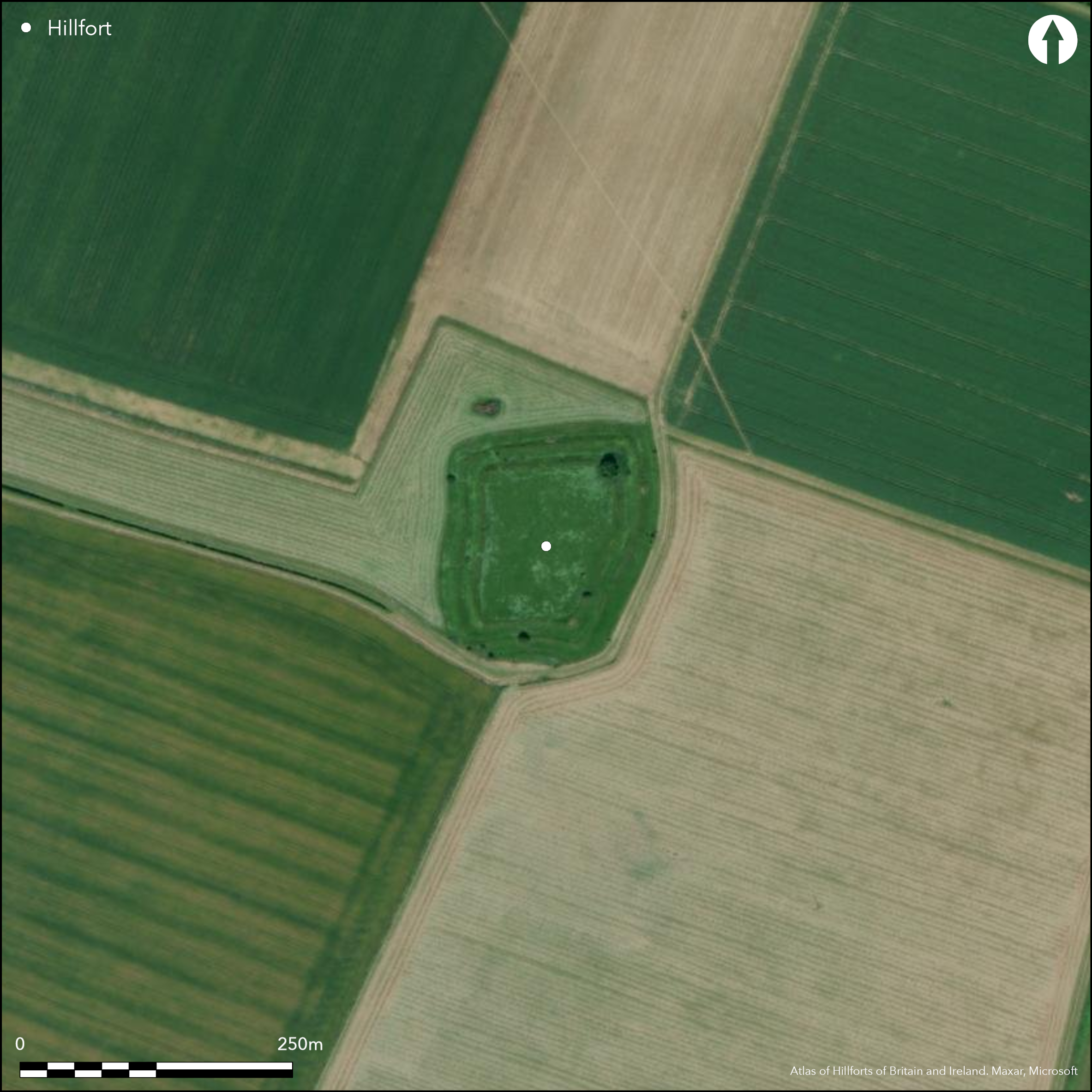
Satellite Imagery
LiDAR 1m DTM Hillshade
Satellite Imagery
Scroll left/right to view further images.
HER: Lincolnshire 30366 (None)
NMR: SK 94 SE 1 (325900)
SM: 1005019
NGR: SK 95409 42339
X: 495409 Y: 342339 (OSGB36)
Lying on a plateau on Honington Heath at 114m OD, a multivallate hillfort enclosing c. 0.58ha. Sub-rectangular in form it measures 116m E-W by 130m N-S and comprises three ramparts and two intermediate ditches. A third possible internal ditch was detected during a geophysical survey carried out by Grantham Archaeology Group (2003). The two innermost banks stand up to 2m high the ditches 9m wide and 1.5m deep. The outer bank has been ploughed in the past and is now slight. It has been described as a counterscarp although a measured survey recorded a rubble limestone core in all three banks which were visible through the outer covering of turf (Umpleby 2003). A possible original entrance lies in the SE, widened by later activity. Two further breaks, probably later, have also been recorded. No internal features are known and the interior has been ploughed in the past. A Roman coin hoard was found in 1691 and further Roman coins were found by Stukeley. Part of a saddle quern was found outside the rampart. Fieldwalking and a measured survey was carried out as part of an MA study (Umpleby 2003). A resistance survey in 2002 revealed ditch type anomalies, possibly natural and circular and linear type anomalies. Low resistance in the interior which followed the line of the inner rampart was interpreted as a further possible ditch. Probably Iron Age based on morphology. The site is recorded on 1885-1900 OS mapping.
Citizen Science: ✗
Reliability of Data: Confirmed
Reliability of Interpretation: Confirmed
X: -64648 Y: 6977434 (EPSG: 3857)
Longitude: -0.5807438099052681 Latitude: 52.96990719375096 (EPSG:4326)
Country: England
Current County or Unitary Authority: Lincolnshire
Historic County: Lincolnshire
Current Parish/Community/Council/Townland: Honington
None
| Extant | ✓ |
| Cropmark | ✗ |
| Likely Destroyed | ✗ |
SSSI; Lowland calcareous grassland
| Woodland | ✗ |
| Commercial Forestry Plantation | ✗ |
| Parkland | ✗ |
| Pasture (Grazing) | ✗ |
| Arable | ✗ |
| Scrub/Bracken | ✗ |
| Bare Outcrop | ✗ |
| Heather/Moorland | ✗ |
| Heath | ✓ |
| Built-up | ✗ |
| Coastal Grassland | ✗ |
| Other | ✗ |
A level terrain fort lying on a plateau at 114m OD
| Contour Fort | ✗ |
| Partial Contour Fort | ✗ |
| Promontory Fort | ✗ |
| Hillslope Fort | ✗ |
| Level Terrain Fort | ✓ |
| Marsh Fort | ✗ |
| Multiple Enclosure Fort | ✗ |
| Hilltop | ✗ |
| Coastal Promontory | ✗ |
| Inland Promontory | ✗ |
| Valley Bottom | ✗ |
| Knoll/Hillock/Outcrop | ✗ |
| Ridge | ✗ |
| Cliff/Plateau-edge/Scarp | ✗ |
| Hillslope | ✗ |
| Lowland | ✓ |
| Spur | ✓ |
Dominant Topographic Feature: Level plateau
| North | ✗ |
| Northeast | ✗ |
| East | ✗ |
| Southeast | ✗ |
| South | ✗ |
| Southwest | ✗ |
| West | ✗ |
| Northwest | ✗ |
| Level | ✓ |
Altitude: 114.0m
N/A
Probably Iron Age based on morphology.
Reliability: D - None
| Pre 1200BC | ✗ |
| 1200BC - 800BC | ✗ |
| 800BC - 400BC | ✓ |
| 400BC - AD50 | ✓ |
| AD50 - AD400 | ✗ |
| AD400 - AD 800 | ✗ |
| Post AD800 | ✗ |
| Unknown | ✗ |
| Pre Hillfort: | None |
| Post Hillfort: | None |
| Morphology/Earthwork/Typology: | None |
Recorded on 1885-1900 OS mapping. RCHME field investigations in 1965 and 1976. Fieldwalking and a measured survey was carried out as part of an MA study (Umpleby 2003). Geophysical survey in 2002 by Grantham Archaeology Group.
| Geophysical Survey (2002): | None |
| Earthwork Survey (2003): | None |
| Other (2003): | Fieldwalking |
| 1st Identified Map Depiction (None): | None |
No above ground features are recorded. A geophysical survey in 2002 revealed ditch type anomalies, possibly natural and circular and linear type anomalies. Low resistance which follows the inner rampart was interpreted as a possible inner ditch.
None
| None | ✓ |
| Spring | ✗ |
| Stream | ✗ |
| Pool | ✗ |
| Flush | ✗ |
| Well | ✗ |
| Other | ✗ |
None
| No Known Features | ✓ |
| Round Stone Structures | ✗ |
| Rectangular Stone Structures | ✗ |
| Curvilinear Platforms | ✗ |
| Other Roundhouse Evidence | ✗ |
| Pits | ✗ |
| Quarry Hollows | ✗ |
| Other | ✗ |
None
| No Known Excavation | ✓ |
| Pits | ✗ |
| Postholes | ✗ |
| Roundhouses | ✗ |
| Rectangular Structures | ✗ |
| Roads/Tracks | ✗ |
| Quarry Hollows | ✗ |
| Other | ✗ |
| Nothing Found | ✗ |
Ditch type anomalies, possibly natural, and circular and linear type anomalies. An area of low resistance follows the line of the inner rampart
| No Known Geophysics | ✗ |
| Pits | ✓ |
| Roundhouses | ✗ |
| Rectangular Structures | ✗ |
| Roads/Tracks | ✗ |
| Quarry Hollows | ✗ |
| Other | ✓ |
| Nothing Found | ✗ |
Roman coins
| No Known Finds | ✗ |
| Pottery | ✗ |
| Metal | ✓ |
| Metalworking | ✗ |
| Human Bones | ✗ |
| Animal Bones | ✗ |
| Lithics | ✗ |
| Environmental | ✗ |
| Other | ✗ |
None
| APs Not Checked | ✓ |
| None | ✗ |
| Roundhouses | ✗ |
| Rectangular Structures | ✗ |
| Pits | ✗ |
| Postholes | ✗ |
| Roads/Tracks | ✗ |
| Other | ✗ |
A possible original entrance lies in the SE, widened by later activity. Two further breaks, probably later, have also been recorded.
| 4: | Three later paths have mutilated the banks on the N and E sides |
| 2: | None |
Guard Chambers: ✗
Chevaux de Frise: ✗
| 1. Simple Gap (South east): | Inner rampart |
| 1. Simple Gap (South east): | Middle rampart |
Multivallate hillfort enclosing c. 0.58ha. Sub-rectangular it measures 116m E-W by 130m N-S and comprises three ramparts and two intermediate ditches. A third possible internal ditch was detected through geophysics carried out by Grantham Archaeology Group. The two innermost banks stand up to 2m high the ditches 9m wide and 1.5m deep. The outer bank has been ploughed in the past and is now slight. It has been described as a counterscarp although a measured survey recorded rubble limestone cores in all three banks which were visible through the outer covering of turf (Umpleby 2003).
| Area 1: | 0.58ha. |
| Total: | 0.58ha. |
Total Footprint Area: 1.22ha.
None
| ✗ | Measurements taken from satellite imagery |
| ✓ | None |
| NE Quadrant: | 3 |
| SE Quadrant: | 3 |
| SW Quadrant: | 3 |
| NW Quadrant: | 3 |
| Total: | 3 |
| Partial Univallate | ✗ |
| Univallate | ✗ |
| Partial Bivallate | ✗ |
| Bivallate | ✗ |
| Partial Multivallate | ✗ |
| Multivallate | ✓ |
| Unknown | ✗ |
| Partial Univallate | ✗ |
| Univallate | ✗ |
| Partial Bivallate | ✗ |
| Bivallate | ✗ |
| Partial Multivallate | ✗ |
| Multivallate | ✗ |
Uncertainty over the counterscarp
| None | ✗ |
| Earthen Bank | ✓ |
| Stone Wall | ✗ |
| Rubble | ✓ |
| Wall-walk | ✗ |
| Evidence of Timber | ✗ |
| Vitrification | ✗ |
| Other Burning | ✗ |
| Palisade | ✗ |
| Counter Scarp Bank | ✗ |
| Berm | ✗ |
| Unfinished | ✗ |
| Other | ✗ |
None
| None | ✗ |
| Earthen Bank | ✗ |
| Stone Wall | ✗ |
| Murus Duplex | ✗ |
| Timber-framed | ✗ |
| Timber-laced | ✗ |
| Vitrification | ✗ |
| Other Burning | ✗ |
| Palisade | ✗ |
| Counter Scarp Bank | ✗ |
| Berm | ✗ |
| Unfinished | ✗ |
| No Known Excavation | ✓ |
| Other | ✗ |
| ✗ | None |
| ✓ | A third possible ditch has been recorded by geophysics |
Number of Ditches: 2
| ✗ | None |
Grantham Archaeology Group, 2003, Honington Camp Hill Fort: Geophysical Survey (Resistance). Intervention Report. Unpublished
Umpleby, G. H. 2003. A Chronology and Interpretation of Honington Camp, Kesteven. MA dissertation, unpublished
Atlas of Hillforts:
Wikidata:
This work is licensed under CC BY-SA 4.0

 and should be cited as:
Lock, Gary and Ralston, Ian. 2024. Atlas of Hillforts of Britain and Ireland. Available at: https://hillforts.arch.ox.ac.uk
Document Version 1.1