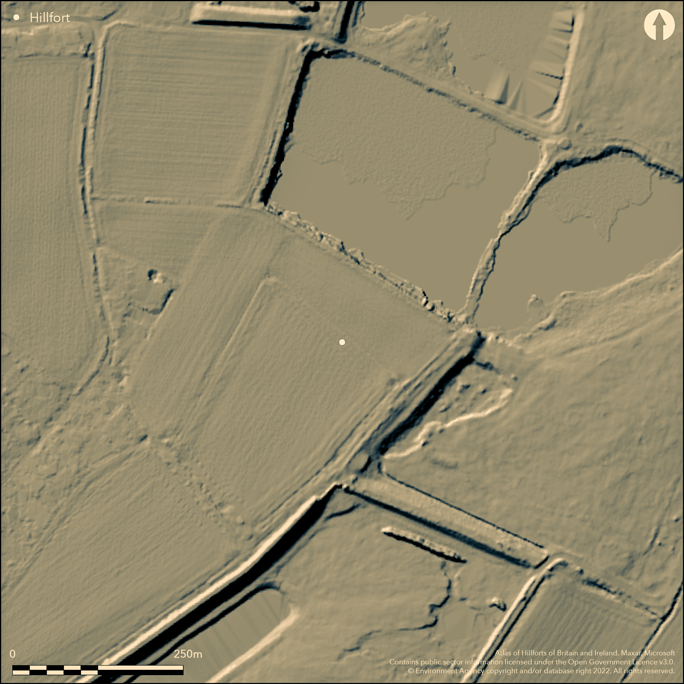
LiDAR 1m DTM Hillshade
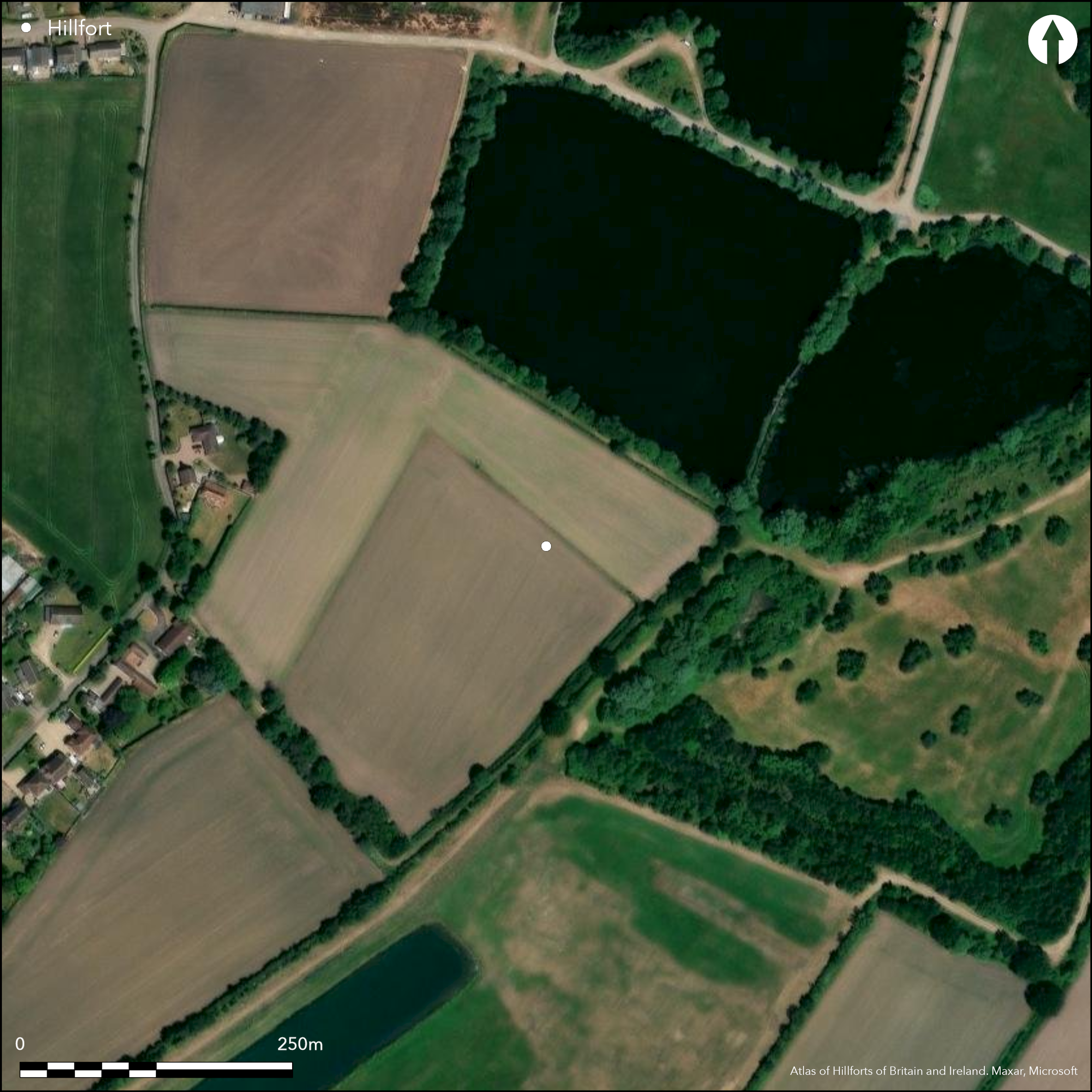
Satellite Imagery
LiDAR 1m DTM Hillshade
Satellite Imagery
Scroll left/right to view further images.
HER: Lincolnshire 43556 (None)
NMR: TF 25 NW 17 (352675)
SM: 1018353
NGR: TF 22328 59808
X: 522328 Y: 359808 (OSGB36)
The cropmarked remains of a bivallate enclosure, probably a low-lying hillfort 340m to the SE of North Road Farm with the River Bain to the SE and River Witham to the SW, now partially destroyed. Discovered by aerial photographs in 1976 showing two 5m wide ditches set 16m apart which form a rounded oblong measuring 330m by 170m. Excavation of the ditches ahead of gravel extraction in 1979/80 (Chowne et al. 1986) showed that the outer ditch was originally 2m deep and U-shaped and the inner ditch 1.8m deep and flat-bottomed. The ditches, which produced evidence for re-cutting had originally been water-filled. A causeway visible on aerial photographs in the N was probably the original entrance but is now destroyed. The interior was not investigated and no internal features are known. Artefacts including early to middle Iron Age pottery, a loom weight and beehive quern were recovered from the surface of a 0.5m thick layer of peat within the ditch. Further work across a section of the outer ditch in the SE produced small amounts of wood, some of it worked, fragments of leather, pottery, animal bone and an iron object (Seagar Smith 1998). Environmental remains suggest the ramparts, which are now ploughed down, were reinforced by hedges and posts, with the enclosure sited in grassland interspersed with trees and arable. Radiocarbon dates from wood gave a 3rd century BC to early 1st century AD date which supports the dating from pottery. It is scheduled as a small multivallate hillfort, although a corral for stock is also suggested. The site is not recorded on OS mapping.
Citizen Science: ✗
Reliability of Data: Confirmed
Reliability of Interpretation: Confirmed
X: -19311 Y: 7005486 (EPSG: 3857)
Longitude: -0.17347163162882254 Latitude: 53.12140169612624 (EPSG:4326)
Country: England
Current County or Unitary Authority: Lincolnshire
Historic County: Lincolnshire
Current Parish/Community/Council/Townland: Tattershall Thorpe
Lies on the Southrey gravel terrace and now partially lost to gravel extraction. It is also vulnerable to ploughing. On Heritage at Risk Register (2015).
| Extant | ✗ |
| Cropmark | ✓ |
| Likely Destroyed | ✓ |
None
| Woodland | ✗ |
| Commercial Forestry Plantation | ✗ |
| Parkland | ✗ |
| Pasture (Grazing) | ✗ |
| Arable | ✓ |
| Scrub/Bracken | ✗ |
| Bare Outcrop | ✗ |
| Heather/Moorland | ✗ |
| Heath | ✗ |
| Built-up | ✗ |
| Coastal Grassland | ✗ |
| Other | ✗ |
A lowland, level terrain fort lying at 13m OD
| Contour Fort | ✗ |
| Partial Contour Fort | ✗ |
| Promontory Fort | ✗ |
| Hillslope Fort | ✗ |
| Level Terrain Fort | ✓ |
| Marsh Fort | ✗ |
| Multiple Enclosure Fort | ✗ |
| Hilltop | ✗ |
| Coastal Promontory | ✗ |
| Inland Promontory | ✗ |
| Valley Bottom | ✗ |
| Knoll/Hillock/Outcrop | ✗ |
| Ridge | ✗ |
| Cliff/Plateau-edge/Scarp | ✗ |
| Hillslope | ✗ |
| Lowland | ✓ |
| Spur | ✗ |
Dominant Topographic Feature: None
| North | ✗ |
| Northeast | ✗ |
| East | ✗ |
| Southeast | ✗ |
| South | ✗ |
| Southwest | ✗ |
| West | ✗ |
| Northwest | ✗ |
| Level | ✓ |
Altitude: 13.0m
N/A
Base of a pedestal urn, triangular loomweight and beehive quern recovered during excavations. Wood from waterlogged deposits within the ditch radiocarbon dated 3rd century BC to early 1st century AD
Reliability: B - Medium
| Pre 1200BC | ✗ |
| 1200BC - 800BC | ✗ |
| 800BC - 400BC | ✗ |
| 400BC - AD50 | ✓ |
| AD50 - AD400 | ✗ |
| AD400 - AD 800 | ✗ |
| Post AD800 | ✗ |
| Unknown | ✗ |
| Pre Hillfort: | None |
| Post Hillfort: | None |
| Artefactual: | Early to middle IA pottery |
| C14: | 3rd century BC to early 1st century AD |
Discovered by aerial photography in 1976. Excavated in 1979/80 ahead of gravel extraction. Scheduled
| Other (1976): | None |
| Other (1981): | Scheduled |
| Excavation (None): | Chowne et al. (1986) |
No internal features are known
River Bain to the SE and River Witham to the SW
| None | ✓ |
| Spring | ✗ |
| Stream | ✗ |
| Pool | ✗ |
| Flush | ✗ |
| Well | ✗ |
| Other | ✗ |
None
| No Known Features | ✓ |
| Round Stone Structures | ✗ |
| Rectangular Stone Structures | ✗ |
| Curvilinear Platforms | ✗ |
| Other Roundhouse Evidence | ✗ |
| Pits | ✗ |
| Quarry Hollows | ✗ |
| Other | ✗ |
Interior not investigated
| No Known Excavation | ✓ |
| Pits | ✗ |
| Postholes | ✗ |
| Roundhouses | ✗ |
| Rectangular Structures | ✗ |
| Roads/Tracks | ✗ |
| Quarry Hollows | ✗ |
| Other | ✗ |
| Nothing Found | ✗ |
None
| No Known Geophysics | ✓ |
| Pits | ✗ |
| Roundhouses | ✗ |
| Rectangular Structures | ✗ |
| Roads/Tracks | ✗ |
| Quarry Hollows | ✗ |
| Other | ✗ |
| Nothing Found | ✗ |
Early to middle Iron Age pottery, a loom weight, beehive quern, small amounts of wood, some of it worked, fragments of leather, pottery, animal bone and an iron object (Seagar Smith 1998)
| No Known Finds | ✗ |
| Pottery | ✓ |
| Metal | ✓ |
| Metalworking | ✗ |
| Human Bones | ✗ |
| Animal Bones | ✓ |
| Lithics | ✗ |
| Environmental | ✓ |
| Other | ✓ |
None
| APs Not Checked | ✗ |
| None | ✓ |
| Roundhouses | ✗ |
| Rectangular Structures | ✗ |
| Pits | ✗ |
| Postholes | ✗ |
| Roads/Tracks | ✗ |
| Other | ✗ |
Possible simple gap entrance with causeway across the ditches in the N. Now destroyed.
| 1: | None |
| 2: | None |
Guard Chambers: ✗
Chevaux de Frise: ✗
| 1. Simple Gap (North): | Inner rampart (assumed from cropmarked ditches) |
| 1. Simple Gap (North): | Outer rampart (assumed from cropmarked ditches) |
Two 5m wide ditches set 16m apart which form a rounded oblong measuring 330m by 170m. Outer ditch was originally 2m deep and U-shaped and the inner ditch 1.8m deep and flat-bottomed.
| Area 1: | 5.0ha. |
| Total: | 5.0ha. |
Total Footprint Area: Noneha.
None
| ✗ | Area estimated |
| ✓ | None |
| NE Quadrant: | 2 |
| SE Quadrant: | 2 |
| SW Quadrant: | 2 |
| NW Quadrant: | 2 |
| Total: | 2 |
| Partial Univallate | ✗ |
| Univallate | ✗ |
| Partial Bivallate | ✗ |
| Bivallate | ✓ |
| Partial Multivallate | ✗ |
| Multivallate | ✗ |
| Unknown | ✗ |
| Partial Univallate | ✗ |
| Univallate | ✗ |
| Partial Bivallate | ✗ |
| Bivallate | ✗ |
| Partial Multivallate | ✗ |
| Multivallate | ✗ |
None
| None | ✓ |
| Earthen Bank | ✗ |
| Stone Wall | ✗ |
| Rubble | ✗ |
| Wall-walk | ✗ |
| Evidence of Timber | ✗ |
| Vitrification | ✗ |
| Other Burning | ✗ |
| Palisade | ✗ |
| Counter Scarp Bank | ✗ |
| Berm | ✗ |
| Unfinished | ✗ |
| Other | ✗ |
Environmental evidence from the ditch suggests the bank was created from upcast from the ditch and reinforced by hedges and possibly posts
| None | ✗ |
| Earthen Bank | ✓ |
| Stone Wall | ✗ |
| Murus Duplex | ✗ |
| Timber-framed | ✗ |
| Timber-laced | ✗ |
| Vitrification | ✗ |
| Other Burning | ✗ |
| Palisade | ✗ |
| Counter Scarp Bank | ✗ |
| Berm | ✗ |
| Unfinished | ✗ |
| No Known Excavation | ✗ |
| Other | ✓ |
| ✗ | None |
| ✓ | None |
Number of Ditches: 2
| ✗ | None |
Chowne, P, Girling, M, Greig, J. 1986. Excavations At An Iron Age Defended Enclosure At Tattershall Thorpe, Proceedings of the Prehistoric Society, Vol. 52. 159-88
Seager Smith,R. 1998. Further Excavations at the Iron Age Enclosure at Tattershall Thorpe, Lincolnshire, by Peter Chowne, 1986. Lincolnshire History and Archaeology, 33.
Atlas of Hillforts:
Wikidata:
This work is licensed under CC BY-SA 4.0

 and should be cited as:
Lock, Gary and Ralston, Ian. 2024. Atlas of Hillforts of Britain and Ireland. Available at: https://hillforts.arch.ox.ac.uk
Document Version 1.1